

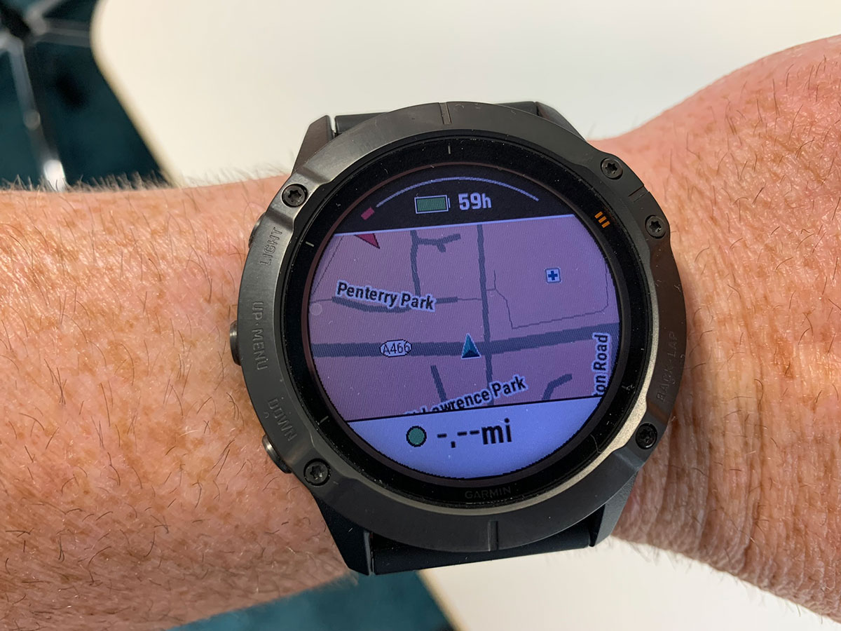
A GPX file is a small digital file containing GPS location data for a route, track or collection of waypoints. GPX stands for GPS Exchange Format. Walkers can open the file in a compatible hiking app, GPS watch or handheld navigation device and use it to follow a planned route.
I use GPX files to plan my walks, share routes and guide groups through the mountains. You will find free GPX downloads with many of the walking guides on Welsh Man Walking, allowing you to load the same route onto your own device before setting off.
GPX files at a glance
- GPX means: GPS Exchange Format.
- What it contains: coordinates, elevation data and organised route, track or waypoint information.
- What it looks like: a line and points displayed over a map inside a compatible app or device.
- What opens it: many hiking apps, navigation websites, GPS watches and handheld GPS units.
- Does it contain the map? Usually not—the app or device supplies the underlying map.
- Does it guarantee safety? No. A GPX route is a navigational aid and should be used alongside sensible preparation and backup navigation.
What does GPX stand for?
GPX stands for GPS Exchange Format. It is a standard file format used to transfer geographical information between different apps, websites and GPS devices. Most GPX filenames end with .gpx.
If you opened one as plain text, you would see structured XML code containing coordinates and other data. You normally do not need to read or edit that code: a compatible app converts it into a route line, track or set of points that can be understood visually.
What information does a GPX file contain?
A GPX file can contain latitude and longitude coordinates, elevation, time information and names or descriptions attached to particular locations. Exactly what is included depends on how the file was created.
Waypoints
Individual saved locations such as a summit, car park, viewpoint, junction or emergency meeting point.
Routes
An ordered collection of points describing where you intend to travel. Some devices calculate guidance between those points.
Tracks
A detailed breadcrumb line made from many track points. It may represent a planned path or a journey previously recorded by a GPS device.
How does a GPX route work?
The GPX file itself does not normally contain a full illustrated map. Instead, it supplies geographical points that your app, watch or GPS unit places over its own mapping. The resulting line shows the route you are expected to follow, while your device’s GPS indicates your current position.
If your marker remains close to the route line, you are broadly following the planned walk. Some devices provide arrows, turn notifications or an alert when you move away from the route. Features vary between apps and devices, so learn how yours behaves before relying on it in unfamiliar terrain.
How to download, open and use a GPX file
- Download the file: select the GPX download supplied with a trusted route guide and save the
.gpxfile to your phone or computer. - Choose a compatible app or device: use a hiking app, mapping website, GPS watch or handheld GPS unit that supports GPX imports.
- Import the file: choose the app’s import, open, upload or share option and select the downloaded file.
- Inspect the route: check the start point, distance, ascent, terrain and whether the line appears complete.
- Download offline mapping: if your chosen app supports it, save the surrounding map before travelling into weak-signal areas.
- Charge your equipment: begin with sufficient battery and consider carrying a power bank on longer walks.
- Follow your position: during the walk, compare your live GPS position with the imported route line.
The precise buttons vary between platforms. On a phone, tapping or sharing a downloaded GPX file will often display compatible apps. A watch or handheld GPS may require its companion app, a USB connection or cloud synchronisation.
What can open a GPX file?
GPX is widely supported, but compatibility and available features vary. Common options include:
- Walking, hiking and cycling apps on iPhone and Android
- Digital mapping websites such as Outdooractive, which I use to plan and manage routes
- Compatible Garmin watches and handheld hiking GPS devices
- Other GPS watches, bike computers and outdoor-navigation units
- Desktop mapping and route-planning software
Importing the same file into two different apps may produce slightly different instructions or distance figures because each platform processes route data and maps in its own way.
Why walkers use GPX files
- Preparation: examine distance, elevation and the shape of a route before leaving home.
- Navigation: compare your live position with the planned line while walking.
- Sharing: send a route to friends without requiring everybody to use the same app.
- Recording: save where you walked and review time, distance and elevation afterward.
- Reuse: retain successful routes and follow them again in the future.
I particularly enjoy planning a route and then guiding a group around it. Everybody can understand the expected distance and duration beforehand, and the GPX line provides reassurance at unclear junctions. It also lets me share the route with readers once I have completed and checked the walk.
Try a free GPX route from Welsh Man Walking
Many WMW walking guides include a free GPX file alongside parking information, route statistics, photographs and a detailed description. Here are three routes where you can see how the download fits into a complete guide:
- Horseshoe Ridge circular walk in the Brecon Beacons
- Dragon’s Back and Waun Fach circular walk
- Four Waterfalls Walk from Gwaun Hepste
Download the file before travelling, import it into your preferred navigation tool and inspect the route carefully rather than waiting until you arrive at the car park.
GPX files and walking safety
A GPX file can make navigation easier, but it cannot assess weather, path closures, river levels, erosion, access restrictions or your ability. GPS accuracy can also be affected by woodland, steep valleys and surrounding cliffs.
Check the weather and current local advice, carry appropriate clothing and equipment, and tell somebody your plans. Save maps for offline use and consider carrying a paper map and compass—particularly in remote or mountainous country. A phone can lose signal, battery power or suffer damage, so never make one device your only safety plan.
Frequently asked questions
What is a GPX file in simple terms?
It is a file containing GPS points that compatible apps and devices can display as locations, a route or a recorded track.
What does GPX stand for?
GPX stands for GPS Exchange Format. It was designed to exchange geographical data between different software and devices.
Is a GPX file a map?
Not usually. It contains geographical data, while your app or GPS device normally supplies the visible base map beneath the route or track.
Can I open a GPX file on my phone?
Yes, provided you have a compatible iPhone or Android app. Download the file, then open, share or import it into your chosen hiking or navigation app.
Can a Garmin device use GPX files?
Many Garmin watches and handheld GPS products support routes or tracks imported from GPX files. The transfer method and features depend on the model and its companion software.
Do GPX files work without internet access?
The GPX data can be stored on your device, but the app may still need an offline map to display the surrounding area without a signal. Download both the route and any required mapping before your walk.
Are GPX files free?
Many GPX files are free, including the downloads provided with WMW route guides. Some mapping platforms charge for route planning, offline maps, advanced navigation or exporting files.
Is following a GPX route enough to stay safe?
No. Treat it as one navigation tool. Conditions and paths can change, devices can fail, and a downloaded line does not replace judgement, suitable equipment or backup navigation skills.
Great article on GPX files and how to use them. I will encourage others in our group to create their own or use one that has been shared so they can improve their own navigational skills.
Thank you Mike, using GPX files has helped us out every weekend and saved a lot of time not wasted on getting lost.