Hiking to Fantapytten, Lysefjord’s ‘Infinity Pool’, is a tough task, and should not be tried if you have mobility issues, or you’re not used to hiking. BUT, if you can do it, it will take your breath away, it’s a brand-new trail, and you’ll spend approximately 75% of your time close along the fjord.
You are several hundred meters above sea level, the trail winds along several mountain cliffs and gorges, including Skjerajuvet and Fantahålå and you will walk through stunning landscapes and past countless panoramic viewpoints, finishing up at the infinity pool.
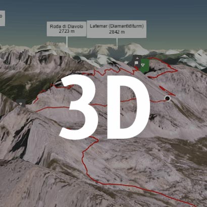
Walk this route yourself in 3D!
The Video is a 3D walk through of this route; it will give you a unique sense of having walked through the route before you start.
I have created 3D Videos of my adventures and have shared them with the OutdoorActive community as well as my walking community.
Staying in Borestranda, Kleppe we drove to the start of this hike, it took us just over an hour to get to The Boulder Skylodge Car Park, you are allowed to park in the bottom car park, the top car park is for people staying at the ‘The Bolder Skylodge‘, which would be an amazing experience.
This is a demanding hike. From the start, the terrain is mountainous, with many small ascends and descends, while the trail winds along and past several cliffs, small gorges and rock formations. Before gorge Skjerajuvet, you will climb a short, but steep hill with a telephone mast at the top, before you meet some new slopes towards Mount Hatten.
Past Hatten, the trail runs downhill following an old cairned route. Here, the terrain is a lot easier, so you can enjoy the views on the Lysefjord, right in front of you, in all its glory. Just before you reach a mountain shelf near Fantahålå, the trail dives down through a fairy-tale like forest slope called Lausefjell to “Fantapytten” – a shallow puddle with a world-class view on the Lysefjord.
Getting There: Directions, GPX and App Link
The Hiking App I use is ‘OutdoorActive‘ which has a free and Pro version, the Pro version will allow you to download the routes to your phone and use them without using up your data. The reason I mention it is that if you were to download it, below is the link to this route in my hike list on that app, you can follow the arrows and voice on that. I think it is best that you do get the app, as most of these walks are a bit tricky to explain.
- The start point is at the lower car park of The Boulder Skylodge.
- This is a difficult hike, very demanding, so make sure you have plenty of water and food, and you come prepared for all weathers. You could even take your swim stuff and have a swim in one of the pools as we did.
Navigation Aids:
Hike Map
Hike Profile
- Distance: 5m / 8km
- Duration: 5-6 hours (lots of sightseeing)
- Highest point: 1302ft / 400m
- Difficulty: Difficult and very demanding (steep short ascent and descents), lots of steps, large rocks to step up on and over, and ladders. Take plenty of water and food.
- Route conditions: Well-worn pathways most of the way around, good walking shoes are essential.
Hike Description & Pics
The hike for us started at The Boulder Skylodge, took us just over an hour to drive there from Kleppe and we arrived at around 9am. There are no facilities, cafe’s, or water stops on this hike, and I cannot say this strong enough, please take your time and follow the red marks on the rocks. There are occasions where you could easily go off course, and if you can download this route as a gpx file or follow the route on the app, then do, you don’t want to lose track of the red marks, which is your path there and back.
From the car park, head up towards the upper car park and on your left, you will see a sign pointing you in the direction to Fantapytten. It’s a great start as you will see a small shallow lake on your left, and then once you have made your way through the trees to the first level, you will get a magnificent view down the fjord looking at the bridge and the port.


From that beautiful spot looking at the bridge, this is where the real trail begins, and you get your first taste of the descends and ascends as you make your way along the Lysefjord. They are both steep, and you need to concentrate because of roots sticking out, rocks to step over and around and make your way over walkways and up ladders.


There is a lot of work to do yet before we get to Fantapytten, but there is an excellent opportunity to rest at gorge Skjerajuvet, which is very deep and you have a diving board rock where you can get some awesome pics looking over the Lysefjord.
Just before it is a steep short climb which eventually takes you in-between large granite rocks, and on top is a large mast that can be walked too, but there is only one way, and you would need to leave your current path, then walk back to rejoin.


From here, there is again a steep climb, but once at the top it becomes a lot easier and more open, and you are once again treated to panoramic views of the Lysefjord. This path has some ladders and quite difficult rock climbs, and we passed a large pond on our left, which we decided to have a swim in on the way back.


You are now on Hatten, a peak and a plateau, which is a nice relief after the tough terrain you have left behind. After a short while you will start to head back down again, but it’s a nice easy stroll that dives down through a fairy-tale like forest slope called Lausefjell.


Once down through this wood, it’s only a short walk to Fantapytten, the infinity pool looking over the Lysefjord. It’s a beautiful position for the natural pool, but one thing we found out, is that it’s not the best to have a swim in. It’s very dirty and muddy, but we had a go anyway, as it was nice to cool off after the walk.
This was a tough first leg, obviously you have the return journey, and I just want to point out again that it is demanding, so make sure you have plenty of water and food, and all the appropriate clothing and footwear, you will need it.
As you seen from the pics it was a beautiful day, but not long after we got to back to the car a really bad storm came in with thunder and lightning, and very heavy rain and strong winds. I’m glad we dint get caught in it, but we did go prepared for it as we checked the weather before we left.
That’s me resting before the final drop down to the car park, we absolutely loved it!
That’s it, you’re all done, and I hope you have had a great experience, and have had great weather.
It is worth downloading this route onto the Outdooractive app, it’ll re-assure you time wise and that you’re not heading in the wrong directions. There is so much space up there and lots of alternative paths you could accidently join.
Hope you enjoy this walk, and I’d love it if you could share this post either with the social media buttons that follow you down the screen on your left, or below in the footer. Also, comments are very welcome, I love meeting new people and talking, and you never know we could meet up on one of our walks.

Fundraising for CALM, they do save lives!
Do you want to join me in making a difference? I’m raising money in aid of Campaign Against Living Miserably and every donation will help. Thank you in advance for your contribution to this cause which means so much to me.
More information about Campaign Against Living Miserably: Campaign Against Living Miserably (CALM) is leading a movement against suicide. Every week 125 people in the UK take their own lives. And 75% of all UK suicides are male.
CALM exists to change this. Join the campaign to take a stand against suicide.
Please donate an amount you can afford, everything helps these people.
I have raised £572 so far, and I will keep trying to raise more.

