

Walk this route yourself in 3D!
The Video is a 3D walk through of this route, it will give you a unique sense of having walked through the route before you start.
I have created 3D Videos of my adventures and have shared them with the OutdoorActive community as well as my walking community.
Blorenge Circular Walk Abergavenny – The Punchbowl & Keepers Pond – 3D Video
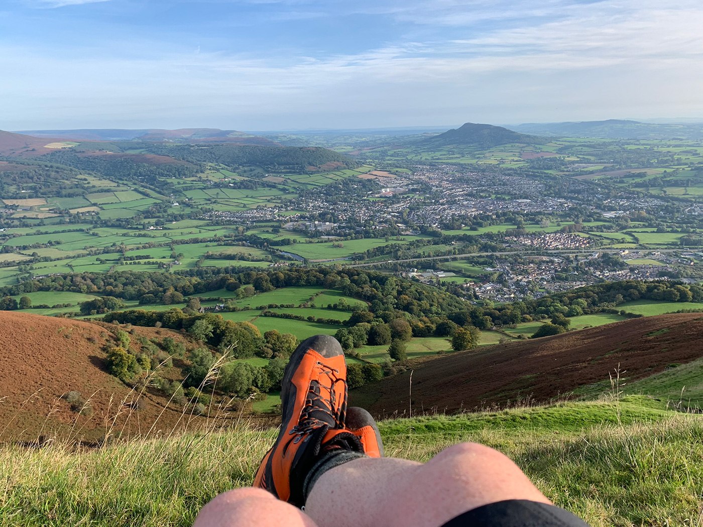
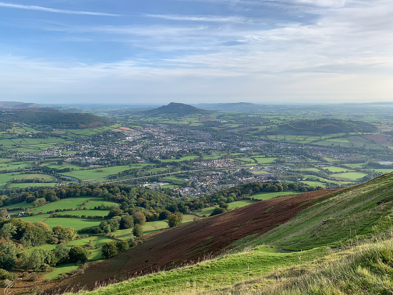
The Blorenge is one of three mountains that surround the town of Abergavenny, the other two which you can see from the top are the Sugar Loaf and the Skirrid. These are a part of the Black Mountains at the foot of the Brecon Beacons and at the bottom of the Blorenge is the Monmouthshire & Brecon Canal, which you will walk under as you start this walk.
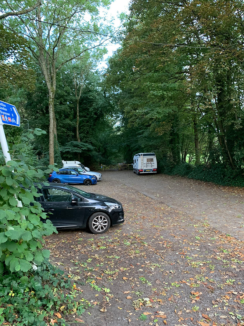
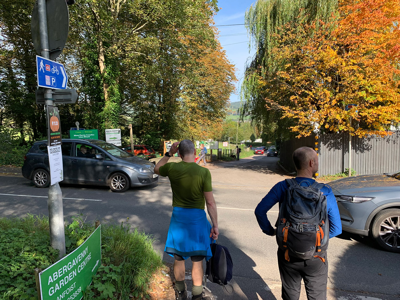
You can walk from the town where there is plenty of parking to start your walk up the Blorenge, but I will detail where we parked in a little car park on the B4246 and is called ‘Llanfoist Crossing Car Park‘.
On a nice day this a beautiful walk, you have the 2 ponds and the views are very good, but on a bad day take plenty of layers and your wets as at the top it’s exposed.
Recommended: Places to stay in Brecon, in the Bannau Brycheiniog (Brecon Beacons) National Park.
Recommended: Places to stay in Crickhowell, in the Bannau Brycheiniog (Brecon Beacons) National Park.
Getting There: Directions, GPX and App Link
The Hiking App I use is ‘OutdoorActive‘ which has a free and Pro version, the Pro version will allow you to download the routes to your phone and use them without using up your data.
The reason I mention it is that if you were to download it, below is the link to this route in my hike list on that app, you can follow the arrows and voice on that. I think it is best that you do get the app, as most of these walks are a bit tricky to explain.
- Head to Abergavenny, and the best road to be on is the ‘Heads of the Valleys Road’.
- You will leave this road shortly after joining it and head to a village called ‘Llanfoist’, which is between the Blorenge and Abergavenny.
- Just outside the village you will see ‘Llanfoist Crossing Car Park‘, where you are starting
Navigation Aids:

- Follow this route on the Outdooractive App, it is free, and it will guide you around safely.
- Download my hand crafted *GPX file, and use it on your own guidance devices.
- * If you’re not sure what a GPX file is, I have put this post together that will hopefully explain it in plain words. It’s worth considering as well as mobile app navigation, as they will make your hikes better & safer.
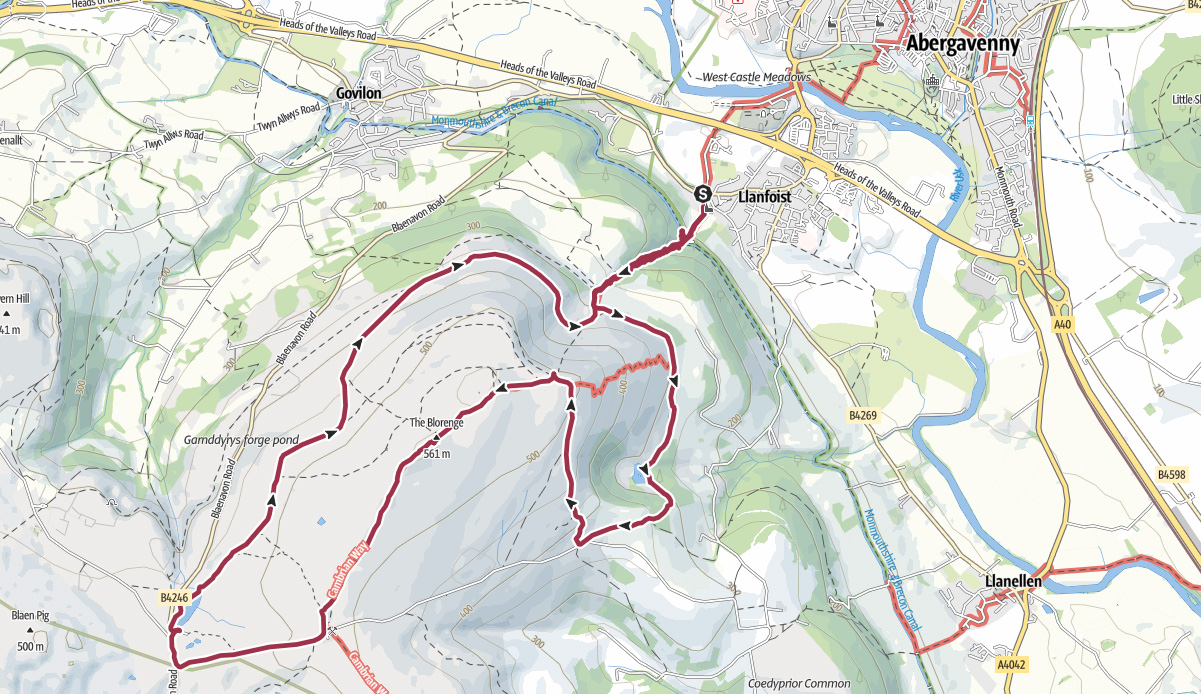
Hike Map
Hike Profile
- Distance: 8m / 13km
- Duration: 4 hours
- Highest point: 1827ft / 556m
- Difficulty: Moderate (steep short climbs), sometimes loose terrain through the woods, and some rocks to navigate.
- Route conditions: Well-worn pathways all the way around, good walking shoes are a must really.

Sim Local can help reduce or even eliminate roaming fees completely. Click here for eSIM data plans worldwide! 10% Discount using ‘WELSHMAN’
Hike Description & Pics
Let’s get going – If you need help organising this trip, see links below.
This route is available from my OutdoorActive account, it is free and will guide you all the way around, no getting lost. Once on the app, click ‘Navigate’ in the bottom bar, and from the walk’s start point it will guide you all the way around.
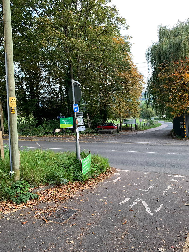
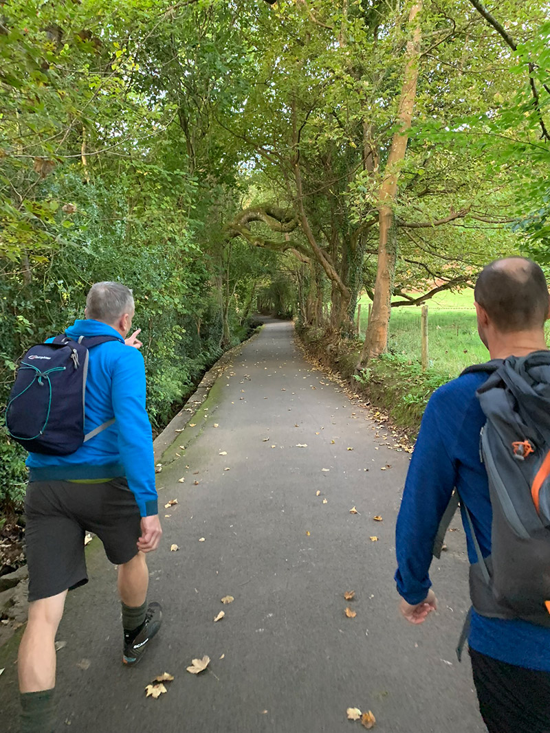
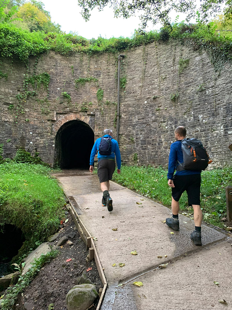
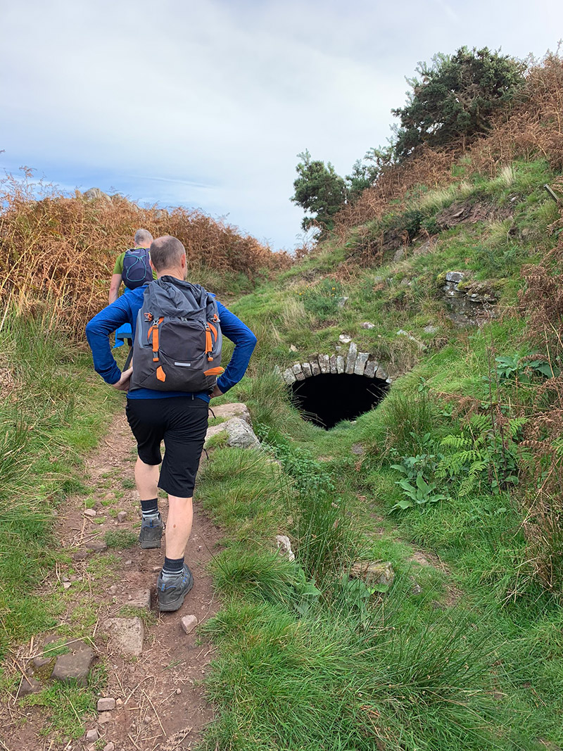
Best place to start is at the ‘Llanfoist Crossing Car Park‘, there is limited car parking and it does get busy, and from there you can set off across the main road and up towards the tunnel underneath the Monmouthshire & Brecon Canal, which we will walk up and see at the end of the walk, it’s a very special place as you will see.
So, once outside the car park cross the main road and head straight forward up the lane, and on your left you will see ‘Saint Faith Parish Church Llanfoist‘, continue up the lane and you will see the tunnel under the canal. This tunnel is very damp, and so very slippery and is very dark, so please be careful.
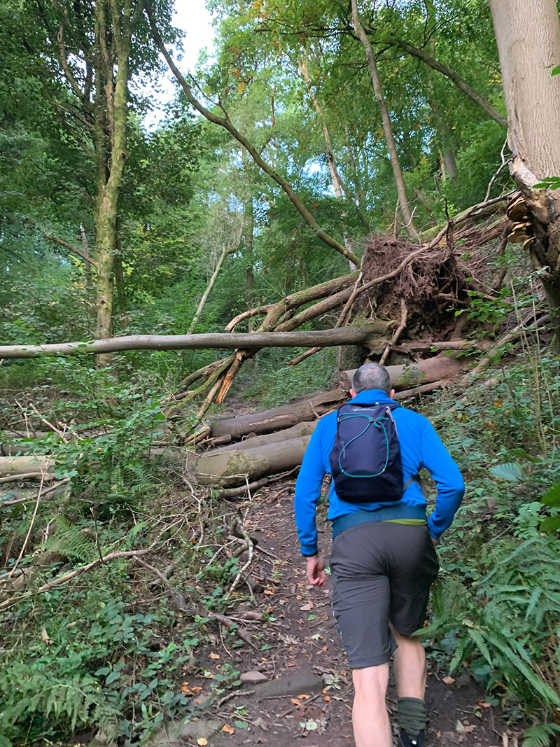
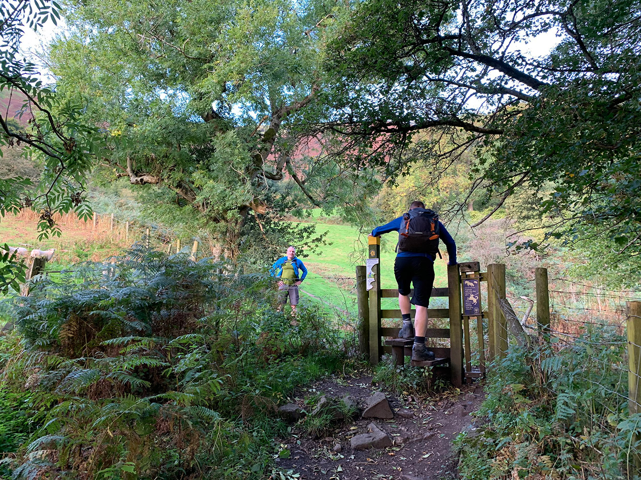
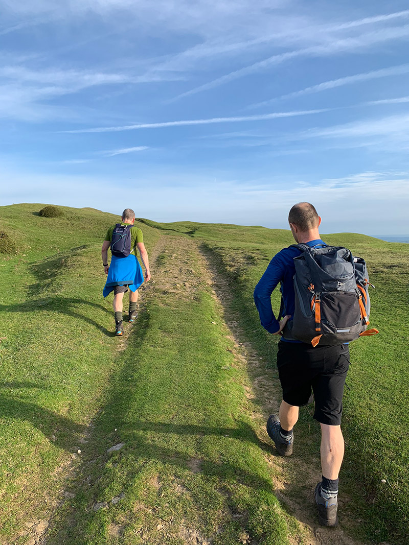
Once on the other side, you will see a set of beautiful cottages and a path in front of you heading up through the woods. This part of the walk I think is the hardest bit, it is quite steep and if its wet it can be very muddy and so again very slippery as a lot of water comes down this way when it’s raining.
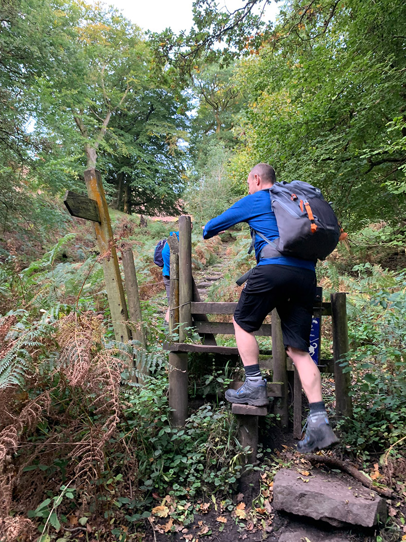
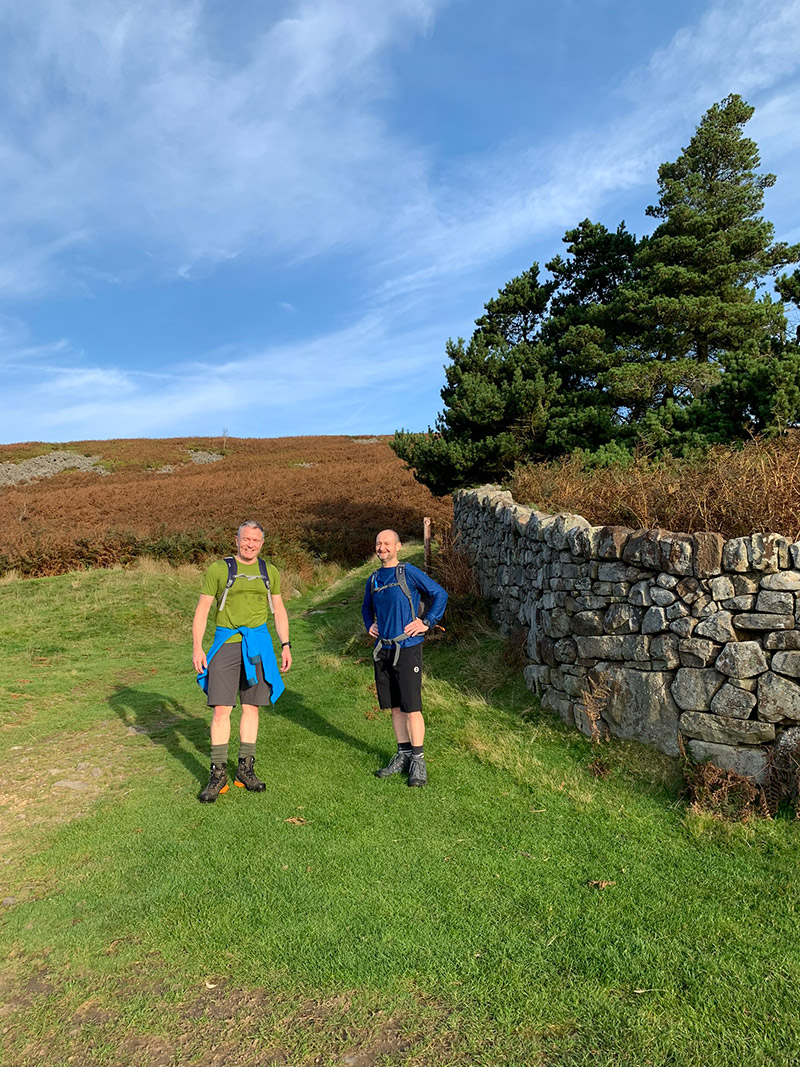
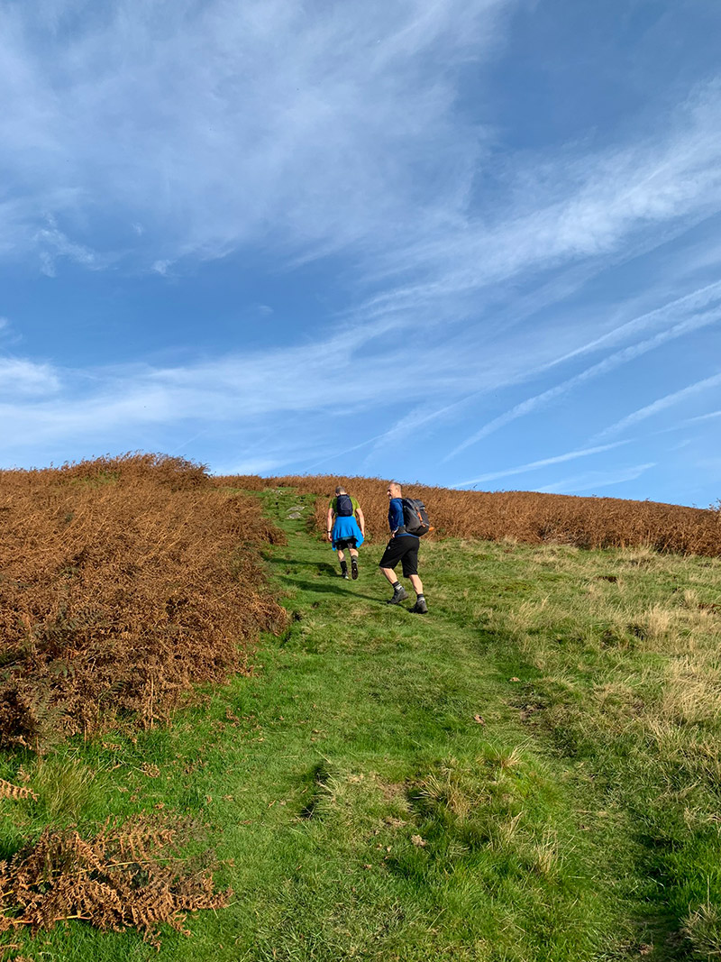
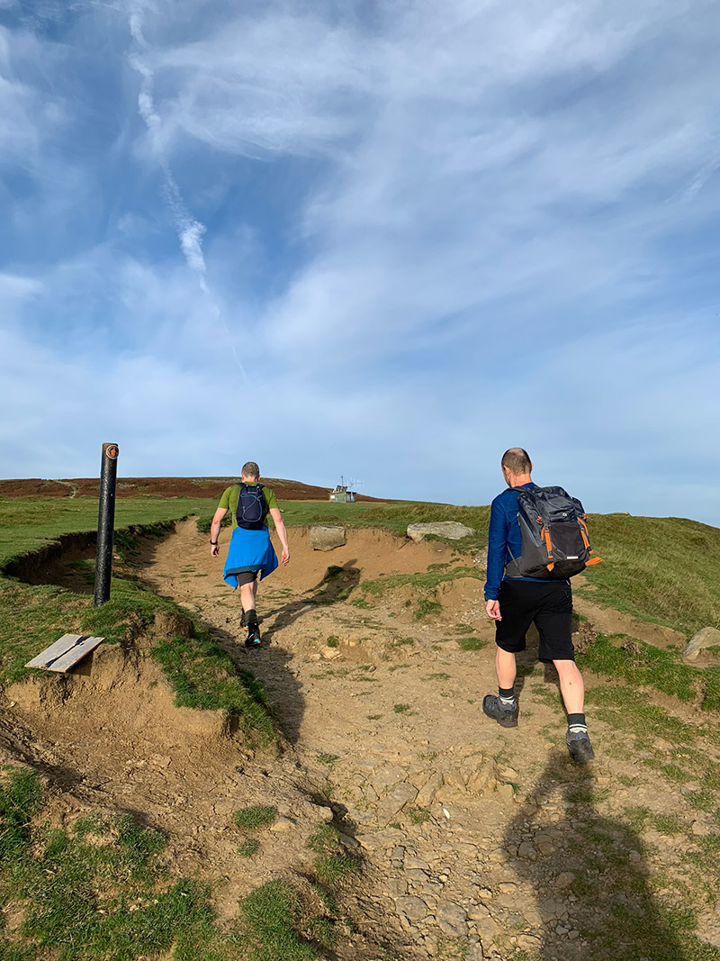
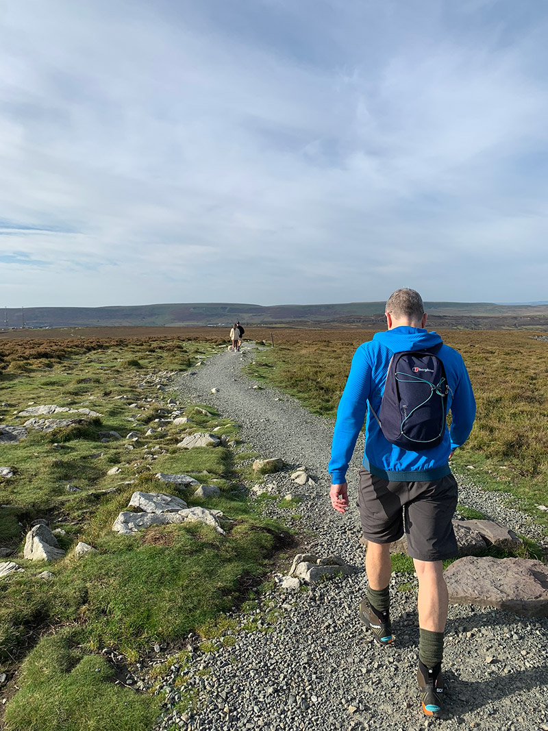
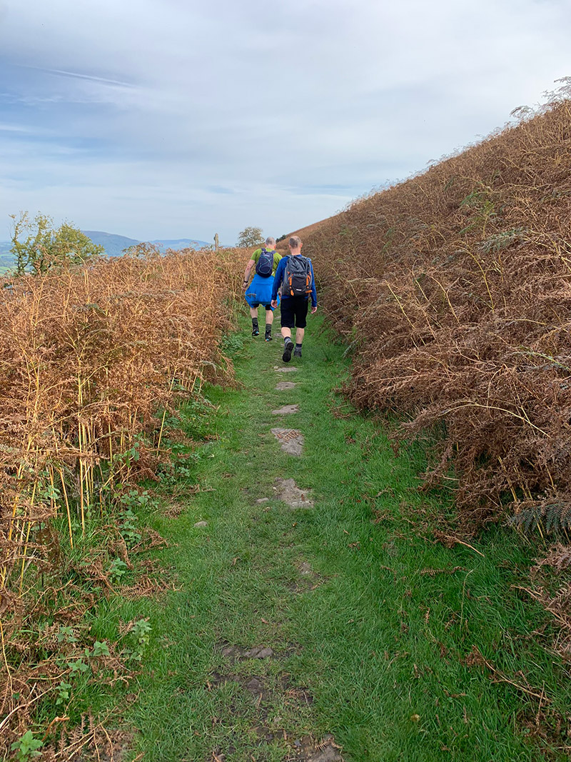
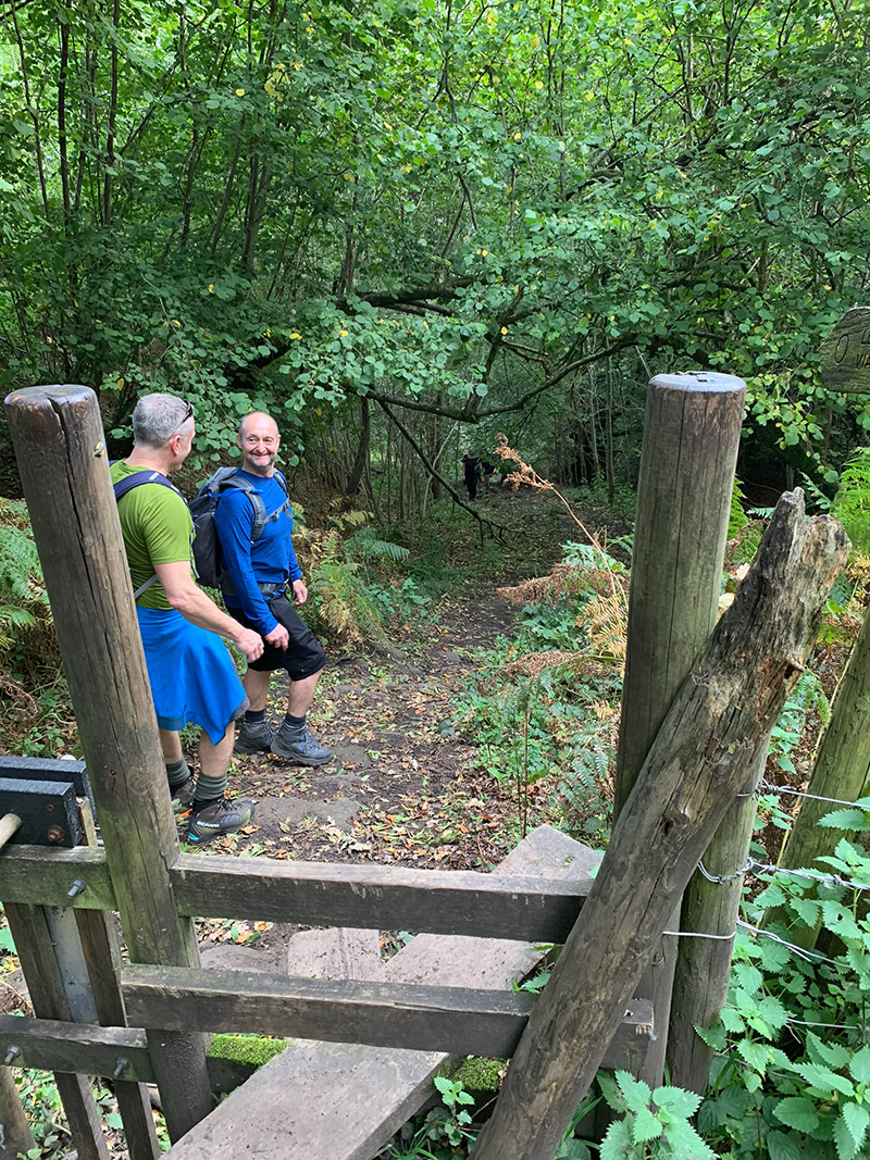
As you head up there is a large tree to make your way over, and then 4 sets of stiles to go over before you are out of the woods and onto the open land. After the 4th stile, you need to carry on walking up and then on your left the 5th stile will appear and that is the end of that climb. You will then follow that fence path all the way making your way around the mountain to the left.
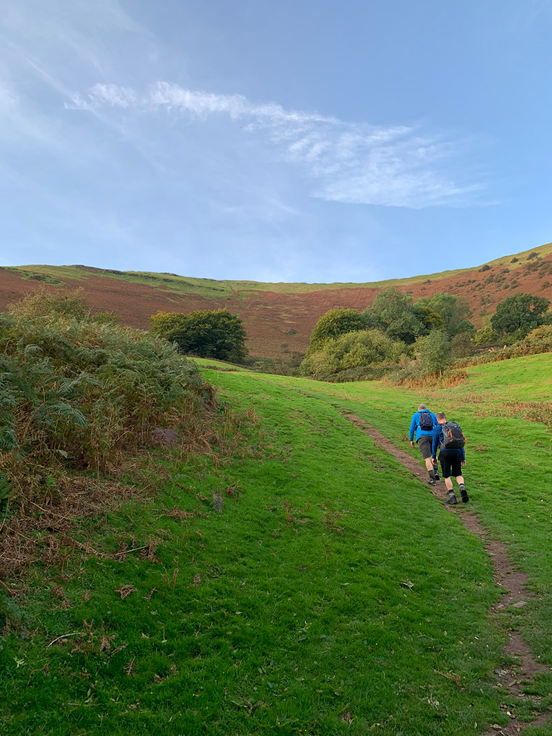
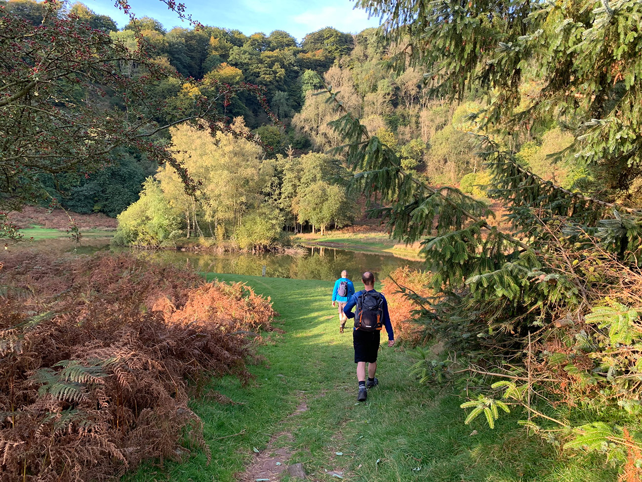
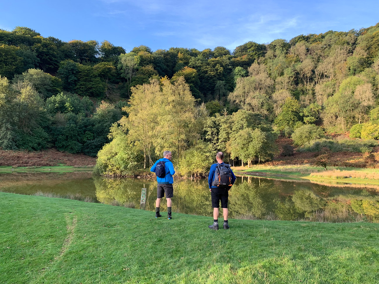
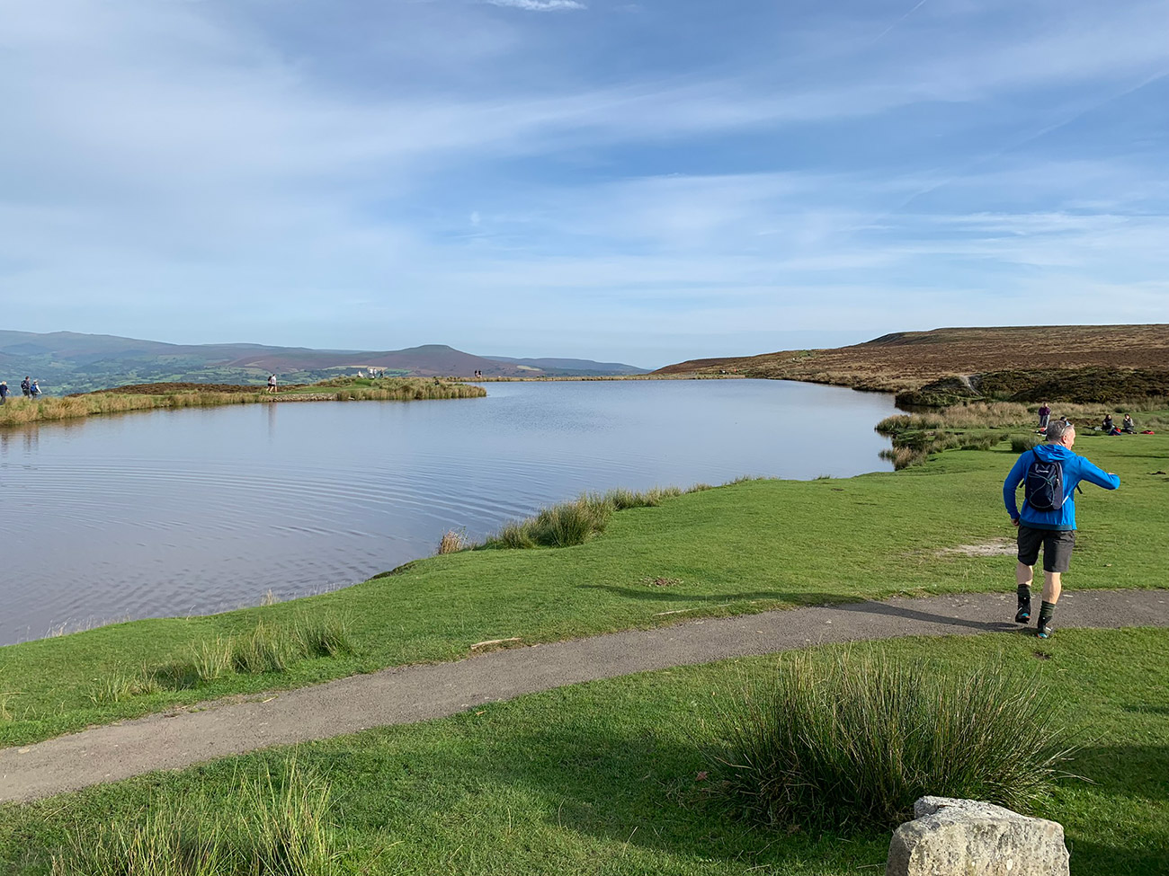
Along the path the views to your left are beautiful, and in the summer the ferns grow pretty high, so you feel like you’re walking through a passageway, and it’s very peaceful. The paths lead on further until it slowly opens up onto the first lake which is called the ‘Punchbowl‘.
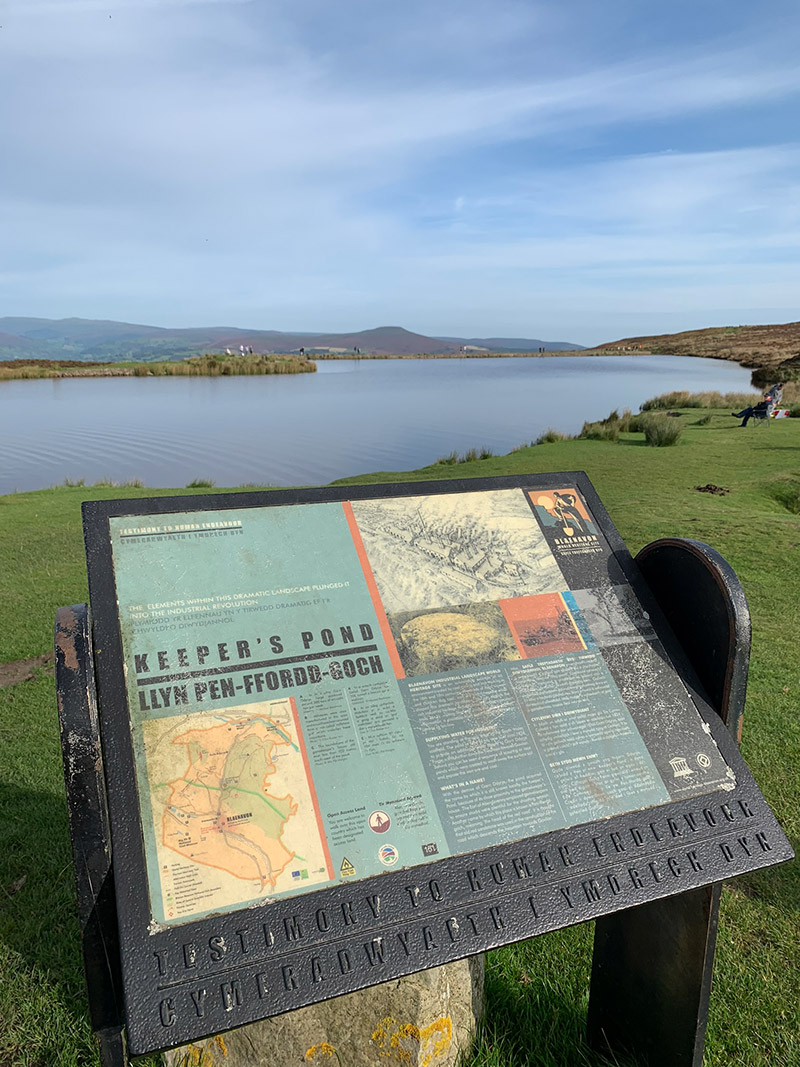
The unusual shape of the Punchbowl was formed by glacial erosion during the last Ice Age. As the ice retreated, it left behind a circular, bowl-like depression called a cwm (the Welsh word for valley). The lake you see today is not a natural feature but was added later by people.
There is evidence of charcoal hearths among the trees, dating back to the site’s history as a working woodland. It’s thought that the beech trees were last pollard around 1900. An old dry stone wall also lies along the western boundary of the site.
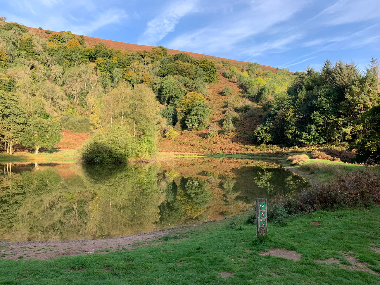
To continue the walk, keep the lake on your right, and in the far-left corner a path will appear and that will take you back into the woods, and you will start to gently move up hill, as you follow a brick wall around. You will eventually join a road, only very briefly, before you make a sharp right turn at the edge of the manmade wall, and then the path ahead will take you up to the top of the bowl, where we sat and had some lunch.
– Find accommodation in the Brecon Beacons with Booking.com

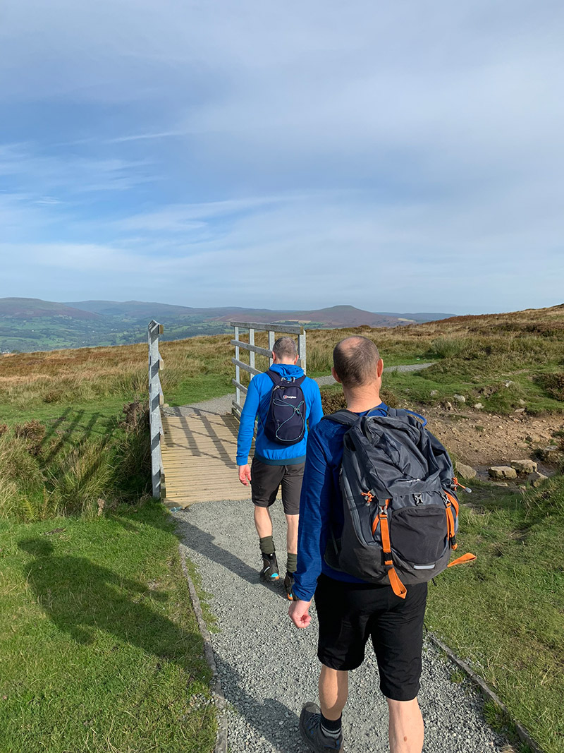
After a little rest and taking in the incredible views, we set off in the direction of the trig point, the highest point of the Blorenge. It can get very windy up here, and if it’s raining it can be quite brutal, so make sure you take some extra layers and a warm hat.
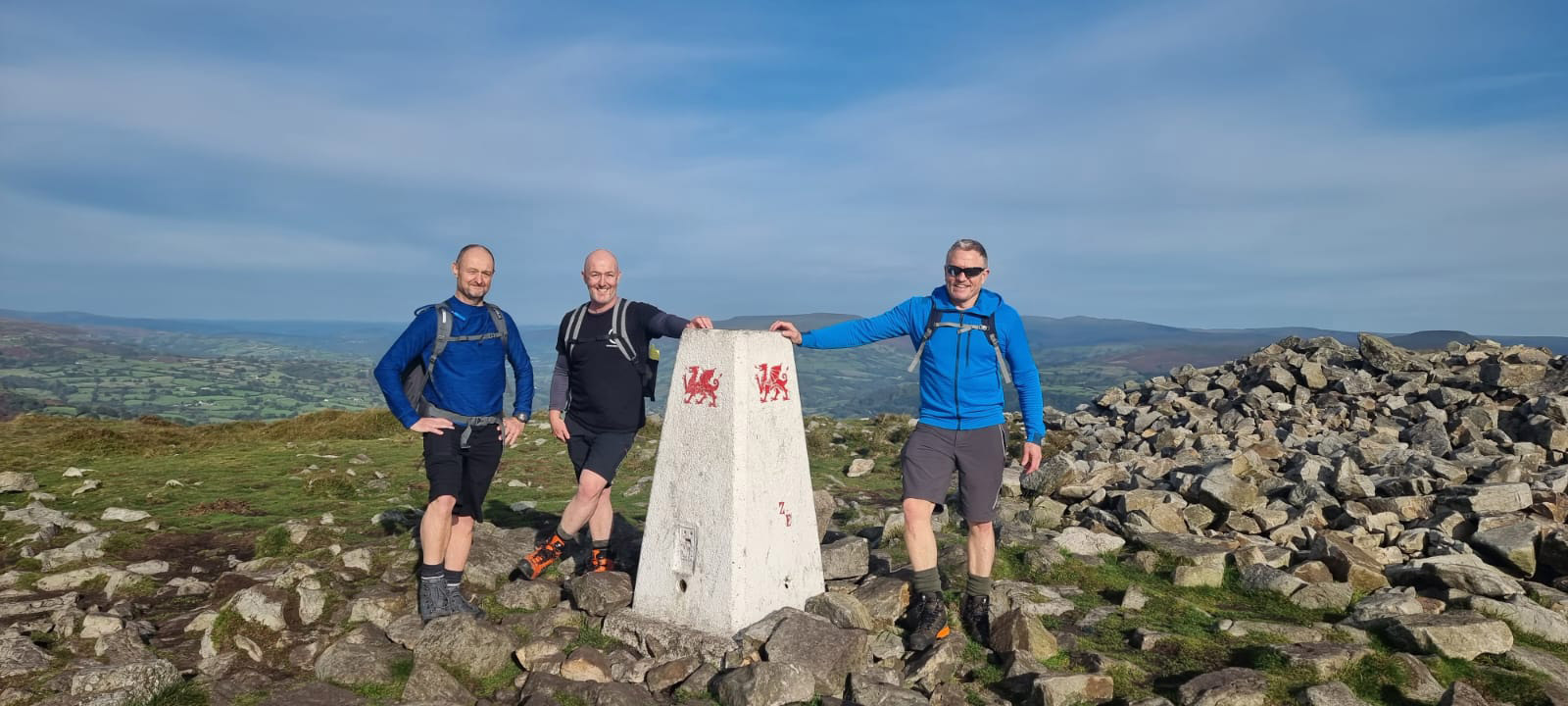
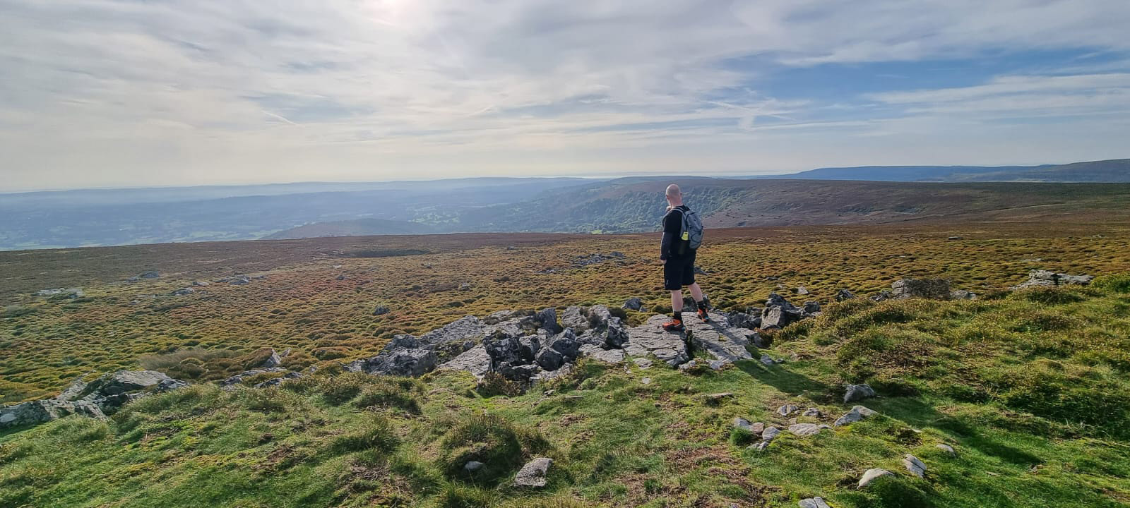
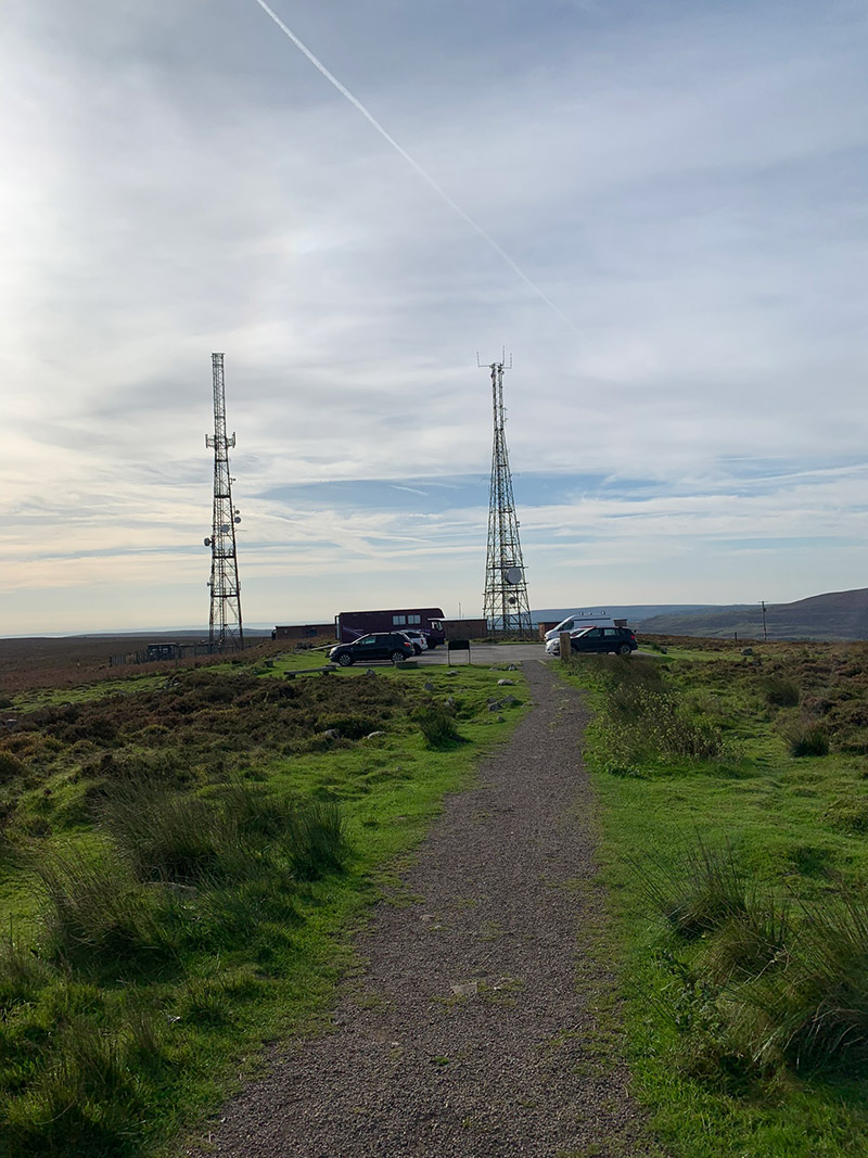
We got the standard trig point pic in, and then pretty much in line with the peak there is a well-worn path, that is leading you in the direction of 2 large ariels sticking up in the distance, this is the way to ‘Keepers Pond’.
On the way there you will see a large brick seat facing back towards the peak, then you walk past the aerials, and follow the road to ‘Keepers Pond‘.
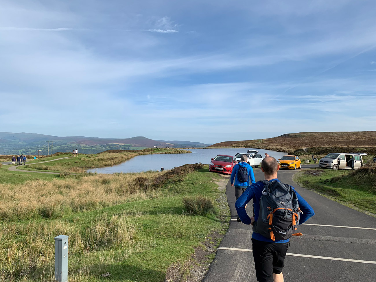
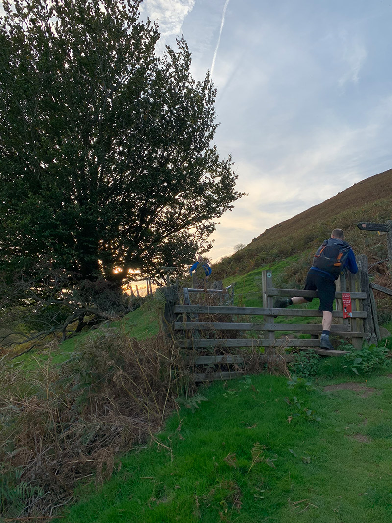
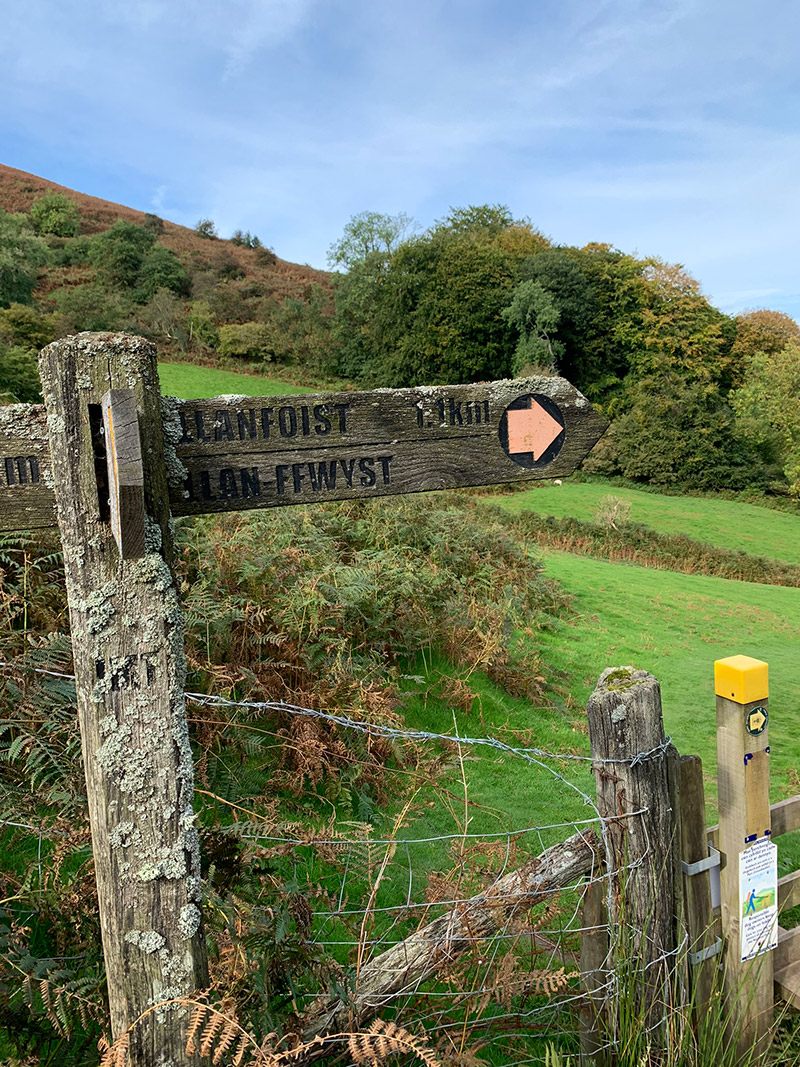
To leave Keepers Pond and continue on with the walk, we crossed over a very little bridge on the other side of the lake, and then followed that path along the side of the mountain for a little while, and a bit into the walk you will see a way marker and a sign that points to turn left and go to Llanfoist.
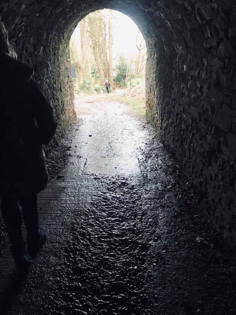
This walk and what it has to offer hasn’t finished yet, but we need to get to almost the start point to see the next beauty spot, so continue on this path and you will eventually join an old tram road and ahead of you a tunnel will appear on your right, it stands out and looks out of place, but it will re-assure you, you are on the way down.
After a short while you will turn a right bend and then the path will bend left and down and back to the stile you got to after the first climb. You now keep walking down and walk back through the tunnel beneath the canal, and then we can go and take a look at what I was talking about.
Once you have made your way down and have gone through the tunnel, on your left are a set of steps to take up and onto the canal, and at the top you will hopefully see some beautiful barges, and three homes on the canal that are stunning, and I hope the owners don’t mind people looking at them, as you can’t not look and admire them and where they are.
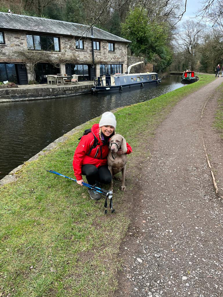
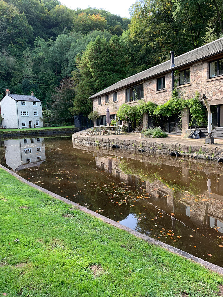
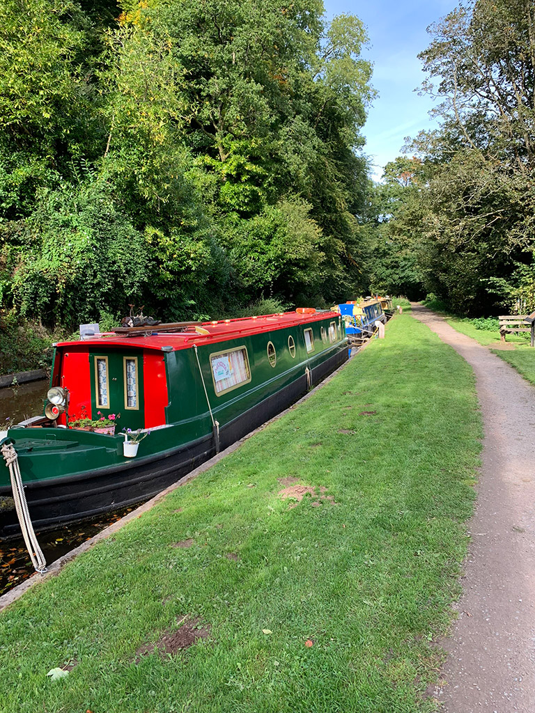
That is an awesome walk, with loads to see, and it’s best to do on a really sunny day as it all seems to come alive, and the beauty is right up there.
To head back to the car, just go back down the steps, follow the lane down and cross the road.
Hi
Thank you for supplying this information. Is there anyway that this walk can be shortened to hours?
Thanks
Christine
Hi Chris, I’m guessing you are asking for 2 hours, which is fine, and what I would do is start at Keepers Pond at the top. There is a car park, and you have some options there. To keep it short but still have a great walk, what I would do is to the right of the pond about 100 yards away there is a dirt road, and in the distance you will see some pylons. If you walk towards them then turn left through another car park and a pathw ill appear which will take you all the way to the trig point. From there carry on in a straight line and that will take you right to the edge of the Blorenge that you see from Abergavenny. You can then track back the same way back to the car. I do have some other paths for the Blorenge so will get them up asap. Hope that helps.