


Region: Scafell Pike, Lake District National Park, Cumbria
Places To Stay: Wasdale Head is the closest spot to the popular route, but Keswick and Ambleside are excellent nearby bases with more facilities. Book early in peak months: Lake District accommodation.
At 978 metres (3,209 feet), Scafell Pike is the highest mountain in England and one of the country’s most sought-after summits. Rising above the dramatic Wasdale Valley in the western Lake District, it attracts walkers from across the UK who come to complete a personal challenge, tackle the English stage of the National Three Peaks or simply experience one of Britain’s great mountain landscapes.
This circular route begins beside Wastwater and follows a steep, increasingly rocky ascent towards Lingmell before continuing across the rugged upper slopes to the summit of Scafell Pike. The return passes through Mickledore and beneath the imposing crags surrounding Scafell, creating a demanding mountain journey rather than a simple out-and-back climb. Although the distance may appear manageable, rough ground, loose boulders, significant ascent and rapidly changing weather make this a serious hike that requires good fitness, suitable equipment and confident navigation. On a clear day, however, the summit panorama and the wild scenery of Wasdale make every step worthwhile.
Looking for more Lake District walks? If you enjoyed Cat Bells, why not tackle the Old Man of Coniston Circular Walk with its historic slate mines and panoramic summit views, take on the classic Helvellyn via Striding Edge for one of England’s most exhilarating ridge walks, or enjoy the peaceful Buttermere Circular Walk, one of the Lake District’s finest low-level routes with beautiful lakeside scenery.
Below are a 3 ideas for trips and tours available in the Lake District, GetYourGuide offer great discounts and availability + Many more!
Looking for Cheap Flights? Try the Skyscanner Flight Checker Below.
This is how I find my ‘Flight Tickets‘, I fly when the price suits my budget. Flying to Heathrow is the best option for London.
Getting There: Directions, GPX and App Link
- Start point: Wasdale Head car park (postcode: CA20 1EX)
- Google Maps: Wasdale Head National Trust car park
- GPX: Download the GPX file here for use on your GPS device or watch
- You can also view and follow this route on my Outdooractive and Komoot profiles
- Avoid the early start – find accommodation near Keswick
Hike Profile
- Distance: 6 miles / 9.6 km (Circular)
- Duration: 4 – 5 hours
- Highest point: 978m / 3,209ft (Scafell Pike summit)
- Difficulty: Strenuous – steep ascents, rocky paths, and mountain terrain
- Route conditions: Very rocky and exposed – good boots and proper gear required

Sim Local can reduce or even eliminate your roaming fees. Click www.simlocal.com/ + 10% Discount Using – ‘WELSHMAN’
Hike Description
The Scafell Pike circular walk begins close to the shore of Wastwater in Wasdale, one of the most dramatic valleys in the Lake District. Wastwater is England’s deepest lake, framed by the steep scree slopes of the Wasdale Screes on one side and some of the country’s highest mountains on the other. Even before the climbing begins, the setting gives a clear indication that this will be a proper mountain day.
From the car park, the route crosses the lower valley and begins climbing beside Lingmell Gill. The ascent starts steadily but soon becomes steeper and rockier as the path rises away from the farmland and valley floor. Looking back, Wastwater stretches towards the western fells, while Great Gable and the surrounding peaks begin to appear across the valley.

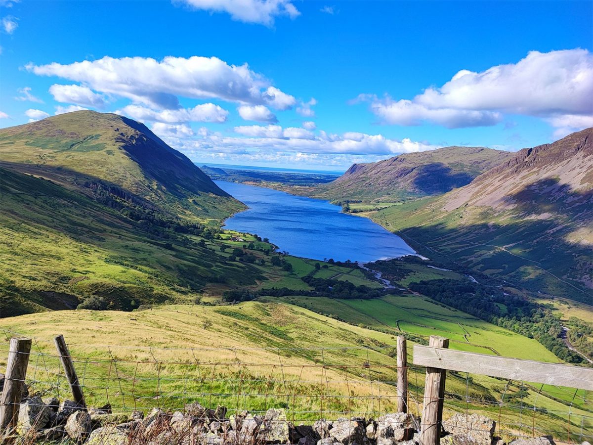
The path is usually easy to identify in good visibility because this is the most popular route to Scafell Pike. However, the number of other walkers should never create a false sense of security. Weather can change extremely quickly, and cloud frequently covers the upper mountain even when conditions appear settled in Wasdale. A map, compass, GPS device or downloaded GPX route should be carried and understood.
The climb continues beside Lingmell Gill towards the broad slopes below Lingmell. The ground becomes increasingly uneven, with stone steps, loose rock and eroded sections requiring careful footing. Lingmell rises to 807 metres and provides an impressive viewpoint over Wasdale, Great Gable and the surrounding valleys, although the route towards Scafell Pike may pass below or close to its summit depending on the exact line followed.
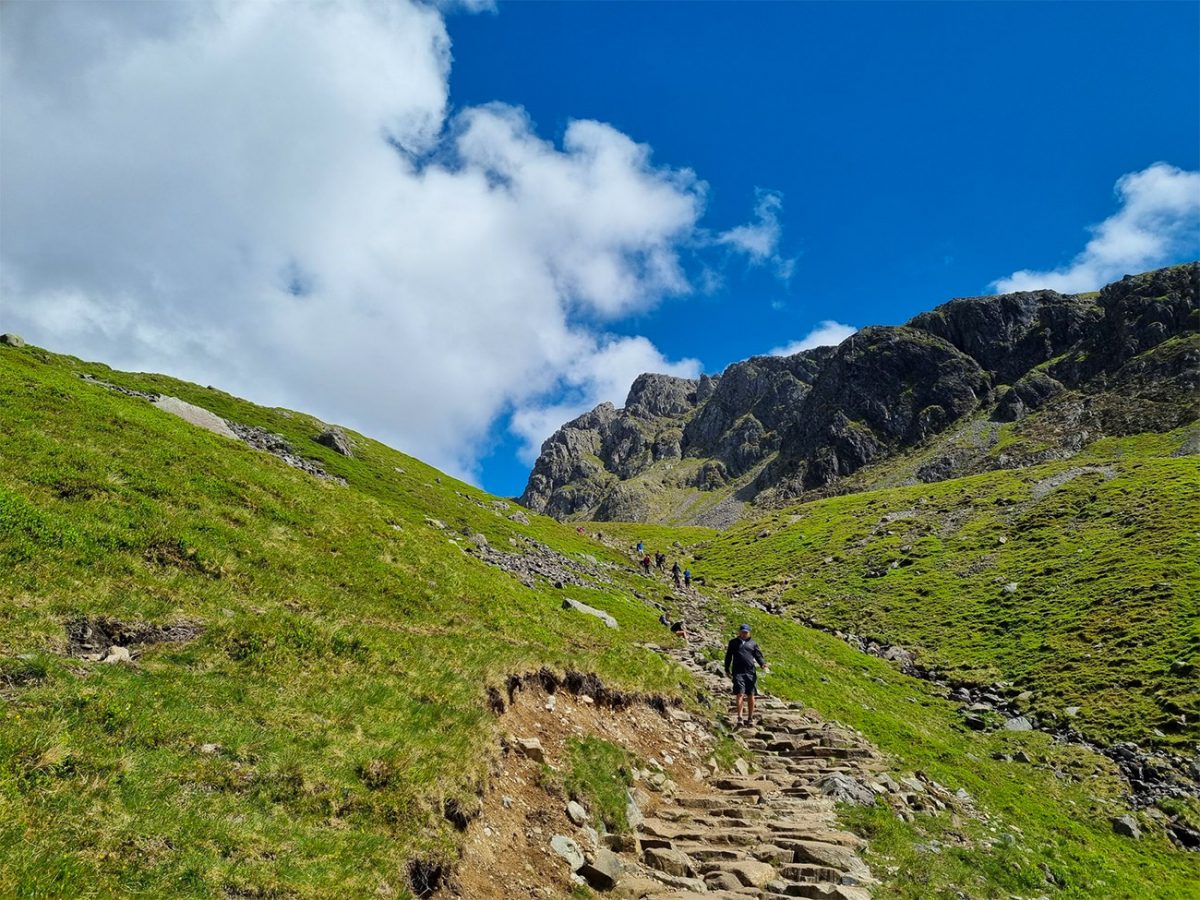
Beyond the Lingmell area, the route crosses Lingmell Col and turns towards the upper slopes of Scafell Pike. The character of the landscape changes significantly here. Grass gives way to an extensive field of shattered rock, scree and large boulders, creating the stark, almost lunar terrain for which the summit plateau is known.
Progress across this section is slower than the distance might suggest. The path can be difficult to distinguish among the stones, particularly in cloud, and the loose rocks demand constant concentration. Painted marks and cairns may help indicate the route, but they should not be relied upon as the sole means of navigation.

The final ascent leads across the summit plateau to the large stone shelter and summit cairn. At 978 metres, Scafell Pike is the highest point in England. The trig pillar stands on top of the summit structure, and reaching it provides a real sense of achievement after the long rocky climb from Wasdale.
In clear weather, the summit views are extensive. Great Gable, Bowfell, Crinkle Crags, the surrounding Scafell massif and many of the central Lake District fells can all be seen. On exceptionally clear days, views may extend towards the mountains of Wales and Scotland and westwards across the Irish Sea towards the Isle of Man. Cloud and mist are common, however, and it is entirely possible to reach the summit without seeing beyond the surrounding rocks.
From the summit, the route descends south-west across rough and broken ground towards Mickledore. This narrow mountain pass lies between Scafell Pike and Scafell and is one of the most dramatic locations on the walk. The descent is steep and loose in places, requiring patience and careful foot placement.
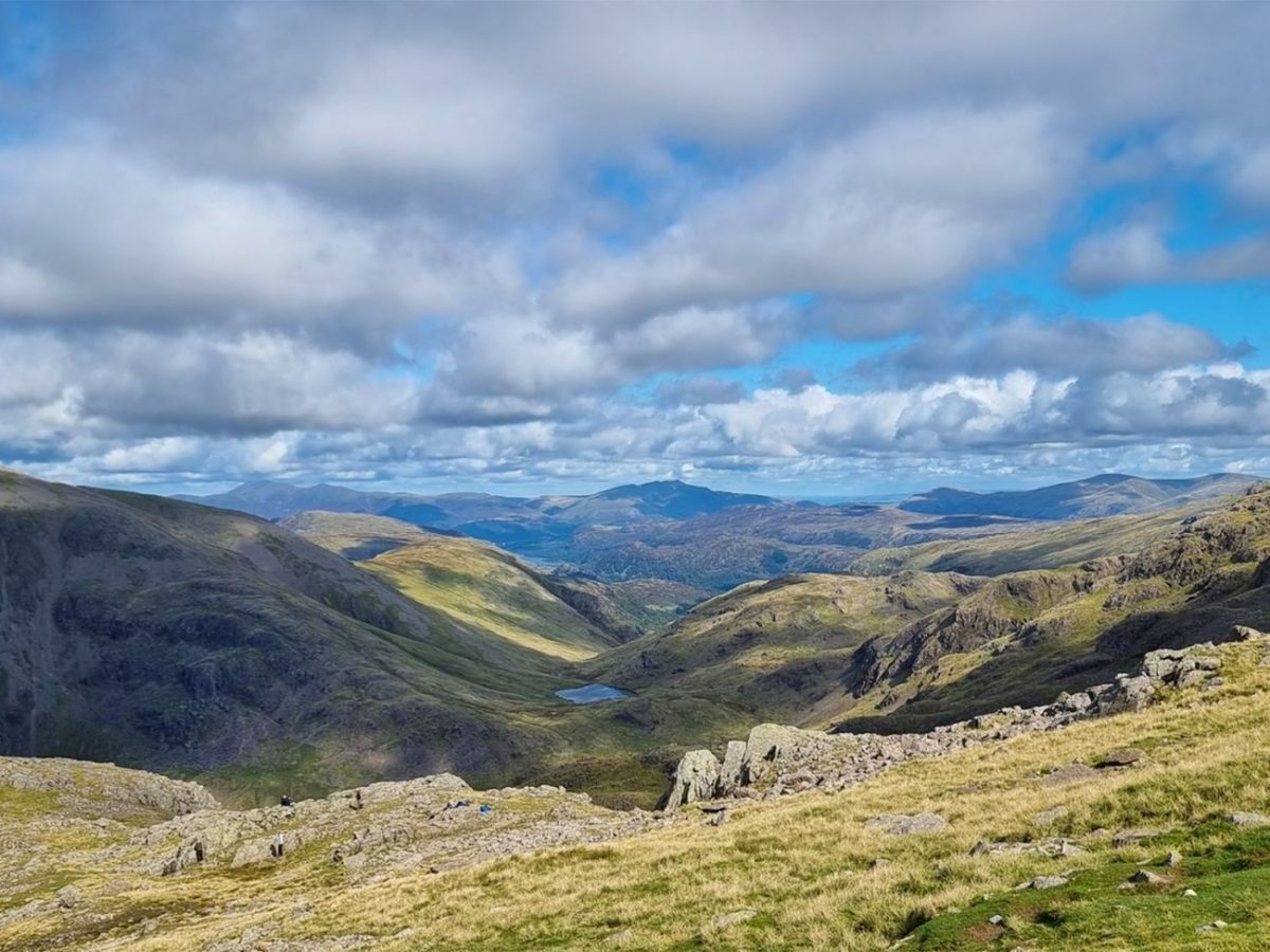
It is important not to attempt to climb directly from Mickledore towards Scafell via Broad Stand. Broad Stand is a dangerous rock-climbing route and is not a suitable continuation for ordinary hillwalkers. This circular instead follows the safer walking line beneath the crags and around the mountain.
From Mickledore, the route rises again towards the area around Symonds Knott, which reaches approximately 959 metres. This additional climb can feel demanding after already reaching Scafell Pike, but it provides a different perspective over the surrounding ridges, gullies and high mountain terrain.
Once beyond the high point near Symonds Knott, the route begins its long descent towards Wasdale. The path remains steep, rocky and uneven for a considerable distance. Loose stones and tired legs make the return just as demanding as parts of the ascent, so it is important not to rush. Walking poles may be particularly useful for reducing pressure on the knees and providing additional stability.
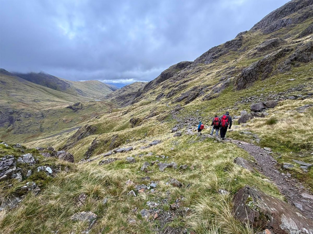
As height is gradually lost, the landscape becomes greener and the valley begins to open below. Wastwater reappears in the distance, providing a useful visual marker for the final stages of the walk. The route eventually reconnects with the lower paths and returns to the car park beside the lake.
This is a demanding but highly rewarding circular mountain route. It combines England’s highest summit with the dramatic scenery of Lingmell, Mickledore, Symonds Knott and the Scafell massif, creating a far more varied experience than simply climbing and descending by the same path.
Completing Scafell Pike is a significant achievement in its own right. For walkers pursuing the National Three Peaks, it can also be combined with Yr Wyddfa in Wales and Ben Nevis in Scotland to complete the trio of the highest mountains in England, Wales and Scotland.

Walk this route yourself in 3D!
The Video is a 3D walk through of this route; it will give you a unique sense of having walked through the route before you start.
I have created 3D Videos of my adventures and have shared them with the OutdoorActive community as well as my walking community.
Scafell Pike, Lake District – England’s Highest Mountain at 978m – 3D Video
Scafell Pike FAQs
Is Scafell Pike hard to climb?
What is the easiest route up Scafell Pike?
How long does the Scafell Pike walk from Wasdale take?
Is it safe to climb Scafell Pike alone?
Can I climb Scafell Pike without a guide?
What equipment do I need for Scafell Pike?
Can dogs climb Scafell Pike?
Is there parking at the start of the Scafell Pike walk?
Are there toilets on the Scafell Pike route?
What is the weather like at the summit of Scafell Pike?


AllTrails: Trail Guides & Maps for Hiking, Camping, and Running | AllTrails ‘Plus’ 30% OFF – Read my ‘Full Review‘ for more details.
Water-to-Go Named Best Watter Bottle for Travel. Click https://watertogo.eu/ + 20% Discount Using – ‘WMW20’