


Region: Ben Nevis, Fort William, Lochaber, Scottish Highlands
Places To Stay: Fort William is your best base, with everything from hostels to hotels and mountain lodges. Try: Stay near Ben Nevis or browse more Scottish Highlands Accommodation.
The Ben Nevis Mountain Track is the classic walking route to the summit of the United Kingdom’s highest mountain. Beginning at the Glen Nevis Visitor Centre near Fort William, this demanding out-and-back walk climbs from the floor of Glen Nevis to the broad, rocky summit plateau at 1,345 metres.
Previously known as the Tourist Path or Pony Track, the route is the most straightforward way to climb Ben Nevis, but the old name can be misleading. This is not an easy sightseeing trail: walkers face approximately 1,300 metres of ascent, several hours of continuous climbing, rough stone steps, loose rocks and an exposed summit where cloud, wind, rain and snow can arrive at any time of year.
The lower route climbs above Glen Nevis through grassy and increasingly rocky terrain, passing high above Lochan Meall an t-Suidhe before crossing the Red Burn. Beyond this point, a long series of zigzags rises across the mountain’s stony western flank towards the summit plateau.
Reaching the top is an unforgettable moment. The summit contains a trig point, emergency shelter and the ruins of the former meteorological observatory, which operated during the late nineteenth and early twentieth centuries. In clear weather, the views can extend across Loch Linnhe, the Mamores, the Great Glen and a vast area of the western Highlands.
However, the summit is frequently covered by cloud even when Fort William is bright and dry. The plateau is bordered by severe cliffs and gullies, making reliable navigation essential when snow or mist hides the path. The popularity of the route should never be mistaken for safety.
Fit walkers with suitable equipment and mountain awareness can complete the walk during settled summer conditions, but beginners should prepare carefully and consider joining an experienced companion or qualified guide. When snow and ice are present, Ben Nevis becomes a winter mountaineering objective rather than an ordinary hike.
For another major Scottish mountain day, your Ben Macdui and Derry Cairngorm circular walk offers a much longer and more remote expedition across the Cairngorm plateau. Walkers seeking a shorter Highland summit with dramatic scenery may prefer your Stac Pollaidh circular walk, while your wider Lochaber walking guide can help visitors build a longer stay around Fort William.
Looking for more Scottish walks? Try Ben Macdui Circular, Buachaille Etive Mòr (coming soon), or The Cairngorm Plateau Traverse (coming soon).
Below are a 3 ideas for trips and tours available in Fort William, GetYourGuide offer great discounts and availability + Many more!
Looking for Cheap Flights? Try the Skyscanner Flight Checker Below.
This is how I find my ‘Flight Tickets‘, I fly when the price suits my budget. Flying into Inverness, Glasgow or Edinburgh works best for Fort William.
Getting There: Directions, GPX and App Link
- Start point: Glen Nevis Visitor Centre, Fort William (postcode: PH33 6ST)
- Google Maps Glen Nevis Visitor Centre
- GPX: Download the GPX file here for use on your GPS device or watch
- You can also view and follow this route on my Outdooractive and Komoot profiles
- Avoid the early start – find accommodation near Ben Nevis
Hike Profile
- Distance: 9.3 miles / 15 km (circular)
- Duration: 6 – 8 hours
- Highest point: 1,345m / 4,413ft (Ben Nevis summit)
- Difficulty: Challenging – long, steep and exposed
- Route conditions: Well-marked mountain path, rocky near the top – boots, layers, and navigation gear essential

Sim Local can reduce or even eliminate your roaming fees. Click www.simlocal.com/ + 10% Discount Using – ‘WELSHMAN’
Hike Description
The walk up to Ben Nevis begins at the Glen Nevis Visitor Centre car park, approximately two miles from central Fort William. Whilst we were in Fort William, we shopped at the large supermarket there and stocked up on drinks, food and managed to have a look around the town, and also see the incredibly beautiful lake.
Starting at the Visitor Centre is the best idea for the Mountain Track as it has visitor information, parking and toilets, but it’s opening hours and charges should be checked before travelling.
Ben Nevis is one of Britain’s busiest mountains, so the car park can fill early during summer weekends, bank holidays and periods of settled weather. An early start provides more daylight, cooler climbing conditions and a quieter first section.
Before leaving, check a dedicated mountain forecast rather than relying on the weather shown for Fort William. Conditions at 1,345 metres can be dramatically colder, wetter and windier than those in the glen, and the upper mountain can remain snow-covered even when the valley feels like summer.
Pack a bag to cover all weather types, and also make sure you have plenty of food and drink, and eat as often as you can to keep your energy up.

Leave the Visitor Centre and cross the footbridge over the River Nevis. Turn right briefly along the river before following the signed path uphill between the wall and fence.
The trail begins climbing almost immediately. The opening section gains height through woodland and grassy lower slopes, providing increasingly wide views across Glen Nevis.

Cross the track near Achintee and join the original Mountain Track rising from the Ben Nevis Inn. Turn uphill and continue on the broad stone path. There is a long way to go, so keep a slow pace and build into the walk.
The route climbs across the hillside in a long rising traverse. Although the surface is generally constructed and easy to identify in clear weather, the gradient is persistent and there are few genuinely level sections.
A path from Glen Nevis Youth Hostel joins from the right. Continue uphill on the main route.

As the trail becomes steeper, it turns through a series of broad zigzags. The route fades to the left before coming back around on a wide ark, but don’t be tempted to cut the zigzag off, it’s not worth it, you want gain much time and also it is much harder.
Stone pitching and drainage work help protect the heavily used mountain path from erosion, but the steps can be tiring and slippery when wet, frosty or icy.
Looking back, the views open along Glen Nevis towards the Mamores. Stob Bàn and the surrounding ridges become increasingly prominent as height is gained.
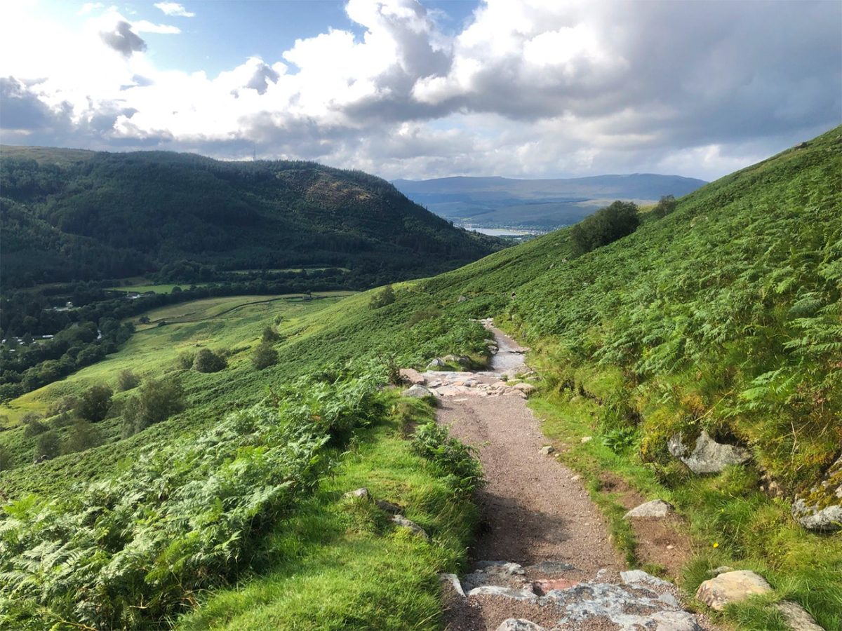
The path crosses several small streams on footbridges before curving around the slopes above the Red Burn.
Near the head of the burn, the correct maintained route turns sharply left. Avoid following eroded shortcuts, which damage the mountain and can be loose and dangerous underfoot.
The path eventually reaches the broad shoulder beside Lochan Meall an t-Suidhe, popularly known as the Halfway Lochan.
Despite the nickname, this point does not represent half the physical effort. A substantial amount of ascent remains, and the terrain becomes rougher and more exposed above this level.
The route does not normally descend to the lochan itself. Instead, it stays above and to the east of the water before reaching an important junction.

At the junction, keep right to remain on the Mountain Track. The path heading left traverses beneath the North Face and is not part of this standard ascent.
Continue climbing until the route crosses the upper Red Burn. In normal summer conditions this is usually straightforward, but after heavy rain or during thawing snow the water may be stronger and the surrounding stones slippery.
This can be a useful place to assess progress, energy and the weather. If cloud is building, winds are increasing or anyone in the group is already struggling, turning around is often the safest decision.
Beyond the Red Burn, the character of the walk changes noticeably. Vegetation becomes sparse and the route enters a much rougher landscape of granite stones, scree and boulders.
The Mountain Track now climbs in a long series of wide zigzags across the western flank of Ben Nevis.

These upper zigzags can feel relentless. The summit may still be hidden, and the apparently similar bends make it difficult to judge how much climbing remains.
Remain on the constructed path wherever possible. Cutting directly between the zigzags accelerates erosion and creates loose descent lines.
As the trail rises, the views back over Lochan Meall an t-Suidhe, Glen Nevis, Loch Linnhe and Fort William become increasingly impressive when cloud allows.

The path eventually passes above the steep ground leading into Five Finger Gully. This area has been associated with serious accidents, particularly when people descending in poor visibility have travelled too far south-west while trying to avoid the North Face.
Do not assume that following random cairns or other walkers will lead safely downhill. Small informal cairns may be misleading, especially where snow obscures the established track.
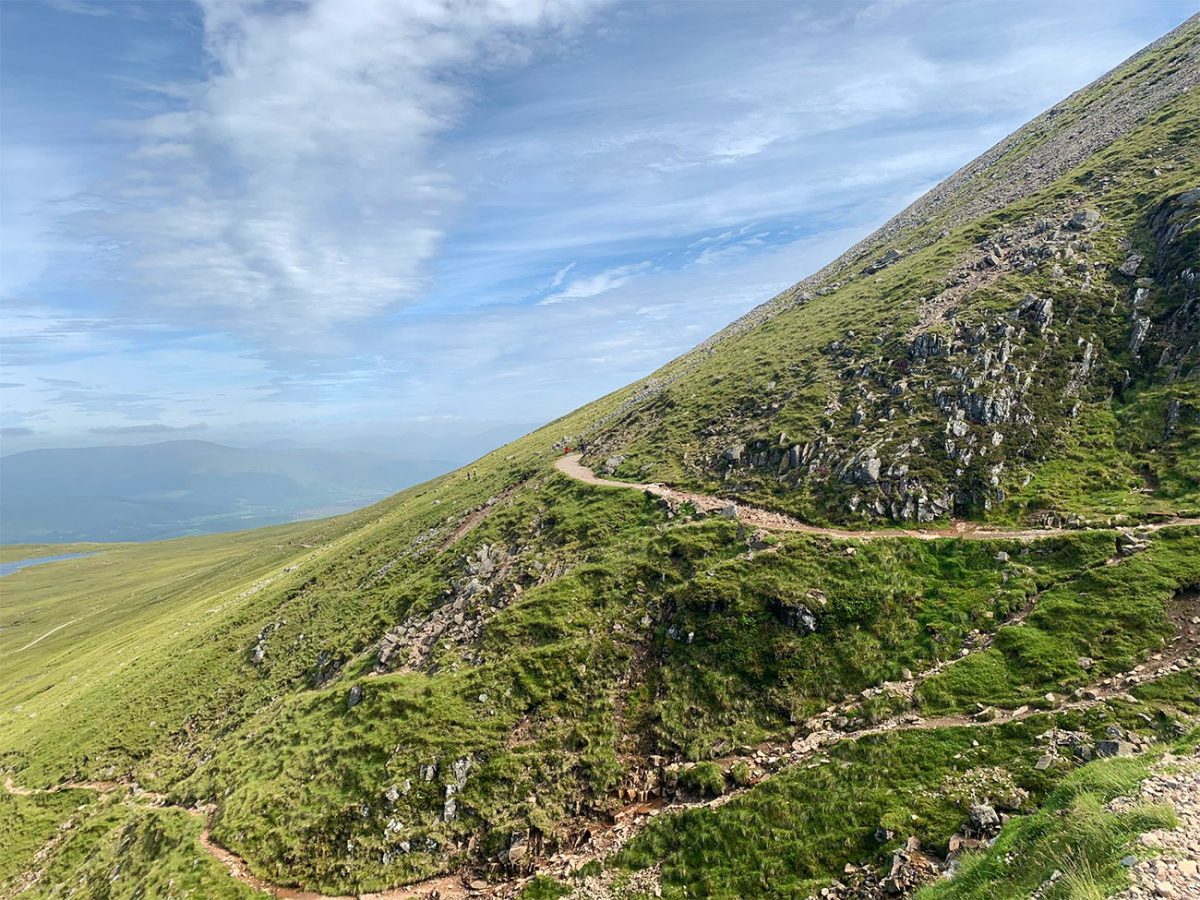
Higher still, the gradient gradually begins to ease as the route approaches the summit plateau.
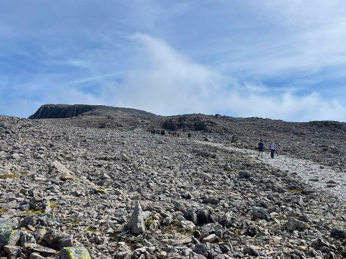
The terrain remains extremely rocky, and progress can be slow across the loose stones. In wet weather, the rocks may be slippery; under snow, the path and cairns can disappear almost completely.

The upper plateau is much more serious than its relatively flat appearance suggests. Severe cliffs and gullies surround large parts of the summit, including Gardyloo Gully and the cliffs of the North Face.

The route passes near the tops of major gullies before reaching the central summit area. Keep well back from all edges, particularly in cloud, high winds or snow.
Cornices can form above the cliffs during winter and may extend beyond solid ground. Never approach a snowy edge merely to look over it.
Continue across the plateau towards the ruined observatory and summit structures.

Ben Nevis reaches 1,345 metres, making it the highest mountain in Scotland, the United Kingdom and the British Isles.
The summit is marked by a trig point and cairn. Standing here means that, for those moments, you are higher than everyone else on land anywhere in Britain, a simple fact that gives the summit a special appeal despite the crowds and often severe weather.
Nearby are the ruins of the former summit observatory. The building was staffed between 1883 and 1904, when observers lived and worked in exceptionally harsh conditions to record mountain weather. The resulting observations contributed significantly to the understanding of British meteorology.
The summit shelter is intended for emergency use. It is not heated or staffed and should never be treated as a substitute for adequate clothing, shelter and preparation.
On a clear day, the panorama can include the Mamores, Grey Corries, Glen Coe mountains, Loch Linnhe, the Great Glen and large areas of the western Highlands.

More distant islands and ranges may also be visible in exceptional clarity, but summit views should be considered a bonus rather than an expectation. Cloud covers the upper mountain frequently.
The cliffs of the North Face fall away dramatically to the north and north-east. Experienced climbers use famous lines such as Tower Ridge, but these are completely separate from the Mountain Track and require technical mountaineering skills.
Take photographs, eat and add clothing before becoming cold, but avoid spending too long on the exposed summit. Windchill can lower the effective temperature rapidly.

The descent follows the same Mountain Track back to Glen Nevis.
Before leaving the summit, identify the correct direction carefully. This is one of the most important navigational moments of the entire walk.
In clear, snow-free summer conditions, the large cairns and worn route may be easy to follow. In cloud or snow, the safe descent line requires accurate map-and-compass navigation to avoid Gardyloo Gully, the North Face and Five Finger Gully.
Walkhighlands gives specific bearings for the most dangerous summit section, but these should only be used by someone who understands how to apply bearings accurately and adjust for the conditions and map being used. Copying numbers without competent navigation skills does not make the descent safe.

Retrace the route across the plateau before beginning the long descent through the upper zigzags.
Descending places different strain on the knees, thighs and ankles. Fatigue often becomes more apparent on the way down, so maintain a controlled pace rather than rushing.
Loose stones can move beneath the feet, and wet rock can be treacherous. Trekking poles may help with balance, although they do not replace careful foot placement.
Continue down towards the Red Burn. In cloud, make sure you remain on the principal track and do not drift towards the dangerous ground south of the route.
Cross the burn and continue to the junction near Lochan Meall an t-Suidhe.
The lochan provides an attractive landmark, but resist the temptation to assume that the hard work is finished. A significant descent still remains, and slips commonly happen when concentration relaxes.
Follow the broad path down through the stone-pitched bends.
Allow 7–9 hours for most reasonably fit walkers, with additional time for photographs, rests and difficult conditions. The present 6–8-hour estimate is possible for strong walkers, but it is slightly optimistic as general visitor guidance.
There is no technical scrambling on the Mountain Track during dry, snow-free conditions, but the walk remains physically demanding. Approximately 1,300 metres of ascent is comparable to climbing a staircase for several hours before having to descend it again.
Carry sturdy walking boots, waterproof jacket and trousers, warm insulating layers, hat, gloves, food, water, head torch, first-aid supplies, emergency shelter, paper map, compass, charged phone and backup battery.
Do not rely solely on a mobile phone. Cold temperatures can reduce battery life, screens can fail in heavy rain and network coverage is inconsistent.
The popularity of Ben Nevis can create a false sense of reassurance. A busy path does not remove the risks posed by exhaustion, hypothermia, poor visibility, snow and cliffs.
The Mountain Track is nevertheless a remarkable route. It allows walkers without technical climbing skills to journey from the green floor of Glen Nevis to a summit with a climate, landscape and atmosphere that feel entirely different from the valley below.

Walk this route yourself in 3D!
The Video is a 3D walk through of this route; it will give you a unique sense of having walked through the route before you start.
I have created 3D Videos of my adventures and have shared them with the OutdoorActive community as well as my walking community.
Ben Nevis (Tourist Route) Walk FAQs
Is the Mountain Track the easiest route up Ben Nevis?
Is Ben Nevis suitable for beginners?
Is it safe to climb Ben Nevis alone?
Is there snow on Ben Nevis during summer?
How long does it take to climb Ben Nevis?
Is the Ben Nevis path signposted and easy to follow?
Can I take my dog up Ben Nevis?
What equipment should I carry?
Are there toilets or refreshments on the mountain?
Can I use public transport to reach the start?

Water-to-Go Named Best Watter Bottle for Travel. Click www.watertogo.eu + 20% Discount Using – ‘WMW20’

AllTrails: Trail Guides & Maps for Hiking, Camping, and Running | AllTrails ‘Plus’ 30% OFF – Read my ‘Full Review‘ for more details.