
Region: Bannau Brycheiniog National Park, Wales
The Brecon Beacons Blaen-y-Glyn Waterfalls has many circular walks you can follow, and this is right up there with one of the best, and is also I’d say in the difficult range, especially if you are doing this in winter. This loop takes in a large number of waterfalls at the start and at the end, a World War II Canadian Wellington Bomber memorial, the diving board at Fan-Y-Big then glacial ridge walks most of the way around, it’s a challenging walk, but so rewarding and beautiful.
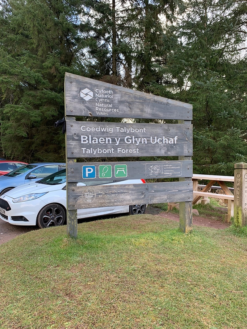
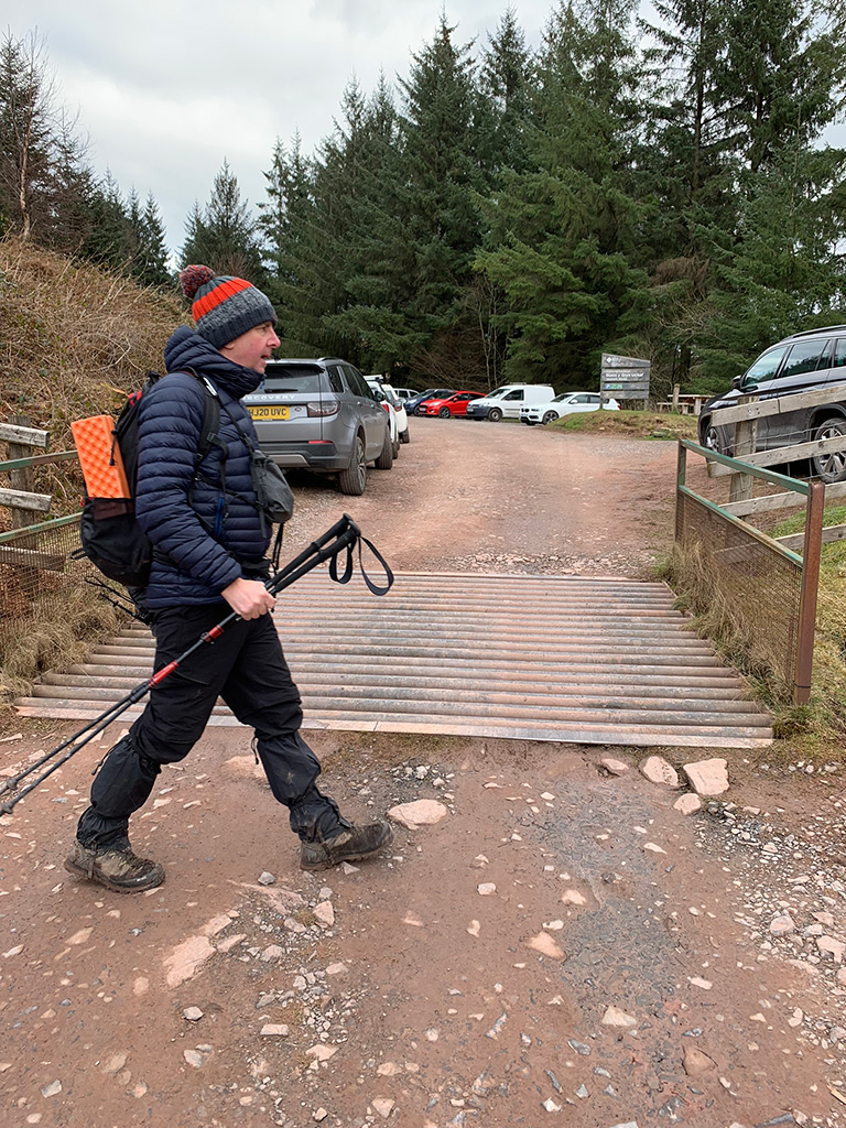
The start point is Blaen y Glyn Uchaf car park (Talybont-on-Usk, Merthyr Tydfil LD3 7YT), it can get full quickly, so get there early, and take in the views as you drive there from any direction, it’s a beautiful area. On a nice day this a beautiful walk, you have the waterfalls, the woods, the ridges and the famous diving board, but on a bad day take plenty of layers and your wets as at the top it’s really exposed, and the wind can be very strong.
Getting There: Directions, GPX and App Link
- Start point: Blaen y Glyn Uchaf car park.
- Parking: Parking is available in the Blaen y Glyn Uchaf car park. It gets busy early, especially in summer and on weekends.
- GPX: Download my hand crafted GPX file, and use it on your own guidance devices.
- I added this route to my Outdooractive and Komoot accounts, feel free to view and download this trail from there.
- If you’re not sure what a GPX file is, I have put this post together that will hopefully explain it in plain words. It’s worth considering as well as mobile app navigation, as they will make your hikes better & safer.
Hike Profile
- Distance: 8m / 13km
- Duration: 4 hours
- Highest point: 1722ft / 525m
- Difficulty: Moderate (steep short climbs), sometimes loose terrain through the woods, and some rocks to navigate.
- Route conditions: Well-worn pathways all the way around, good walking shoes are a must really.

Sim Local can help reduce or even eliminate roaming fees completely. Click here for eSIM data plans worldwide! 10% Discount using ‘WELSHMAN’
Hike Description & Pics
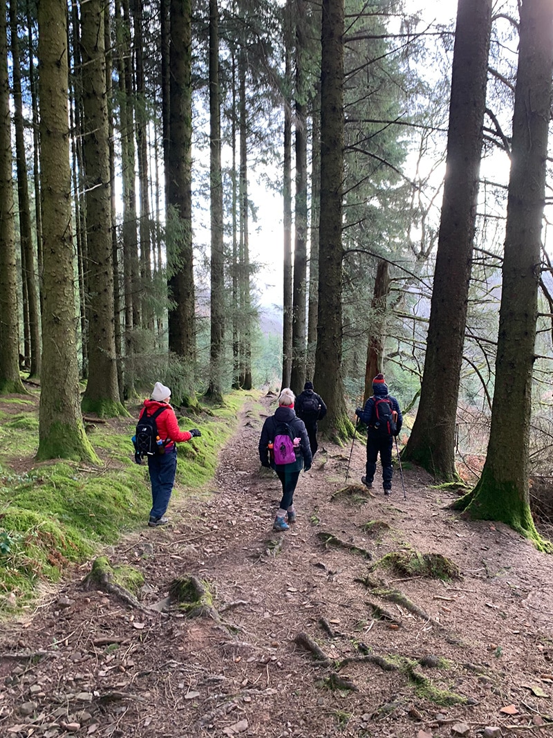
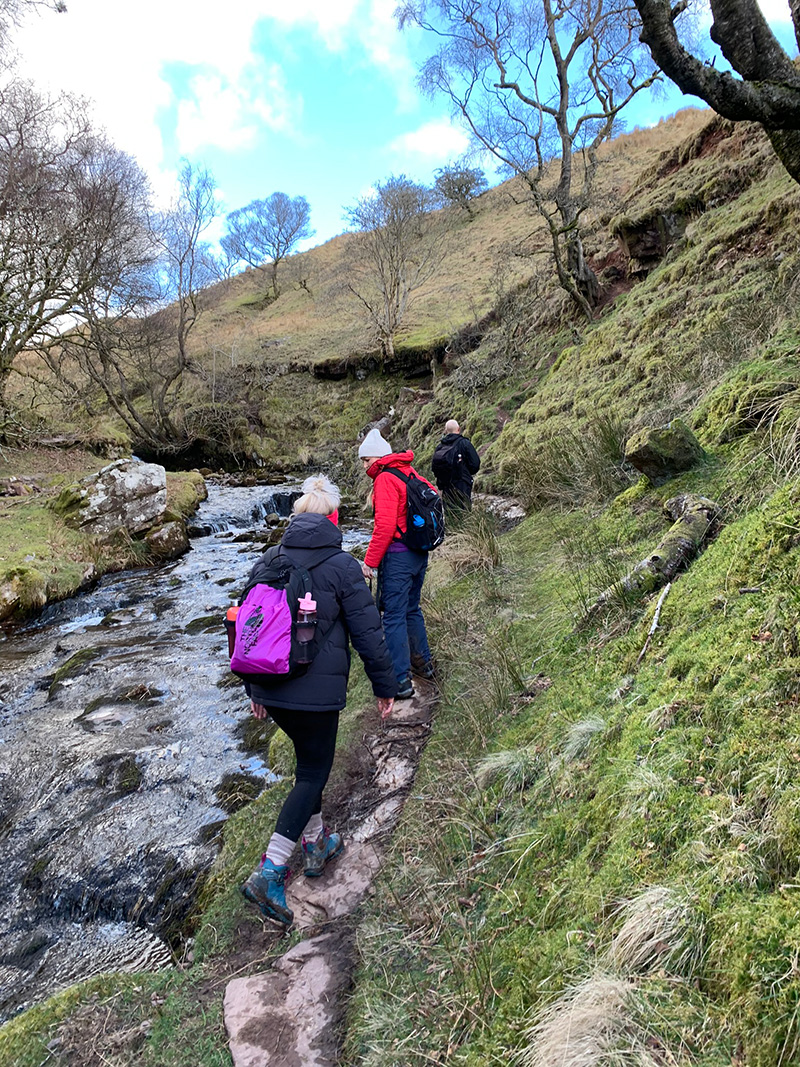
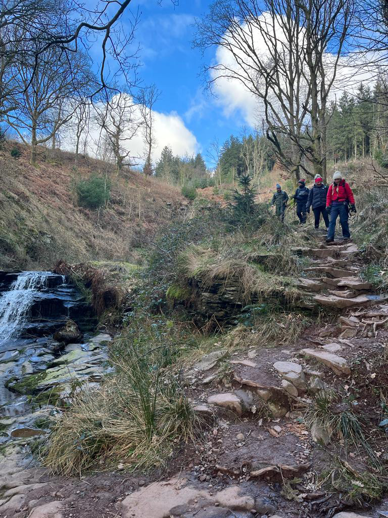
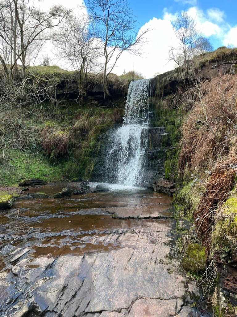
The start point is at ‘Blaen y Glyn Uchaf car park‘, there is limited car parking, and it does get busy, and from there you can set off left and follow the waterfalls, down and through the woods.
The tourist info board there will explain the woods, the waterfalls and the different routes, but hopefully you have this route to use, as it’s a beautiful way to get around Talybont Forest in the Bannau Brycheiniog (Brecon Beacons) National Park.
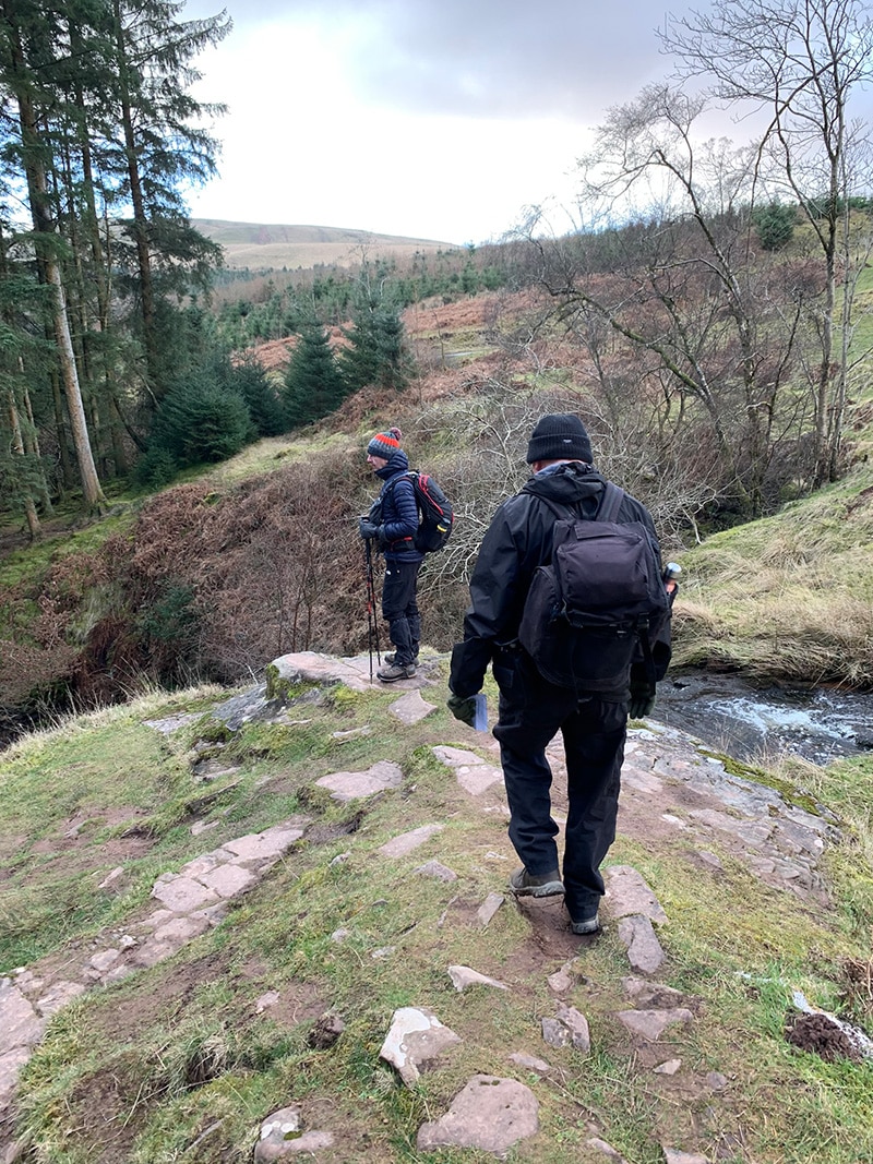
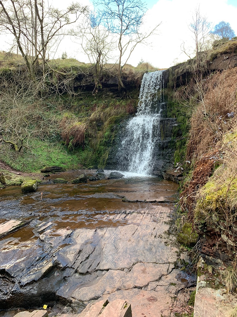
The Blaen-y-Glyn woods are very moody and atmospheric, and you have the sound of the fast-flowing water as it runs over the waterfalls, and you also have the background sound of birds in the trees. It’s a beautiful start to a walk, and it’s downhill so that’s a bonus.
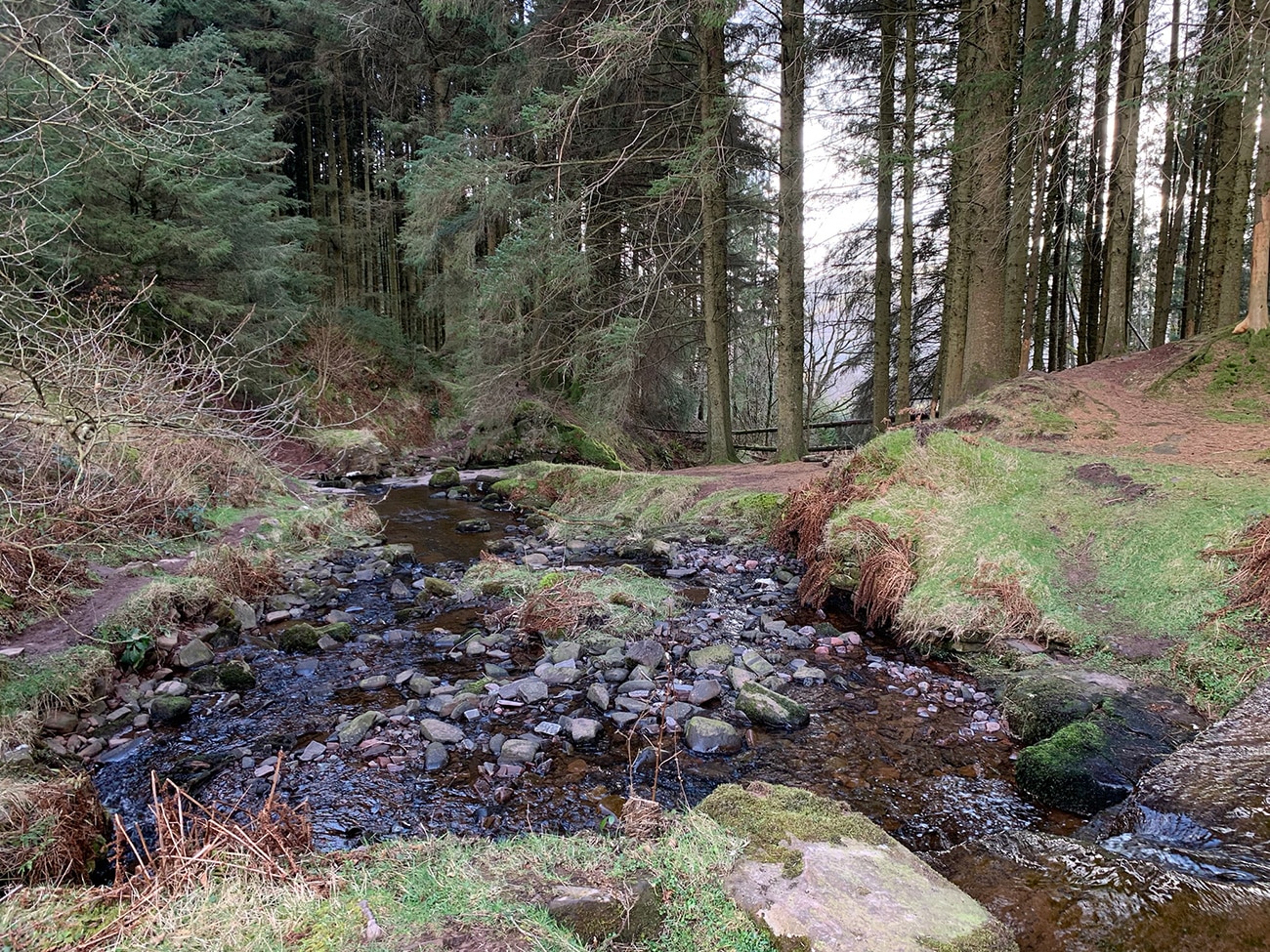
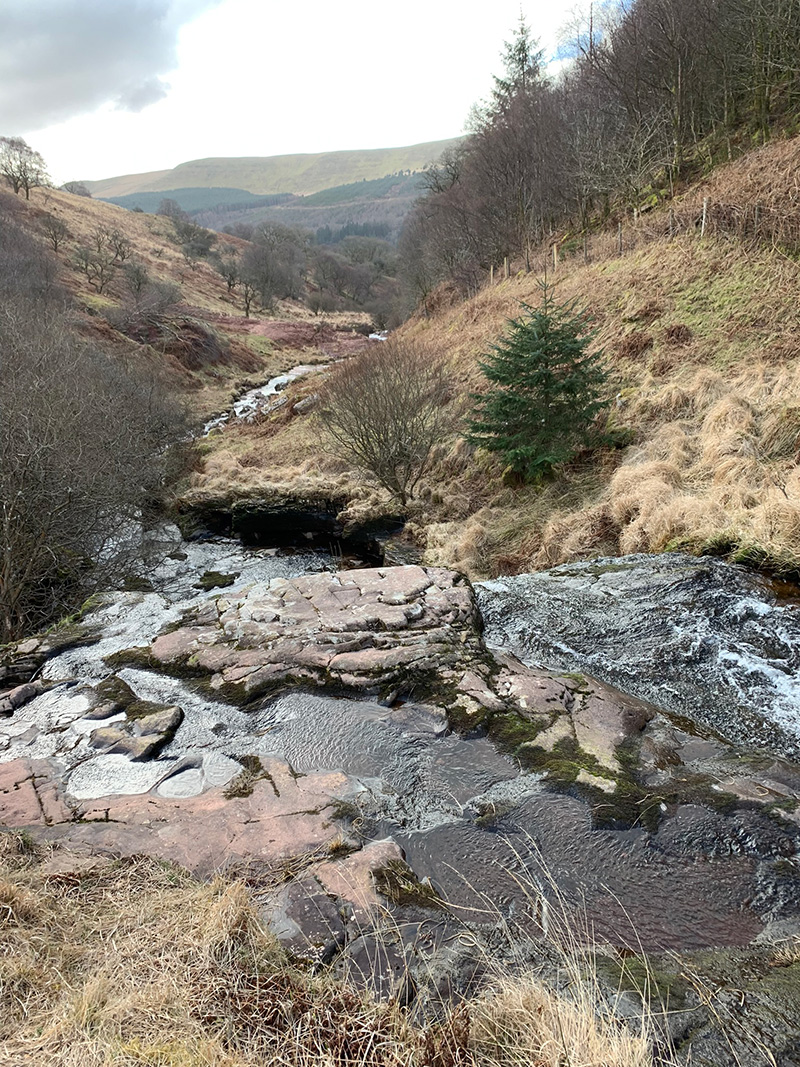
As you make your way down you will at a certain point take a left, if you were to carry on it would take you down to the lower car park which is called Blaen-y-Glyn Isaf car park, and you have more waterfalls, and the woods are again very beautiful and peaceful to walk in.
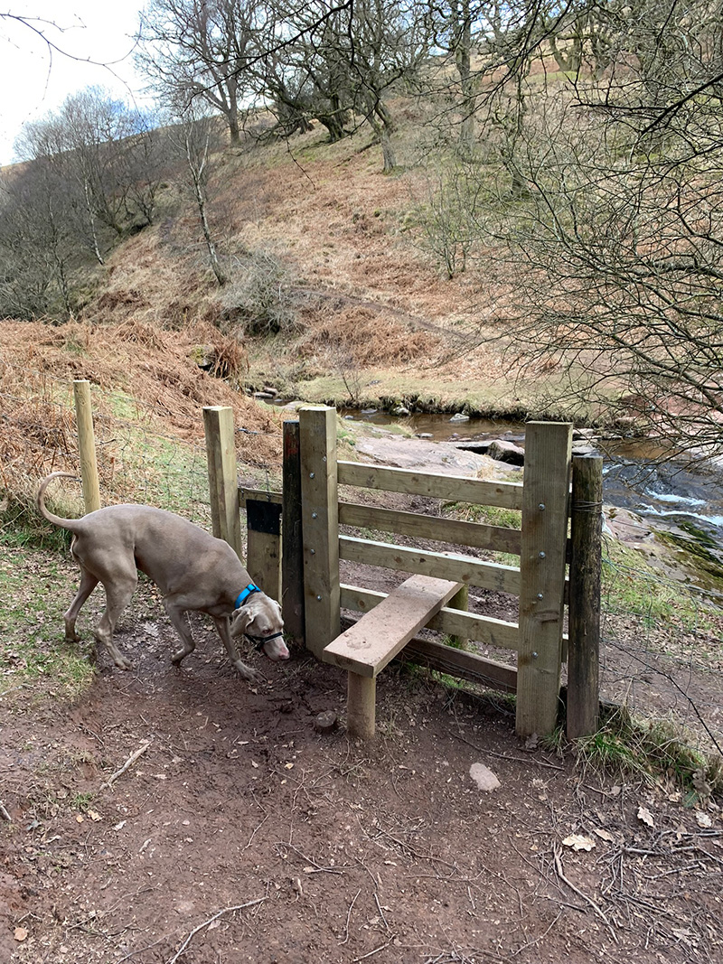
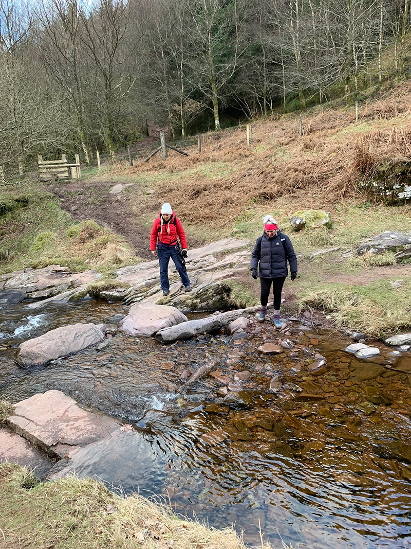
The end part of this walk, and the start of the next part is when you go over a stile, and cross the water running down the valley, you are then on the right-hand side of the river following it up.
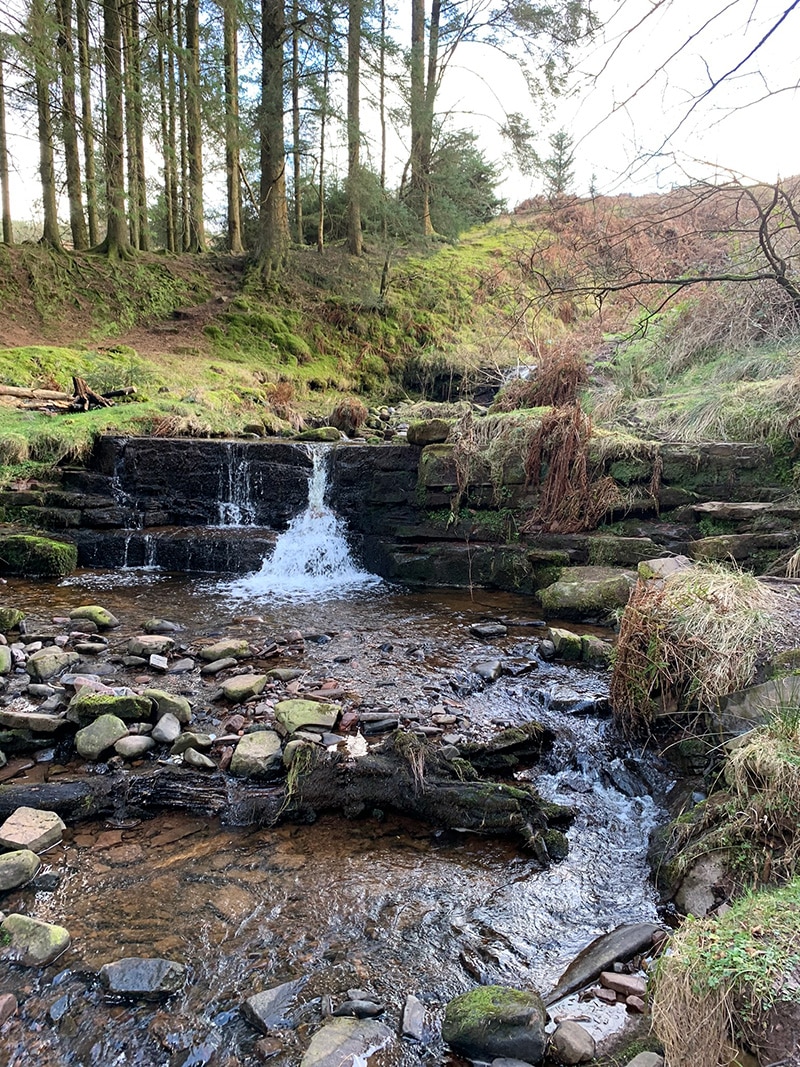
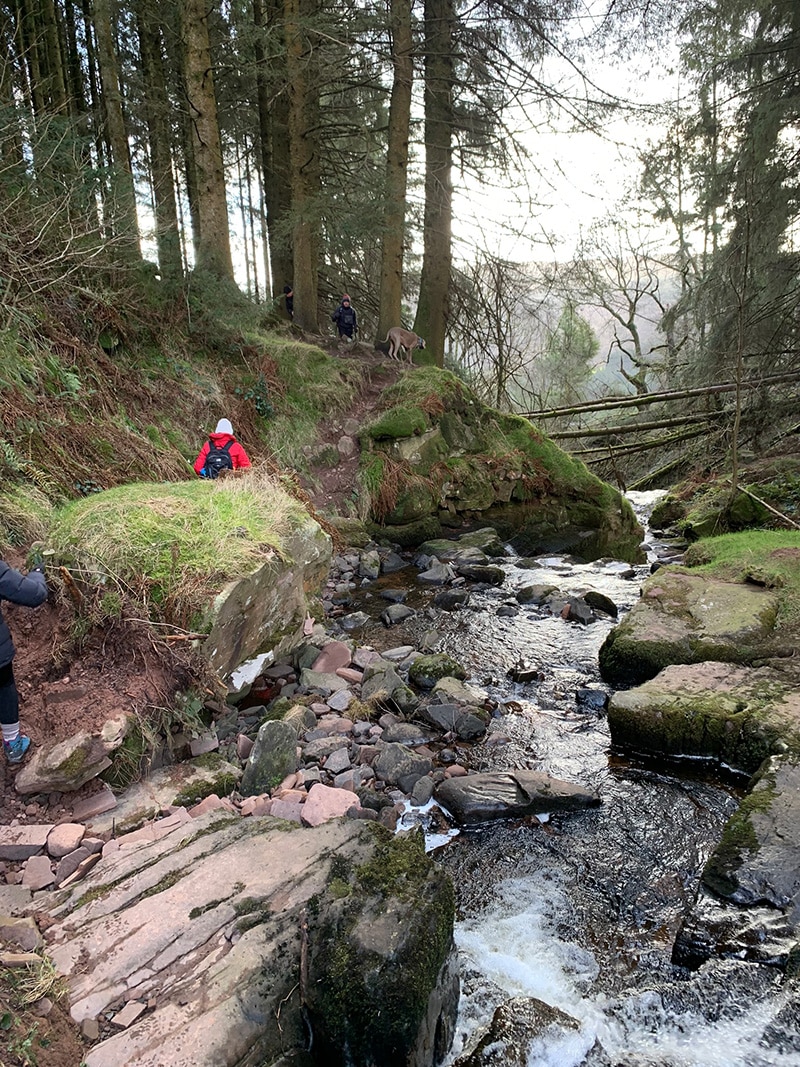
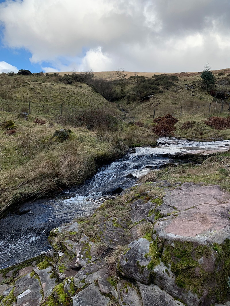
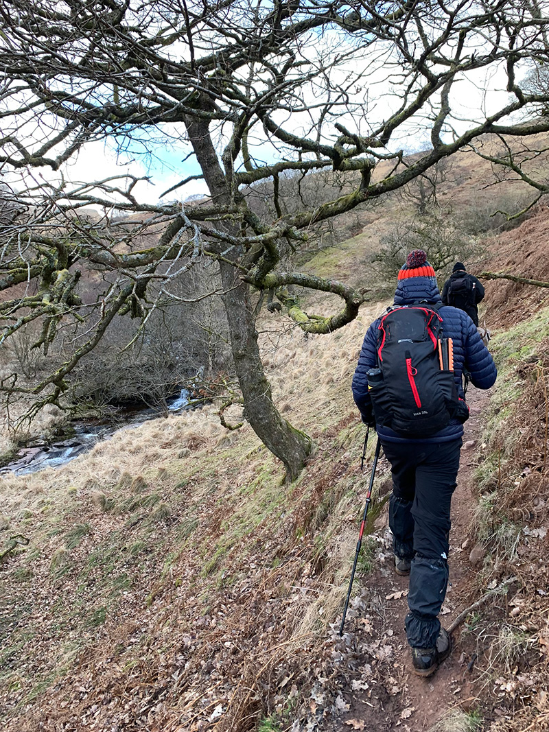
Once over the river, you head up the valley, and the river and its waterfalls are always on your left, and you follow it up until you reach the plateau between the ridges.
On your right as you walk up you will see the peak of ‘Allt Forgan’ at 513m, and eventually you will also pass the woods on your left, and you are then into open space, but look behind you as you walk up and see how the river runs down the valley and the views are superb.
It’s a very calming walk, as you again have the water sound and the wind will also start to pick up the higher you get, adding to the hike.
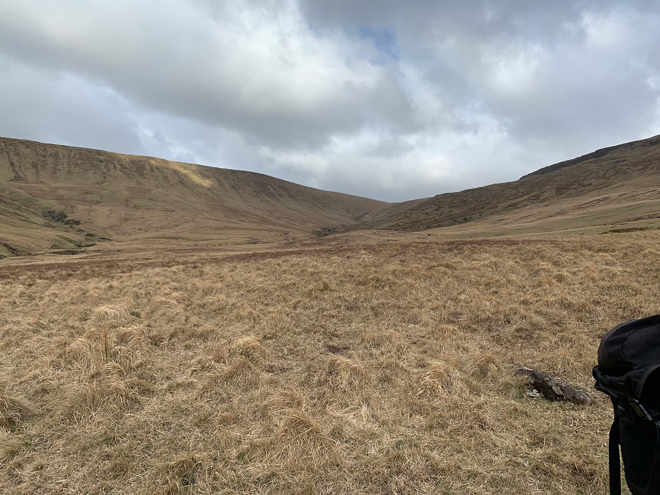
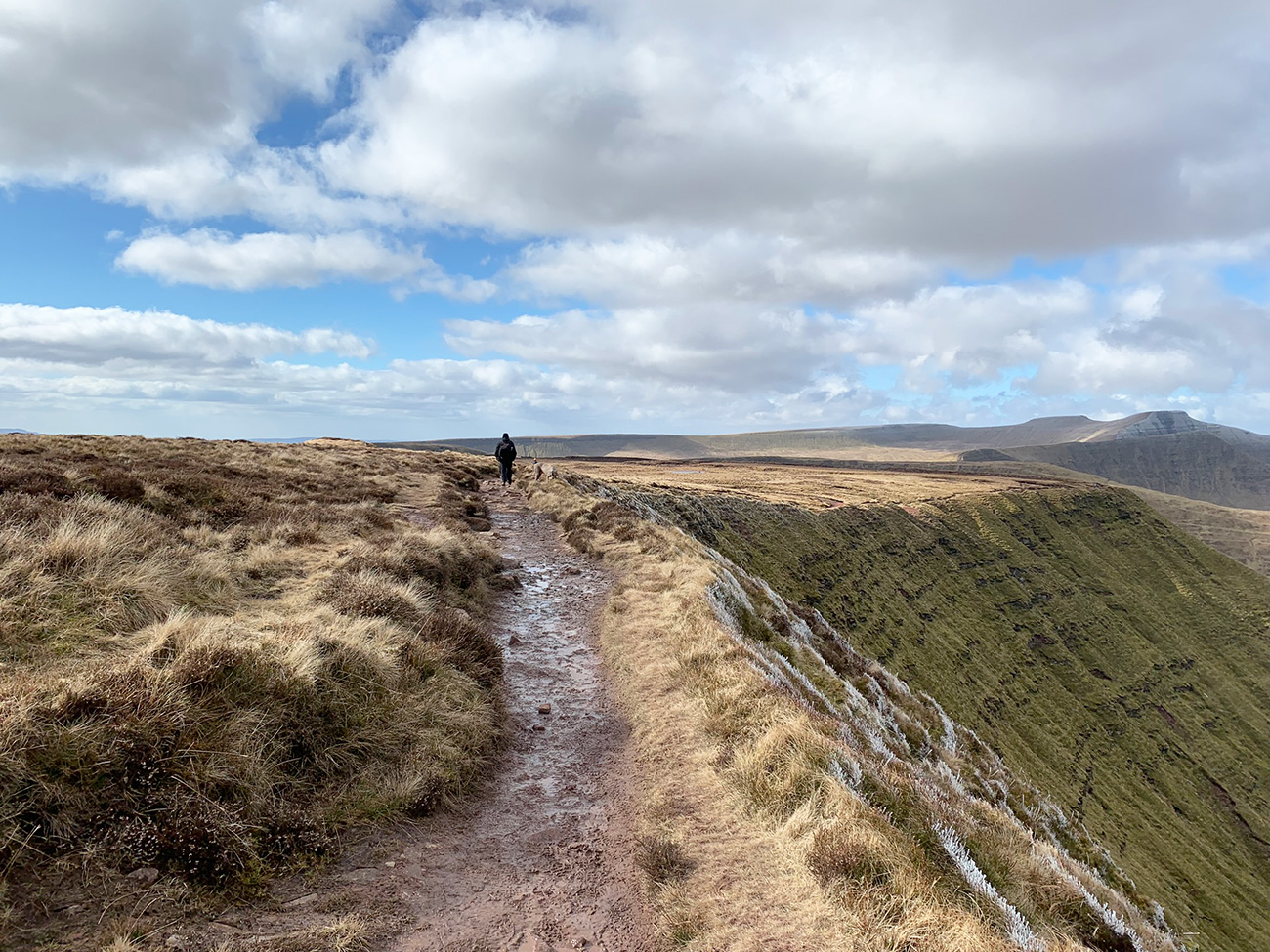
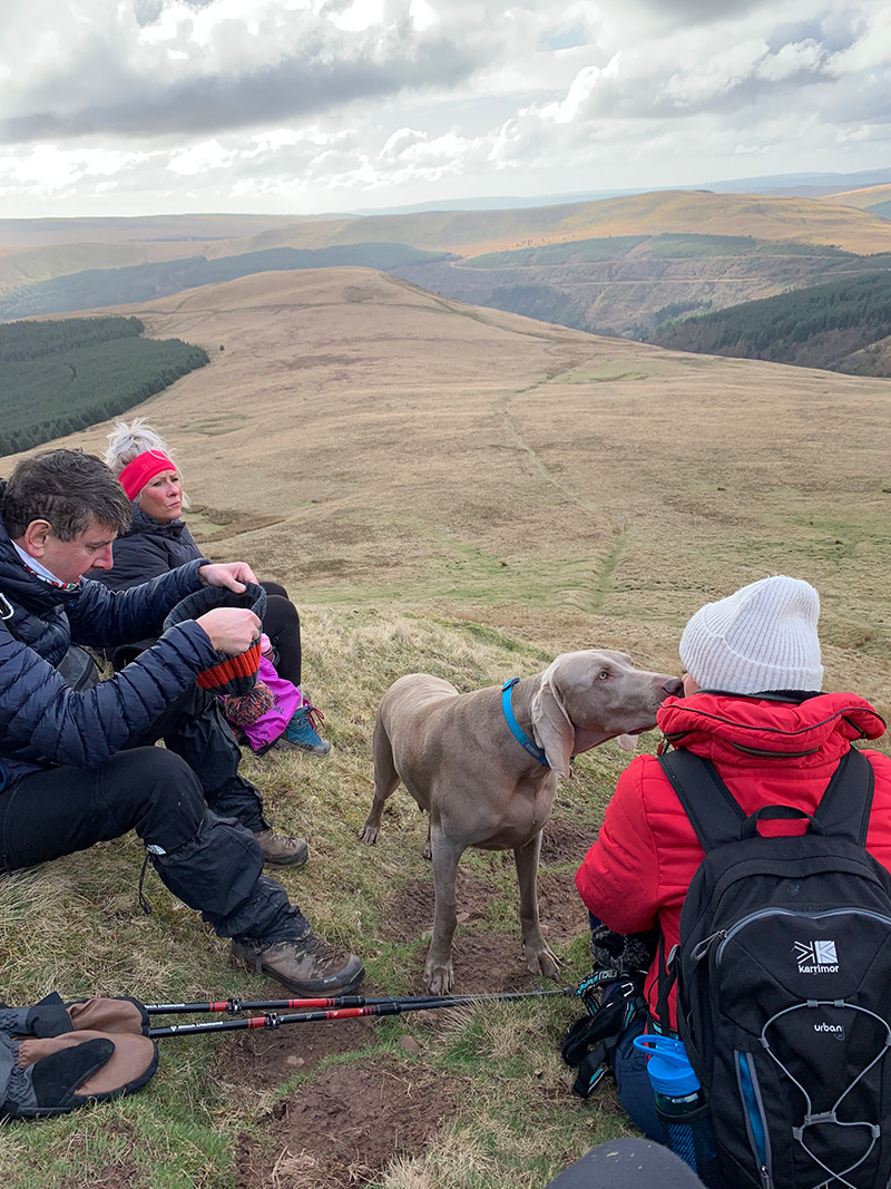
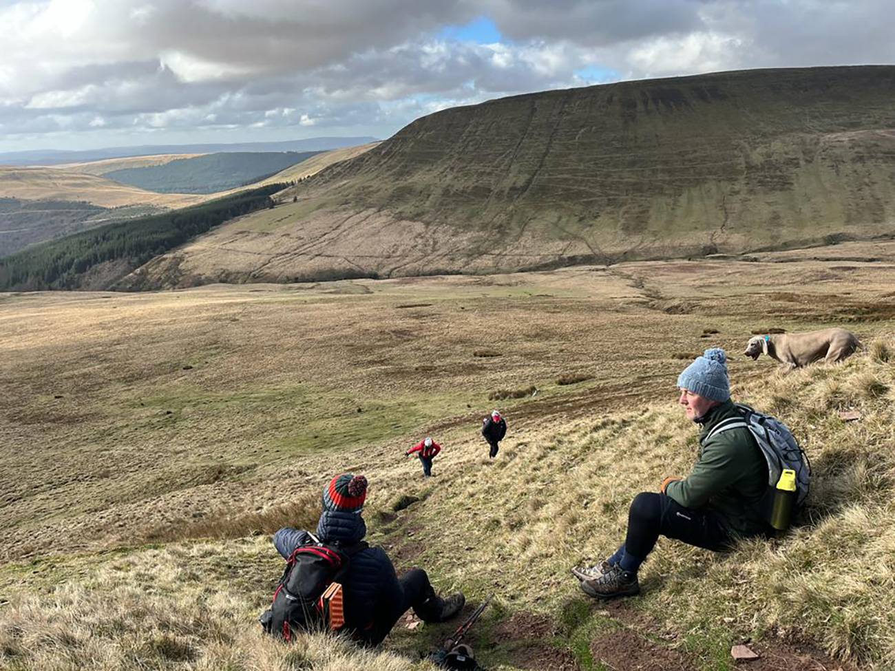
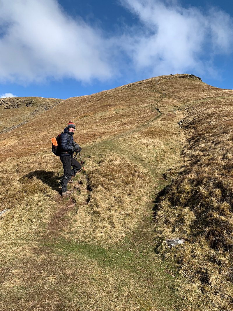
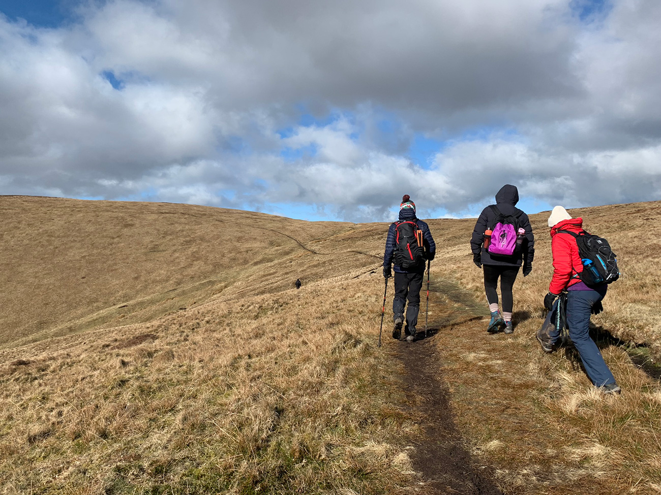
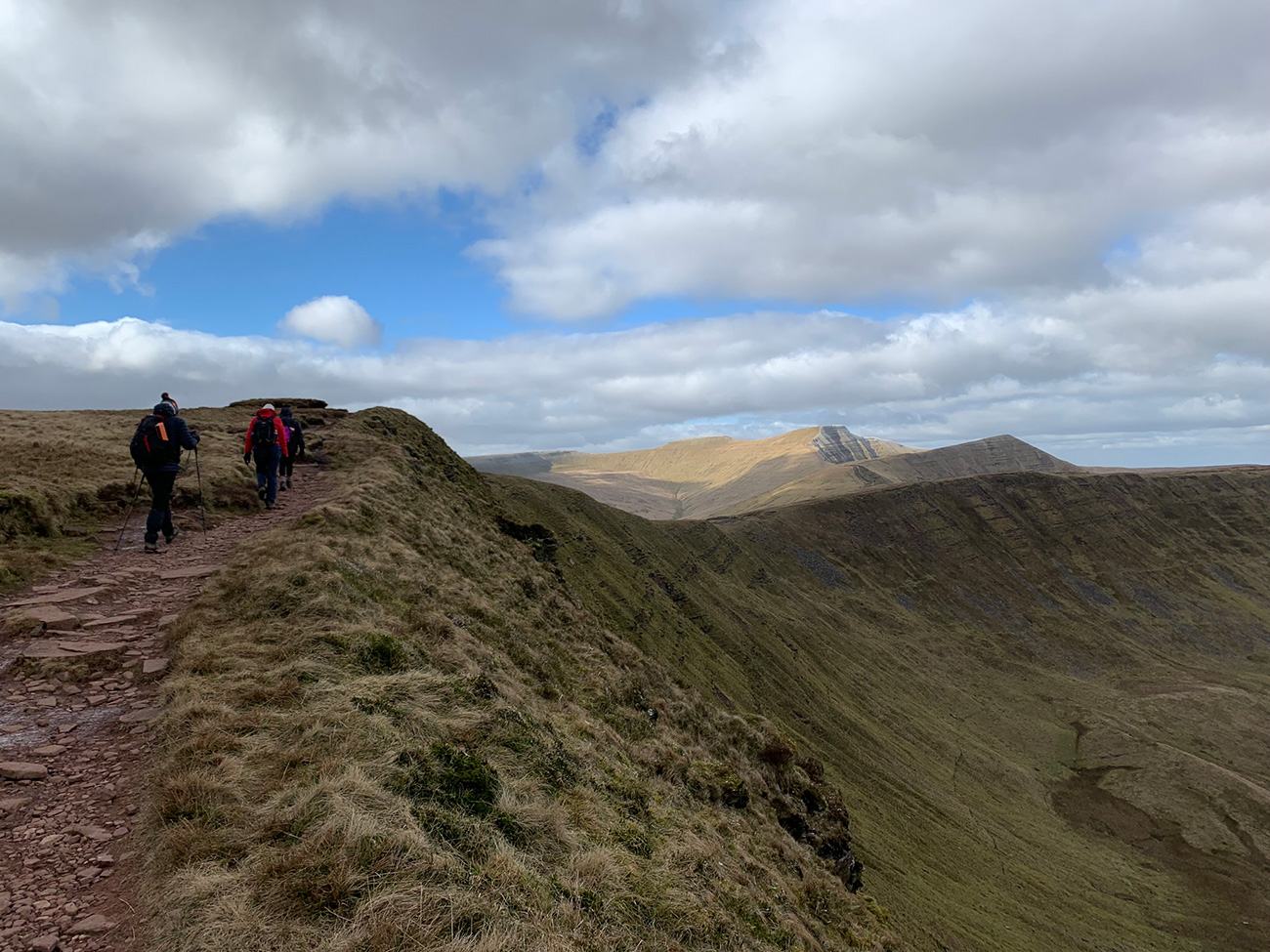
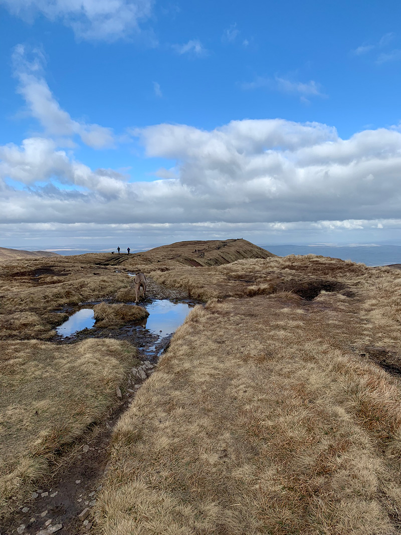
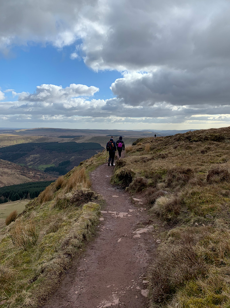
On the plateau between the ridges, you will take a right turn and start heading up the hill in front of you, this is quite a hard climb, it’s steep and the wind can really pick up and the ground is also quite muddy and no real path there, but there is just enough of a path line to guide you up to the peak of the ridge.
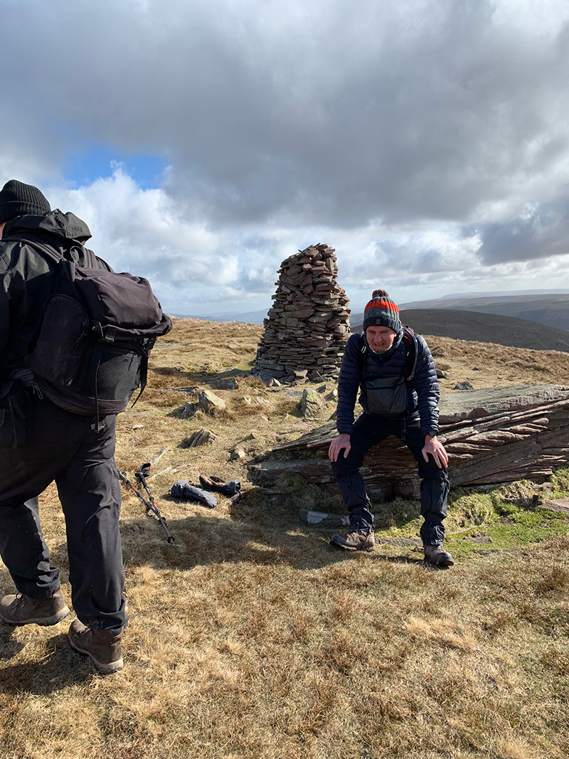
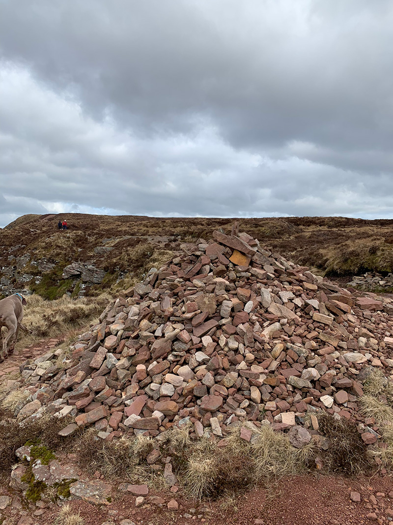
Why I say peak of the ridge, is because you will eventually get to a pile of stones, but it’s not the highest point of ‘Carn Pica’ which stands at 756m. That is further along, and we won’t be going there on this walk, instead following the ridgeline towards the ‘Canadian War Memorial’.
But this is a great opportunity for pics, and we also had a little break going up, as it’s been all uphill pretty much since the stile way back by the river crossing.
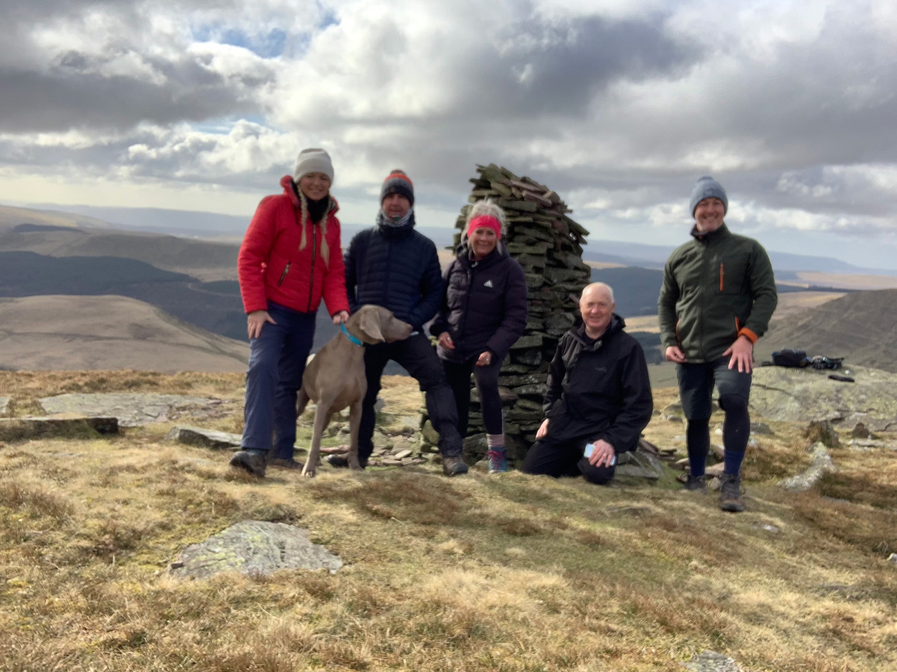
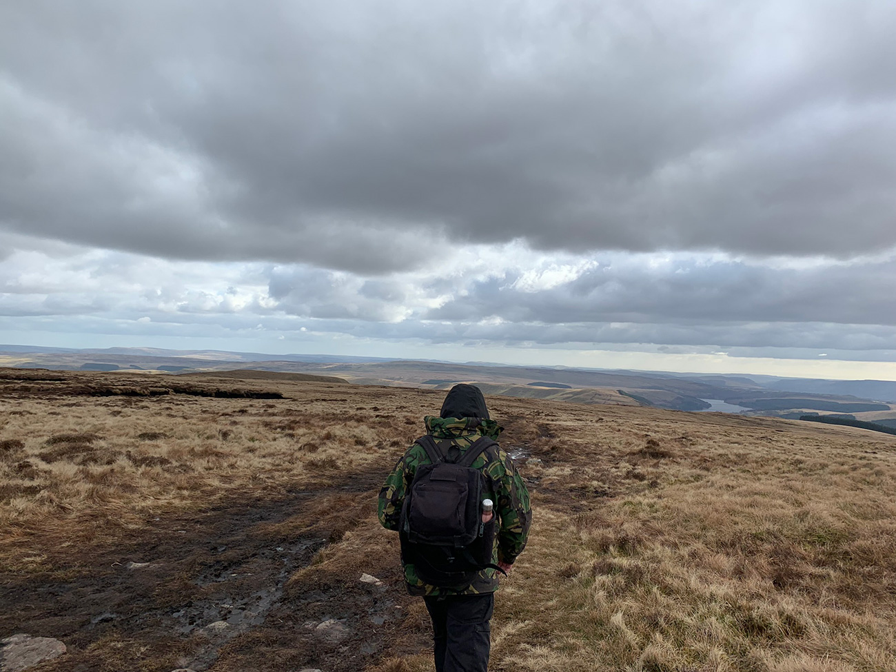
After a little rest and taking in the incredible views, we set off in the direction of the ‘Canadian War Memorial‘, following the ridgeline. It can get very windy up here, and if it’s raining it can be quite brutal, so make sure you take some extra layers and a warm hat.
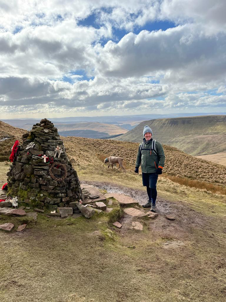
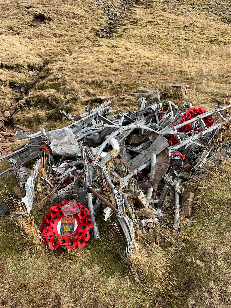
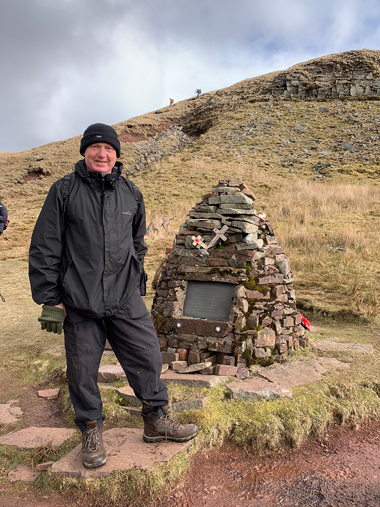
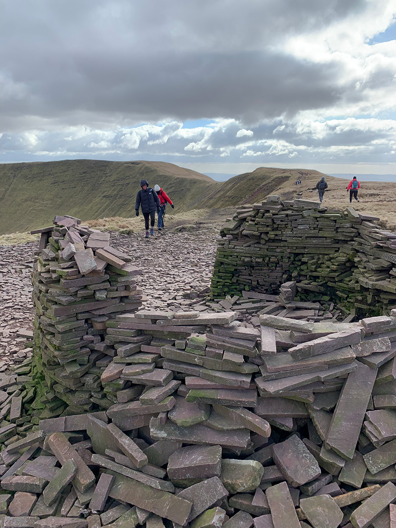
From the ridge, you will see the small memorial down below you on the left, if you walk slightly past it a path will appear to lead you down to it. It is a memorial to the 6 Canadian crew members who died on the night of the 20th of November 1944, the story is that on a cross country exercise, the crew developed trouble in the starboard Hercules XVI engine and flew into shower clouds, building up heavy layers of ice on the wings. With insufficient power from the port engine, the aircraft lost height and crashed into Garreg Goch killing all six Canadian crew members.
Parts of the wreckage are still there, and the story, names and memorial are kept in great condition for people to come and read and pay their respects.
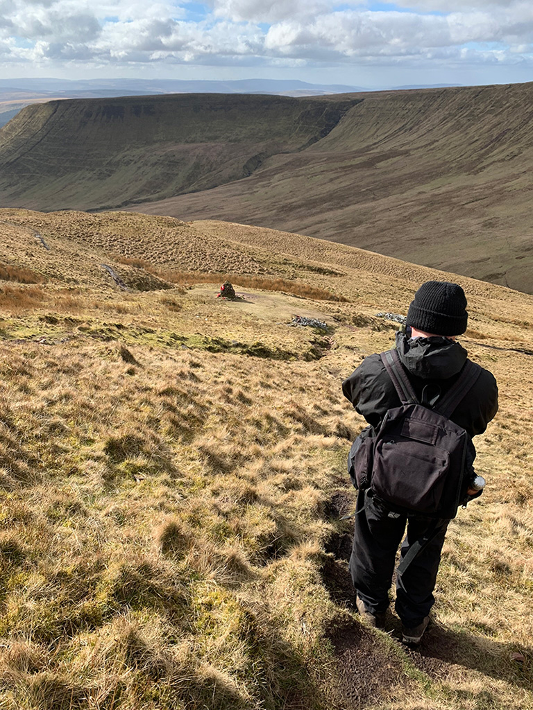
To leave the memorial, you don’t need to go back up the path you came down on, but instead walk in a diagonal back to the ridge top, and towards the ridgeline to take you left across the valley.
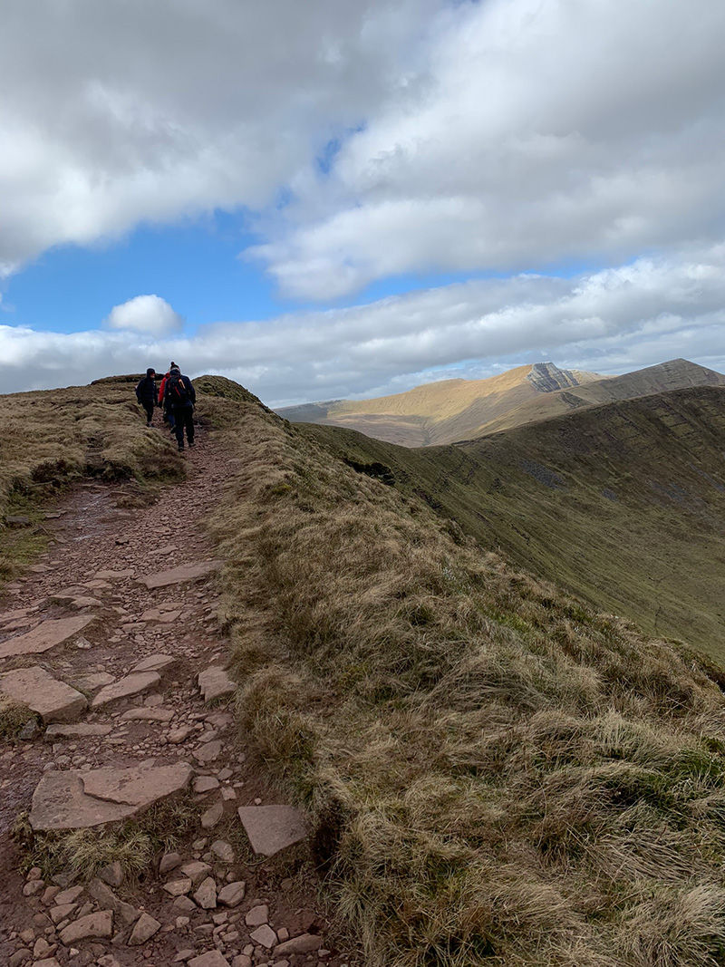
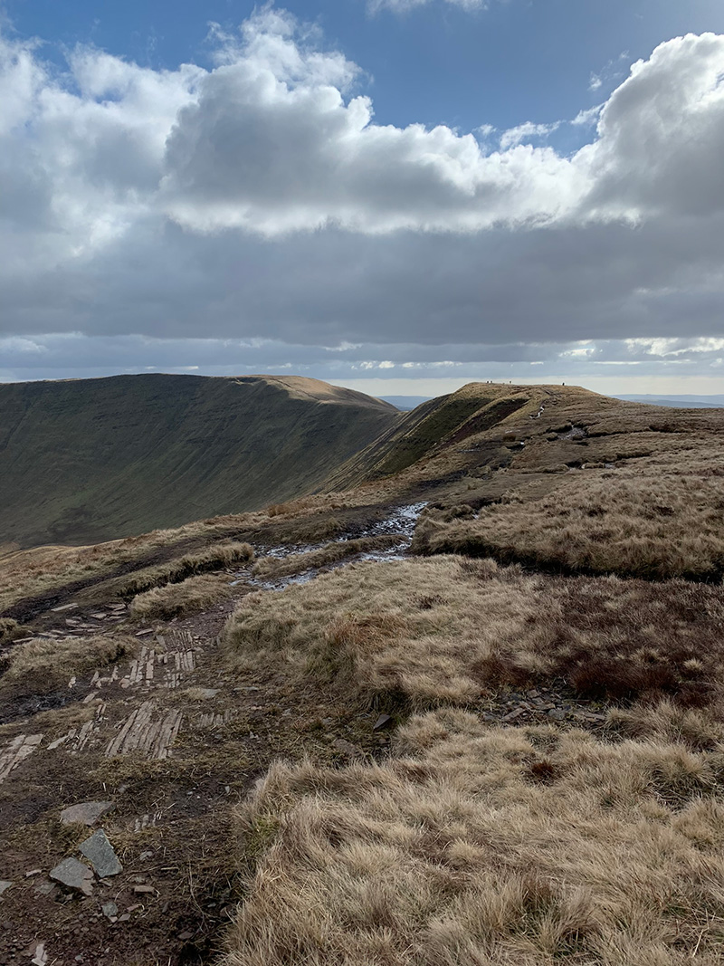
The exciting part of this next section is that you are crossing over to a ridgeline on the other side of the mountain, and along there you will have views to Fan-y-Big and also Cribyn and Pen-y-Fan, the views are incredible, and I hope when you do this walk you have good weather, so you can see for yourself.
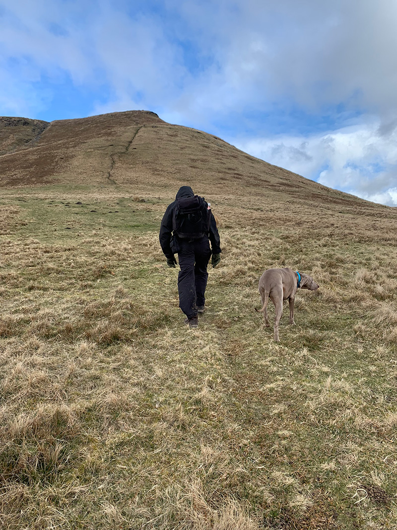
On the way there, you will walk over 2 further peaks, the first one is ‘Bwlch-y-Ddwyallt’ at 754m and the other is ‘Craig Cwareli’ at 730m.
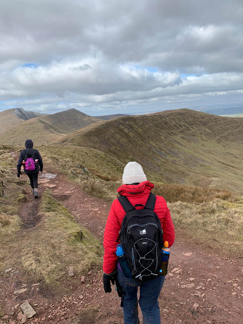
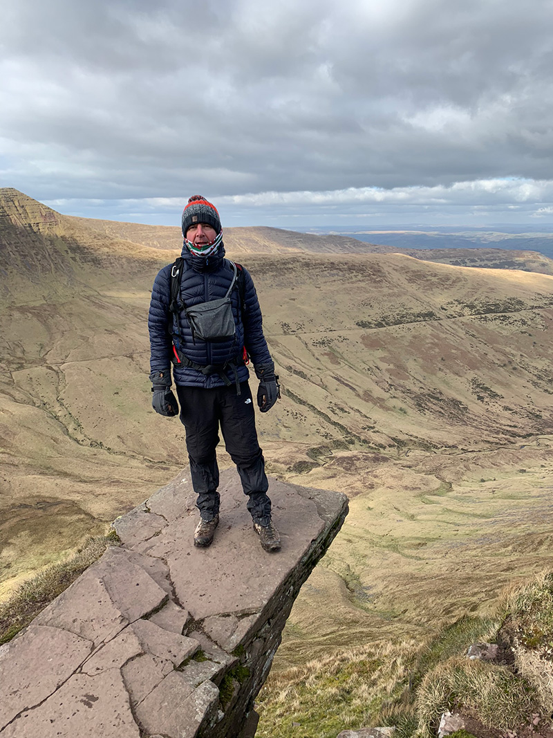
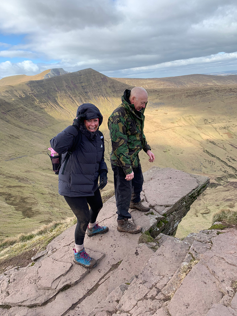
The ridgeline is impressive all the way around, and again as it is quite a long walk and tough in the wind, we stopped between the two and had a coffee break. It’s also worth noting that once we get to Craig Cwareli, we will set off to the right and go visit the diving board at Fan-y-Big, but then come back on ourselves back to that split point to continue the path back to the car park.
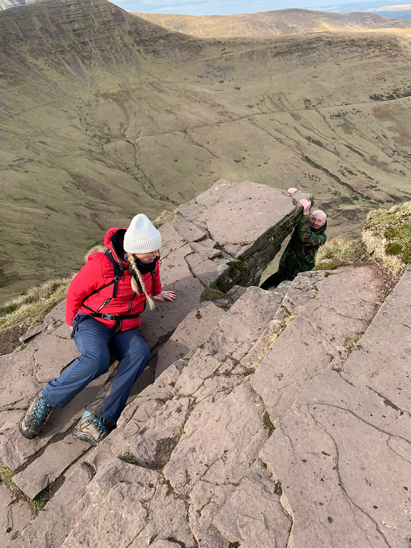
Here are some fun pics of the group at the diving board on Fan-y-Big, it’s impressive and you will get some great shots here with some good creative angles.
As I said earlier, after visiting Fan-y-Big you turn around and go back the way you came, up to ‘Craig Cwareli’ point, and it’s also worth noting that once you get there and carry on you will be joining the ‘Cambrian Way‘ and following a very rocky uneven path towards ‘Craig-Fan Ddu’ at 683m.
The going is quite difficult, and all of us went over on our ankles, and at a point where you will see a pile of stones, you will split off to the right and then you are back on a ridge line, but this time on the opposite side to the one you started on where the memorial is.
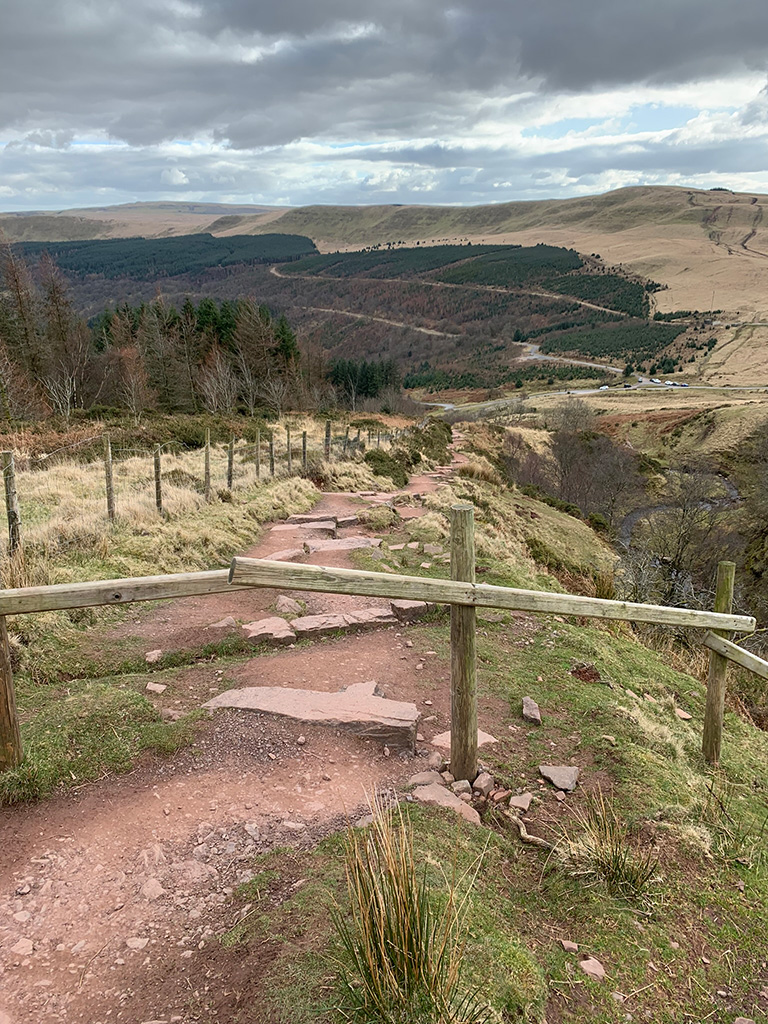
The return walk is quite long and after the long walk behind you, it’s quite a hard day and the terrain isn’t easy, but you are on the last leg, and at some point, you will come to the end of the path up high and start to make your way down, and back to the car park.
There are a couple more waterfalls to pass and you will start to return to the woods, and a left turn right at the bottom will take you into the car park, and we had another coffee to finish on the bench there. This is a really good walk, a really interesting one and is quite a tough task, but you’ve done it, and that’s all folks!

Walk this route yourself in 3D!
The Video is a 3D walk through of this route, it will give you a unique sense of having walked through the route before you start.
I have created 3D Videos of my adventures and have shared them with the OutdoorActive community as well as my walking community.
Blaen-Y-Glyn Waterfalls Circular Walk, Wellington Bomber Memorial & Fan-Y-Big – 3D Video