

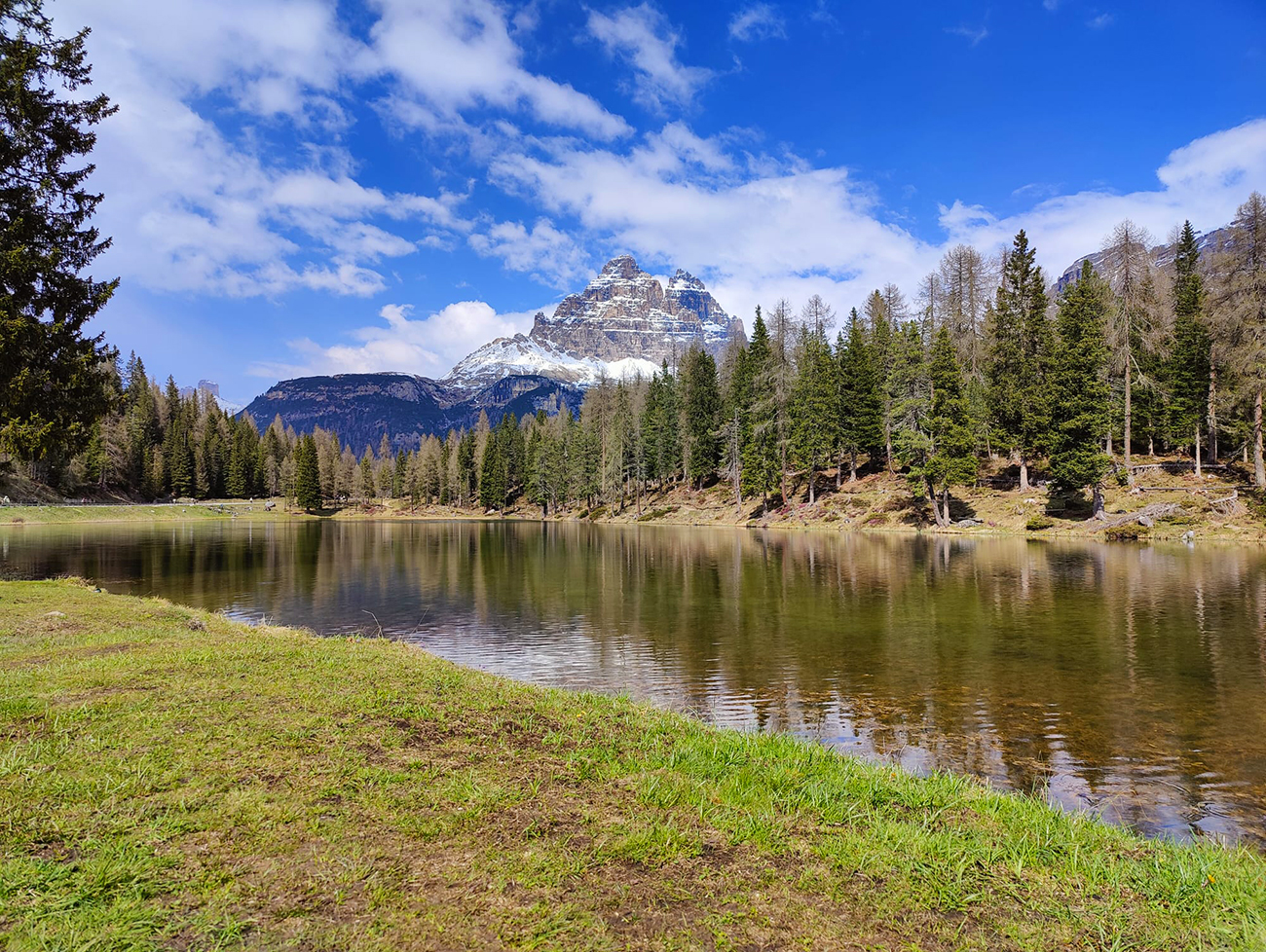
Region: Tre Cime di Lavaredo, Ampezzo, Dolomites, Italy
Places To Stay: To hike the Tre Cime di Lavaredo, you can stay in Dobbiaco, San Candido or slightly further away you have Cortina d’Ampezzo. There are also plenty of rural villages where you can stay and various types of hotels, B&B’s or hostels in the region. Looking for more Dolomites trails? Head to my ‘Dolomites Hiking Guides‘ page to see all regions and routes.
The Tre Cime di Lavaredo are probably the most recognisable mountains in the Dolomites, and for many people they are the image that immediately comes to mind when they think about hiking in northern Italy. These three towering limestone peaks, known as the Little Peak, Big Peak and Western Peak, have become the symbol of the Dolomites UNESCO World Heritage Site, and once you stand beneath them it is easy to understand why.
Most visitors drive straight up to Rifugio Auronzo before walking the famous circular trail, but we wanted to experience the mountains properly. Instead, we started much lower down at Lago d’Antorno, adding a long climb through forests, rocky mountain paths and lingering snowfields before eventually reaching the famous Three Peaks.
We completed the hike in late May 2024, right at the beginning of the summer season. Snow still covered large sections of the higher ground, which meant we couldn’t complete the full circuit around the peaks, but in many ways it made the day even more memorable. Walking through fresh snow with the Tre Cime towering above us was an experience we certainly weren’t expecting, and although the mountain forced us to turn back earlier than planned, we wouldn’t have changed a thing.
If you’re planning a trip to the Dolomites, don’t stop with Tre Cime. The region is packed with unforgettable hikes, from the turquoise waters of Lago di Sorapis to the spectacular viewpoints at Cinque Torri and the beautiful circuit around Croda da Lago. You can also browse all of my Dolomites hiking guides, complete with GPX downloads, route maps and practical advice to help you plan your own adventure.
Below are a few ideas for day tours and transfers around San Candido, with GetYourGuide offering great discounts and easy booking + a huge amount of options in the Dolomites area.
For a wider choice of accommodation in the Dolomites, Booking.com has a huge variety to browse through.
Getting There: Directions, GPX and Map
- Start/Finish: Lake Antorno car park/bus stop.
- Transport: There are seasonal buses from Cortina and other towns, we drove and parked at the lake, it was May and well out of season, but it was still very busy, and this car park filled up quickly.
- GPX: Download the GPX file here.
- Follow this route on my Outdooractive or Komoot profiles.
- Avoid the early start – find accommodation in Dobbiaco

Travel Data: I use eSIMs to stay connected — quick setup and no roaming faff. Sim Local has been solid in Italy/Europe with good prices and coverage.
Hike Profile
- Distance: Approximately 17km
- Duration: 7-8 hours
- Total ascent: approximately 750m
- Highest Point: Forcella Lavaredo, approximately 2,454m
- Total Elevation Gain: Approximately 700m
- Difficulty: Moderate to Challenging
- Route Type: Out and back with Tre Cime circuit
Route Overview
| Section | From → To | Path | Distance | Notes |
|---|---|---|---|---|
| 1 | Lago d’Antorno → Route T1-T2 | Wide Road | ~0.8 km | Lake side walk before joining the trail path |
| 2 | Route T1 – Rifugio Auronzo | Open alpine path | ~3 km | Scenic section with some steep climbs the towers in view |
| 3 | Rifugio Auronzo → Rifugio Lavaredo | Road then rocky paths | ~1.5 km | Walk anti-clockwise around the towers |
| 4 | Rifugio Lavaredo → Rifugio Locatelli | T1 | ~2 km | Quiet walk with wide views |
| 5 | Rifugio Locatelli → Rifugio Auronzo | T2 | ~5 km | Easy return back to the rifugio |
| 6 | Rifugio Auronzo → Lago d’Antorno | T2 | ~4 km | Downhill return along roads, and well marked trail paths |
Flying into Italy? Quick Skyscanner Checker
From Heathrow, we flew to Venice Marco Polo, and hired cars, Skyscanner found the cheapest flights, try the flight widget above.
Hike Description
Our walk began beside the peaceful waters of Lago d’Antorno, where there is a large parking area at the start of the trail. Even arriving in late May, it was easy to see why this place becomes incredibly busy during the summer. The Tre Cime were already standing high above us in the distance, almost teasing us with what lay ahead.
You can pay to drive directly to Rifugio Auronzo, where the classic circular walk begins, but we wanted to earn those views properly. Starting from the lake adds a significant amount of climbing, but it also makes the whole experience feel much more rewarding.

The first part of the hike follows a quiet road lined with pine trees before leaving the tarmac behind and climbing steadily into the forest. It is a beautiful start to the day. The woodland feels peaceful, the path is easy to follow and every so often the trees open just enough to reveal another glimpse of the towering limestone peaks waiting ahead.


As we gained height, the forest gradually began to thin, giving way to larger boulders, open mountainsides and bigger views across the valley. Even though the climb becomes steeper in places, the scenery constantly changes, so it never feels repetitive.
Before long we reached the first patches of snow.
By late May there was still far more snow than we expected, but rather than becoming a problem it actually became part of the adventure. The route remained easy enough to follow, although the snow made some sections surprisingly slippery. We found ourselves laughing as much as hiking, sliding down little banks, throwing the odd snowball and enjoying the novelty of walking through winter conditions while standing in the sunshine.


Eventually the snow became less frequent and the rocky trail returned, bringing a series of shorter but steeper climbs before Rifugio Auronzo finally appeared ahead of us.
Seeing the refuge after the long climb from the valley was a brilliant feeling. Around us were walkers who had driven straight to the car park, while we had spent the morning gradually working our way up through the forests and mountains below. It felt like we had really earned our place there.


From Rifugio Auronzo the famous circular route around the Tre Cime begins. We headed to the right, following the well-defined trail towards Rifugio Lavaredo and the spectacular viewpoints beneath the enormous north faces of the Three Peaks.
The scale of the landscape is difficult to describe until you see it for yourself. The photographs never quite prepare you for how enormous the cliffs are or how small they make you feel standing beneath them.
Unfortunately, this was where the snow finally won.


As we continued climbing towards the shoulder beside the peaks, the snow became much deeper and eventually blocked our progress completely. Rather than taking unnecessary risks, we decided to turn around and retrace our steps. The GPX route provided with this guide shows the full circular walk, but because of the conditions on the day we simply returned the same way we had climbed.

Although we didn’t complete the full circuit, it honestly didn’t matter.
The walk had already given us everything we had hoped for. We’d climbed through peaceful forests, crossed snowy mountainsides, stood beneath some of the most famous peaks in Europe and experienced the Dolomites in conditions that made the day completely unique.
The return journey brought one final surprise.
As we descended, the cloud gradually disappeared and the sunshine returned, opening up magnificent views across the valley that had been hidden earlier in the day. Looking back towards the snow-covered mountains we had just walked through gave us a completely different perspective of the landscape.


By the time we reached Lago d’Antorno again, we were already talking about coming back.
Next time we’ll hopefully complete the full circuit, but if the mountains have taught me anything over the years, it’s that sometimes the route doesn’t go to plan. You simply enjoy the day you’ve been given, and this was one we’ll remember for a very long time.

Walk this route yourself in 3D!
The video is a 3D walkthrough of this route; it’ll give you a great idea of what to expect before you set foot on the mountain.
I’ve created 3D videos of my walks and shared them with the Outdooractive and Welsh Man Walking communities.
Places to Stay in the Dolomites – My Picks
I’ve put together a few guides to make choosing a hotel in the Dolomites easier. If you’re after a romantic break, I’ve found some cosy hideaways. If it’s hiking that’s front and centre, I’ve rounded up the best hotels with trails right from the door. There are also ski-in ski-out favourites, family-friendly bases, and hotels with those wow-factor mountain views or even hot tubs to sink into after a long day.
Places to Stay in Cortina
For a wider choice of accommodation in the Dolomites, Booking.com has a huge variety to browse through.
Recommended Stays

Right in the centre of the famous ski resort of Cortina d’Ampezzo, the 4-star Hotel De La Poste is set in an early 19th-century building. It features 2 restaurants and free WiFi throughout.

Parc Hotel Victoria is a great hotel to relax in Cortina, the staff are ready to help at all times and are very friendly. It is located very close to the promenade, shops and restaurants in Cortina, and simple access to the buses.
Practicalities
- Start early: This is one of the busiest walks in the Dolomites — early starts make a huge difference.
- Cash: Rifugi still prefer cash for food, drinks, and toilets.
- Food & water: Plenty of huts, but still carry water on warm days.
- Weather: Conditions can change fast — bring a waterproof even if it’s blue skies.
- Footwear: Trail shoes are fine in dry conditions; boots help after rain.
- Best season: Late June to late September (snow dependent).
- Parking: Parking is available at Lago d’Antorno, where this walk begins. During summer it fills very quickly, so arriving early is recommended. Alternatively you can pay to drive the toll road to Rifugio Auronzo, although this is considerably more expensive and also reaches capacity during busy periods.
- Snow: Even at the end of May we encountered significant snow above Rifugio Auronzo. Conditions vary enormously each year, so don’t assume the paths will be clear simply because it’s late spring. Snow can remain well into June following a heavy winter.
- Navigation: The route is exceptionally well marked and difficult to lose in good visibility, but if snow covers the trail or cloud rolls in, carrying the GPX route offline is still highly recommended.
- Weather: Weather changes quickly above 2,000 metres. Sunshine can quickly turn into cloud, rain or even snowfall outside the middle of summer, so always pack waterproofs and warm layers regardless of the forecast.
- Facilities: toilets, café, Rifugio Auronzo, Rifugio Lavaredo, Locatelli
Tre Cime di Lavarado from Lago d’Antorno FAQs
How difficult is the Tre Cime di Lavaredo hike from Lago d’Antorno?
How long does the Tre Cime di Lavaredo hike take?
How far is the hike from Lago d’Antorno?
Is it worth hiking from Lago d’Antorno instead of driving to Rifugio Auronzo?
Can you hike Tre Cime di Lavaredo in May?
Do you have to pay to visit Tre Cime di Lavaredo?
Is the Tre Cime trail well signposted?
Are there toilets and places to eat on the hike?
Is Tre Cime di Lavaredo suitable for beginners?
When is the best time to hike Tre Cime di Lavaredo?
Can you complete the hike if there is snow?
Is Tre Cime di Lavaredo worth visiting?

Water-to-Go Named Best Water Bottle for Travel. Click www.watertogo.eu + 20% Discount Using – ‘WMW20’

AllTrails: Trail Guides & Maps for Hiking, Camping, and Running | AllTrails ‘Plus’ 30% OFF – Read my ‘Full Review‘ for more details.
Disclosure: I may earn a commission if you buy via the links on this page — at no extra cost to you.