

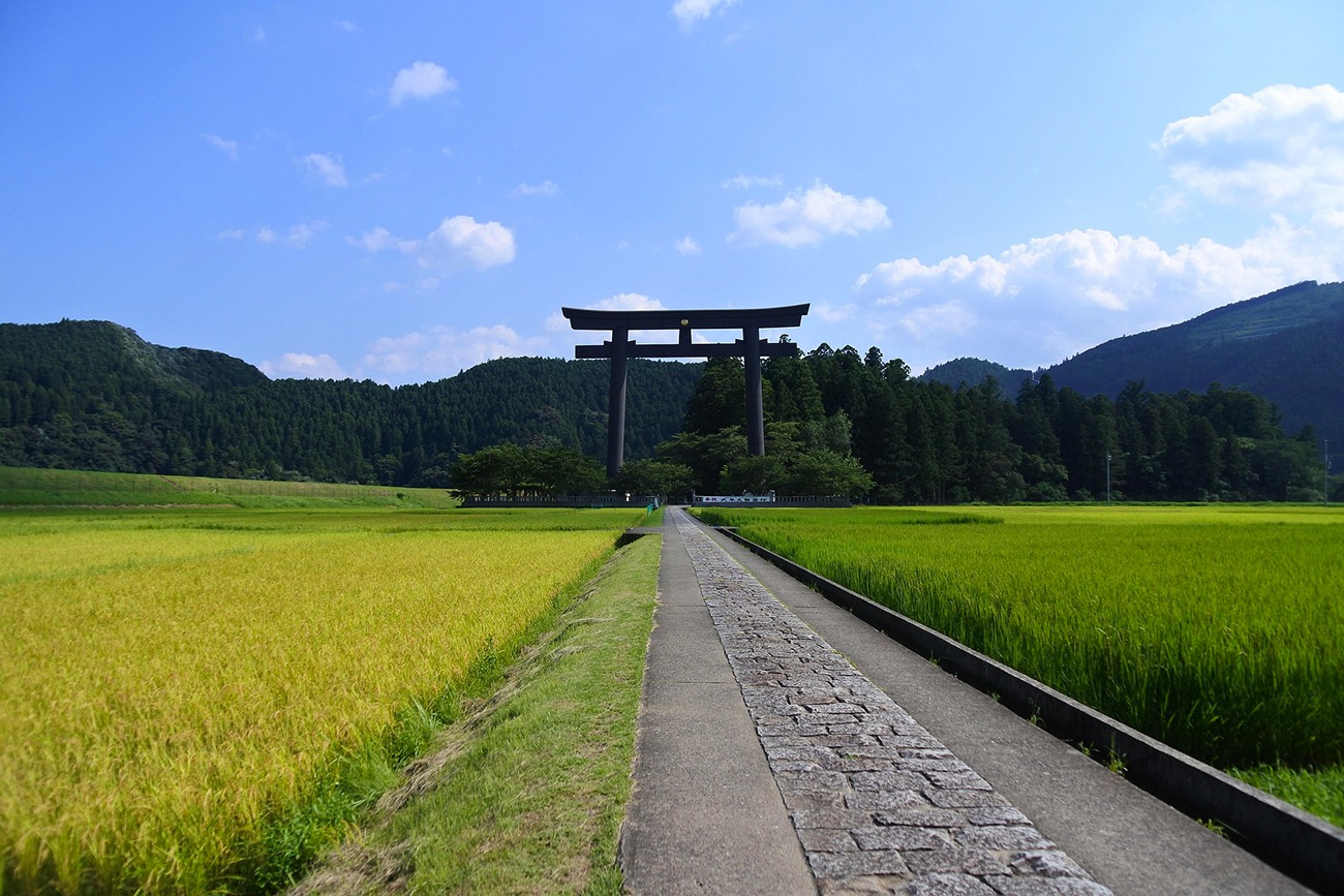
Region: Nakahechi Trail, Kumano Kodo, Kii Peninsula, Wakayama Prefecture, Japan
Places To Stay: One of the great joys of walking the Nakahechi is the unique accommodation along the way. Pilgrims can stay in traditional ryokan (Japanese inns), minshuku (family-run guesthouses), and even shukubo (temple lodgings) where monks serve simple, vegetarian shojin ryori meals. Expect tatami rooms, futon bedding, hot onsen baths, and the warm hospitality of hosts who have welcomed travellers for centuries. Try: Kumano Kodo Accommodation Options to explore stays along the Kumano Kodo.
The Nakahechi is the best-known section of the Kumano Kodo, an ancient network of pilgrimage trails crossing the mountains of Japan’s Kii Peninsula. For more than a thousand years, pilgrims from every level of society—including retired emperors and members of the imperial court—have followed these paths towards the sacred Kumano Sanzan shrines. Today, the route remains one of Japan’s most rewarding long-distance walks and forms part of the UNESCO-listed Sacred Sites and Pilgrimage Routes in the Kii Mountain Range.
Beginning at Takijiri-oji, the traditional gateway into the sacred mountains, this route travels approximately 38 kilometres through cedar and cypress forests, secluded villages and valleys filled with rice fields and persimmon trees. Along the way, small subsidiary shrines known as oji mark the historic pilgrimage route, while ancient stone steps, moss-covered statues and weathered trail markers provide a constant connection with the people who travelled through these mountains centuries ago.
The walking can be demanding, particularly on the steep opening climb and the longer forest stages, but the Nakahechi is about much more than distance. Staying in family-run minshuku, eating beautifully prepared local meals, collecting pilgrimage stamps and soaking in an onsen all become part of the experience. By the time you reach Kumano Hongu Taisha, the walk feels less like a route between two places and more like a journey through Japan’s spiritual heartland.
If you’re planning more walking adventures in Japan, take a look at my complete guide to the best hiking trails in Japan. It brings together all my Japanese routes, from ancient pilgrimage trails and forest-covered mountains to volcanic landscapes and the dramatic peaks of the Japanese Alps.
Looking for more trails in Japan? Visit my ‘Japan Hiking Trails‘ page.
Essential Trail Pack: Plan This Adventure
Before you head out into the mountains, ensure you have your trail navigation, local connectivity, and trailhead basecamps sorted out cleanly.
Avoid expensive roaming fees. Keep your live tracking maps active in the mountains with global data coverage.
Get full offline access and GPX trails. Use code WELSHMANRI9I6 at checkout to claim your global discount.
Secure the closest available accommodation near the trailhead routes with flexible free cancellation options.
Below are 3 ideas for trips, transfers and day tours on the Kumano-Kodo Nakahechi Pilgrimage Route, GetYourGuide offer great discounts and availability + Much more!
For a wider choice of accommodation in the Tanabe region, Booking.com has a huge variety to browse through.

Get a JR Rail Pass if you’re planning to move around a lot, the Japan Rail Pass is worth looking at. You can buy 7-21 day passes before you go, and they give you ‘unlimited‘ rides on the famous bullet trains and most JR lines.
Getting There: Directions, GPX and App Link
- Start/Finish: Starts at Takijiri-oji, the traditional entrance to the sacred Kumano mountains, and finishes at Kumano Hongu Taisha. The pilgrimage can be extended from the Hongu area towards Kumano Nachi Taisha and Kumano Hayatama Taisha using additional sections of the Kumano Kodo, but these are not included in this GPX.
- Google Maps: Starts at Takijiri-oji
- Parking: Parking at Takijiri is limited and this is a linear route, so public transport is the most practical option. Regular buses connect Kii-Tanabe with Takijiri-oji and continue through the Nakahechi area towards Hongu.
- GPX: Download the GPX file here for use on your GPS device or watch
- You can also follow this route on my Outdooractive and Komoot profiles.

Sim Local can reduce or even eliminate your roaming fees. Click www.simlocal.com/ + 10% Discount Using – ‘WELSHMAN’
Hike Profile
- Distance: Approximately 38 km (23.6 miles) from Takijiri-oji to Kumano Hongu Taisha.
- Duration: Usually completed over 2–4 walking days. Two days creates a demanding itinerary, while three or four days allows more time for the shrines, villages and pilgrimage experience.
- Highest point: Approximately 690 metres on the supplied GPX.
- Difficulty: Moderate to challenging. No scrambling or technical climbing is required, but there are steep ascents and descents, long forest stages and substantial cumulative elevation.
- Route conditions: Forest paths, exposed roots, stone steps, uneven and occasionally cobbled sections, quiet roads and paths through mountain villages. Surfaces can become extremely slippery following rain.
Stages & Distances (Typical 3-Day Itinerary)
| Day | Route | Distance | Aprox Time | Notes |
|---|---|---|---|---|
| Day 1 | Takijiri-oji to Takahara | 4 km | 2–3 hours | Short but steep opening climb; useful if arriving from Osaka, Kyoto or Tanabe that morning |
| Day 2 | Takahara to Tsugizakura-oji/Nonaka | Approx. 16 km | 6–8 hours | Forest trails, oji shrines, Gyuba-doji and Chikatsuyu; overnight in the Nonaka area |
| Day 3 | Tsugizakura-oji to Kumano Hongu Taisha | Approx. 20.5 km | 8–10 hours | Long and remote mountain stage via Hosshinmon-oji, finishing at Hongu |
This is the cleanest three-day itinerary because each night ends somewhere with accommodation. There is no accommodation at Hosshinmon-oji, so it should not normally be used as an overnight stage unless you take a bus or accommodation shuttle into the Hongu area.
For stronger walkers, the official two-day itinerary is:
| Day | Route | Distance | Aprox. Time |
|---|---|---|---|
| Day 1 | Takijiri-oji to Chikatsuyu-oji | Approx. 16 km | Around 6 hours |
| Day 2 | Chikatsuyu-oji to Kumano Hongu Taisha | Approx. 24.5 km | Around 9 hours |
Looking to book your Flights? Try the Skyscanner Flight Checker Below.
Getting to the trail: Kansai International Airport is the most convenient major international airport for the western end of the Nakahechi. From Osaka, travel by JR Limited Express Kuroshio to Kii-Tanabe, the principal transport hub for this section of the Kumano Kodo. Buses run daily from Kii-Tanabe Station to Takijiri-oji, with the journey taking approximately 40 minutes. Staying in Tanabe the night before the walk makes it easier to catch a morning bus and begin the first stage early.
Leaving the finish: Buses depart from Hongu Taisha-mae for Kii-Tanabe, Shingu and the nearby onsen settlements of Yunomine, Kawayu and Wataze. Services can be infrequent, particularly later in the day, so check the current timetable before beginning the final stage. A car is unnecessary and can be inconvenient because the walk is linear.
Hike Description
The walk begins at Takijiri-oji, beside the Tonda River. This small shrine traditionally marked the point where pilgrims left the settled world behind and entered the sacred mountains of Kumano. The Kumano Kodo Kan Pilgrimage Centre nearby is a useful place to learn more about the route and pick up maps or a pilgrimage credential before setting off.
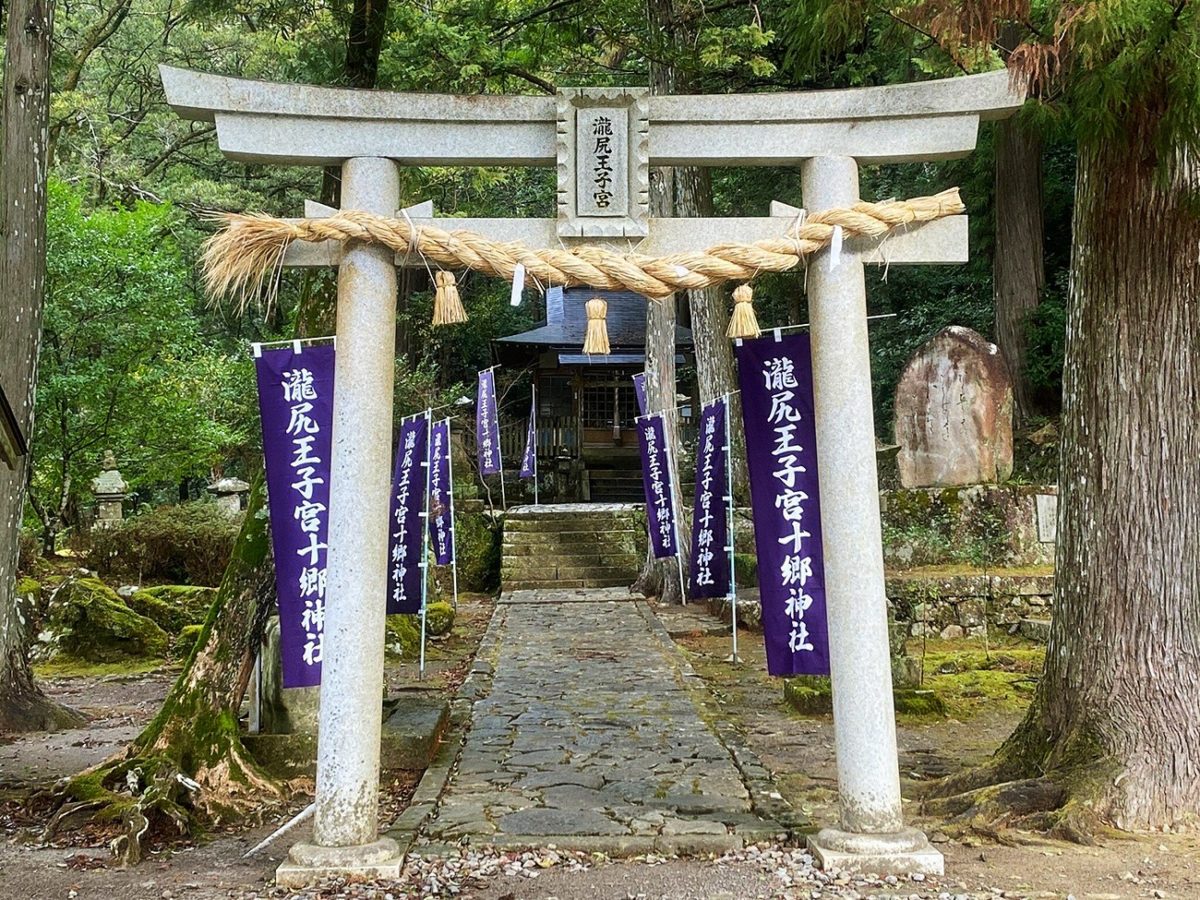
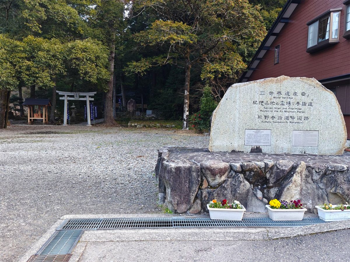
There is very little time for a gentle warm-up. Almost immediately after leaving Takijiri-oji, the trail climbs steeply into dense forest. Stone steps, exposed roots and uneven ground make the opening section considerably harder than its distance might suggest, especially when carrying everything needed for several days. In wet weather, the polished stones and tree roots can also become extremely slippery.
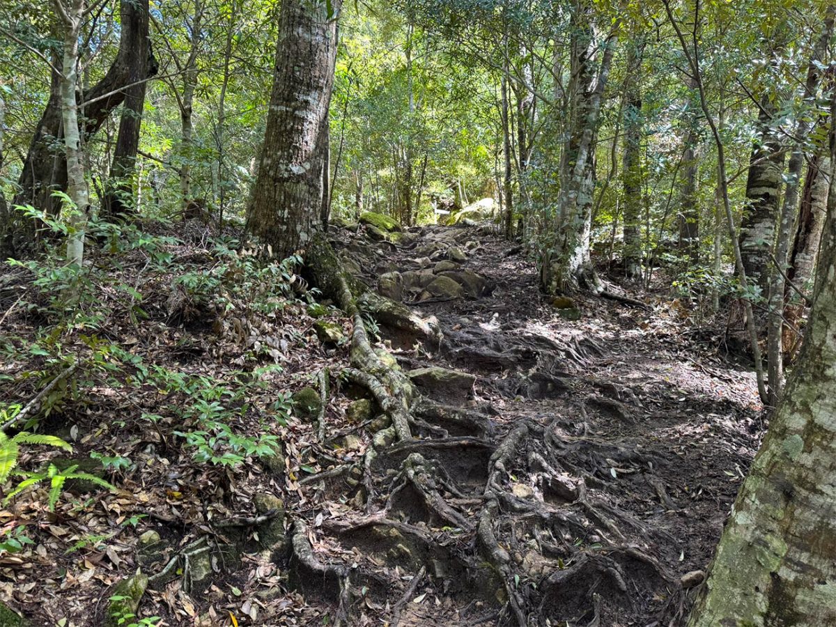
As the traffic noise disappears, the atmosphere changes quickly. The path winds beneath tall cedar and cypress trees, passing small shrines, religious statues and the remains of places associated with earlier pilgrims. These oji were not simply route markers: they were places for purification, prayer and rest on the journey towards the three Grand Shrines of Kumano.
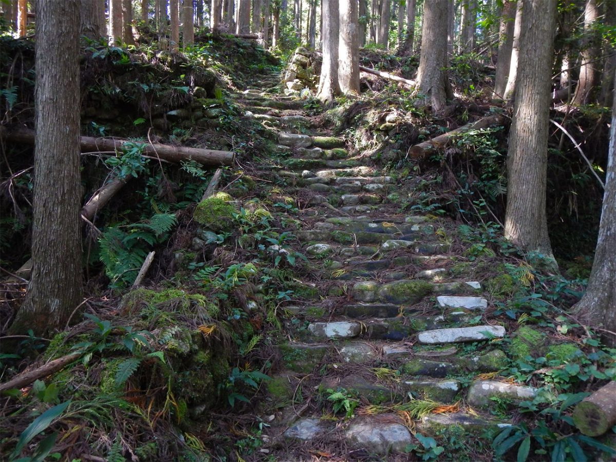
After approximately 3.7 kilometres, the trail reaches Takahara. Often described as a “village in the mist”, it occupies a hillside overlooking layers of forested mountains. On a clear day, the views extend across the surrounding valleys; in mist or low cloud, the village takes on a completely different but equally atmospheric character. Takahara has accommodation and makes an excellent first overnight stop for anyone wanting to divide the route into shorter, more relaxed stages.
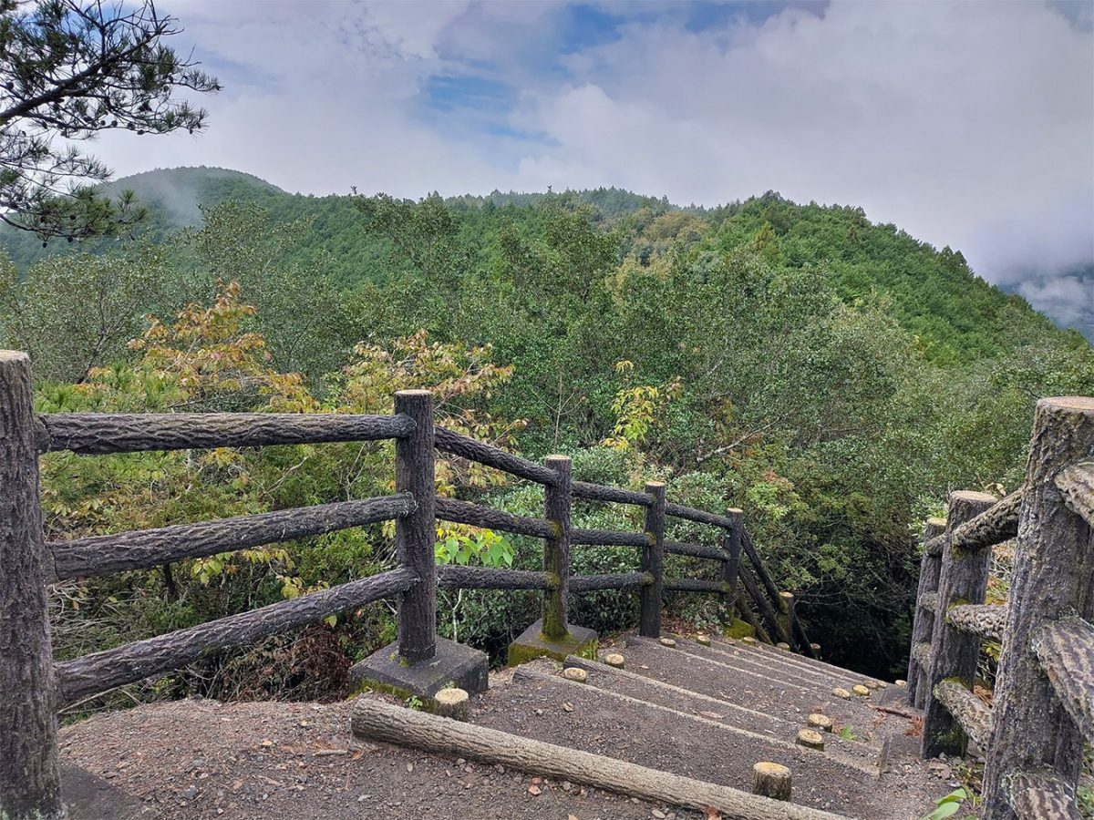
Beyond Takahara, the Nakahechi continues through a mixture of forest paths, small passes and quieter stretches of countryside. The trail repeatedly rises and falls rather than following one continuous climb, and that pattern defines much of the route. The overall altitude is relatively modest—the supplied GPX reaches approximately 690 metres—but the accumulated ascent and descent can make each day feel substantial.
The path passes more oji sites as it heads deeper into the mountains. At times the forest feels almost enclosed, with shafts of sunlight reaching through the trees and moss covering stones beside the trail. Elsewhere, the trees open to reveal glimpses across the valleys. The route is generally well marked, but this remains remote mountain country, so carrying the official maps or an offline GPX remains sensible.
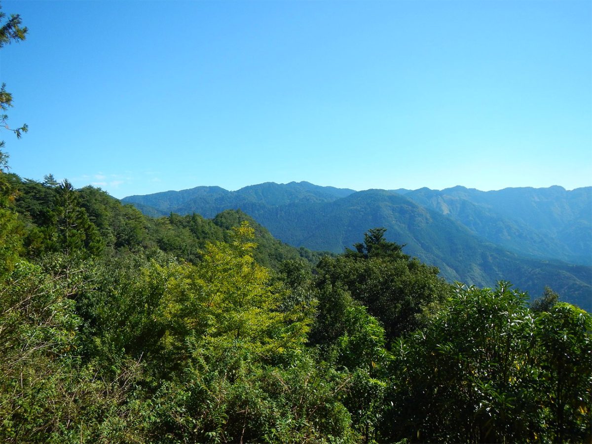
Near Gyuba-doji, a small statue depicts the retired Emperor Kazan sitting on a horse and cow. According to local tradition, he travelled the Kumano pilgrimage route more than a thousand years ago. From here, the trail descends towards the village of Chikatsuyu and the Hiki River.
Chikatsuyu is one of the principal stopping places along the Nakahechi. Historically, pilgrims performed purification rituals in the river before continuing their journey into the sacred mountains. Today, the village provides accommodation and limited facilities, making it a natural overnight stop. The combination of traditional buildings, gardens, small farms and surrounding forest gives it a very different character from Japan’s cities.
From Chikatsuyu, the route initially passes through inhabited areas and along quiet roads before returning to the forest. The walk through Nonaka towards Tsugizakura-oji provides another glimpse of everyday life in the Kii Peninsula, passing homes, vegetable plots, tea fields and small roadside shrines.
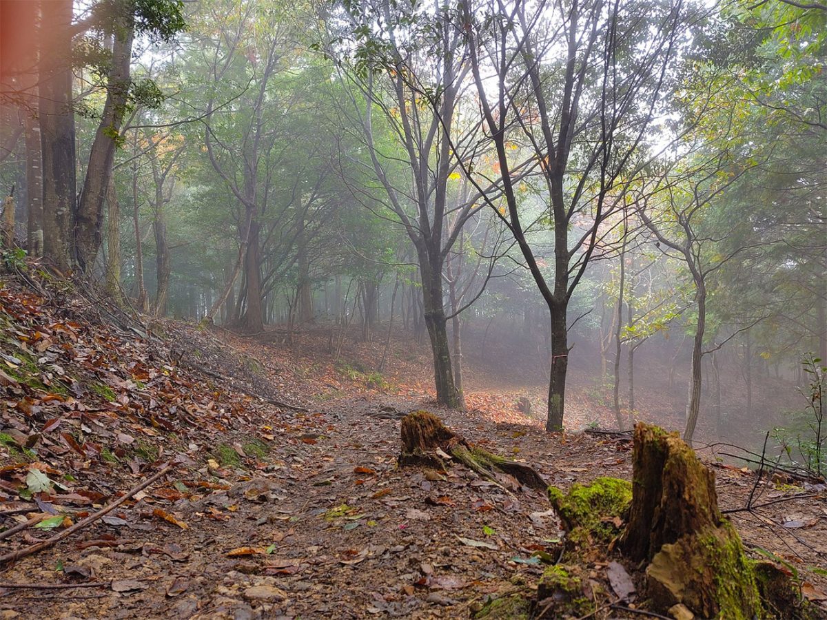
Tsugizakura-oji is one of the most memorable sites on this section of the pilgrimage. The approach is lined by enormous cedar trees, some believed to be several centuries old, and the shrine sits within a deeply atmospheric forest setting. Nearby accommodation makes the Nonaka and Tsugizakura area another good place to divide the journey.
The next stage towards Hosshinmon-oji is one of the longer and more isolated portions of the route. It passes through extensive forest, across mountain passes and between historic sites where settlements and teahouses once served generations of pilgrims. Modern facilities are limited, so this is a day to carry enough food and water rather than relying upon finding cafés or shops along the way.
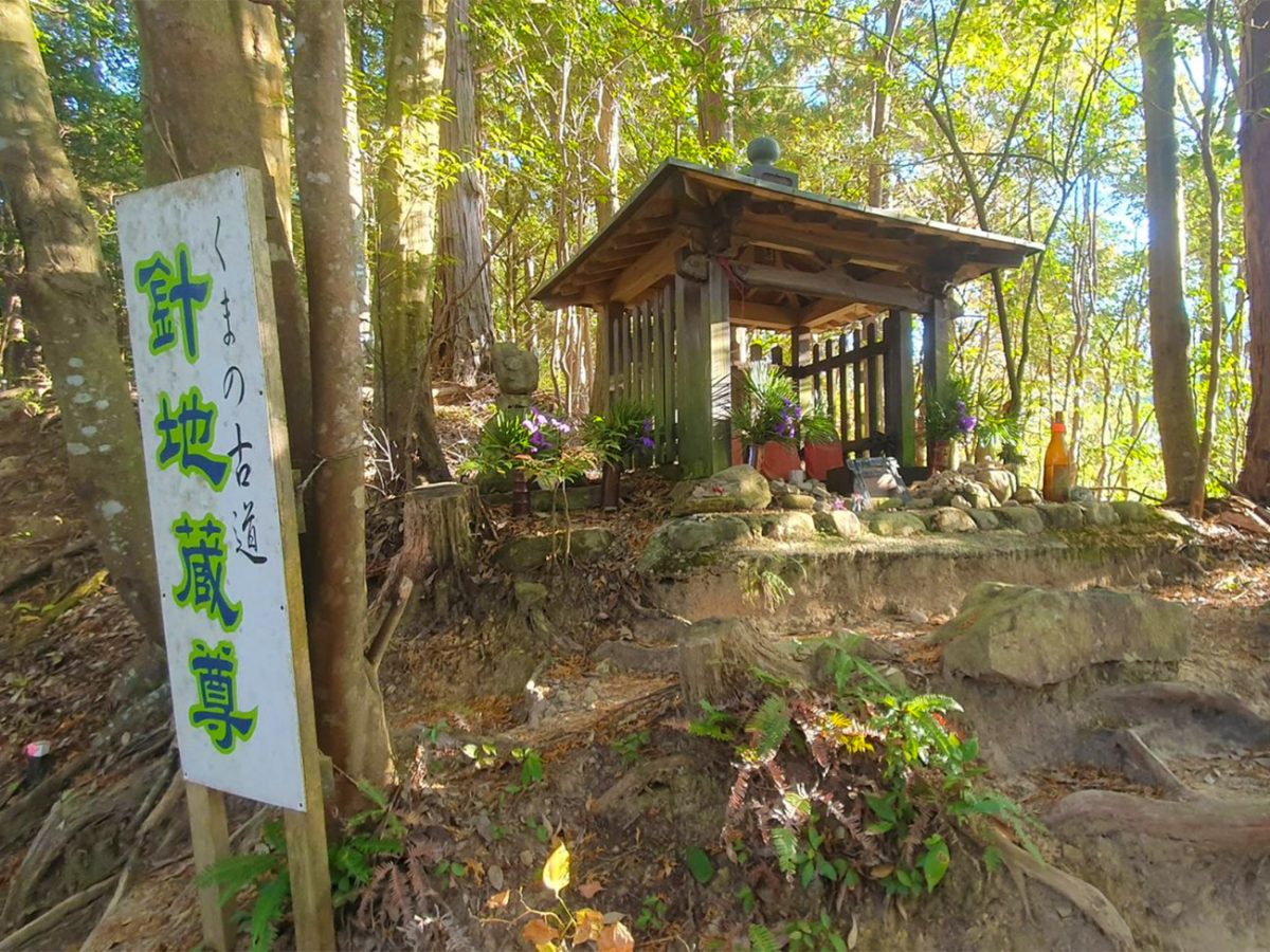
This section reveals the more demanding side of the Nakahechi. The terrain is rarely technical, but repeated climbs and descents, uneven stone surfaces and long periods in the forest require steady concentration. Heavy rain can make the trail muddy and slippery, while hot and humid conditions introduce a completely different challenge. Taking time over this stage makes it much easier to appreciate the small shrines, stone figures and remnants of the old pilgrimage infrastructure along the route.
Reaching Hosshinmon-oji is a significant moment. Its name is commonly interpreted as the “gate of awakening of the aspiration to enlightenment”, and it traditionally marked the outer entrance to the sacred precincts of Kumano Hongu Taisha.
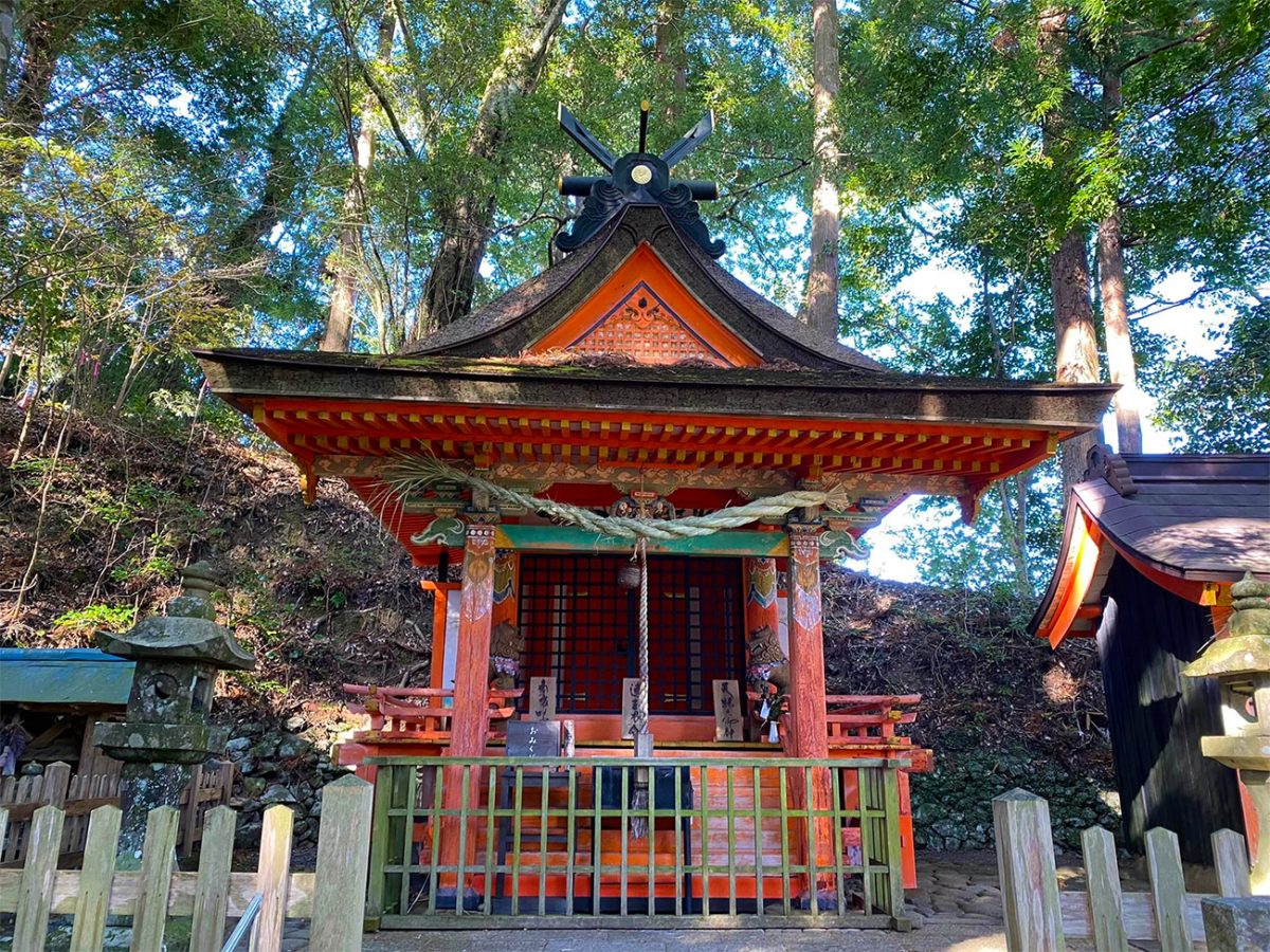
The final seven kilometres are gentler than much of the preceding route. Forest paths alternate with isolated ridge-top communities, fields and quiet lanes. Mizunomi-oji is associated with a historic water source, while Fushiogami-oji provides one of the most significant viewpoints of the pilgrimage. It was traditionally here that travellers caught their first distant sight of their destination and dropped to their knees in prayer.
From Fushiogami-oji, the trail continues its gradual descent towards Hongu. The surrounding valley begins to open, and the sense of nearing the end becomes increasingly noticeable. After passing Haraido-oji, the route enters Kumano Hongu Taisha from behind the shrine complex.
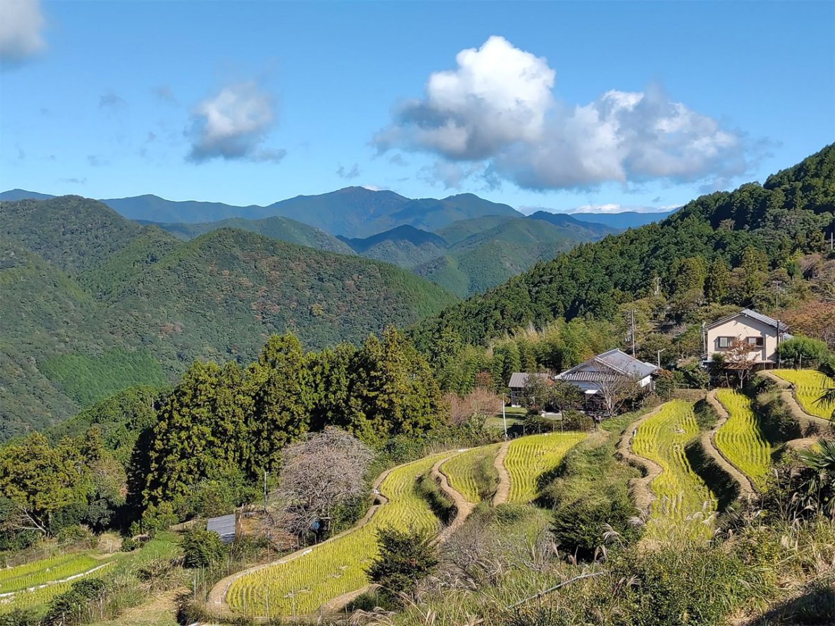
Arriving at Kumano Hongu Taisha gives the walk a fitting conclusion. This is one of the three Grand Shrines of Kumano and has been a destination for pilgrims for centuries. Walkers carrying a pilgrimage credential can collect the appropriate completion stamp here. The official Dual Pilgrim programme also recognises walking from Takijiri-oji to Kumano Hongu Taisha as one of its qualifying Kumano Kodo routes.
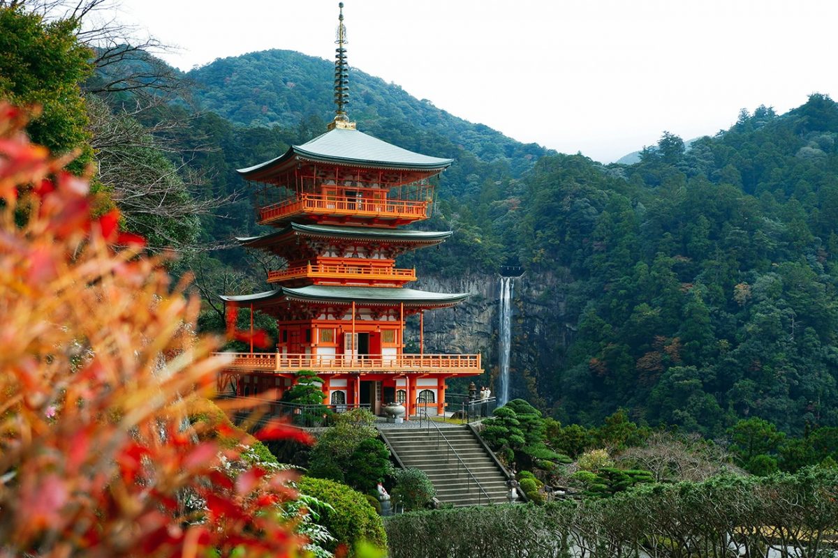
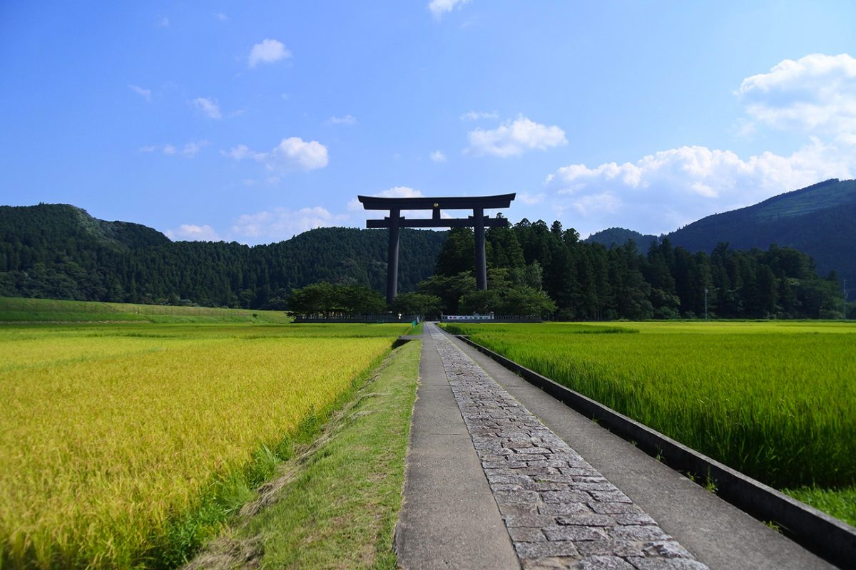
Before leaving Hongu, it is worth walking to nearby Oyunohara, the original location of the shrine before severe flooding in 1889. Its enormous torii gate rises above the surrounding fields and is one of the most recognisable sights in the Kumano region.
More than just a trek, the Nakahechi is a deep immersion in Japan’s spiritual heritage, where the natural landscape itself is seen as divine, and each footstep carries the weight of centuries of devotion.

Walk this route yourself in 3D!
The video is a 3D walkthrough of this route; it’ll give you a great idea of what to expect before you set foot on the mountain.
I’ve created 3D videos of my walks and shared them with the Outdooractive and Welsh Man Walking communities.
Practicalities
Accommodation – Book every night before beginning the walk. Accommodation in Takahara, Chikatsuyu and Nonaka is limited, and small minshuku and guesthouses can fill well in advance during popular walking periods. Many properties offer dinner, breakfast and a packed lunch, but meal requirements and dietary restrictions should be confirmed when booking.
The official Kumano Travel reservation system closes bookings 20 days before arrival, although some accommodation may accept direct reservations after that point if rooms remain available. This is not a route where I would recommend arriving without accommodation arranged.
Luggage transfer – Daily luggage transfer is available between participating accommodation, allowing walkers to carry only a daypack. It must be arranged well in advance; luggage services booked through Kumano Travel currently require at least 20 days’ notice and are connected to accommodation booked through its system. Confirm collection times carefully because they cannot easily be changed at the last minute.
Food and water – Stock up on snacks and emergency food in Tanabe because shops become increasingly scarce once the route enters the mountains. Many accommodation providers can prepare a packed lunch when requested in advance.
Tap water at accommodation is drinkable, but reliable refill points should not be assumed throughout every stage. Begin each day with sufficient water, particularly during hot and humid weather. Vending machines may appear in some villages, but they should be treated as a bonus rather than part of the plan.
Pilgrimage credential and stamps – Pick up a Kumano Kodo pilgrimage credential before beginning the route and collect stamps from the boxes positioned beside oji shrines and other significant sites. Credentials and official maps are available from locations including the Tanabe Tourist Information Centre and the Kumano Kodo Kan Pilgrimage Centre near Takijiri-oji.
Walking the complete route from Takijiri-oji to Kumano Hongu Taisha qualifies as one of the Kumano Kodo achievements recognised by the Dual Pilgrim programme. However, a walker only becomes a Dual Pilgrim after also completing a qualifying section of the Camino de Santiago.
Navigation – The Nakahechi is generally well marked with route signs, numbered markers and Japanese-and-English information boards. Nevertheless, download the GPX and official route maps for offline use. Forest cover and isolated valleys can affect mobile reception and should not be relied upon for navigation or emergency communication.
The official paper maps are particularly useful because they show water, toilets, bus stops, accommodation areas and alternative access points—not just the trail line.
Weather and best time to walk – Spring and autumn normally offer the most comfortable walking conditions. Summer can be extremely hot and humid, with an increased risk of heat exhaustion, biting insects and sudden heavy rain. The official advice is to start early, carry plenty of fluid and protect yourself from the sun during hotter months.
Rain is possible throughout the year, and wet roots, stone steps and cobbled surfaces become very slippery. Carry a waterproof jacket in every season, with warmer layers during the cooler months. Check current weather warnings and trail closures before setting out.
Equipment – Wear supportive walking shoes or boots with reliable grip. Walking poles are useful on the steep descents and slippery stone sections. Carry waterproof clothing, an insulating layer, sufficient water, lunch and snacks, a basic first-aid kit, a headtorch and a charged phone with a power bank.
Avoid treating this like a surfaced heritage trail. Although it passes settlements and is well marked, much of it remains genuine mountain walking through remote forest.
Walking alone – The Nakahechi is suitable for experienced solo walkers who are comfortable on long, isolated forest trails. Its waymarking and established accommodation network make it relatively accessible, but some sections can remain quiet for long periods.
Leave your itinerary with someone, tell your accommodation where you are heading and start early enough to reach the next village before dark. Be aware of snakes, giant hornets and the small possibility of encountering a bear; follow current local advice and do not leave food or rubbish on the trail.
Trail etiquette – The Kumano Kodo remains an active place of pilgrimage rather than merely a recreational footpath. Keep noise to a minimum around shrines and villages, do not enter private property and carry all rubbish out with you. Check before photographing religious ceremonies or local residents, and avoid eating within shrine grounds.
Wild camping is not permitted on the trail, in villages, beside roads or on private property. Overnight stays should be arranged through recognised accommodation or designated campsites away from the pilgrimage path
Nakahechi Trail FAQs
How long does it take to walk the Nakahechi Trail?
Is the Nakahechi Trail suitable for beginners?
Do I need to reserve accommodation in advance?
Can I walk the Nakahechi alone?
What is the best time of year to walk the Nakahechi?
Is the Nakahechi Trail part of a UNESCO World Heritage Site?
Where can I get a Kumano Kodo pilgrimage credential?
Can my luggage be transferred between accommodation?
Do I need to carry food and water?
Do I need a guide to walk the Nakahechi?

Water-to-Go Named Best Water Bottle for Travel. Click www.watertogo.eu + 20% Discount Using – ‘WMW20’

AllTrails: Trail Guides & Maps for Hiking, Camping, and Running | AllTrails ‘Plus’ 30% OFF – Read my ‘Full Review‘ for more details.