


Region: Rhosili, Gower Peninsula, Wales
Places To Stay: Rhosili village and nearby Llanrhidian offer cosy B&Bs and cottages. Try: Stay in Rhosili or explore more Gower Peninsula Accommodation.
The Rhosili Bay Coastal Walk is a wonderfully varied 10-kilometre circuit around the western tip of the Gower Peninsula, combining the high ridge of Rhosili Down, the enormous sweep of Rhosili Bay, the tidal landscape around Worm’s Head and the rugged cliffs above Fall Bay.
Beginning in Rhosili village, the route climbs steeply onto Rhosili Down and reaches the Beacon, the highest point on Gower at approximately 193 metres. From here, the panorama stretches across the full three-mile curve of the beach, over the Loughor Estuary and west towards Worm’s Head. In exceptionally clear conditions, views may extend across the Bristol Channel towards Lundy Island and the north Devon coast.
The route then follows the broad ridge north towards Hillend, crossing open common land where sheep, cattle or grazing ponies may be encountered. This elevated section provides an almost continuous aerial view of the beach before the trail descends towards the dunes at its northern end.
From Hillend, the walk turns south and follows Rhosili Bay beneath the long slopes of the Down. The vast open sand, rolling Atlantic surf and changing reflections make this one of the most memorable sections of the route. At low tide, the remains of the Helvetia, wrecked here in 1887, may be visible closer to the southern end of the beach.
After climbing back towards Rhosili village, the walk continues along the Wales Coast Path towards the Old Coastguard Lookout and Worm’s Head. The headland takes its name from an old Norse word associated with a dragon or serpent, an understandable comparison when its long rocky outline is viewed from the cliffs.
Worm’s Head is a tidal island connected to the mainland by a rough rocky causeway. Crossing is not part of this route and should only be attempted within the safe tidal window, after checking current advice at the Coastwatch lookout. The causeway is generally accessible for approximately 2½ hours on either side of low tide, but conditions can vary.
The final coastal section rounds the headland above Kitchen Corner, Tears Point and Fall Bay. Limestone cliffs, offshore rocks and deep inlets make this side of Rhosili feel wilder and more enclosed than the broad sandy bay to the north.
The return passes through the Vile, one of the best-preserved medieval strip-field landscapes on Gower. The National Trust has restored and manages these individually named fields using wildlife-friendly farming methods, creating habitats for wildflowers, insects and farmland birds.
Allow around 3.5 to 4.5 hours for the route, adding more time for stops or a visit to the Worm’s Head viewpoint. The combination of steep slopes, rough moorland, beach sand, exposed cliffs and farmland makes this a moderate walk requiring good footwear and suitable clothing.
Readers looking for more coastal walks could continue with Whitby to Robin Hood’s Bay Coastal Walk, Lizard Peninsula Circular Walk and Old Harry Rocks and Studland Peninsula Walk are great for anyone wanting to explore more of Britain’s finest coastal routes.
Below are a three ideas for trips and tours available in the Gower Peninsula, GetYourGuide offer great discounts and availability + Many more!
Looking for Cheap Flights? Try the Skyscanner Flight Checker Below.
This is how I find cheap ‘Flight Tickets‘ or travel deals. Flying into Cardiff or Bristol is your best option if coming from afar—then it’s a scenic drive or bus ride westward into Gower.
Getting There: Directions, GPX and App Link
- Start point: National Trust car park, Rhosili Village (postcode: SA3 1PR)
- Google Maps: Rhosili Car Park
- Bus link: Bus 118/119 from Swansea stops at Rhosili Terminus
- GPX: Download the GPX file here for use on your GPS device or watch
- You can also follow this route on my Outdooractive and Komoot profiles
- Avoid the early start – find accommodation near Rhosili
Hike Profile
- Distance: approx 10 km / 6.5 miles (loop)
- Duration: 3.5 – 4.5 hours
- Highest point: ~193 m / 633 ft (The Beacon, Rhosili Down)
- Difficulty: Moderate – includes steep slopes, uneven paths, beach walking
- Route conditions: mixture of grassy moorland, rocky clifftops, sandy beach and farm tracks — sturdy footwear essential

Sim Local can reduce or even eliminate your roaming fees. Click www.simlocal.com/ + 10% Discount Using – ‘WELSHMAN’
Hike Description
Begin the walk at the National Trust car park in Rhosili village, close to the western end of the B4247.
The car park is where most people start when they are heading to the beach, Rhosili Down, Worm’s Head and all the surrounding coast. It can become very busy when we have good weather or on school holidays and bank holidays, so arriving earlier in the day is best.
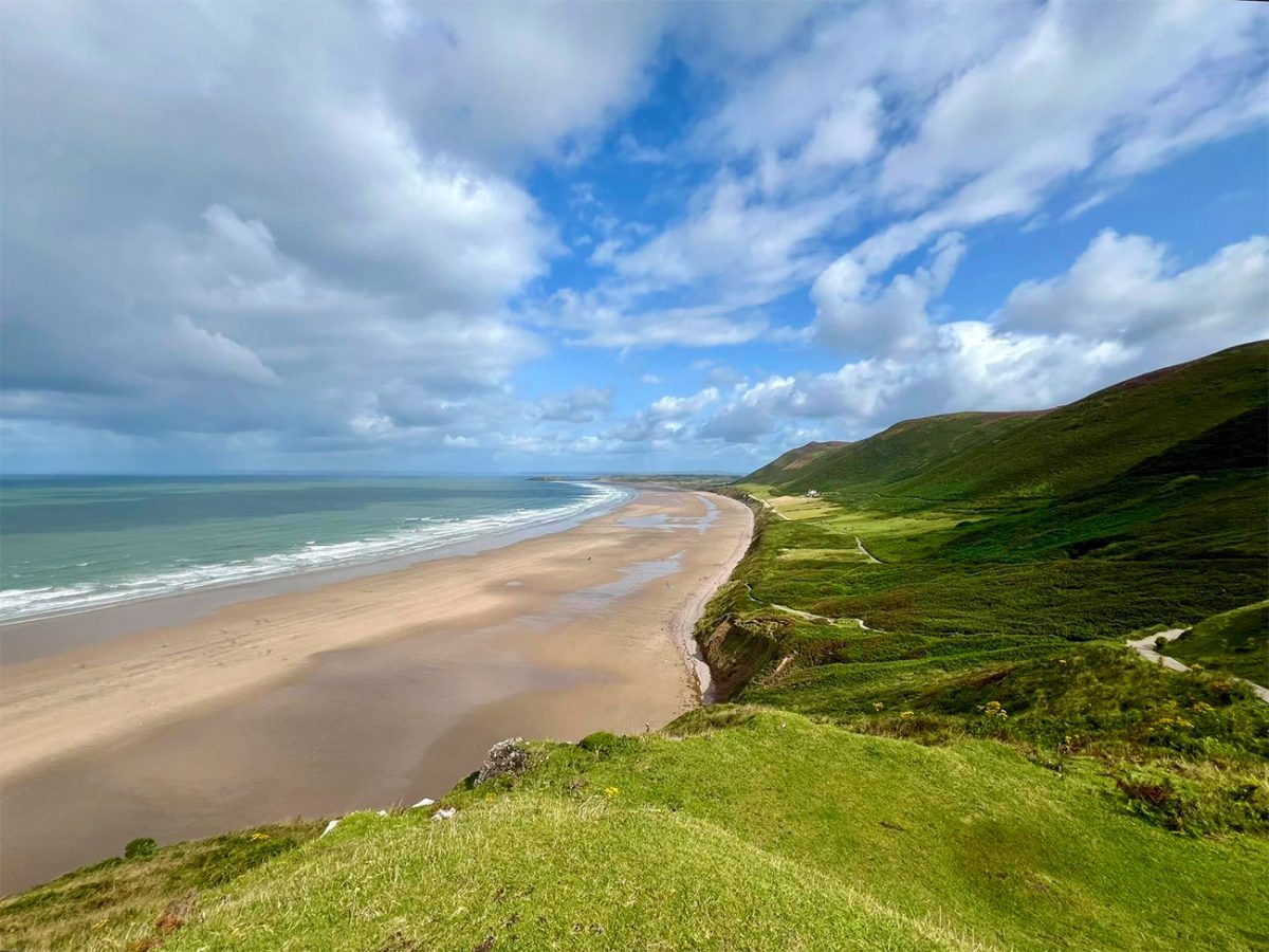
You will need to pay at the car park and National Trust members should follow the instructions displayed there, while non-members will need to check the current costs when they arrive.
The good news is that there are public toilets in the car park, they are not owned by the National Trust, and Rhosili also has cafés, shops and places to eat, but there are few decent facilities once the walk leaves the village.
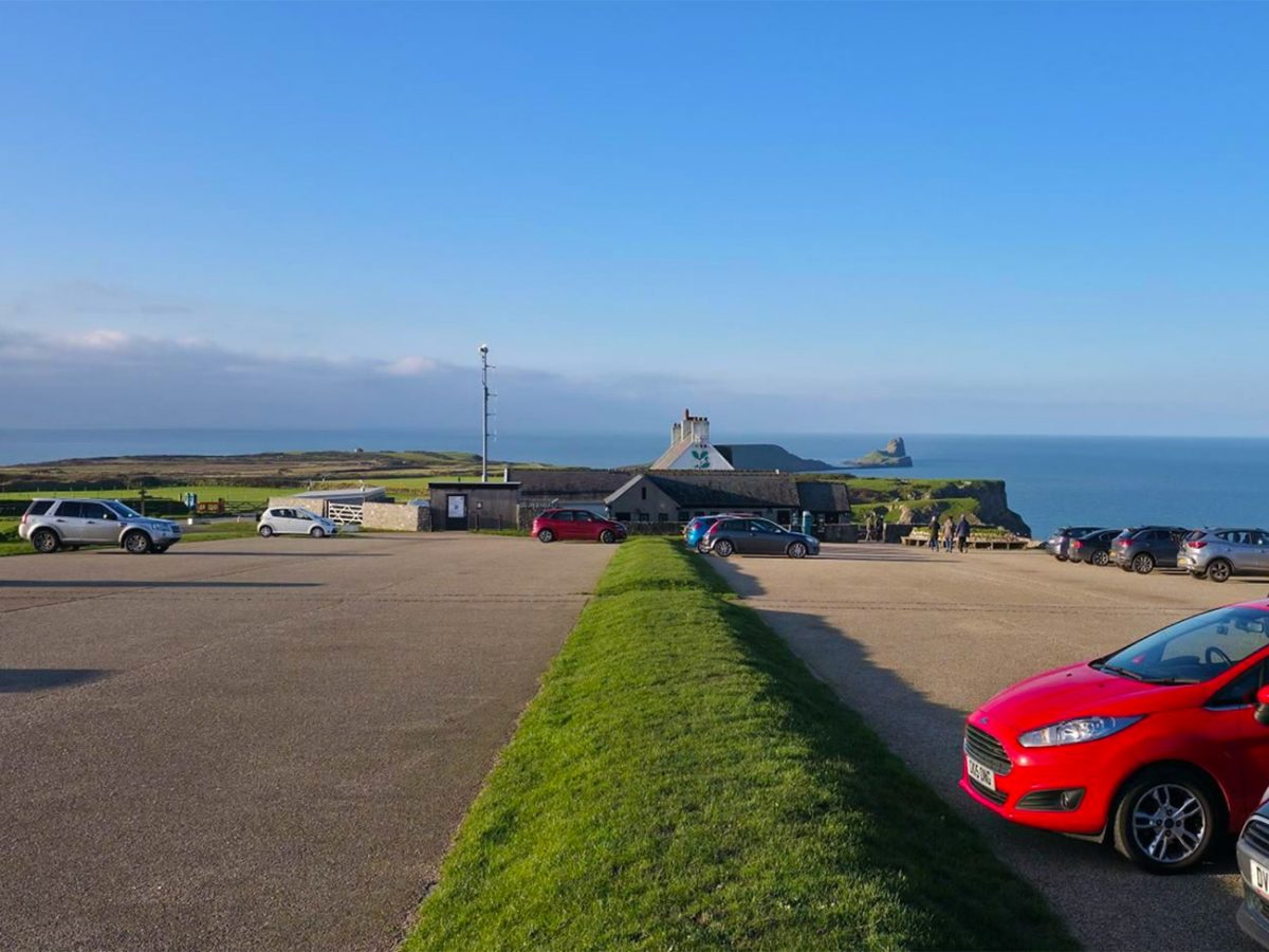
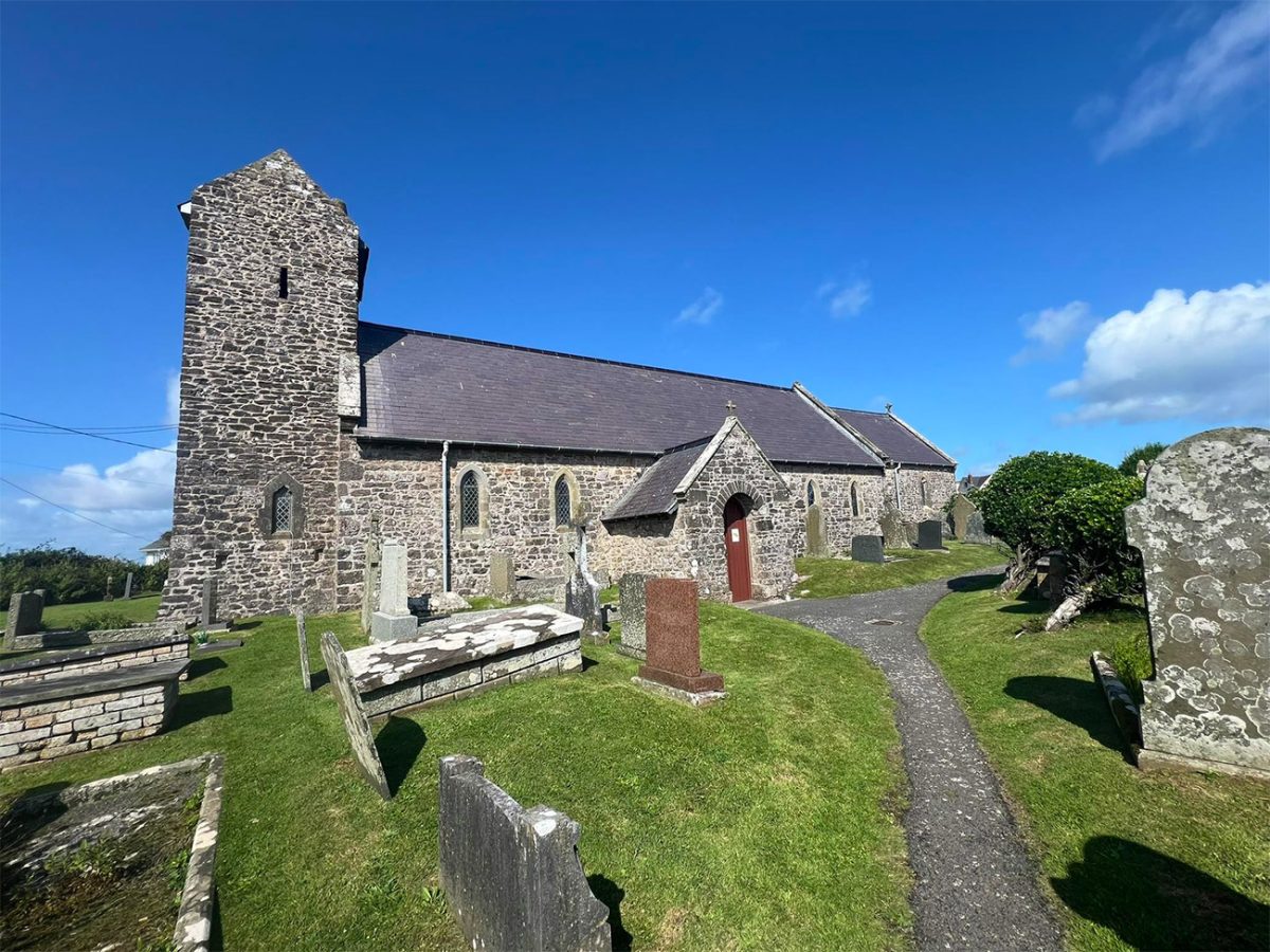
Once you are ready leave the car park and follow the route through the village, passing St Mary’s Church.
This beautiful church has medieval origins and has a quiet position right near the edge of the village. The village itself is small, and once you start walking you will soon leave the houses and head into open land.
You will then be following the path towards Rhosili Down.
The climb begins gently but soon steepens as the trail rises above the village. You will see several parallel tracks cross the hillside, probably created by walkers and animals, so if you have downloaded it use your GPX route and aim for the main ridge.
If the conditions are wet this climb can be slippery, and you will cross grass, loose stones and exposed areas so make sure you have good boots, probably a more sensible option than trainers. As you make your way towards the Beacon, I found myself stopping regularly just to take a look at Worm’s Head back near to where we started, it’s so beautiful.
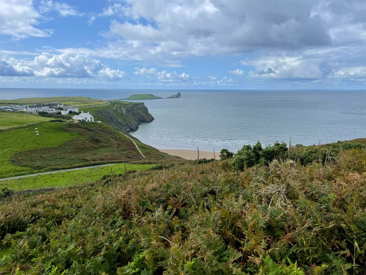
Heading towards the Beacon is the biggest effort of the day, it is very small by any mountain standards, but the climb begins close to sea level and gains height quickly, and at the same time the upper slopes become open and exposed, so strong winds are common, especially when that Atlantic weather crosses the peninsula, so be careful.
Once you reach the Beacon trig point, you are around 193 metres above sea level, and this is the highest point on the Gower Peninsula and the main summit of Rhosili Down. I hope you have good weather as the views are incredible, seeing how Rhosili Bay curves north beneath the ridge, with Hillend and Llangennith at the far end, while Worm’s Head sticks out into the sea at the other end.
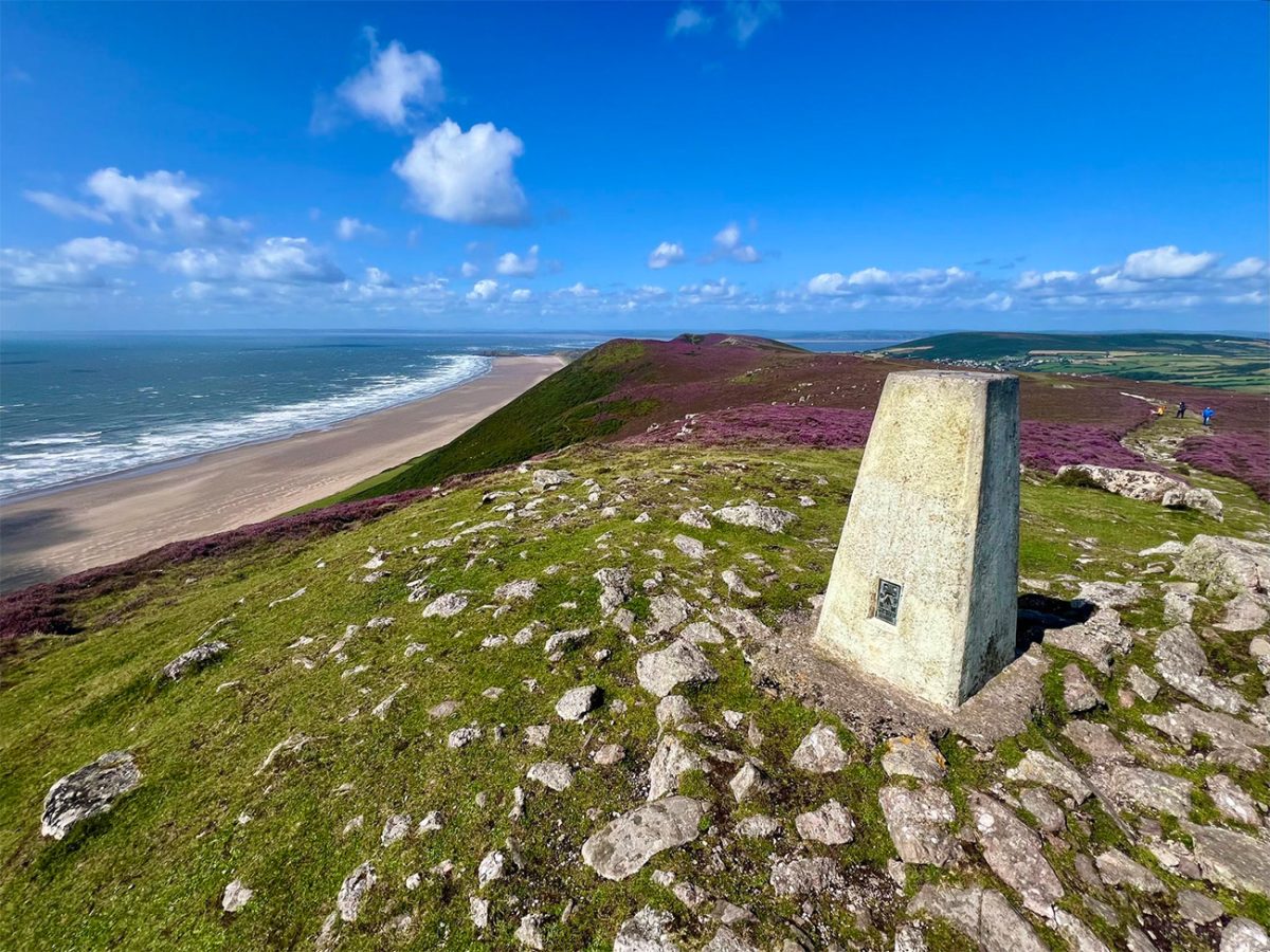
Looking north, you can see towards Burry Holms and the Loughor Estuary, with the Carmarthenshire coast stretching away in the distance. To the south, the broken limestone coast continues towards Fall Bay, Mewslade and Port Eynon.
It’s not just the beach on this walk, there is a lot of history up here. I found it really interesting that Rhosili Down contains evidence of some prehistoric burial sites, and they sit alongside remains of more modern military activity.
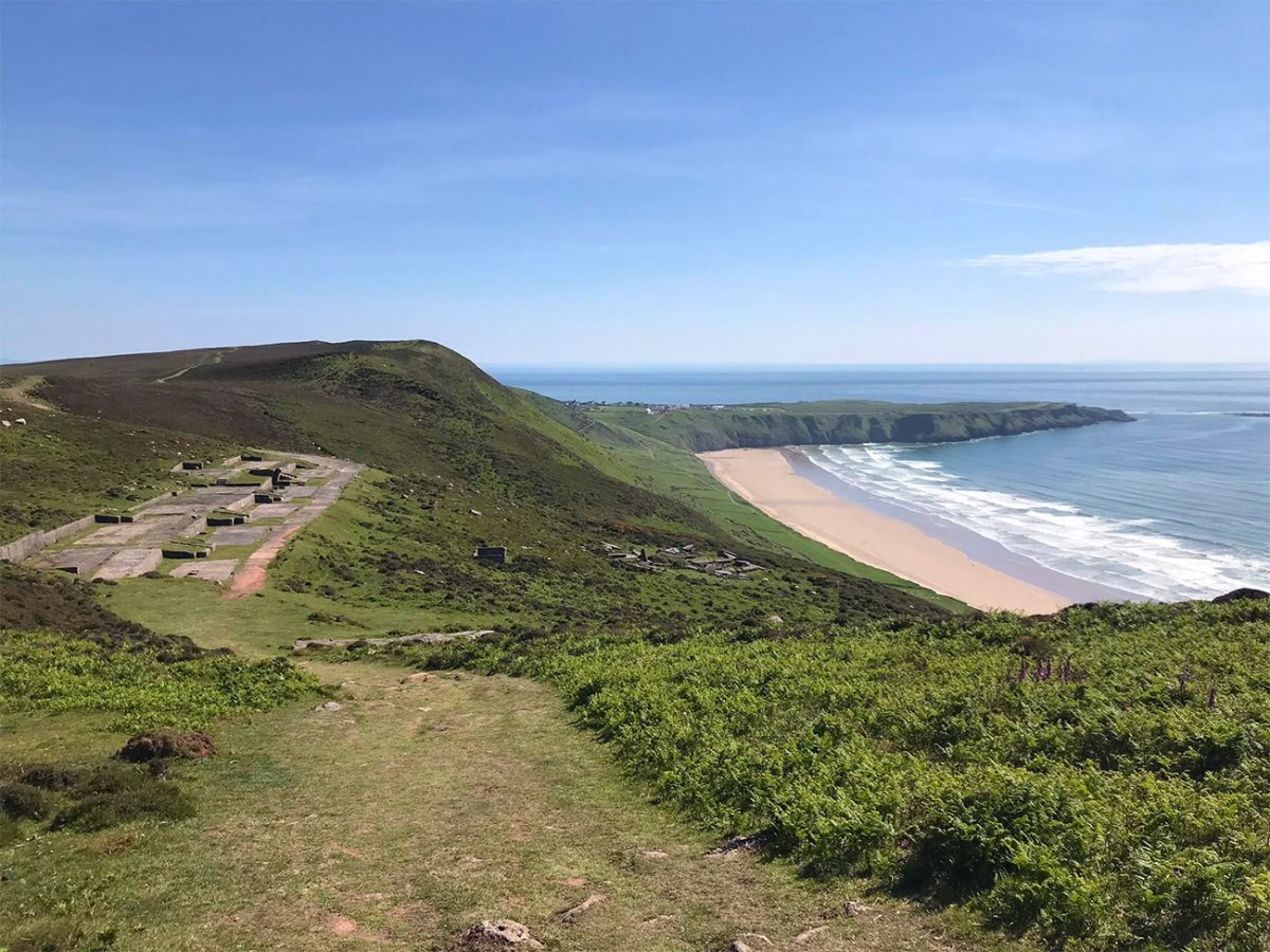
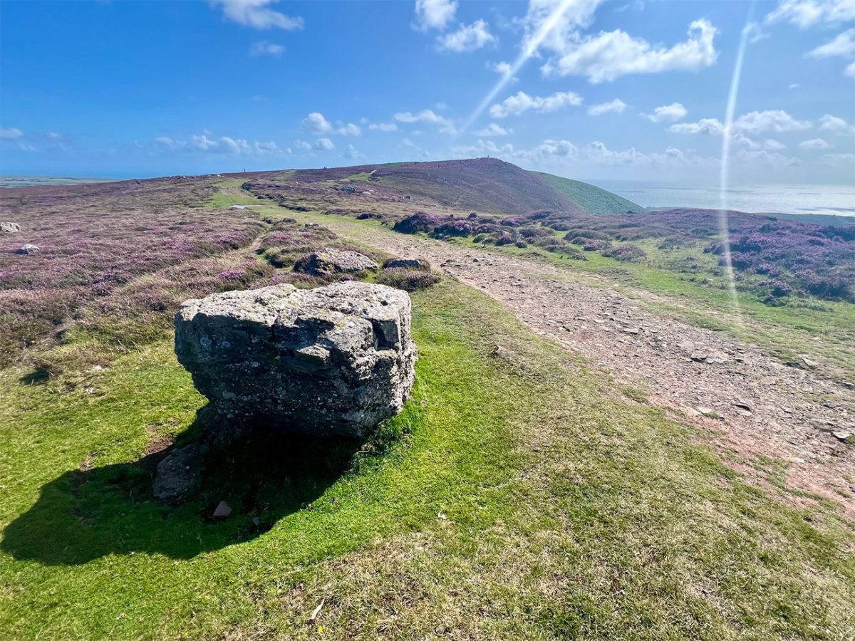
From the Beacon, continue north along the crest of Rhosili Down towards Hillend.
You will notice that several paths run across the common, and you just need to remain on the main northbound ridge route whilst keeping the bay on your left, that way you will be fine.
The elevated position gives you an incredible sense of the scale of Rhosili Bay. The sand extends for approximately three miles, backed for most of its length by the steep slopes of the Down, and you may see grazing animals, so give ponies, cattle and sheep plenty of room and make sure your dog is on a lead.
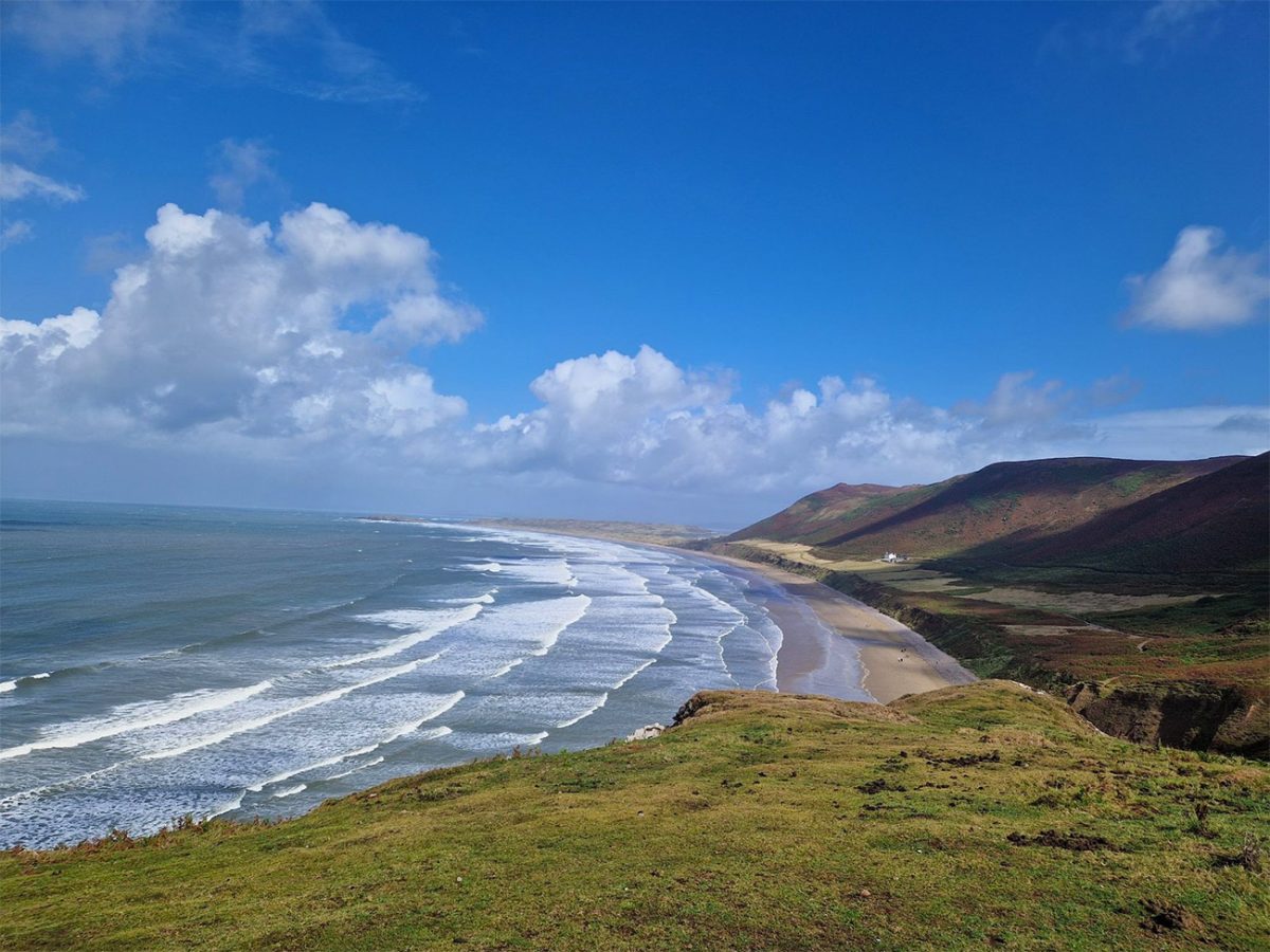
As you continue towards the northern end of the Down, the ridge gradually lowers as Hillend and the dunes become more prominent below. The descent is steeper and rougher than it may first appear, and loose stones, grass and eroded paths require care, especially after rain.
Follow the route towards the road and access tracks near Hillend.
Hillend lies behind the northern end of Rhosili Bay and has a campsite, car park and seasonal visitor facilities. Opening arrangements vary, so carry enough food and water for the full walk rather than depending on them. Cross the necessary access roads carefully and follow signs through or beside the dunes towards the beach.
Sand paths through the dunes are usually very clear, and eventually you will reach the northern end of Rhosili Bay and turn left to begin the long walk south. The direction of travel now changes completely. Rhosili Down rises to your left, while the open sea lies to your right.
This is the longest straightforward section of the route, but you should always be aware of the tide. The beach is extremely broad at lower water, but the available sand narrows as the tide rises. Looking ahead, Worm’s Head gradually returns into view beyond the southern end of the bay.
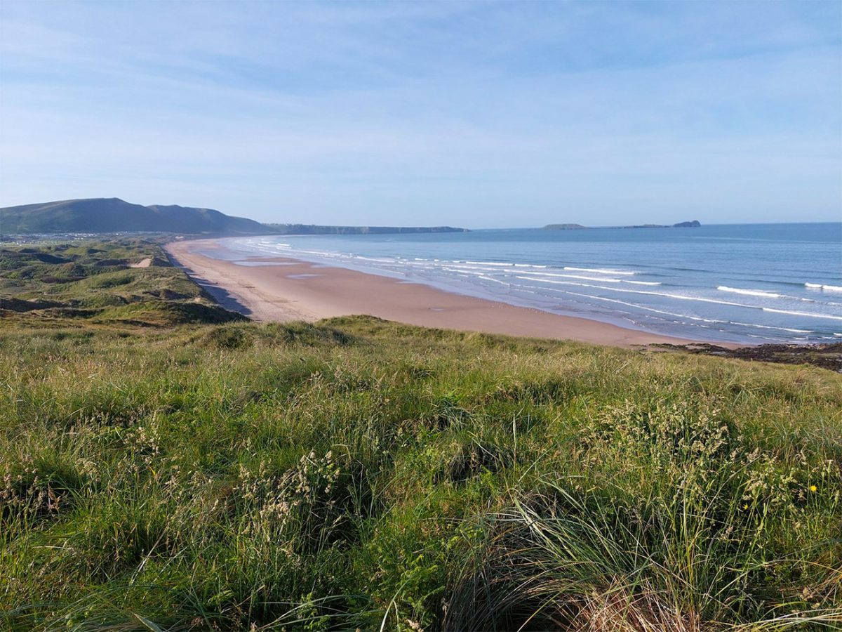
Behind you, Burry Holms sits off the northern edge of the beach. This tidal island contains archaeological remains but should not be approached without understanding the tide and local access conditions.
The ridge walked earlier now towers above the beach and gives you a clear idea of the height gained during the opening climb. The exposed beach doesn’t have much shelter, so sun and wind can make it very tiring and even on days that do not feel especially warm, make sure you carry sun protection and plenty of water, coastal walks have different conditions than mountain walks, and dehydration can settle in quickly.
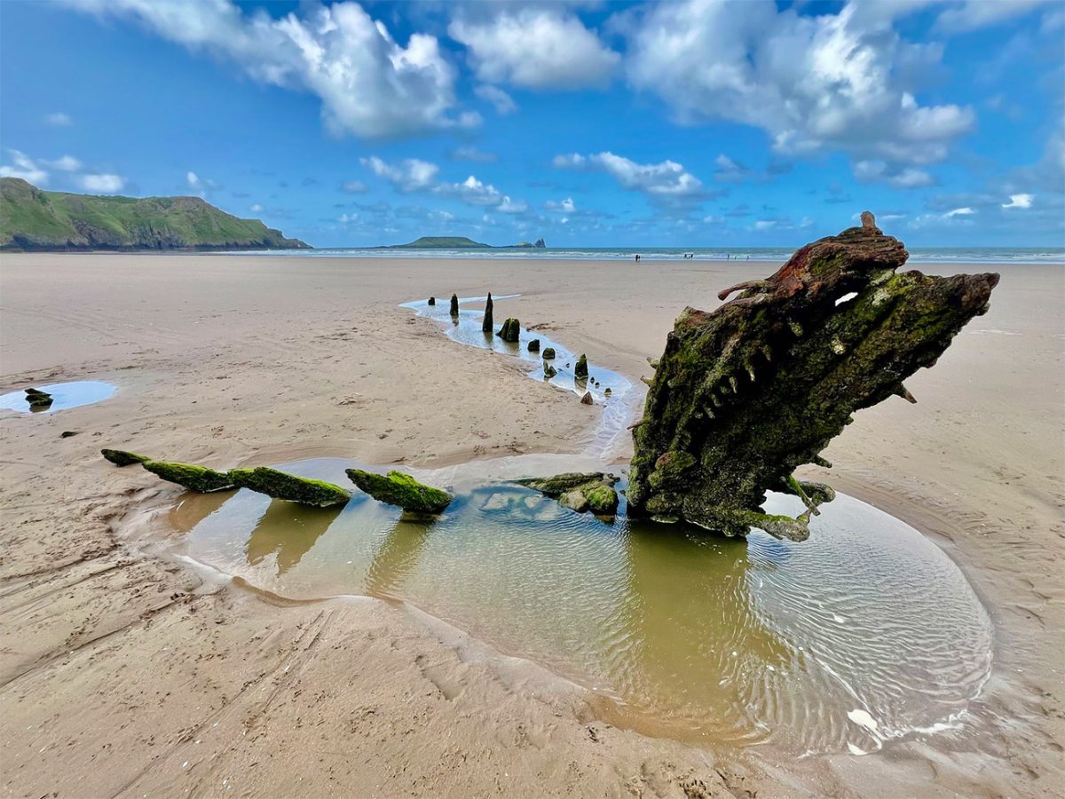
Closer to Rhosili, look for the remains of the Helvetia. The history here is that a Norwegian barque was driven ashore during a storm in 1887. Its timber remains are sometimes visible above the sand at low tide, but the amount that is exposed does change as storms and shifting sand reshape the beach.
Continue towards the southern end of the bay beneath the Old Rectory, which is a white building that stands alone beneath the cliffs, and has become one of the most recognisable features of Rhosili Bay and is now a National Trust holiday cottage.
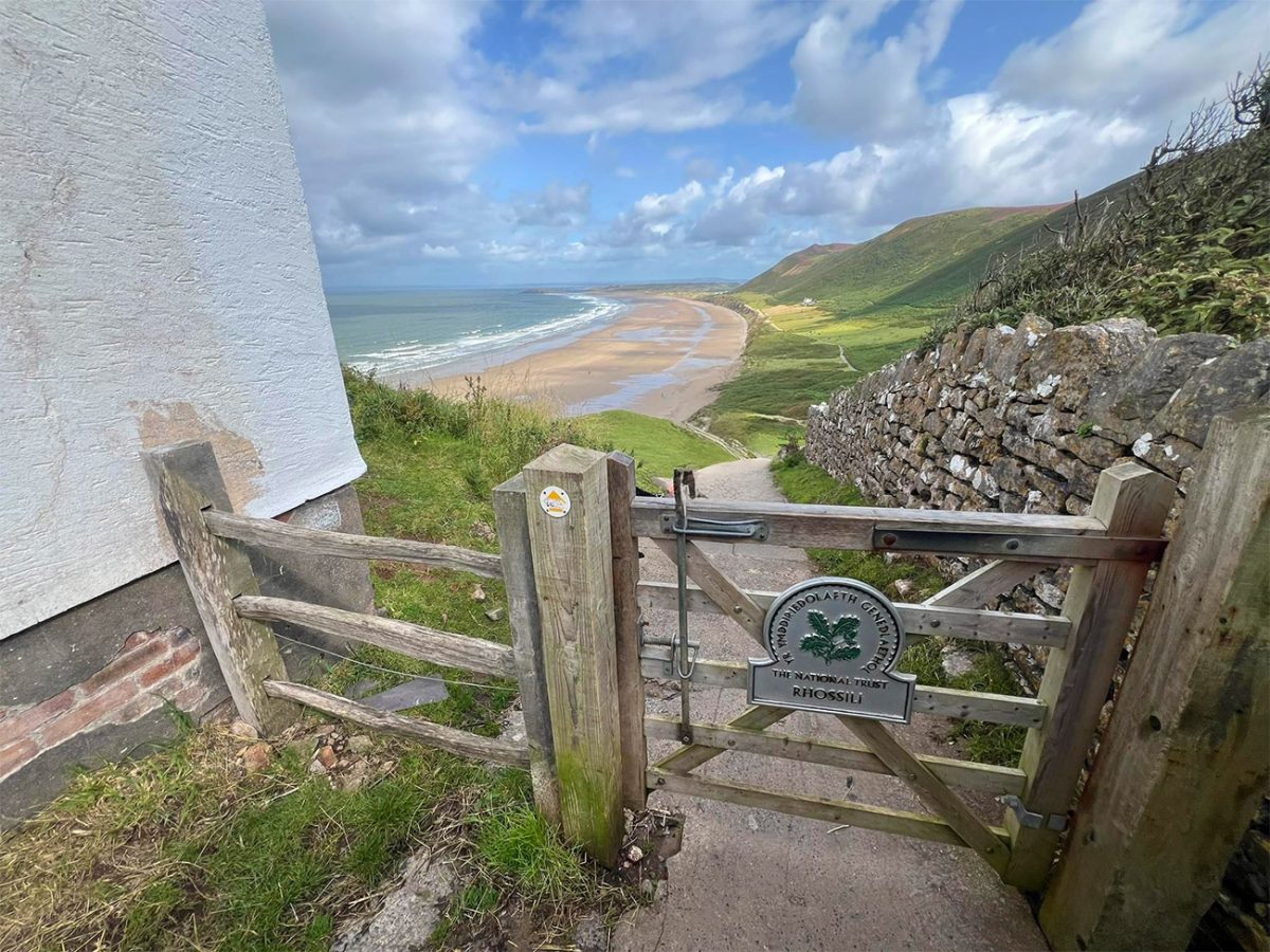
At the end of the beach locate the path climbing from the beach towards Rhosili village. This ascent is steep and can feel surprisingly demanding after the long beach section, so take your time, and be careful if the steps are slippery, these have been well worn over time, and they did catch me out once or twice.
Near the top, the full bay reappears below. This is one of the best viewpoints on the route and a natural place for a rest. But if you want to carry on, instead of returning directly to the car park, turn onto the coast path leading west towards Worm’s Head.
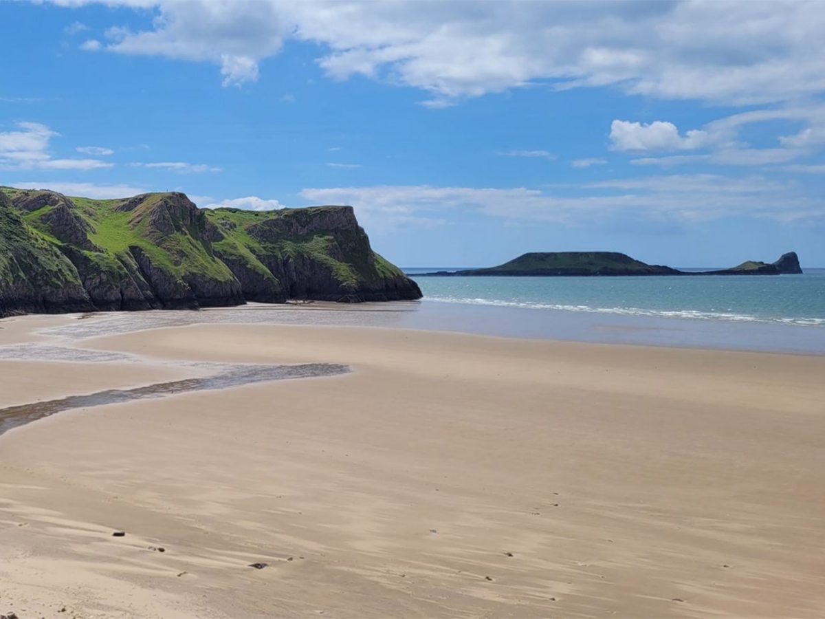
You will pass the National Trust shop in the former coastguard cottages, and the shop and nearby businesses may offer refreshments, but opening times vary by season. Continue along the broad clifftop track, and you will see Worm’s Head come into view. You will see that it consists of several connected rocky sections extending into the Atlantic, and it’s said that from certain angles, the headland resembles a dragon or sea serpent.
This walk does not cross the causeway. Anyone considering the extension must understand that Worm’s Head becomes cut off by the tide. The crossing window is approximately 2½ hours either side of low water, but walkers need sufficient time to cross, explore and return before the causeway is submerged.
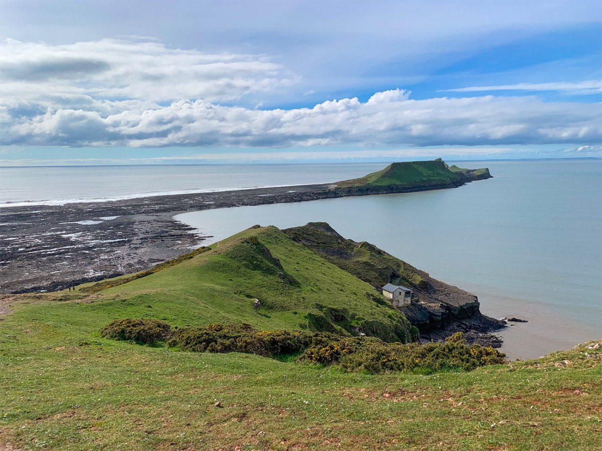
Please be careful if you do as the rocks are uneven, slippery and you will need time to cross. So if you are thinking of heading onto Worm’s Head, I’d treat it as a separate journey rather than casually adding it to this loop.
From the lookout area, continue around the headland following the Wales Coast Path. You will see that the landscape changes as Rhosili Bay disappears behind you. This part of the coast is narrower, rockier and more difficult, with limestone cliffs dropping into channels and small coves.
Follow the path around Kitchen Corner then to Tears Point as it continues all the way around to Fall Bay. If you want to head to Fall Bay, you’ll need to make your way down a steep path onto a secluded beach enclosed by cliffs, but this would be a separate journey from this walk, but well worth it if you have time.
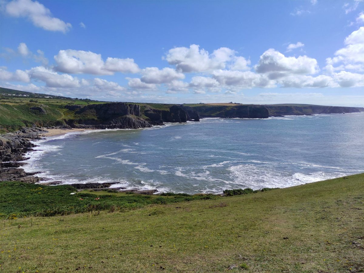
As you make your way uphill towards Rhosili village, you’ll enjoy the gentle pace compared with the climb onto the Down but may start to feel very tired by now, especially if the wind is strong and then it’s not long before you rejoin the village road and return to the National Trust car park.
The full circuit is around 10 kilometres or 6.5 miles, although your GPS may show something slightly different depending on which paths you follow across the Down and exactly where you leave the beach.
I would allow somewhere between 3.5 and 4.5 hours. You could complete it more quickly in calm, dry weather, but soft sand, mud, strong wind and regularly stopping for photographs can easily add time.
The route is best described as moderate, with a few strenuous sections. There is no technical scrambling on the standard circuit, but the climb to the Beacon, exposed ridge, beach sand and rough clifftop paths require reasonable fitness.
Walking boots or trail shoes with good grip are strongly recommended. Waterproof footwear is useful after rain and when crossing streams on the beach.
The route should be avoided during severe winds, thunderstorms or conditions that make the exposed ridge and cliff paths unsafe.

Walk this route yourself in 3D!
The video is a 3D walkthrough of this route; it’ll give you a great idea of what to expect before you set foot on the mountain.
I’ve created 3D videos of my walks and shared them with the Outdooractive and Welsh Man Walking communities.
Rhossili Bay Coastal Walk – 10 km Gower Peninsula Loop – 3D Walkthrough
Rhosili Bay Coastal Walk FAQs
Is the Rhosili Bay walk circular?
How difficult is the Rhosili Bay circuit?
How long does the walk take?
Does this route cross onto Worm’s Head?
When can I cross to Worm’s Head?
When can I cross to Worm’s Head?
Is the walk dependent on the tide?
Can I take my dog?
Is the route suitable for wheelchairs or pushchairs?
Are there cafés and toilets?
What should I bring?

Water-to-Go Named Best Watter Bottle for Travel. Click www.watertogo.eu + 20% Discount Using – ‘WMW20’

AllTrails: Trail Guides & Maps for Hiking, Camping, and Running | AllTrails ‘Plus’ 30% OFF – Read my ‘Full Review‘ for more details.