


Region: Cambridge, Cambridgeshire, England
Places To Stay: Cambridge has plenty of options, from boutique hotels and charming guesthouses to budget-friendly B&Bs. Try: Stay in Cambridge or browse more Cambridgeshire Accommodation.
The Cambridge City Centre Circular Walk is a relaxed five-kilometre journey through one of England’s most distinctive historic cities, linking medieval university buildings, riverside views, green spaces and lively pedestrian streets within an easy half-day route.
Beginning at Market Square, the walk passes through the commercial heart of Cambridge before reaching Christ’s Pieces and Parker’s Piece. These open spaces provide a welcome contrast to the surrounding streets, while Parker’s Piece has an important place in sporting history as the location where Cambridge students agreed an influential set of football rules in 1848.
The route then continues towards Downing Street and the Fitzwilliam Museum before reaching Silver Street and Queens’ College. From here, you can see the famous Mathematical Bridge, the elegant wooden crossing that links two parts of the college across the River Cam.
The second half of the walk explores the historic university quarter around The Backs, Garret Hostel Bridge, King’s Parade, Senate House and Trinity Street. Extending north towards Magdalene Bridge and Quayside adds another attractive riverside section where punts pass beneath the city’s historic bridges.
Although the basic circuit can be completed in around 1.5 to 2 hours, Cambridge rewards a slower pace. Allowing half a day gives you time to photograph the colleges, visit King’s College Chapel or the Fitzwilliam Museum, browse the market and stop at one of the city’s many cafés or historic pubs. College admission arrangements, opening hours and visitor charges vary, so check directly before planning an interior visit. King’s College, for example, publishes separate visitor opening and ticket information.
This is an ideal walk for history lovers, photographers and first-time visitors, but it also works well as part of a wider collection of English city walks. Anyone who enjoys Cambridge’s university atmosphere may also like your Oxford city centre circular walk, while the Bath Georgian highlights walk, York Minster circular walk and London Tube Trekking routes provide natural next steps through other historic British cities.
Below are a three ideas for trips and tours available in Cambridge, GetYourGuide offer great discounts and availability + Many more!
Looking for Cheap Flights? Try the Skyscanner Flight Checker Below.
This is how I find my ‘Flight Tickets‘, I fly when the price suits my budget. Flying to London Stansted is the closest major hub for Cambridge — only 30 minutes away by train.
Getting There: Directions, GPX and App Link
- Start point: Market Square, Cambridge, CB2 3QJ. Visitors arriving by train can join the route at Parker’s Piece or walk approximately 20–25 minutes to Market Square.
- Google Maps: Market Square (CB1 0SS)
- GPX: Download the GPX file here for use on your GPS device or watch
- You can also view and follow this route on my Outdooractive and Komoot profiles
- Avoid the early start – find accommodation in Cambridge
Hike Profile
- Distance: 3 miles / 5 km (circular)
- Duration: 1.5 – 2 hours (or longer with stops)
- Difficulty: Easy – accessible for all fitness levels
- Route conditions: Predominantly flat pavements and surfaced paths, with occasional cobbles, kerbs, busy crossings and shared cycle routes. Comfortable walking shoes are recommended.

Sim Local can reduce or even eliminate your roaming fees. Click www.simlocal.com/ + 10% Discount Using – ‘WELSHMAN’
Hike Description
Begin the Cambridge City Centre Circular Walk at Market Square, one of the liveliest parts of the historic centre. Markets have been held in this area for centuries, and the square remains filled with stalls selling food, books, gifts, clothing and local produce. Even before you set off you could spend an hour just walking around this area, and seeing what people have to sell and even start with something to eat and drink, it’s a great place to start.
The square is surrounded by cafés, shops and historic streets, making it a useful meeting point and an easy place to buy food or water before starting. The Church of St Mary the Great stands nearby and has long been closely connected with the University of Cambridge.
Leave Market Square and make your way towards Petty Cury. This busy pedestrianised street links the market area with the modern shopping quarter around the Grand Arcade and Lion Yard.
Petty Cury is one of the more commercial and modern parts of the route, we sort of accepted it for what it is and just kept looking forward to seeing the architecture and history which we came to Cambridge to see. It can become crowded during weekends, school holidays and university events, and also take care around cyclists and delivery vehicles as there are sections where pedestrian areas meet the busy roads.

Continue towards St Andrew’s Street, passing a mixture of shops, churches and university buildings. This section shows how closely the modern city and the historic university have developed alongside one another.
St Andrew’s Street leads towards Emmanuel College, founded in the late 16th century. The college grounds are private, but its entrance and historic buildings form an attractive feature beside the route.
Cross carefully and enter Christ’s Pieces. This landscaped public space provides a quieter walking section close to the centre, with tree-lined paths, lawns, flowerbeds and benches.
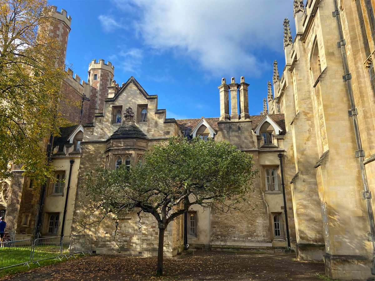
Christ’s Pieces is especially attractive during spring and summer, although its central location means it remains well used throughout the year. Follow the paths towards Drummer Street and Parkside.
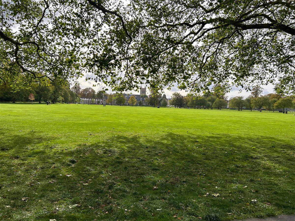
Leave Christ’s Pieces near Parkside and continue towards Parker’s Piece. This broad open common is one of Cambridge’s most historically significant public spaces.
In 1848, a group of University students agreed a unified set of football rules on Parker’s Piece. These Cambridge Rules helped shape the later development of association football, and the site is often described as one of the birthplaces of the modern game. A public sculpture on the common commemorates this history.
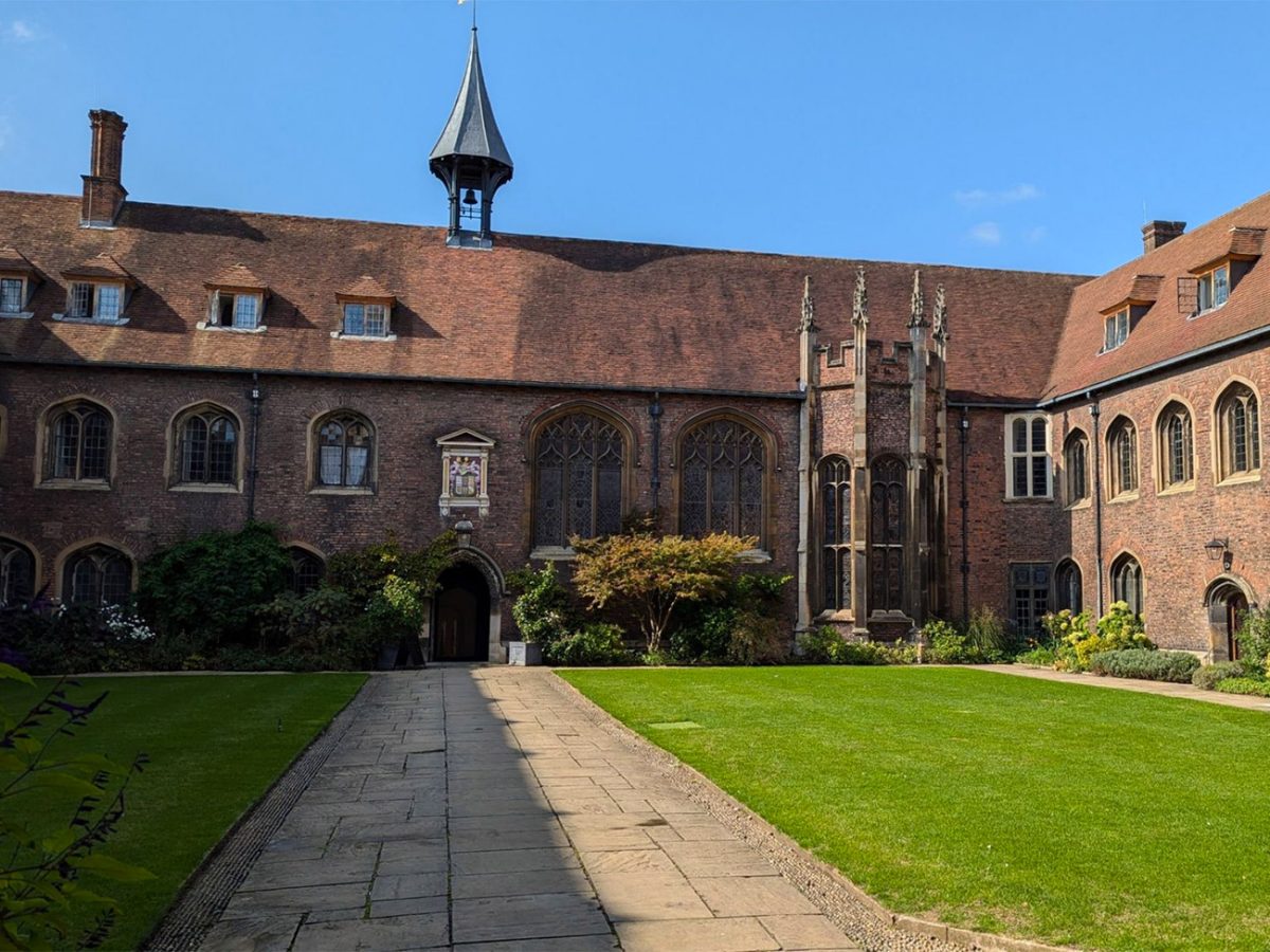
Walk across Parker’s Piece, enjoying the open views and the contrast with the enclosed streets of central Cambridge. The paths are generally broad and level, although large events and wet weather can occasionally affect conditions.
The distinctive lamp at the centre is commonly known as Reality Checkpoint. Several stories attempt to explain the name, but its precise origin remains uncertain.
Leave Parker’s Piece towards Regent Street. This busy route contains numerous cafés, restaurants and shops and forms one of the main approaches into central Cambridge.
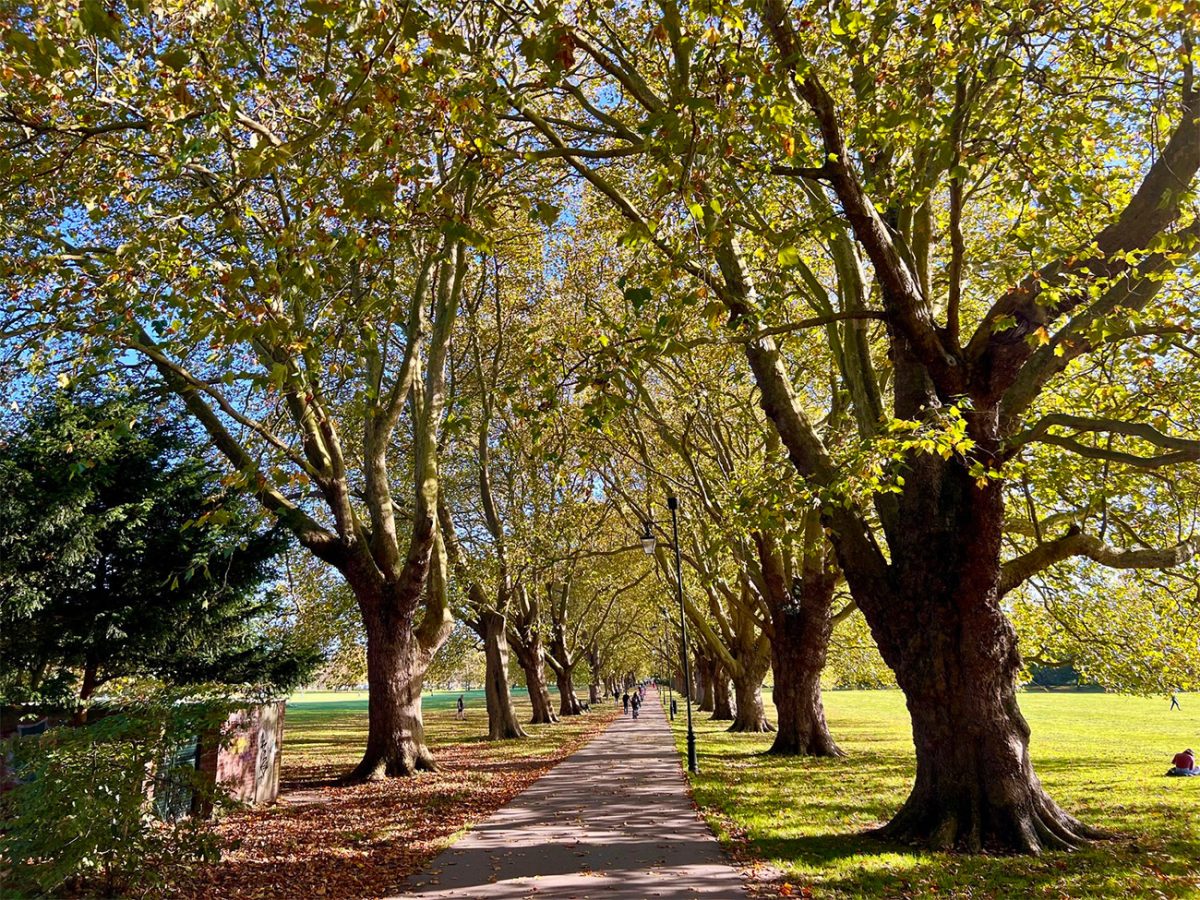
Continue along Regent Street before turning towards Downing Street. The university buildings here belong to several academic departments and museums, giving this part of the city a noticeably different character from the medieval colleges farther west.
Downing Street leads past the Sedgwick Museum of Earth Sciences and other university collections. Some museums are free to enter, although opening arrangements can vary.
A worthwhile extension leads south towards the Fitzwilliam Museum on Trumpington Street. This major university museum holds collections of paintings, manuscripts, antiquities and decorative arts.
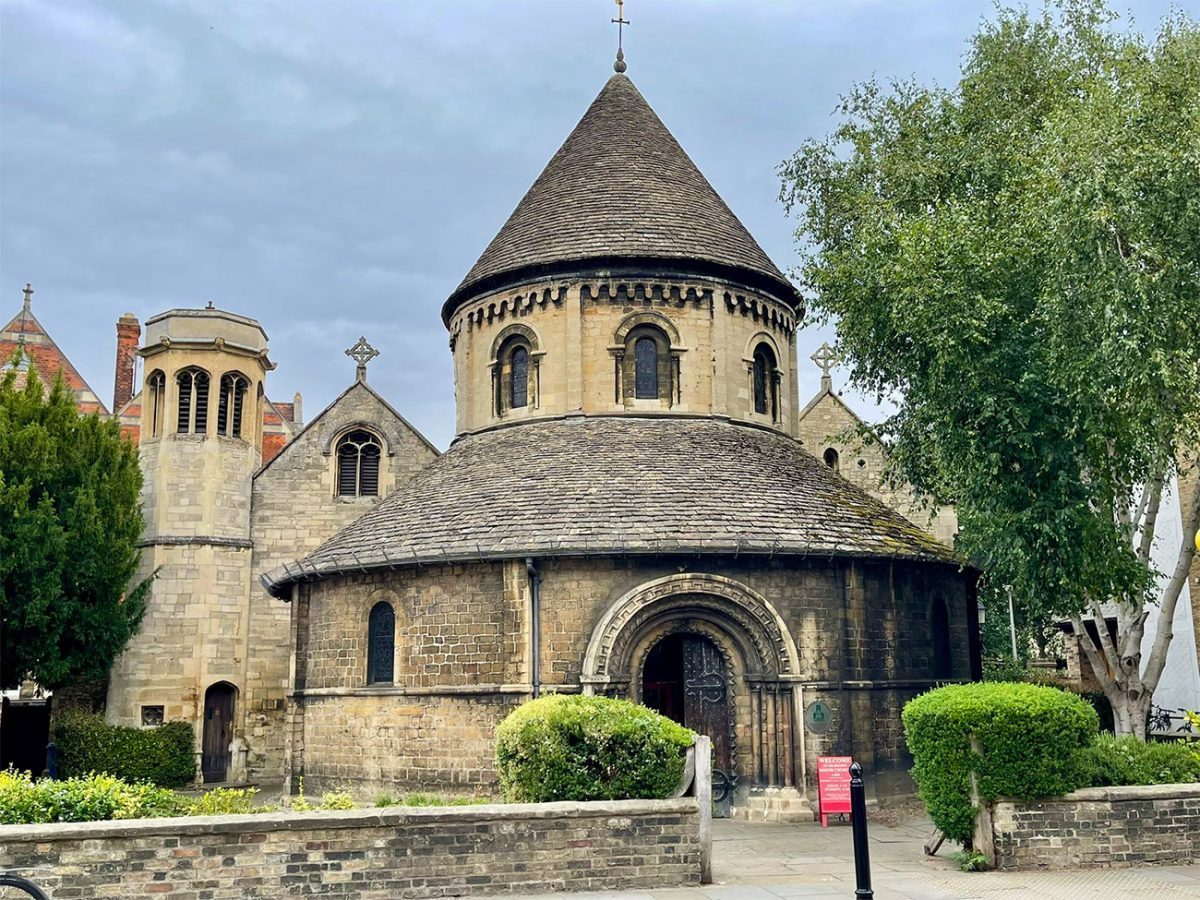
Entry to the Fitzwilliam Museum is generally free, although special exhibitions may have separate arrangements. Visiting it properly could add several hours to the walk, so it may be better treated as a separate stop rather than a quick detour.
Return towards the principal route and continue west through the historic centre. Depending on the exact GPX line, you may pass Pembroke College and several university buildings before reaching Silver Street.
Silver Street descends towards the River Cam and Queens’ College. This is one of the busiest crossings in central Cambridge, with pedestrians, cyclists, buses and vehicles all using a relatively confined area.
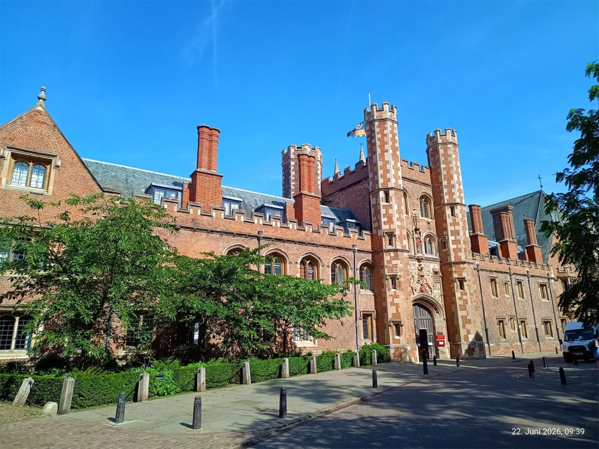
Cross the river using the public Silver Street Bridge. From the bridge and nearby pavement, look north towards the famous Mathematical Bridge.
The Mathematical Bridge is the popular name for the wooden bridge connecting the older and newer parts of Queens’ College. It was designed by William Etheridge in the 18th century and first built by James Essex in 1749. The present structure has been rebuilt while retaining the original overall design.
Despite a persistent local story, the bridge was not built without fastenings and was not later reconstructed by people unable to understand its design. Its appearance comes from the arrangement of straight timbers forming a curved structure.

After crossing Silver Street Bridge, continue towards Queen’s Road and the western side of the historic college district.
This part of Cambridge is associated with The Backs, the landscaped grounds and riverside meadows behind several of the university’s best-known colleges.
Follow the public pavement and the route shown on your GPX rather than entering gateways or crossing college lawns without permission.
The scenery remains excellent from the public approaches. Trees, stone bridges, river meadows and the towers of the colleges combine to create some of Cambridge’s most recognisable views.
Continue towards Garret Hostel Lane and use Garret Hostel Bridge to cross the River Cam. The bridge is an important public pedestrian and cycle connection between the western university sites and the city centre.
Cyclists use this narrow bridge heavily, so keep to one side and remain aware of people approaching from both directions.
The crossing provides attractive views along the river, often with punts passing below. To the south are the grounds and bridges of Clare and King’s Colleges, while Trinity College lies farther north.
After crossing Garret Hostel Bridge, continue into the university quarter. Narrow lanes lead towards Trinity Lane, Senate House Passage and King’s Parade.
This section contains some of the finest historic streetscapes in Cambridge. College walls, gateways, chapels and old university buildings crowd closely around the pedestrian routes.
Pass towards Senate House, the ceremonial building used by the University of Cambridge for degree ceremonies and other formal occasions.
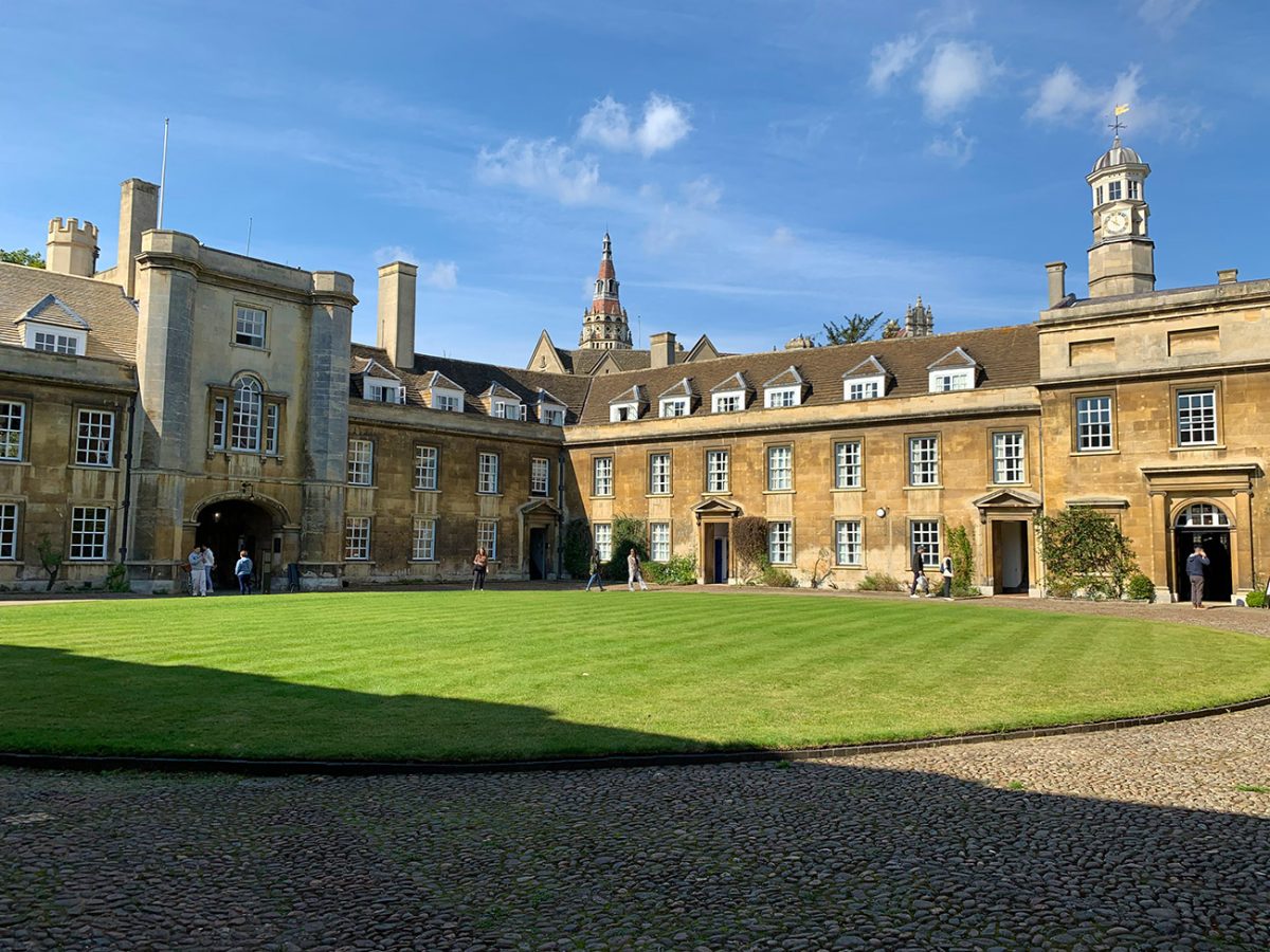
Nearby is the Old Schools complex, while Great St Mary’s Church stands at the edge of Market Square. These buildings illustrate how the university’s administrative and religious history is concentrated within a relatively small part of the city.
Continue towards King’s Parade, where King’s College Chapel dominates the street. The chapel is one of the defining buildings of Cambridge, recognised for its late Gothic architecture, tall windows and fan-vaulted interior.
Seeing the exterior from King’s Parade is free, but entering the college and chapel normally requires a visitor ticket outside public worship. Opening times may also change because of services, university activity and special events, so visitors should check directly with King’s College.
King’s Parade can become extremely busy with walking tours, students, cyclists and visitors. Take care when crossing the road and avoid standing in cycle lanes while photographing the chapel.
Continue north along the historic streets, passing Senate House and moving towards Trinity Street.
Trinity Street is lined by several colleges, including Gonville and Caius College and Trinity College. Many of the gateways can be admired from the street, although casual public access may be restricted.

Trinity College was founded in the 16th century and has associations with figures including Isaac Newton. Its Great Gate is one of the most recognisable college entrances in Cambridge.
Continue through the city towards Bridge Street. This busy historic street connects the university quarter with Magdalene Bridge and the northern riverside.
Before reaching the bridge, you may pass close to St John’s College. The college’s own Bridge of Sighs is located within its grounds and is not visible in full from every public street position.
Cross Magdalene Bridge over the River Cam. This is an excellent place to pause and watch punts travelling between the city centre and the upper river.
The bridge stands near the site of an important historic crossing into Cambridge. Magdalene College lies immediately north of the river and takes its name from Mary Magdalene.
From the bridge, continue towards Quayside. This riverside area contains punting stations, cafés, restaurants and places to sit beside the Cam.
Quayside is one of the livelier sections of the walk, particularly in warm weather. Punting guides call to potential customers, boats move through the crowded waterway and groups gather beside the river.
Punting is not essential to the walking route, but it provides a different view of several college buildings and bridges that cannot be reached freely on foot.
After exploring the riverside, follow the city-centre streets back towards Market Square. Depending on the exact GPX route, this may lead through Bridge Street, Sidney Street or the lanes surrounding the market quarter.
Sidney Street passes close to Sidney Sussex College and returns towards the principal shopping streets.
As you approach Market Square, the spire of Great St Mary’s and the surrounding historic buildings provide useful visual landmarks.
Return to Market Square to complete the five-kilometre circuit. The central location makes it easy to finish with food, visit another attraction or continue exploring independently.
Cambridge is one of Britain’s busiest cycling cities. Pay close attention when crossing cycle lanes, stepping from pavements and using shared routes such as Garret Hostel Bridge.
College entrances, visitor routes and opening hours can change throughout the academic year. Examinations, graduations, services and private events may restrict access even where entry is normally available.
Cambridge City Centre Walk FAQs
Is the Cambridge city walk accessible?
Can I bring a dog?
Do I need to pay to enter the colleges?
Can I cross the Mathematical Bridge?
How long does the Cambridge circular walk take?
What is the best time to visit Cambridge?
Is the route signposted?
How do I reach the starting point by public transport?
Are there toilets and refreshments along the route?
What should I bring?

Water-to-Go Named Best Watter Bottle for Travel. Click www.watertogo.eu + 20% Discount Using – ‘WMW20’

AllTrails: Trail Guides & Maps for Hiking, Camping, and Running | AllTrails ‘Plus’ 30% OFF – Read my ‘Full Review‘ for more details.