


Region: Eryri (Snowdonia) National Park, Pen-y-Pass, Yr Wyddfa (Snowdon), Gwynedd, North Wales
Places To Stay: There are loads of places to stay near Snowdon and Eryri (Snowdonia) National Park. It’s one of the most visited spots in the UK so book early, especially in summer!
Yr Wyddfa (Snowdon) is the highest mountain in Wales, standing proud at 1,085 metres (3,560 feet). This classic circular walk from Pen-y-Pass takes you up the rugged and scenic Pyg Track before descending via the gentler Miners’ Track. It’s a fantastic way to tackle the mountain, combining dramatic landscapes, epic views, and a real sense of adventure, all within a manageable 7.5-mile loop. A great option for fit walkers wanting a big mountain day without tackling technical ridges.
I have created the full list of routes up to the summit, routes that suit all abilities, take a look at my Wyddfa Hike Guides.
Below are a 3 ideas for trips and tours available in Eryri, GetYourGuide offer great discounts and availability + Many more!
Looking for Cheap Flights? Try the Skyscanner Flight Checker Below.
This is how I find my ‘Flight Tickets‘, I fly when the price suits my budget. Flying to Heathrow is the best option for London.
Getting There: Directions, GPX and App Link
- Start point: Pen-y-Pass car park is located on the A4086 between Llanberis and Capel Curig. Postcode: LL55 4NU.
- Parking: The main car park fills up *very* early — pre-booking is essential via the Snowdonia National Park website. Or use the Park & Ride from Nant Peris. Google Maps link to Pen-y-Pass
- GPX: Download the GPX file to use on your devices.
- You can also view and follow this route on my Outdooractive and Komoot profiles.
- Avoid the early start – find accommodation near Snowden
Hike Profile
- Distance: 7.5m / 12km
- Duration: 4.5 – 6 hours
- Highest point: 3,560ft / 1,085m
- Difficulty: Moderate to hard – steep rocky paths, with some scrambling near the top of the Pyg Track. Weather can change quickly.
- Route conditions: Stone paths, rocky ascents, exposed in places. Proper hiking boots essential. Take layers, map, food, and water.

Sim Local can reduce or even eliminate your roaming fees. Click www.simlocal.com/ + 10% Discount Using – ‘WELSHMAN’
Hike Description
The Pyg Track up and the Miners’ Track down is one of the most popular ways to climb Yr Wyddfa (Snowdon), and you’ll soon see why. Combining the dramatic mountain scenery with the well-maintained paths and some of the finest views in Eryri (Snowdonia) National Park, this circular route offers an unforgettable journey to the highest summit in Wales.
The walk begins at Pen-y-Pass, one of the most famous mountain trailheads in the UK. Sitting high in the heart of Eryri, the car park is surrounded by rugged peaks and steep glacial valleys, immediately zoning you in on the walk. The Pyg Track starts directly opposite the car park and you will waste no time in gaining height as it climbs steadily above the valley floor.
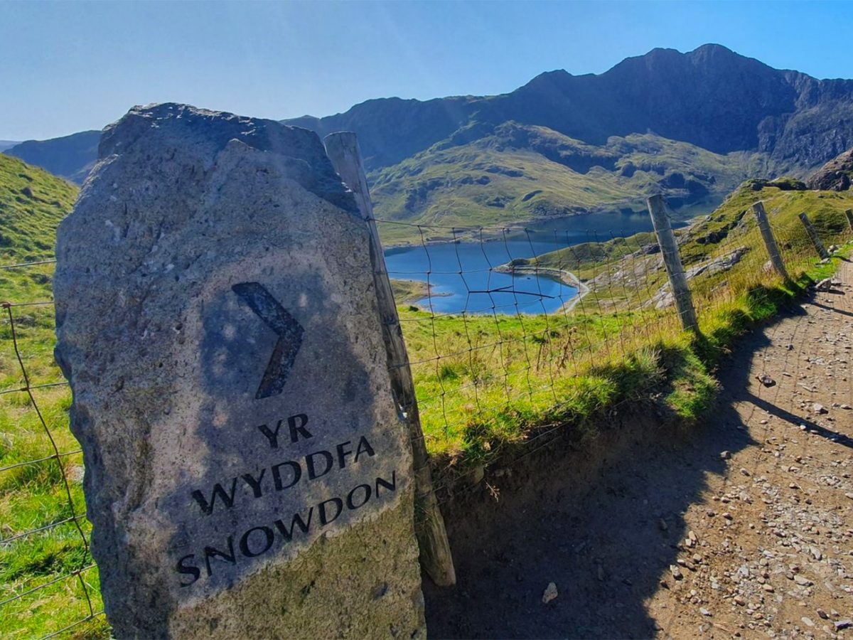
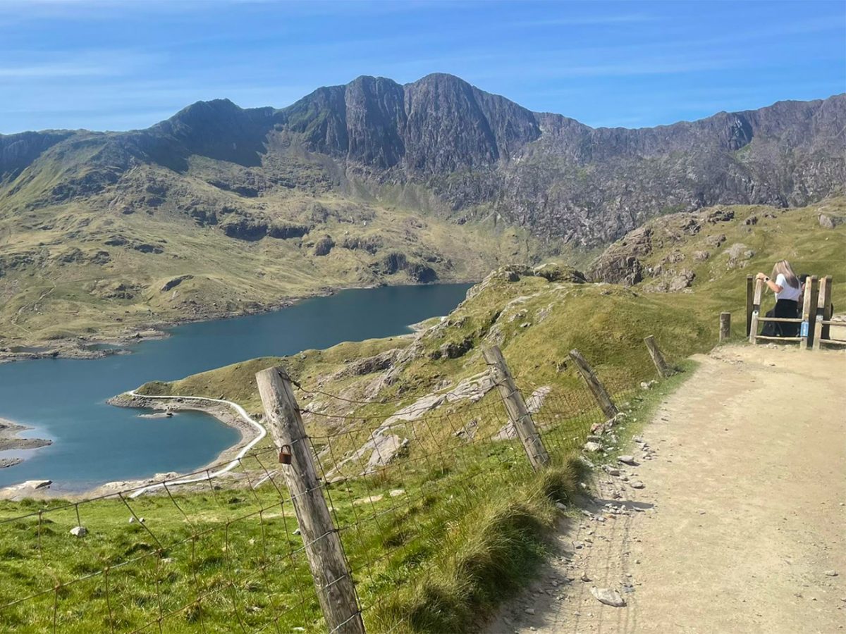
Almost immediately, the incredible views begin to open up behind you. Looking back, you’ll see the dramatic walls of the Llanberis Pass dominate the landscape, while the distinctive profile of Elidir Fawr rises above the horizon. The path itself is well constructed but rocky underfoot, winding its way across the mountainside through terrain shaped by glaciers thousands of years ago.

As the climb continues, one of the most striking features of the route comes into view. High above and to the right stands Crib Goch, the famous knife-edge ridge that forms part of the Snowdon Horseshoe. Considered one of the most challenging mountain routes in Britain, its narrow crest often attracts experienced hikers and scramblers. Even if you’re not tackling it yourself, seeing walkers carefully make their way across the ridge adds a bit of drama to the landscape.
The higher you climb, the more impressive the scenery becomes. The path traverses the eastern flank of Yr Wyddfa, providing constantly changing views across some of the most spectacular mountain scenery in Wales. Below, the turquoise waters of Llyn Llydaw begin to appear, while beyond them the surrounding peaks create an almost alpine atmosphere rarely found elsewhere in the UK.
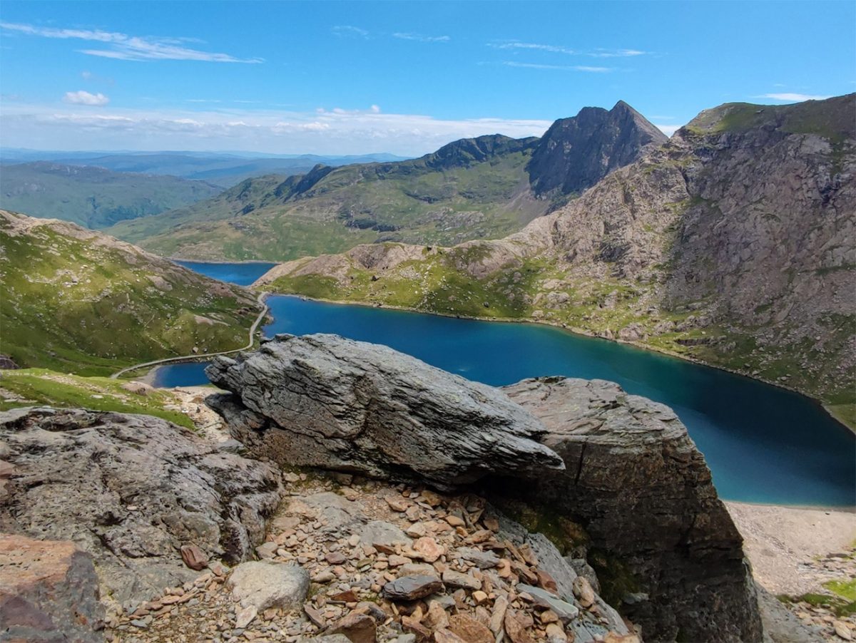
One of the highlights of the route is the view across Glaslyn, a beautiful mountain lake sitting beneath the summit of Yr Wyddfa. According to Welsh legend, this is the lake where King Arthur’s sword, Excalibur, was thrown after his death. Whether or not the story is true, there is something undeniably magical about the setting. Surrounded by steep rocky slopes and often reflecting the mountains above, it is one of the most photographed locations in Eryri.
As the Pyg Track approaches the upper slopes, the gradient begins to increase and the terrain becomes more rugged. The final ascent follows a steeper rocky path where the Pyg and Miners’ Tracks merge. This section can be busy during weekends and holidays, particularly during the summer months, but the summit is now within reach. Take your time, enjoy the views and savour the anticipation as Wales’ highest point draws closer.

Eventually, the summit plateau comes into view and the famous trig point of Yr Wyddfa stands proudly at 1,085 metres above sea level. Reaching the summit is a special moment. Not only are you standing on the highest mountain in Wales, but also one of the most iconic peaks in the United Kingdom.
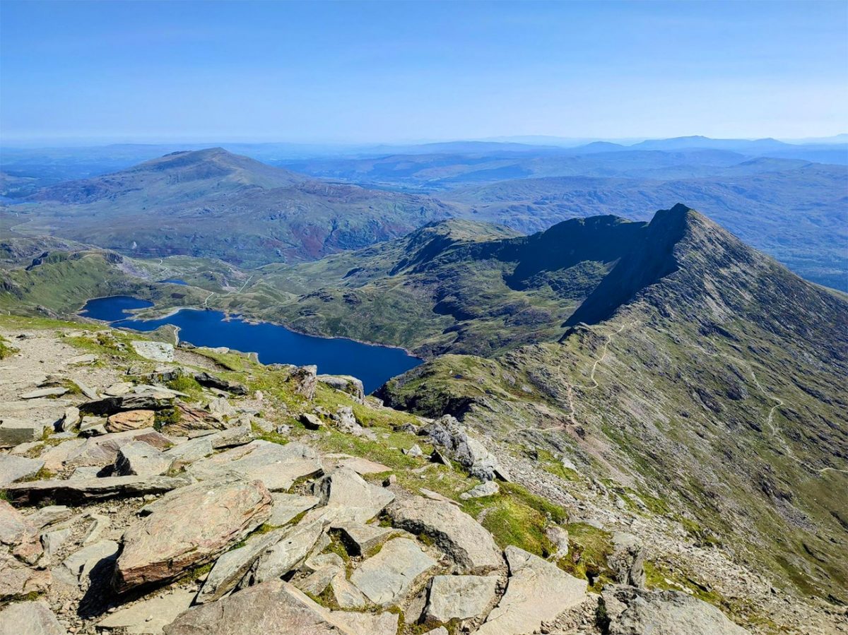
The views from the top are extraordinary. On a clear day, much of North Wales opens up. To the west lies Anglesey and the Irish Sea, while to the south the mountains seem to stretch endlessly towards Cadair Idris and Mid Wales. Looking east, the rolling hills of the Welsh borders can often be seen, while on exceptionally clear days you can sometimes see views as far as Ireland, the Isle of Man and even the Lake District.
The summit is also home to Hafod Eryri, the visitor centre that sits just below the trig point. Open during the main season, it provides refreshments and shelter, although many walkers prefer to find a quieter spot among the surrounding rocks to enjoy a well-earned lunch while taking in the scenery.
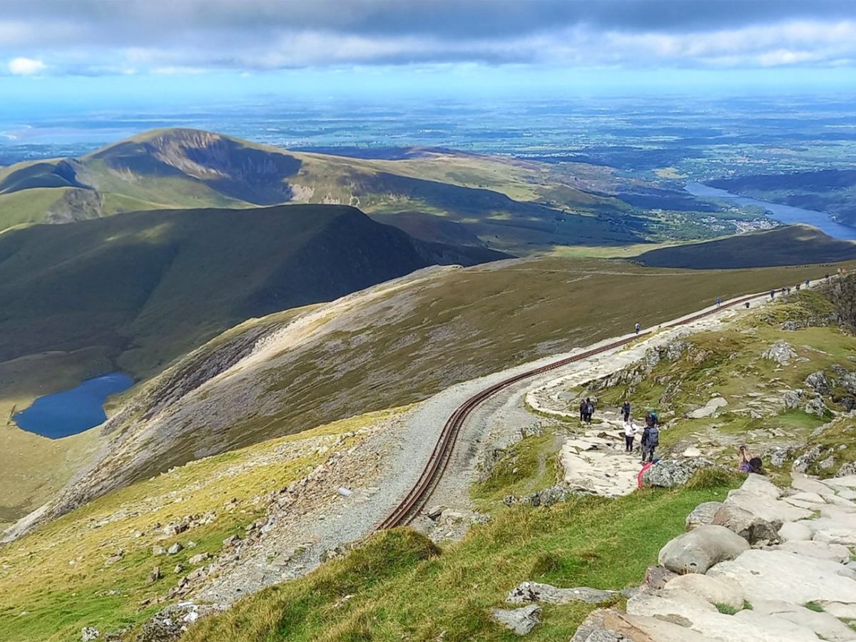
After spending time on the summit, the return journey follows the Miners’ Track. Retracing your steps briefly to the junction, the route then heads down onto a wider path that offers a completely different perspective on the mountain. Unlike higher up on the the Pyg Track, the Miners’ Track passes much closer to the lakes, allowing walkers to appreciate the glacial landscape from below.
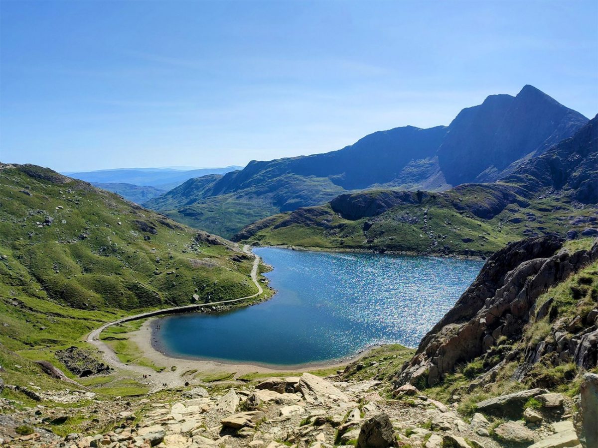
The descent towards Glaslyn and Llyn Llydaw is one of the most scenic sections of the entire walk. The lakes appear almost impossibly blue on sunny days, contrasting against the grey rock of the surrounding mountains. Reflections often are seen across the water while the towering cliffs above provide a dramatic backdrop.

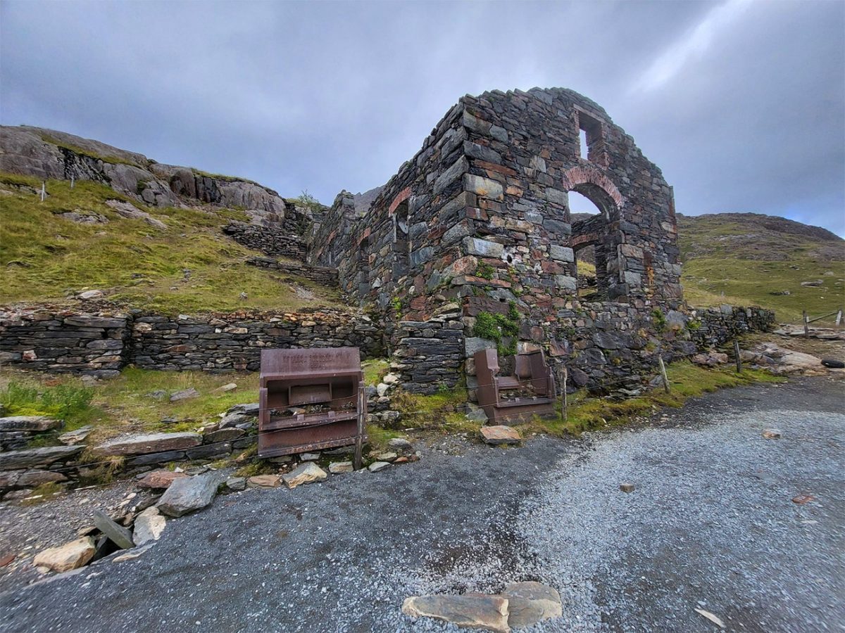
As you continue downhill, evidence of the area’s industrial past begins to appear. Remains of old mining buildings can still be seen beside the path, offering a glimpse into the harsh working conditions faced by miners who once extracted copper from these mountains. The contrast between the area’s natural beauty and its industrial heritage adds another fascinating layer to the walk.
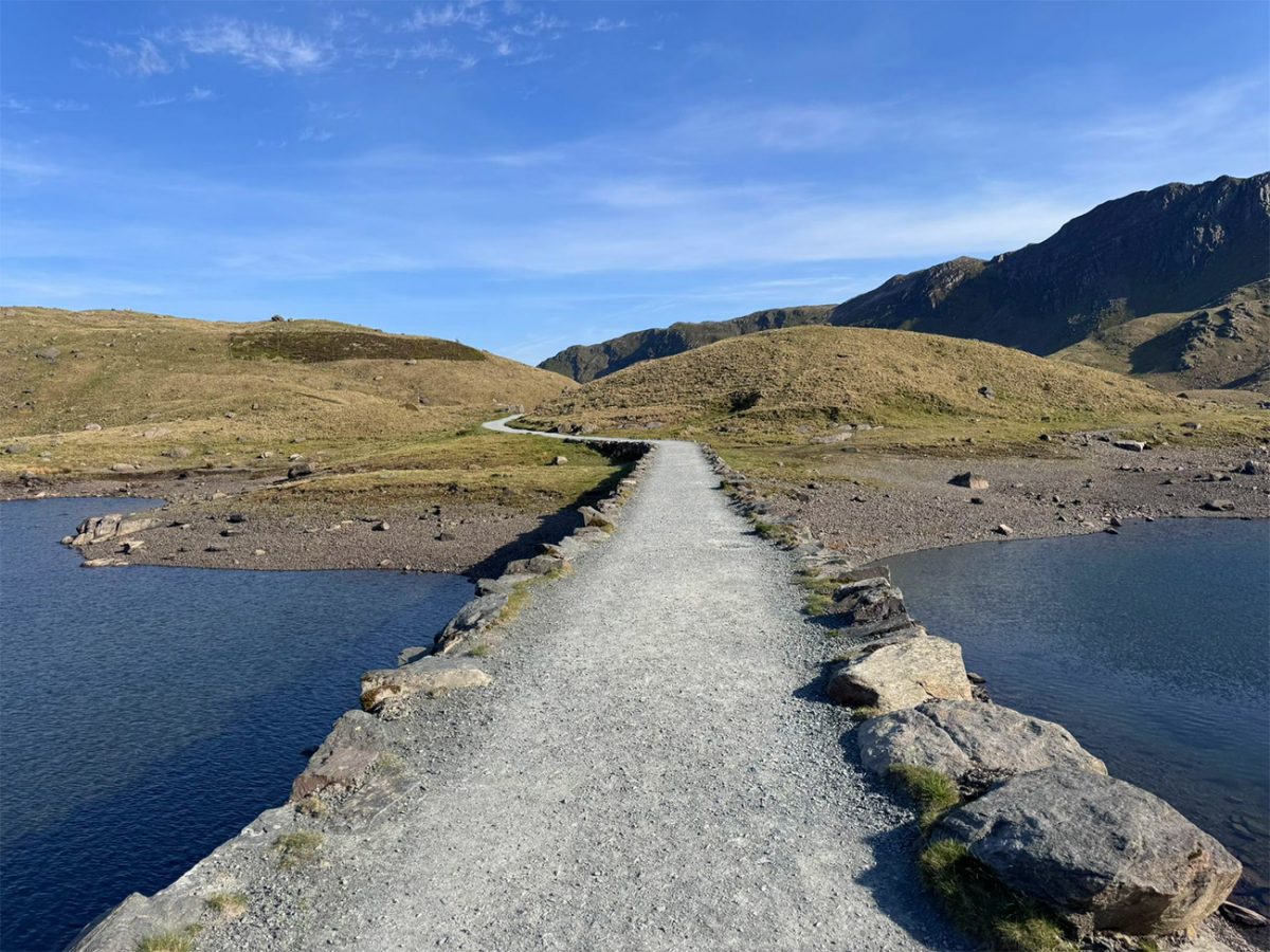
The final section follows a gentler path alongside Llyn Llydaw before returning towards Pen-y-Pass. By this stage, the hardest work is behind you and there is time to appreciate the incredible landscape you’ve travelled through. Looking back towards the summit often provides one last opportunity to admire Yr Wyddfa rising above the lakes and valleys below.
This route perfectly showcases why Yr Wyddfa remains Wales’ most popular mountain. The combination of dramatic scenery, fascinating history, mountain lakes, legendary stories and the achievement of standing on the highest point in Wales makes it a walk that stays with you long after you’ve returned home. Whether it’s your first visit to Eryri or one of many, the Pyg Track and Miners’ Track circular remains one of the finest mountain walks in the UK.

Walk this route yourself in 3D!
The video is a 3D walkthrough of this route; it’ll give you a great idea of what to expect before you set foot on the mountain.
I’ve created 3D videos of my walks and shared them with the Outdooractive and Welsh Man Walking communities.
Yr Wyddfa (Snowdon) – Pyg Track Up, Miners’ Down – 3D Walkthrough
Yr Wyddfa (Snowdon) FAQs
How hard is the Pyg Track and Miners’ Track route?
What makes this Yr Wyddfa route so popular?
How long does the Pyg Track and Miners’ Track walk take?
Where does the walk start and where can I park?
Is the Pyg Track and Miners’ Track route suitable for beginners?
What should I wear and carry for the walk?
Are there toilets on the route?
Is the café at the summit of Yr Wyddfa always open?
Can children or dogs complete this route?
Should I climb Yr Wyddfa in bad weather?

AllTrails: Trail Guides & Maps for Hiking, Camping, and Running | AllTrails ‘Plus’ 30% OFF – Read my ‘Full Review‘ for more details.

Water-to-Go Named Best Water Bottle for Travel. Click https://watertogo.eu and get 20% off using code: ‘WMW20’