

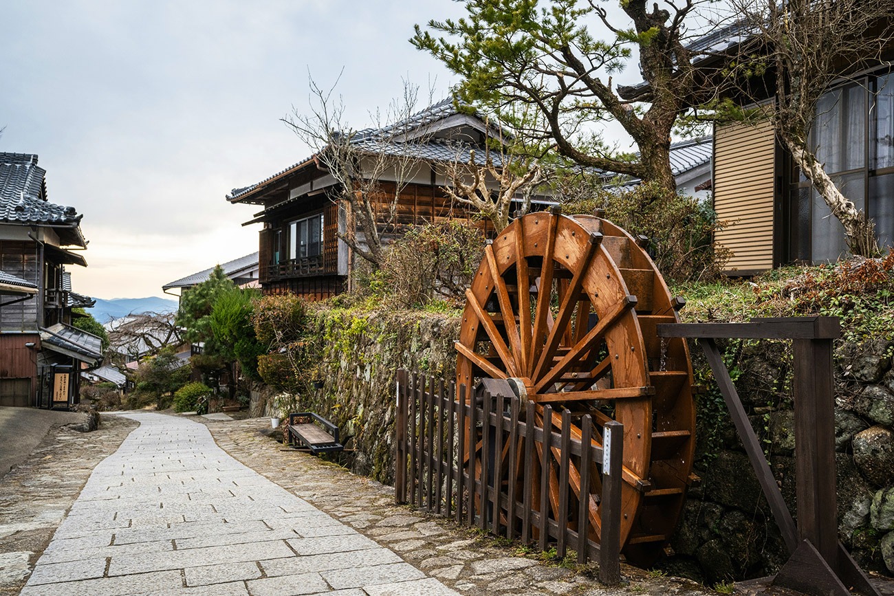
Region: Nakasendō (Kiso Valley) — Magome (Gifu) to Tsumago / Nagiso (Nagano), Japan
Places To Stay: Base yourself in Magome (or nearby Nakatsugawa) at the start, then overnight in Tsumago (traditional minshuku) or continue to Nagiso for more options. Expect Edo-period post town charm: timber facades, lanterns, and hearty country meals.
The Nakasendō was one of the five great highways of Edo-period Japan, linking Kyoto with Edo modern-day Tokyo across more than 500 kilometres of central Japan. Along the way, post towns known as juku provided food, accommodation and rest for samurai, merchants, officials and ordinary travellers making the long journey across the country.
Today, one of its most beautiful and accessible surviving sections runs through the Kiso Valley between the preserved post towns of Magome and Tsumago. It is only around 8–9 kilometres long, but packs an extraordinary amount into a half-day walk: old stone paving, cedar and cypress forest, waterfalls, tiny farming hamlets, traditional tea houses and the 801-metre Magome Pass.
Starting among the steep cobbled streets and wooden buildings of Magome, you climb gently into the mountains before crossing the pass and descending through the forest towards Tsumago, one of Japan’s best-preserved Edo-period post towns. There are bigger and harder hikes in Japan, but few give you this much history, scenery and atmosphere for relatively little effort. It is less a mountain challenge and more a chance to spend a few hours actually walking through Japan’s past.
Looking for more trails in Japan? Visit my Japan Hiking Trails page.
Below are 3 ideas for trips, transfers and day tours in Nagoya (gateway city). GetYourGuide offer great discounts and availability + Much more!
For a wider choice of accommodation in the Tokyo, Booking.com has a huge variety to browse through.
Flying in? Quick Skyscanner Checker
Nearest major airports: Chūbu Centrair (Nagoya/NGO) and Matsumoto (domestic). Shinkansen via Nagoya works best.
Getting There: Directions, GPX and App Link
- Start/Finish: Start in Magome (Gifu) → finish in Tsumago (Nagano). Optional extension to Nagiso Station.
- Transport: JR from Nagoya to Nakatsugawa (Chūō Line), then bus/taxi to Magome. Return from Tsumago or Nagiso by bus/train.
- GPX: Download the GPX file here.
- You can follow this route on my Outdooractive and Komoot profiles.
Hike Profile
- Route: Magome → Magome Pass → Tsumago
- Distance: approximately 8–9 km;
- Duration: 2.5–3.5 hours walking; allow 4–5 hours with Magome, tea house, waterfalls and Tsumago stops
- Highest point: Magome Pass – approximately 801 m
- Difficulty: Easy–Moderate
- Route type: Linear
- Terrain: Stone paving, woodland paths, rural lanes and short sections of asphalt
- Optional extension: Tsumago → Nagiso Station – approximately 3.5 km / 1 hour
Stages & Distances (Typical Day Walk)
| Stage | From → To | Approx. distance | What to expect |
|---|---|---|---|
| 1 | Magome → Magome Pass | ~2.5 km | Stone streets, steady climb, forest; reach the 801 m high point |
| 2 | Magome Pass → Tateba-jaya | ~1.5 km | Predominantly downhill through forest; traditional rest house |
| 3 | Tateba-jaya → Ōtaki & Metaki | ~1.5 km | Woodland, old road and the Male & Female waterfalls |
| 4 | Ōtaki & Metaki → Tsumago | ~2.5–3 km | Otsumago, rural lanes and arrival in the preserved post town |
| Optional | Tsumago → Nagiso Station | ~3.5 km | Quieter rural extension with convenient JR connection |

Get a JR Rail Pass if you’re planning to roam widely. 7–21 day passes give ‘unlimited’ rides on most JR lines, including shinkansen.

Sim Local can reduce or even eliminate your roaming fees. Click www.simlocal.com/ + 10% Discount Using – ‘WELSHMAN’
Hike Description
Magome is a brilliant place to begin because the history starts before you’ve even begun walking. The old post town climbs steeply up the hillside along a stone-paved main street lined with dark timber houses, shops, restaurants, inns and old water channels. Arrive early enough and it can still feel remarkably quiet before the day visitors appear.
It is worth taking your time here rather than treating Magome simply as the trailhead. During the Edo period, post towns such as this provided accommodation, food, horses and other services for travellers using the Nakasendō. Government officials, merchants, pilgrims and samurai all passed along this route when travelling between Kyoto and Edo.
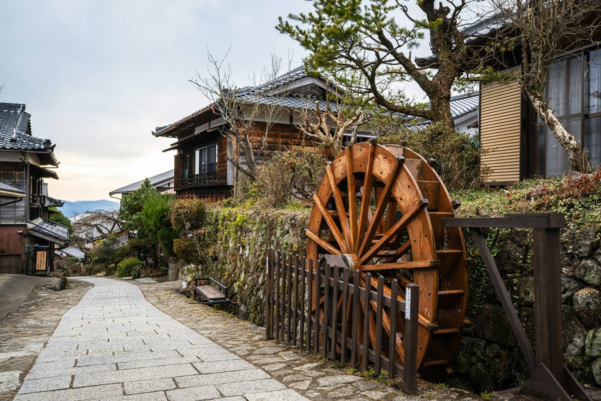
Follow the old road uphill through Magome and the buildings gradually begin to thin. There are some lovely views from the upper part of the town towards Mount Ena and the surrounding countryside before the route leaves the settlement behind and heads into the forest.
The direction from Magome to Tsumago is the one I’d choose. You still have to climb, but you begin relatively high at around 600 metres and only need to reach the 801-metre Magome Pass before the general trend turns downhill towards Tsumago at approximately 420 metres. Walking in the opposite direction means considerably more climbing.
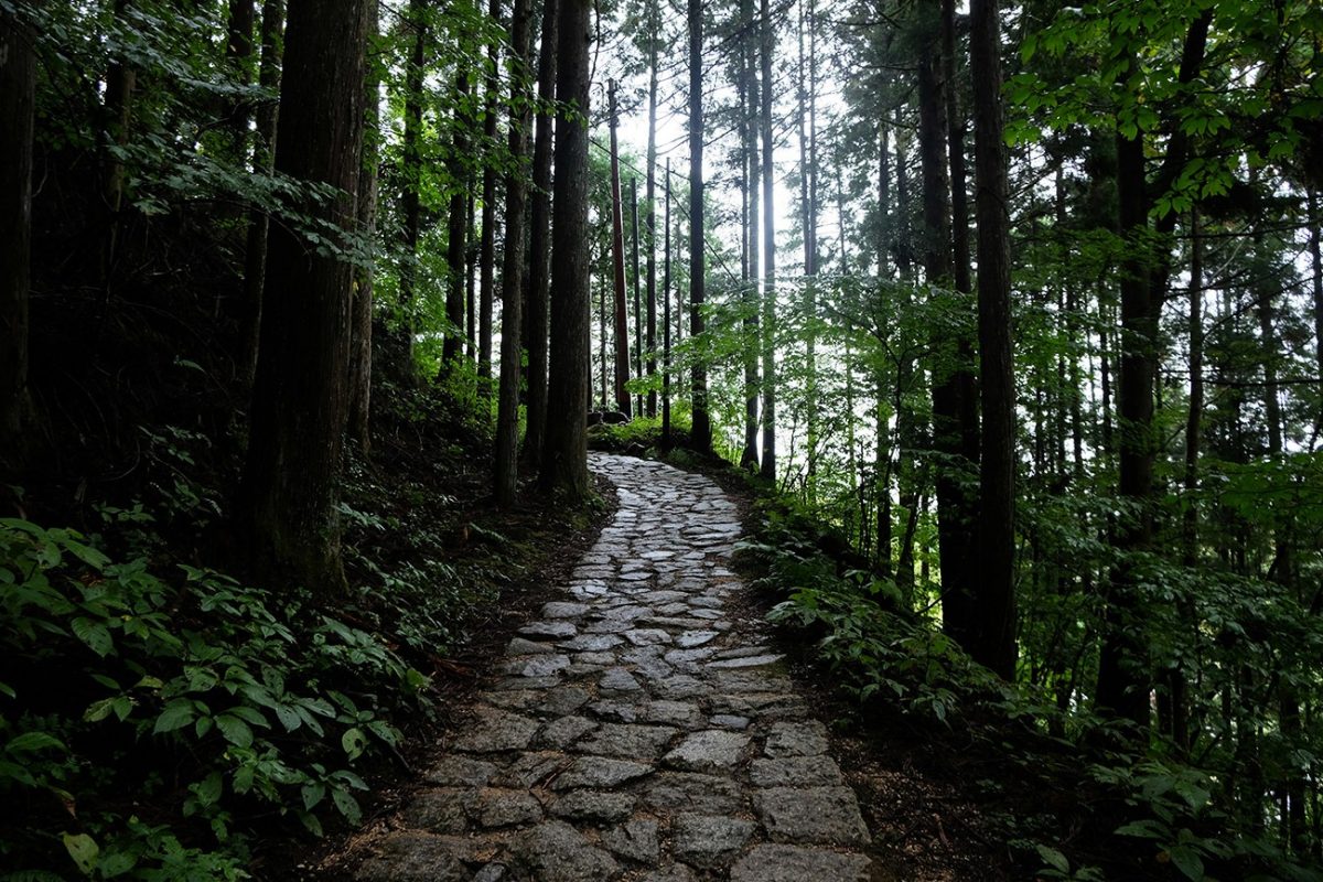
Once beyond Magome, the character of the walk changes quickly. Cobbled sections give way to woodland paths beneath cedar and cypress, interspersed with quiet lanes, small fields and isolated houses. Although this is now promoted as a walking trail, it never feels as though somebody designed a recreational path through the landscape. You are following an old route that existed because people genuinely needed to travel between these communities.
That is what I like most about this walk. There is no huge summit or dramatic mountain objective pulling you forward, so you have time to notice everything else: moss covering the stones, water running beside the trail, small shrines hidden among the trees and traditional houses appearing unexpectedly around a corner.

The route is generally very easy to follow and signage includes English in many places. You may also notice bells positioned along sections of the trail. This is Asiatic black bear country and walkers are encouraged to make noise while passing through quieter forest sections. Carrying a bear bell is a sensible precaution too.
Eventually you reach Magome Pass, at approximately 801 metres the high point of the walk. It isn’t a dramatic exposed mountain summit and you shouldn’t expect a huge panorama from the top; it is much more understated than that. The attraction is the sense of crossing the same wooded mountain pass that generations of travellers had to negotiate on their journey along the Nakasendō.
From the pass, the overall direction becomes downhill towards Tsumago. Before long you reach one of the best stops on the route: the traditional Tateba-jaya teahouse. This old-style rest house continues the tradition of providing somewhere for travellers to pause, and depending on opening, walkers can stop for tea beside the traditional irori hearth. Donations are appreciated.
Continue through the forest and another highlight appears at Ōtaki and Metaki — the Male and Female waterfalls. The two falls sit close to the historic route and make an excellent place for a break, particularly when there has been plenty of water flowing through the valley.
The path then continues through woodland, small settlements and the hamlet of Otsumago. There are sections of old paving alongside more ordinary lanes and short stretches of modern road, which is a useful reminder that the Nakasendō has never stopped being part of the landscape around it.
Gradually the first traditional buildings of Tsumago begin to appear.
If Magome feels polished and picturesque, Tsumago somehow feels even more removed from modern Japan. The town was one of the pioneers of Japan’s historic preservation movement, with residents beginning efforts to protect its traditional buildings during the 1960s. Modern intrusions such as overhead power lines were removed or hidden, helping preserve the extraordinary appearance of the old main street.
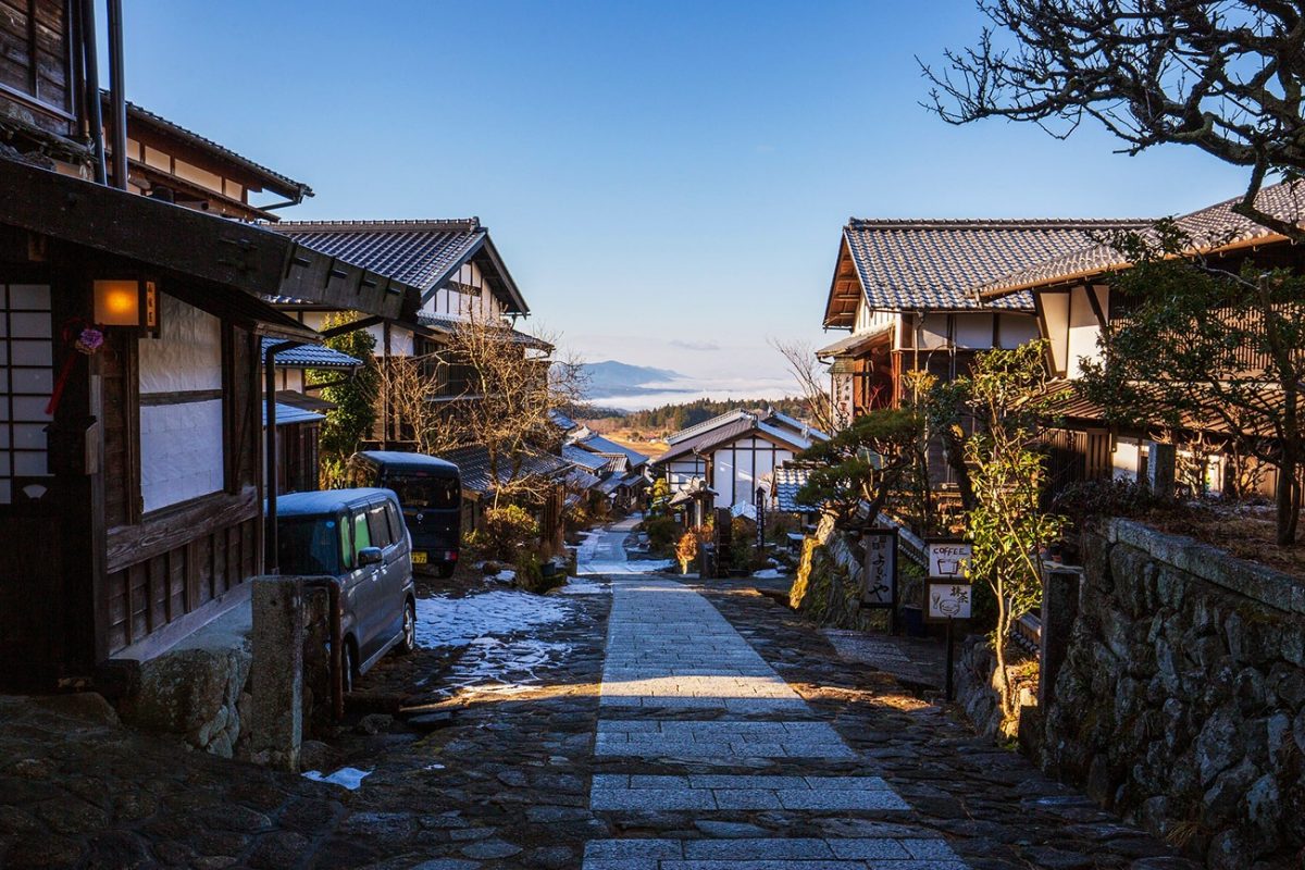
Take some time here after the walk. Timber-fronted inns and houses line the road alongside shops, museums and places selling local food. Once most of the daytime visitors leave, Tsumago becomes quieter again and it is easy to understand why spending a night in one of the traditional minshuku can add so much to the experience.
For most walkers, Tsumago is the perfect finish. If you want to carry on, however, the old route continues through quieter countryside towards Nagiso Station. Contrary to the 6–7 km currently shown on this page, this extension is only around 3.5 km and takes roughly another hour. It doesn’t have quite the same preserved character as the Magome–Tsumago section, but it is a pleasant way to reach the railway on foot rather than taking the bus.
The Nakasendō between Magome and Tsumago isn’t a difficult hike, and that’s actually part of its appeal. In only a few hours you cross an old mountain pass, walk through cedar forest, pass waterfalls and tea houses and explore two of the finest surviving post towns in Japan.

Walk this route yourself in 3D!
The video is a 3D walkthrough of this route; it’ll give you a great idea of what to expect before you set foot on the mountain.
I’ve created 3D videos of my walks and shared them with the Outdooractive and Welsh Man Walking communities.
Nakasendō – Kiso Valley (Magome to Tsumago) – 3D Walkthrough
Places to Stay (Magome • Tsumago • Nagiso)
Tip: Many traditional minshuku in Tsumago take phone/email bookings. If you want online booking via Booking.com, consider nearby towns too (e.g., Nakatsugawa and Nagiso).
Start – Magome (or Nakatsugawa for more choice)

Browse Magome stays (Booking.com)
Stay on the historic slope for a dawn start, or base in Nakatsugawa (more dining/transport) and bus up to Magome.
For a wider choice of accommodation in the Kiso Valley, Booking.com has a huge variety to browse through.
Practicalities
- Start/Finish: Walk from Magome in Gifu Prefecture to Tsumago in Nagano Prefecture. The route is linear, with public transport available at either end.
- Getting to Magome: From Nagoya, take the JR Chūō Line to Nakatsugawa, then a local bus to Magome. Check the current bus timetable before travelling as services are not continuous throughout the day.
- Returning from Tsumago: Buses connect Tsumago with Nagiso Station, where you can join the JR Chūō Main Line. Alternatively, continue walking approximately 3.5 km to Nagiso Station.
- Luggage forwarding: Same-day baggage forwarding operates between the Magome and Tsumago tourist information centres during much of the main walking season. Drop-off and collection times and prices can change, so check the current service before travelling.
- Food & water: Magome and Tsumago both have cafes, restaurants and shops, but facilities between the towns are limited. Carry water and a snack even if you plan to stop at the traditional teahouse.
- Navigation: The Magome–Tsumago route is well maintained and generally well signposted in both Japanese and English. Download the GPX and an offline map as backup.
- Bear awareness: Asiatic black bears inhabit the surrounding forests. Bear bells are used along the route and walkers are encouraged to make their presence known, particularly on quieter sections of trail.
- Footwear: Hiking boots aren’t essential in good weather, but comfortable walking shoes or trail shoes with decent grip are recommended. Old cobbles, roots and stone surfaces can become slippery when wet.
- Best season: Spring and autumn are particularly good. Late spring brings fresh green forest, while autumn colours generally develop from around mid-October into early November. June and early July can be very wet, while winter may bring snow and icy stone surfaces.
- Cash: Carry some Japanese yen. Smaller tea houses, shops, inns and local services may not accept international cards.
- Respect the villages: Magome, Otsumago and Tsumago are living communities rather than open-air museums. Stay on the route through residential areas, avoid blocking entrances and keep noise down.
- Allow time for the towns: The actual hike can be completed in around three hours, but rushing it misses much of the point. I’d allow at least half a day so you can explore Magome, stop along the route and properly enjoy Tsumago at the finish.
Below are 3 ideas for trips, transfers and day tours in Nagoya (gateway city). GetYourGuide offer great discounts and availability + Much more!
Nakasendō (Kiso Valley) FAQs
How long is the Nakasendō Trail from Magome to Tsumago?
Is the Magome to Tsumago walk difficult?
Which direction is better: Magome to Tsumago or Tsumago to Magome?
How do I get to Magome and return from Tsumago?
Is luggage forwarding available between Magome and Tsumago?
Are there bears on the Nakasendō between Magome and Tsumago?
Can I buy food and water along the route?
What is the best time of year to walk the Nakasendō?
Is the Magome to Tsumago trail suitable for families?
Can I continue walking from Tsumago to Nagiso?

Water-to-Go Named Best Water Bottle for Travel. Click www.watertogo.eu + 20% Discount Using – ‘WMW20’

AllTrails: Trail Guides & Maps for Hiking, Camping, and Running | AllTrails ‘Plus’ 30% OFF – Read my ‘Full Review‘ for more details.