

Region: Edale, Peak District National Park, Derbyshire
Walk summary: This 7.9-mile clockwise Kinder Scout circular walk starts in Edale, passes Upper Booth and climbs Jacob’s Ladder before following the southern edge through Swine’s Back, Noe Stool, Edale Head and Crowden Tower. It returns through Grindsbrook Clough to Grindsbrook Booth and Edale, with 1,516ft of ascent. Our walking time was 3 hours 55 minutes, with a total outing of around 4 hours.
| Distance | 7.9 miles / 12.7km |
|---|---|
| Ascent | 1,516ft / 462m |
| Walking time | Our recorded time: 3 hours 55 minutes |
| Total time | Around 4 hours for us; allow longer for a slower pace and breaks |
| Difficulty | Moderate to challenging — steep climbing, rough moorland and a rocky descent |
| Route | Clockwise circular walk |
| Start and finish | Edale village car park |
| Main landmarks | Upper Booth, Jacob’s Ladder, Swine’s Back, Noe Stool, Edale Head and Crowden Tower |
| Return | Grindsbrook Clough → Grindsbrook Booth → Edale |
| Suitable for | Fit walkers with some hillwalking experience; families and dogs able to manage rough ground |
This route gives you the climb up Jacob’s Ladder and the gritstone scenery along Kinder Scout’s southern edge in one circular walk. The broad, exposed upland feels very different from the sheltered fields around Edale, and the return through Grindsbrook Clough adds a rougher finish to the day.
The route described here follows my existing GPX and does not visit Kinder Downfall. It is a specific Edale circuit rather than a tour of every Kinder Scout landmark. For another nearby day out, see my Mam Tor circular walk from Castleton or browse the Peak District walking guides.
Kinder Scout circular walk map, GPX and parking
- Parking and start: Edale village car park.
- Parking: Pay-and-display. Check the displayed tariff and allow enough time for your walk and any stops.
- GPX: Download my Kinder Scout circular walk GPX for the clockwise route described below.
- Route apps: Outdooractive or Komoot.
- Facilities: Public toilets at the main car park and food and drink options in Edale. Carry supplies for the upland section.
- By train: Edale station is on the Hope Valley line between Manchester and Sheffield. Check current services before travelling.
Download the route before setting out. A GPX line helps identify the intended circuit, but it does not show every safe foothold on the rocky descent. Carry a map and know how to use it if visibility deteriorates.
Kinder Scout circular walk route description
Edale to Upper Booth
Begin at Edale village car park and follow the mapped route through the village onto the westward path towards Upper Booth. This is the gentler opening to the walk, before the main climb takes you out of the valley and onto Kinder’s higher ground.
The fields, stone walls and surrounding slopes make a good introduction to the Edale Valley. Keep to the paths through farmland and leave gates as you find them. It is worth settling into a comfortable pace here rather than using up your energy before Jacob’s Ladder.


Climbing Jacob’s Ladder
From Upper Booth, continue towards Jacob’s Ladder. The climb is steep but steady, with the path gaining height above the valley. It is the main sustained ascent on this circuit, so take it at your own pace and pause when you need to.
As you climb, the view back towards Edale opens out. The change from valley paths to exposed upland is also noticeable: conditions can feel much colder and windier higher up, even when the start of the walk was comfortable. Wet weather can leave muddy approaches and slippery surfaces.


Swine’s Back, Noe Stool and Edale Head
The route continues through Swine’s Back and past Noe Stool towards Edale Head. Follow the GPX through this section rather than heading towards a different Kinder Scout landmark: several longer circuits continue elsewhere across the plateau.
This is where the character of the walk changes. Gritstone formations, rough paths and open moorland replace the valley scenery. The views are a major part of the attraction, but there is little shelter and the ground needs attention underfoot.
In mist, recognisable rocks and distant ridges can disappear. Stay on the intended route and avoid cutting across unfamiliar peat or boggy ground simply because it looks shorter on a screen.


Crowden Tower and the southern edge
Continue along the southern edge towards Crowden Tower. The rock formations give this part of Kinder its distinctive appearance, and there are plenty of opportunities to stop and take in the views back towards the valley.
Keep back from drops when stopping for photographs, particularly in wind or poor visibility. Our circuit continues towards the Grindsbrook descent; it does not make the detour to Kinder Downfall that the previous version of this page described.


Descending Grindsbrook Clough to Edale
Return through Grindsbrook Clough, descending towards Grindsbrook Booth before completing the circuit back to Edale and the car park. This is the confirmed return for this walk, rather than the Ringing Roger option.
Do not treat the descent as an easy finish just because the main climb is behind you. The clough contains rough, rocky ground: take your time, choose secure footholds and use your hands for balance where necessary. Wet rock, mud and higher water levels can make progress slower, so leave extra time in those conditions.
As you lose height, the open upland gives way to the valley again. Finish through Grindsbrook Booth and return to Edale, where you can stop for refreshments after the walk.


Kinder Scout walk practicalities
- Time: We recorded 3:55 walking and about 4 hours overall. Treat that as our experience, not a deadline: allow more time for breaks, slower group members, navigation and a cautious descent.
- Fitness: The distance, sustained climb and rough return make this a proper hillwalk. Some hillwalking experience and good fitness are advisable.
- Weather: Expect exposed ground higher up. Check the forecast and avoid conditions beyond your experience; fog, strong wind, snow and ice can make the route significantly harder.
- Navigation: Carry the downloaded GPX and a map. Do not rely on following other walkers or having mobile reception.
- Footwear and supplies: Wear footwear with dependable grip and carry waterproofs, warm layers, food and water.
- Children and dogs: Suitable only if they can manage the distance, climbing and rocky descent. Keep dogs on a lead and follow local signs. Young children or inexperienced walkers may need a shorter alternative.
- Facilities: Use Edale’s toilets and refreshments before or after the walk. The former Moorland Centre is no longer open as a public visitor centre.
For current village information, see the Peak District National Park’s Edale information. The National Trust’s Kinder Scout guidance also covers the rugged terrain and dog guidance for the area; its published route and timings are separate from my recorded circuit.
Places to stay near Edale
Accommodation links below are affiliate links. I may earn a commission if you book through them, at no extra cost to you. These are options to browse, rather than places I am claiming to have personally stayed.
Edale accommodation is the most direct place to look if you want to stay near the start. Castleton and Hope are other bases to consider for a longer Peak District visit, with onward travel to Edale needed for this walk.

An option in Hope to investigate for your group. Check the listing carefully for the accommodation format, capacity and booking terms.

An option on the outskirts of Castleton. Check availability, current facilities and travel arrangements to the Edale start.
Preview the Kinder Scout route in 3D
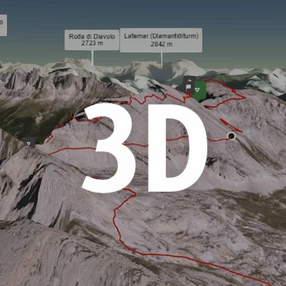
Preview the route before you walk
Watch the circuit to get an overview of the climb and return to Edale.