

Region: Ortisei, Val Gardena, Dolomites, Italy
This is my firsthand guide to hiking from the top of the Seceda cable car back down to Ortisei. I completed the route in late May/early June 2025, following the GPX shared on this page.
The outing begins in Ortisei, using the Ortisei–Furnes gondola and Furnes–Seceda cable car to reach approximately 2,500 metres. From the upper station it is only a short walk to the famous Seceda viewpoint, but my route goes much further: across the alpine meadows beneath the Odle peaks, past traditional mountain huts and Rifugio Firenze, then all the way down to Ortisei.
| Distance | 9.1 miles / 14.6 km |
|---|---|
| Ascent | 548 ft / 167 m |
| Moving time | 4 hours 35 minutes |
| Time to allow | Around 6 hours, including viewpoints and stops |
| Difficulty | Difficult because of the length, time on your feet and continuous descent |
| Walking route | Point-to-point: Seceda upper station to Ortisei |
| Complete outing | Starts and finishes in Ortisei, with a cable-car ascent |
| Navigation | Well-marked trails; GPX recommended |
| Facilities | Ortisei, cable-car stations and seasonal mountain huts |
Important: Taking the cable car removes the major climb from the valley, but it does not turn this into an easy viewpoint visit. The full walk is long and includes a sustained descent of roughly 1,200 metres. It can be demanding on tired legs and knees.
Where to stay: Ortisei is the most convenient base because the outing begins at the Seceda lift and finishes back in town. This is an affiliate link, so I may earn a commission at no extra cost to you.
Seceda Cable Car, Access and Route Map
- Start of the outing: Ortisei and the lower Seceda lift station.
- Start of the walk: The upper Seceda cable-car station, at approximately 2,500 metres.
- Finish: Ortisei.
- Lift journey: Ortisei–Furnes gondola followed by the Furnes–Seceda cable car.
- Parking: We drove to Ortisei and used available parking in town. Check local signs and current restrictions when you arrive.
- Lift information: Check current operating dates, hours and ticket arrangements on the official Seceda website before travelling.
- GPX: Download my Seceda route GPX.
- Route apps: View the route on Outdooractive or Komoot.
My Seceda Ridgeline Hike
Ortisei to the Seceda Upper Station
The day begins in Ortisei at the lower station of the Seceda lift system. The Ortisei–Furnes gondola provides the first stage, followed by the larger Furnes–Seceda cable car. Together they take you rapidly from the town to the high plateau.
Stepping out at approximately 2,500 metres gives immediate access to a completely different landscape. Wide alpine meadows surround the station, with views opening across Sassolungo, the Sella Group and the surrounding South Tyrolean mountains.

The Famous Seceda Viewpoint
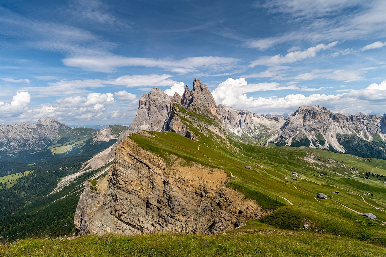
Most visitors initially follow the short path towards the famous Seceda viewpoint. Within a few minutes, the full ridgeline of the Odle–Geisler peaks begins to appear. The combination of steep green meadows, pale limestone towers and the dramatic drop beyond the edge creates one of the defining views of the Dolomites.
It is worth allowing time here rather than treating the viewpoint as a quick photograph. The position gives a remarkable sense of height, and the jagged summits stretch far into the distance.
Across the Alpine Meadows
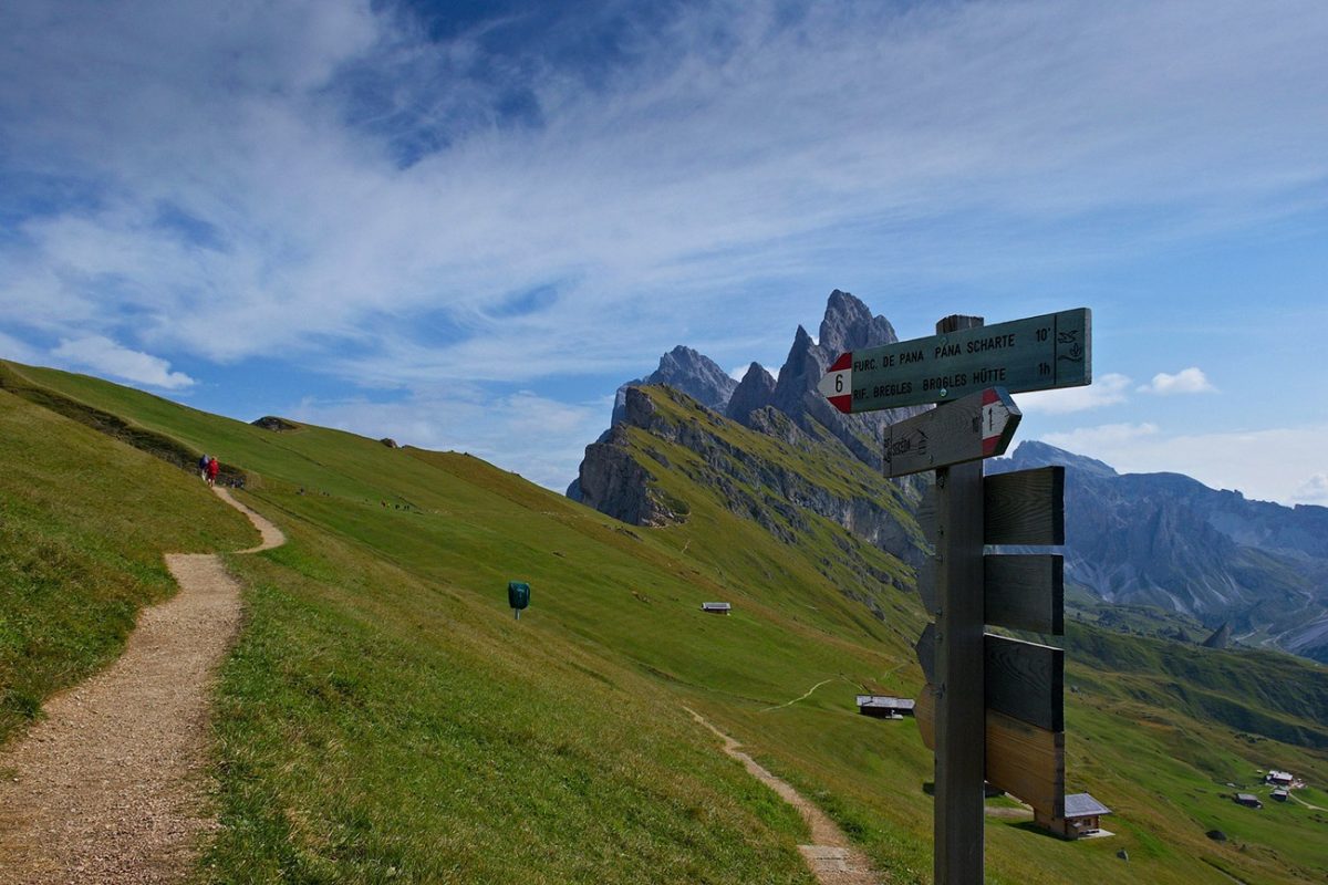
The route then continues across open grazing land beneath the Odle group. Rather than remaining directly on the sharp crest, the walking path follows the broader grassy slopes below it. The trails were clear and very well marked when we walked them.
Pieralongia can be seen nearby and it is possible to detour towards it before returning to the main path. It is not included in the GPX for this route, so anyone visiting it should allow extra time and distance.
Mountain Huts and Rifugio Firenze
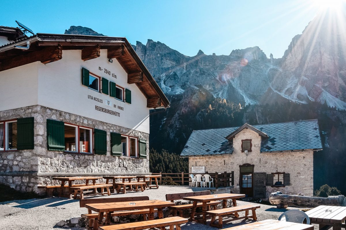
Several traditional huts sit across the meadows, providing seasonal opportunities for food, drinks and a rest. The route passes Baita Troier before continuing towards Rifugio Firenze, also known as Regensburger Hütte.
Rifugio Firenze sits lower than Seceda among woodland and alpine pasture. This is a useful place to pause before the long final descent. Opening dates and hours are seasonal, so never rely on a hut being open without checking beforehand and still carry your own food and water.
The Long Descent to Ortisei
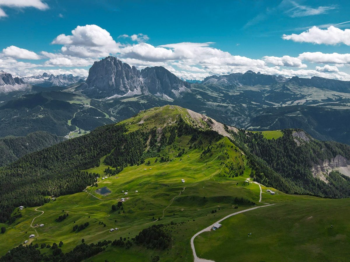
The full route continues downhill towards Ortisei. It is not technically difficult in normal, snow-free conditions, but the descent is long and continuous. After several hours on the upper meadows, it becomes tiring and may be uncomfortable for anyone with sensitive knees.
The path gradually leaves the busiest Seceda trails behind and passes through quieter forest, pasture and traditional mountain landscapes. Small clearings reveal more views across Val Gardena before the route reaches the lower slopes and finally the outskirts of Ortisei.
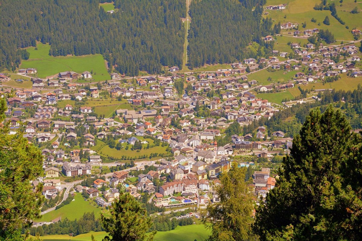
Arriving among the houses and streets of Ortisei creates a clear finish to a complete mountain journey. The cable car may remove the initial ascent, but 9.1 miles and hours of downhill walking still make this a substantial hike rather than a simple viewpoint visit.
Practicalities and Safety
- Season: Treat this as a snow-free mountain hike. Lift operations, hut openings and trail conditions are seasonal and can change from year to year.
- Weather: Conditions can change rapidly around 2,500 metres. Carry waterproofs, warm layers and sun protection even when Ortisei is warm.
- Winter conditions: Snow, rain and strong wind can make this route extremely difficult or impossible as a normal hike. Do not assume the summer GPX is suitable in winter.
- Difficulty: The paths are generally straightforward in good conditions, but the distance and continuous descent make the full route difficult.
- Footwear: Wear hiking boots or trail shoes with reliable grip. Wet grass, mud and rock can become slippery.
- Hiking poles: Poles are useful for reducing strain during the long descent.
- Navigation: The route is very well marked, but carry the downloaded GPX and an offline map as a backup.
- Food and water: Refugios can provide refreshments when open, but take enough supplies to complete the route independently.
- Facilities: Ortisei has extensive facilities, with additional seasonal facilities at the lifts and mountain huts.
- Shorter alternative: It may be possible to leave near Rifugio Firenze and use the Col Raiser lift, but this changes the finish and may require onward transport from Santa Cristina. Check lift operations and logistics before relying on it.

Preview the Seceda route in 3D
This walkthrough shows the route and terrain before you set out.
Seceda Ridgeline FAQs
How long is the Seceda hike to Ortisei?
My route from the Seceda upper station to Ortisei is 9.1 miles, or approximately 14.6 kilometres.
How long does the Seceda Ridgeline hike take?
My moving time was 4 hours 35 minutes. Allow around six hours for the full experience, including the viewpoint, photographs and stops along the route.
How difficult is the Seceda hike?
I rate the full route as difficult because of its 9.1-mile length, time on your feet and long continuous descent. The marked paths are not especially technical in good, snow-free conditions.
Is this Seceda route circular?
The walking section is point-to-point from Seceda’s upper cable-car station to Ortisei. The complete outing effectively begins and ends in Ortisei because the cable cars take you to the start of the walk.
How do you reach the start of the Seceda hike?
From Ortisei, take the Ortisei–Furnes gondola and then the Furnes–Seceda cable car. The walk begins outside the upper station at approximately 2,500 metres.
Can you visit Seceda without doing the full hike?
Yes. The famous viewpoint is only a short walk from the upper cable-car station, so visitors can see the ridgeline and return by lift without walking down to Ortisei.
Is the Seceda cable car open all year?
No. The lifts follow seasonal operating periods and may close between seasons or because of conditions. Check the official Seceda website before making the journey.
Are there places to eat and toilets on the route?
Ortisei has plenty of facilities, while the cable-car stations and mountain huts provide additional seasonal options. Hut availability and opening hours should always be checked in advance.
Can the Seceda walk be shortened?
You can simply return from the viewpoint by cable car. On the longer route, Col Raiser may offer another exit near Rifugio Firenze, but it finishes away from Ortisei and requires careful checking of lift times and onward transport.
When should you hike Seceda?
Complete this version only when the summer hiking trails are open and free from hazardous snow. Conditions vary each year, so check the forecast, trail status and lift operations rather than relying on a fixed calendar date.