

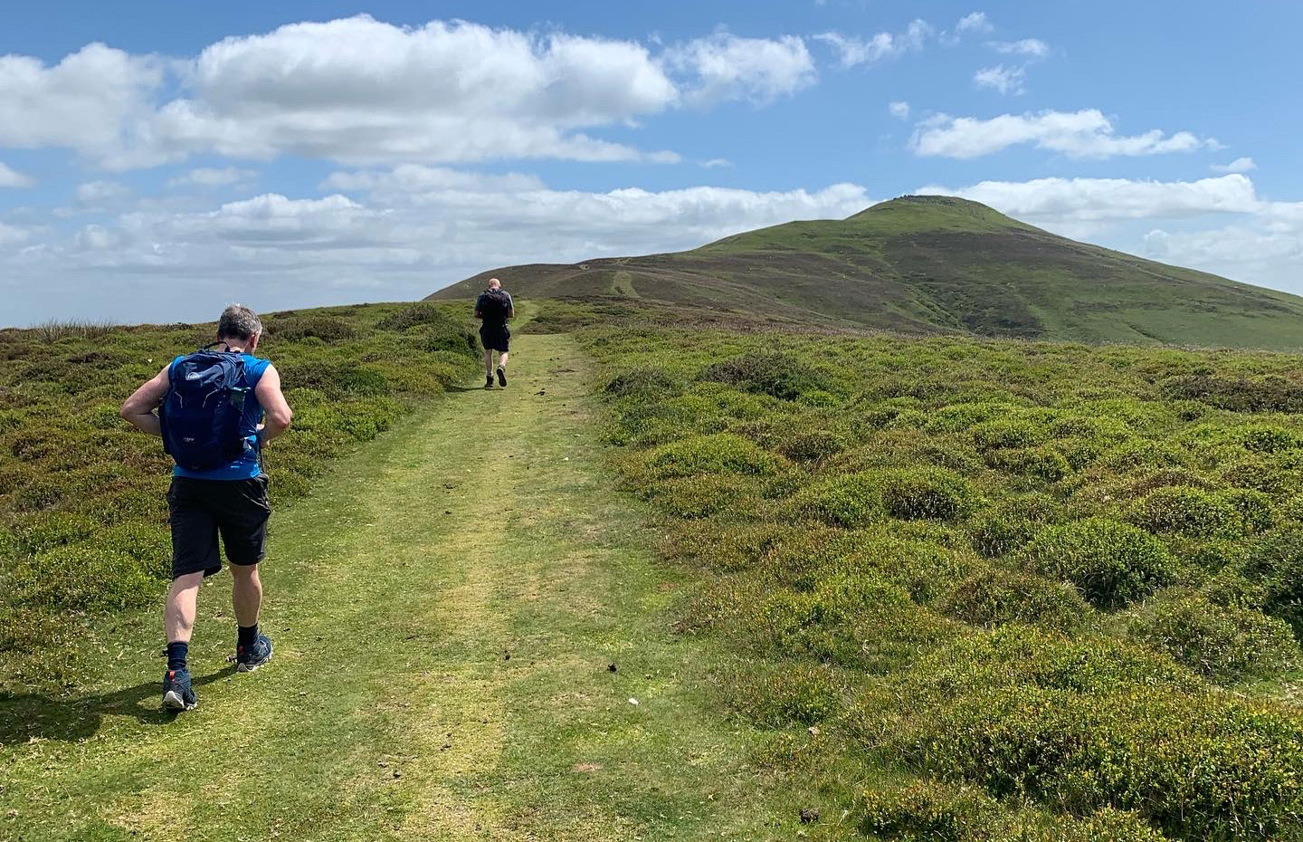
Region: Crickhowell — Black Mountains, Bannau Brycheiniog (Brecon Beacons) National Park, Wales
Places To Stay: Base yourself in Crickhowell for bookshops, cafes, pubs and easy access to Table Mountain, or stay in Abergavenny, a proper community town packed with everything you need. Looking for more Welsh walks? Head to my Wales Hiking Guides page to see all regions and routes.
This 9.5-mile circular walk from Crickhowell to Sugar Loaf is a much longer alternative to the popular short routes from Abergavenny. It follows an anticlockwise circuit through farmland, wooded lanes and the village of Llangenny before climbing to the 596m summit of Sugar Loaf and returning to Crickhowell.
If you want a shorter day, compare this route with my classic Sugar Loaf circular walk or the St Mary’s Vale route, both starting closer to Abergavenny.
I walked the route again in September 2026 and followed the downloadable GPX exactly. It took four hours, including roughly 20 minutes enjoying a coffee at the summit. The route was straightforward in dry conditions, although the farmland could become muddy after sustained rain and the exposed summit can be extremely windy.
With approximately 2,252ft (686m) of ascent, this is a challenging hill walk rather than the easiest way to reach Sugar Loaf. Its appeal is the complete journey from Crickhowell: quiet lanes, Welsh cottages, green fields, woodland, the long summit climb and a final return through Llangenny. Back in town, Book-ish is a good place for a post-walk coffee and cake.
Staying overnight? Check my guide to the Best Places To Stay in the Brecon Beacons
Below are a few ideas for day tours around the Brecon Beacons / Black Mountains area. GetYourGuide makes it easy to book + see more here.
Getting There: Directions, GPX and Map
- Start/Finish: Beaufort Street Car Park, Crickhowell. I used this because the secondary-school car park was closed on Saturday.
- Public transport: Abergavenny is the nearest railway station. Bus services connect Abergavenny and Crickhowell, but check the current timetable before travelling, particularly on Sundays and bank holidays.
- GPX: Download the GPX file here.
- Route Finder: Follow this route on my Outdooractive and Komoot profiles.
Hike Profile
- Distance: 9.5 miles / 15.3 km circular
- Duration: 4 hours recorded, including a 20-minute summit break
- Total ascent: 2,252ft / 686m
- Highest point: Sugar Loaf summit – 596m / 1,955ft
- Direction: Anticlockwise, following the supplied GPX
- Difficulty: Challenging – a long route with substantial ascent and a sustained climb to Sugar Loaf
- Terrain: Lanes, farmland, woodland paths and exposed mountain tracks; farmland can become muddy after rain
Route Stages at a Glance
| Stage | Route | What to expect |
|---|---|---|
| 1 | Crickhowell to the farmland | Town streets and lanes lead onto field paths between Penprysg Farm and Graig Wood. |
| 2 | Farmland to Llangenny and Hall Farm | Field paths, short lane sections, woodland and the bridge over the Grwyne Fawr. |
| 3 | Hall Farm to Sugar Loaf | A sustained climb across open ground to the exposed 596m summit. |
| 4 | Sugar Loaf to Llangenny | Descend from the summit through open hillside and woodland towards the village. |
| 5 | Llangenny to Crickhowell | A final climb after the village, followed by the return into Crickhowell. |
Hike Description
Start from Beaufort Street Car Park in Crickhowell and follow the GPX anticlockwise through town. Make your way towards Standard Street and continue onto Bellfountain Road. After approximately half a mile, leave the road for the farmland between Penprysg Farm and Graig Wood. The secondary-school car park used in the older version of this guide was closed when I returned on a Saturday in September 2026, which is why Beaufort Street is now the recommended start.


As you carry on walking through these fields, sometimes the paths are not clear so keep a look out for the little round yellow arrow signs, usually placed in field corners with stiles, but if you’re using the gpx, it will guide you through. At the end of this current field, you will for a short distance join a road called ‘Llangenny Lane’, turn right onto this road, after 100 yards or so, turn left down a lane which is called ‘Millbrook Road’.
It seems strange to be heading down again when your supposed to be heading up, but stick with it, as you’re basically walking around to the side of the Sugar Loaf to then hike up to it.
The lane you’re on is well trodden, and you’ll come across some great things to look at including a tree with a hobbit like opening to it, and then a little bridge with the river ‘Grwyne Fawr’ running beneath it. This is a great place to stop and have a look around, and then as you continue along this road, before you move back onto farmland there are some beautiful Welsh cottages, and then you will arrive at ‘Hall Farm’, and you’re back onto farmland.


Beyond Hall Farm, the route crosses green fields and Sugar Loaf becomes increasingly prominent ahead. Continue following the GPX and the public paths through the farmland. Several routes approach the mountain, so staying with the mapped line prevents this longer Crickhowell circuit from becoming mixed with one of the shorter Abergavenny approaches.
The climb becomes more sustained as you approach the open mountain. The summit is 596m high and can be extremely windy even when conditions lower down feel calm. From the top, the wide views across the Black Mountains and towards Abergavenny reward the long approach from Crickhowell.


Continue anticlockwise from the summit using the GPX. The route loses height across the open hillside, enters woodland and eventually joins a lane towards Llangenny. Much of this section is downhill, but do not treat the remainder as finished: there is another noticeable climb after the village.
The route was straightforward when I re-walked it, but several turns through the lanes, fields and woodland are easier to identify with the GPX or Outdooractive map open. Download the route before setting off rather than relying on a mobile signal.


As the route approaches Llangenny, it passes attractive cottages, the village church and the local pub. Road sections require normal care, particularly where there is no pavement.
After crossing through Llangenny, the final climb can catch tired legs by surprise. It is not as long as the ascent of Sugar Loaf, but it arrives late in a route containing 2,252ft of total ascent. Once over it, follow the mapped return towards Crickhowell.


Complete the circuit back at Beaufort Street Car Park. Crickhowell has several cafés, pubs and shops for a post-walk stop; one of my favourites is the independent bookshop and café Book-ish.



Walk this route yourself in 3D!
The video is a 3D walkthrough of this route; it’ll give you a great idea of what to expect before you set foot on the mountain.
I’ve created 3D videos of my walks and shared them with the Outdooractive and Welsh Man Walking communities.
Places to Stay in Crickhowell
For a wider choice of accommodation in the Bannau Brycheiniog, Booking.com has a huge variety to browse through.
Recommended Stays

This lovely, old stone building is at the foothills of the Black Mountains amid beautiful countryside and views of the Brecon Beacons. It has a restful feel, comfortable rooms and a free Wi-Fi zone.

In Crickhowell, the Dragon Inn has views of the mountains and the Brecon Beacons National Park. It offers modern rooms with free Wi-Fi, a full cooked breakfast and free parking.
Staying overnight? Check my guide to the Best Places To Stay in the Brecon Beacons
Practicalities
- Season: Walkable throughout the year in suitable conditions, but Sugar Loaf is exposed to strong winds and winter weather.
- Footwear: Walking boots or grippy trail shoes. The farmland is manageable in dry weather but can become muddy after rain.
- Water and food: Carry what you need for the full walk and stock up in Crickhowell before starting. A Water-to-Go bottle is one option.
- Parking: Beaufort Street Car Park is the recommended start. Check the information board and current charges when you arrive. The secondary-school car park was closed on the Saturday of my September 2026 visit.
- Dogs: Yes, but keep on a lead around livestock and on the farmland sections.
- Navigation: The route was straightforward in dry conditions, but use the GPX for the farmland, woodland and lane junctions.
- Good for: Experienced walkers wanting a longer Sugar Loaf circuit with countryside, woodland, a summit and village scenery.
Crickhowell to Sugar Loaf FAQs
How long is the walk?
Is it hard?
Which way round is best?
Is navigation straightforward?
What’s special about Sugar Loaf?
Where should I park for this walk?
Can I shorten the walk?
Is it family friendly?
What about boggy / muddy bits?
Is it good in winter?

Water-to-Go Named Best Water Bottle for Travel. Click www.watertogo.eu + 20% Discount Using – ‘WMW20’
Disclosure: I may earn a commission if you buy via the links on this page — at no extra cost to you.