


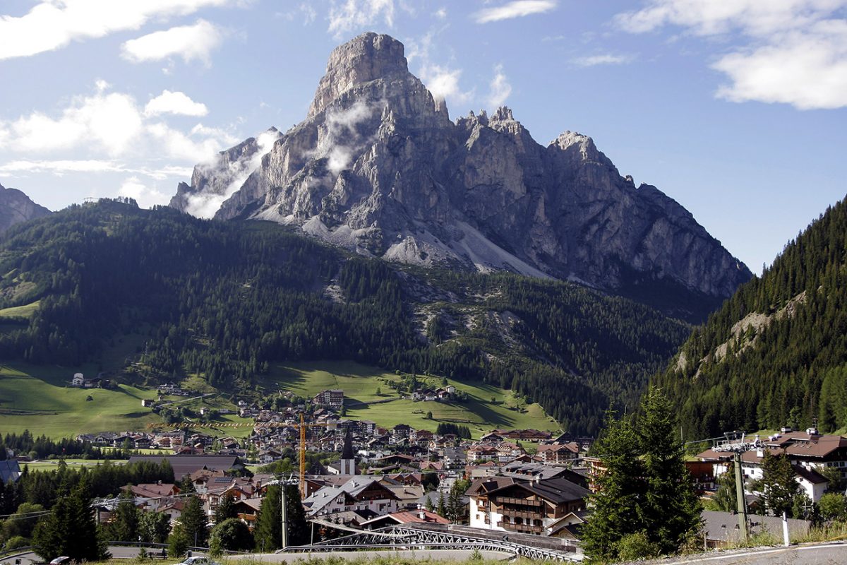
Region: Corvara — Alta Badia, Dolomites, Italy
Places To Stay: Corvara is an easy base — lifts on the doorstep, plenty of cafés and bakeries, and a good mix of spa hotels and friendly B&Bs. If you want to be right by the lifts, stay near the Boé/Col Alt side of town. Up on the plateau, rifugi like Pralongià and Bioch make great lunch stops (and overnight options if you fancy sunrise above the valleys).
Looking for more Dolomites trails? Head to my ‘Dolomites Hiking Guides‘ page to see all regions and routes.
Below are a few ideas for day tours and transfers around Corvara, with GetYourGuide offering discounts and easy booking + see more here.
For a wider choice of accommodation in the Dolomites, Booking.com has a huge variety to browse through.
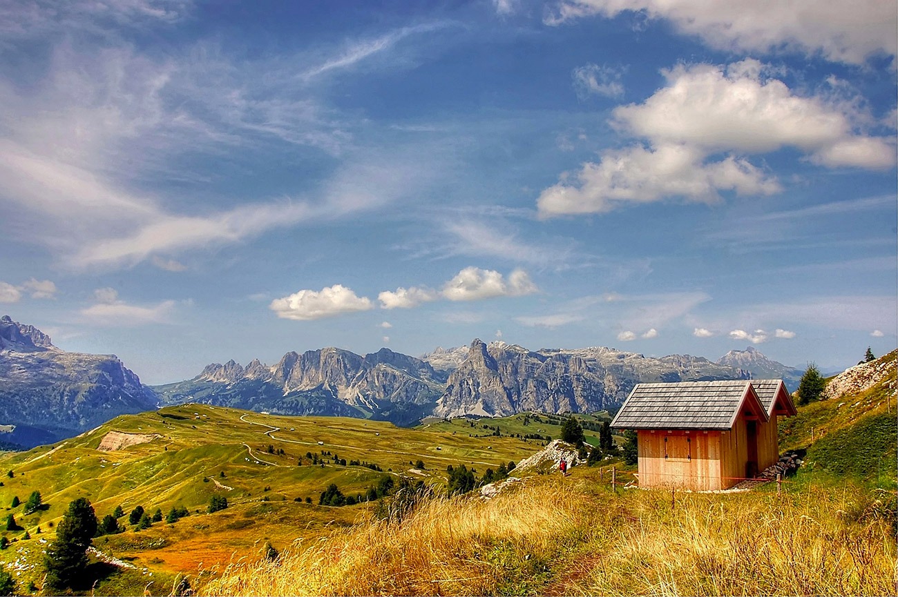
Pralongià is the easy win in Alta Badia: you ride up from Corvara, land on a rolling meadow plateau, and spend the day linking the viewpoints and huts with the Sella, Marmolada and Sassongher in constant view. The paths are wide and well signed, you can keep things short or stretch it out, and there’s always a rifugio not far away for a coffee or a bowl of soup.
Getting There: Directions, GPX and Map
- Start/Finish: Corvara (Col Alt lift) → Pralongià plateau loop → return via lift to Corvara.
- Transport: Corvara is linked by bus to Brunico/Bruneck and other Alta Badia villages; parking available near lifts.
- Download the GPX here.
- You can also follow this route on my Outdooractive Profile.
Travel Data: I use eSIMs to stay connected — quick setup and no roaming faff. Sim Local has been solid in Italy/Europe with good prices and coverage.

Sim Local can reduce or even eliminate your roaming fees. Click www.simlocal.com/ + 10% Discount Using – ‘WELSHMAN’
Hike Profile
- Distance: 10–14 km (loop variations).
- Duration: 4–6 hours with photo/hut stops.
- Ascent: ~400–600 m depending on the loop and lift choice.
- Highest point: Pralongià plateau ~2,100–2,200 m.
- Difficulty: Moderate — broad tracks, a few short steeper bits.
- Terrain: Meadow paths and gravel tracks with occasional forest spurs.
Route Overview (Typical Loop). Take Col Alt or Boé lift to gain the plateau quickly.
| Section | From → To | Distance | Notes |
|---|---|---|---|
| 1 | Top station → Rifugio Bioch | 2–3 km | Easy warm-up across rolling meadows; Sassongher and Sella views. |
| 2 | Bioch → Rifugio Pralongià | 2–3 km | Classic hut-to-hut stroll; perfect coffee stop. |
| 3 | Pralongià → Störes ridge spur (optional) | 1–2 km | Short detour for a higher panoramic bump. |
| 4 | Störes/plateau high point → Rifugio Marmotta / Inzija | 2–3 km | Gentle undulations; big skyline of Marmolada and Sella. |
| 5 | Return arc → Top station | 3–4 km | Close the loop via a different line for fresh views. |
Flying into Italy? Quick Skyscanner Checker
From Heathrow, we flew to Venice Marco Polo, and hired cars, Skyscanner found the cheapest flights, try the flight widget above.
Hike Description
From Corvara, take the Col Alt lift and at the top you’re straight onto the open plateau. The first leg towards Rifugio Bioch sets the tone, with wide tracks, soft gradients, and huge incredible views in every direction. Once you start you will find that you barely check for directions on your phone, map or watch, because the signage is so clear and the terrain is friendly.
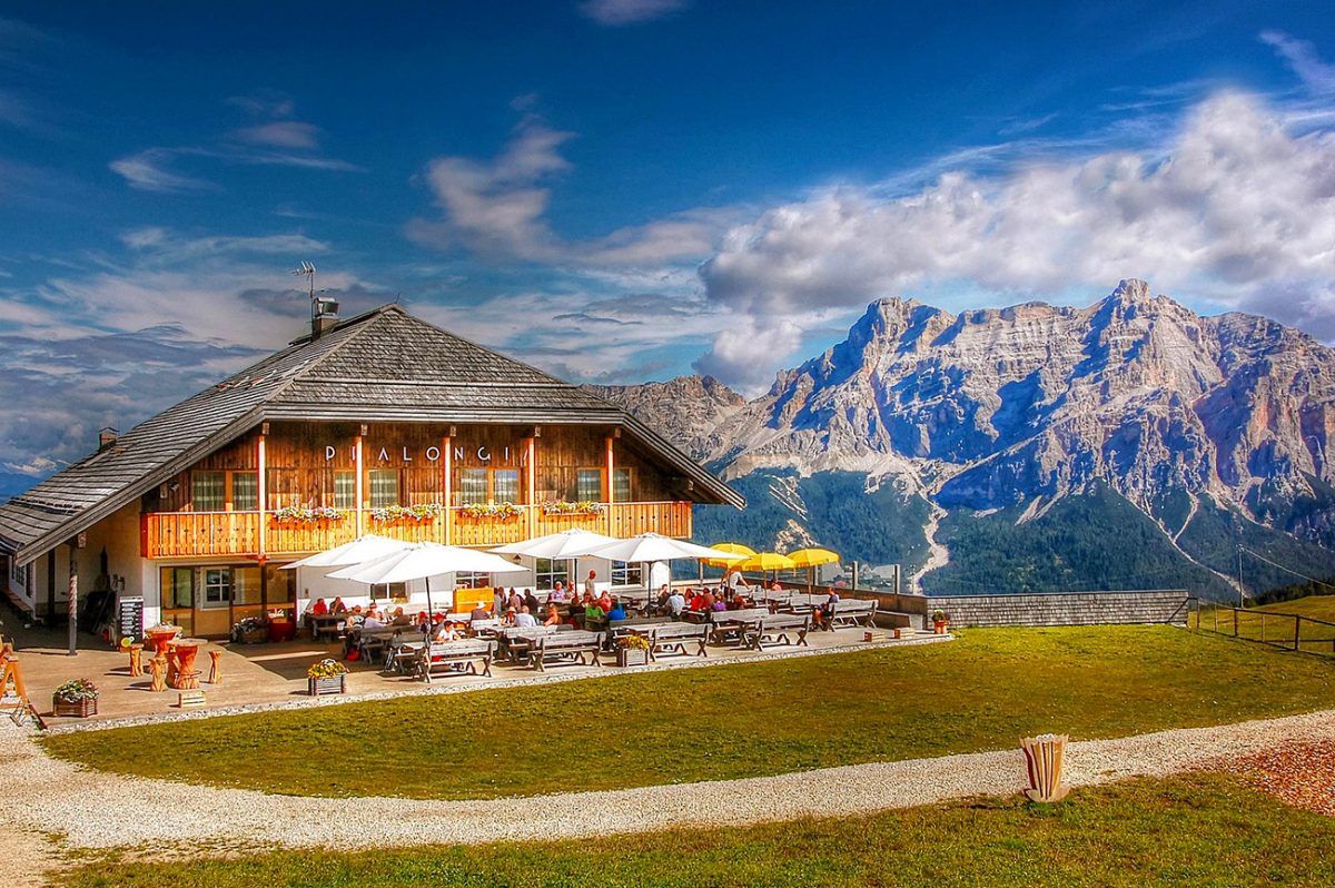
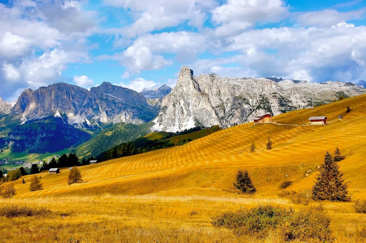
From Bioch, carry on to Rifugio Pralongià, one of the most popular huts in the area thanks to its position and huge terrace. If you’ve timed it for late morning, this is a great coffee/strudel stop. On a clear day you’ll spot Marmolada’s glacier line, the Sella towers, and Sassongher all above Corvara.
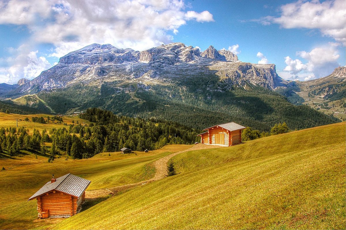
Next, take the short spur up towards the Störes ridge if you fancy a slightly higher perch — nothing technical, just a little extra climb for a proper panorama. Then drift back across the plateau towards Rifugio Marmotta or Inzija. The paths undulate gently, crossing meadows with wooden huts and the odd grazing herd. It never feels busy once you step away from the hut clusters.
To finish, close the loop back to your top station via a different line so the views keep changing. If the legs are still fresh you can add a small extra loop; if not, it’s an easy roll back to the lift for a quick drop into Corvara and a gelato on the way to the hotel.
Places to Stay in the Dolomites – My Picks
I’ve put together a few guides to make choosing a hotel in the Dolomites easier. If you’re after a romantic break, I’ve found some cosy hideaways. If it’s hiking that’s front and centre, I’ve rounded up the best hotels with trails right from the door. There are also ski-in ski-out favourites, family-friendly bases, and hotels with those wow-factor mountain views or even hot tubs to sink into after a long day.
- Most Romantic Hotels in the Dolomites ⇢
- Best Hotels for Hiking in the Dolomites ⇢
- Best Ski-In Ski-Out Hotels in the Dolomites ⇢
- Best Family Friendly Hotels in the Dolomites ⇢
- Best Hotels with Mountain Views in the Dolomites ⇢
- Best Hotels with Hot Tubs in the Dolomites ⇢
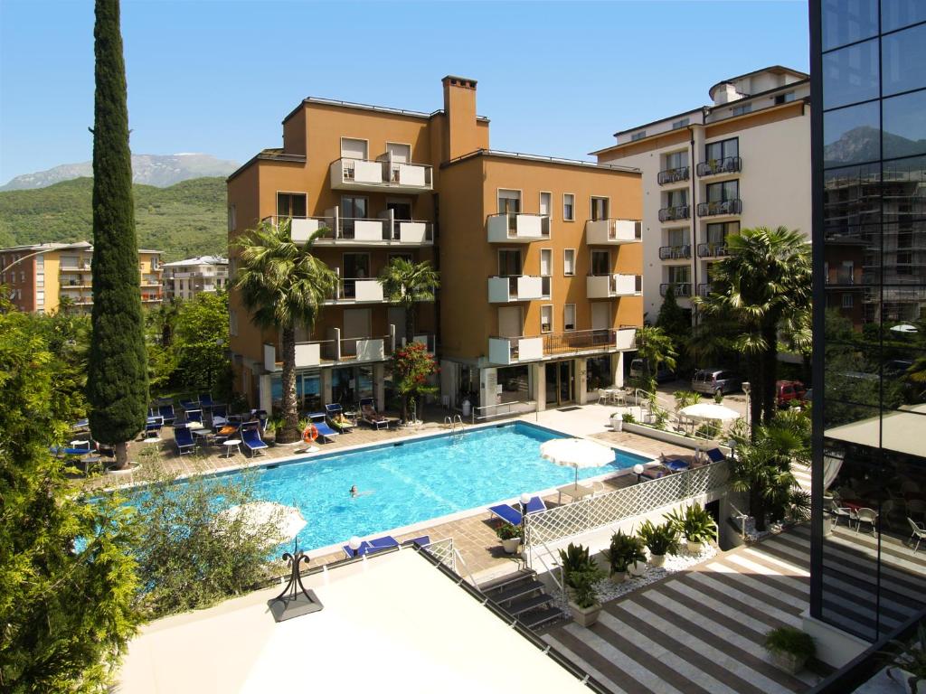
Places to Stay in Corvara
For a wider choice of accommodation in the Dolomites, Booking.com has a huge variety to browse through.
Corvara Base
Classic Alta Badia hospitality with spa and great food — easy walk to lifts.
Peaceful rooms, wellness area, and a reputation for standout service.
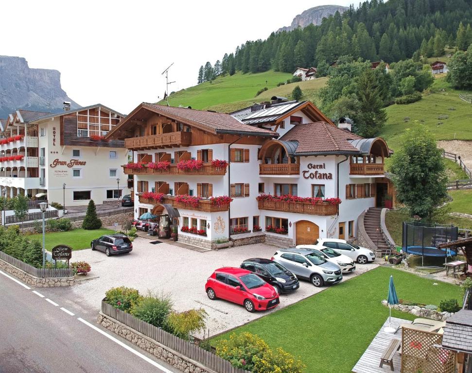
Friendly B&B with simple rooms and good breakfasts — handy for the Col Alt lift.
Great value base if you’re out hiking all day.

AllTrails: Trail Guides & Maps for Hiking, Camping, and Running | AllTrails ‘Plus’ 30% OFF – Read my ‘Full Review‘ for more details.
Practicalities
- Lifts: Col Alt/Boé/Pralongià lifts run roughly June–Oct; check dates/times.
- Food & drink: Lots of huts — card acceptance varies; carry some cash.
- Gear: Light hiking shoes are fine; pack a warm layer and rain shell.
- Weather: Afternoon storms happen in summer — start early.
- Families: Great with lift access and broad tracks; plenty of short-loop options.
- Options: Add or skip hut spurs to tailor distance; signage is excellent.
Pralongià Loop FAQs
How long is the loop?
Typically 10–15 km depending on which hut spurs you add.
Is it suitable for beginners?
Yes with lift access — broad tracks, gentle gradients, and lots of bail-out options.
Best time to go?
Late June–October when lifts and huts are open. Autumn light is cracking for photos.
Do I need a lift ticket?
Yes for the Col Alt/Boé lifts. You can walk from town but it adds a big initial climb.
Are there water points?
Mainly at huts — carry a bottle and top up when you stop.
Family friendly?
Very — short loops, smooth tracks, and regular hut stops.
Dogs allowed?
Yes on a lead; check lift rules and hut signs.
Any tricky bits?
Not really — just short ups/downs. No exposure or technical sections.
Where should I stop for lunch?
Bioch or Pralongià for the views; Marmotta/Inzija if you want it quieter.
Can I extend the day?
Yes — add the Störes spur or link extra signed loops before dropping back to the lift.

Walk this route yourself in 3D!
The video is a 3D walkthrough of this route; it’ll give you a great idea of what to expect before you set foot on the mountain.
I’ve created 3D videos of my walks and shared them with the Outdooractive and Welsh Man Walking communities.

Water-to-Go Named Best Water Bottle for Travel. Click www.watertogo.eu + 20% Discount Using – ‘WMW20’