

Region: Corvara — Alta Badia, Dolomites, Italy
Places To Stay: Corvara is an easy base — lifts on the doorstep, plenty of cafés and bakeries, and a good mix of spa hotels and friendly B&Bs. If you want to be right by the lifts, stay near the Boé/Col Alt side of town. Up on the plateau, rifugi like Pralongià and Bioch make great lunch stops (and overnight options if you fancy sunrise above the valleys).
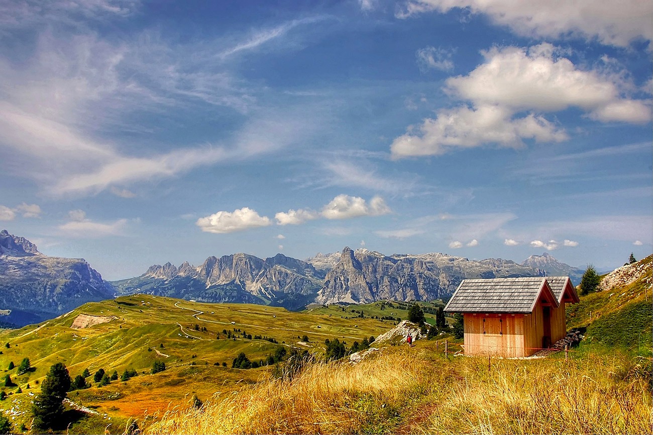
Pralongià is one of the easiest ways to enjoy a full day among the high mountains of Alta Badia without tackling anything technical. The Col Alt lift carries you out of Corvara and onto an open plateau of rolling meadows, scattered wooden huts and wonderfully clear views towards the Sella Group, Marmolada and Sassongher.
The walking is predominantly on broad, well-signposted tracks, with several rifugi positioned around the loop for coffee, lunch or the almost obligatory slice of strudel. Don’t mistake that accessibility for a completely effortless walk, though. This particular circuit covers around 12.7km and includes a substantial descent beyond Störes followed by a steady climb back to Col Alt. It remains an approachable mountain day, but there is enough distance and ascent to make the return to Corvara feel well earned.
Looking for more Dolomites trails? Head to my ‘Dolomites Hiking Guides‘ page to see all regions and routes.
Below are a few ideas for day tours and transfers around Corvara, with GetYourGuide offering discounts and easy booking + see more here.
For a wider choice of accommodation in the Dolomites, Booking.com has a huge variety to browse through.
Getting There: Directions, GPX and Map
- Start/Finish: Corvara (Col Alt lift) → Pralongià plateau loop → return via lift to Corvara.
- Transport: Corvara is linked by bus to Brunico/Bruneck and other Alta Badia villages; parking available near lifts.
- GPX: Download the GPX here.
- You can also follow this route on my Outdooractive and Komoot profiles.
- Avoid the early start – find accommodation in Corvara

Sim Local can reduce or even eliminate your roaming fees. Click www.simlocal.com/ + 10% Discount Using – ‘WELSHMAN’
Hike Profile
- Distance: approximately 12.7km
- Ascent: approximately 670m
- Highest point: Störes, approximately 2,180m
- Lowest point: approximately 1,730m
- Difficulty: Moderate
- Terrain: Broad gravel tracks, meadow paths and quieter lower slopes; no technical or exposed sections
Route Overview (Typical Loop). Take Col Alt or Boé lift to gain the plateau quickly.
| Section | From → To | Distance | Notes |
|---|---|---|---|
| 1 | Top station → Rifugio Bioch | 2–3 km | Easy warm-up across rolling meadows; Sassongher and Sella views. |
| 2 | Bioch → Rifugio Pralongià | 2–3 km | Classic hut-to-hut stroll; perfect coffee stop. |
| 3 | Pralongià → Störes ridge spur (optional) | 1–2 km | Short detour for a higher panoramic bump. |
| 4 | Störes/plateau high point → Rifugio Marmotta / Inzija | 2–3 km | Gentle undulations; big skyline of Marmolada and Sella. |
| 5 | Return arc → Top station | 3–4 km | Close the loop via a different line for fresh views. |
Flying into Italy? Quick Skyscanner Checker
From Heathrow, we flew to Venice Marco Polo, and hired cars, Skyscanner found the cheapest flights, try the flight widget above.
Hike Description
The day begins with the Col Alt lift from Corvara, removing the long initial climb from the valley and depositing you at Ütia Col Alt, almost 2,000 metres above sea level. It is an immediate change of atmosphere. Corvara sits below, the trees begin to thin out and the landscape opens into the broad grassy slopes for which the Pralongià plateau is known.
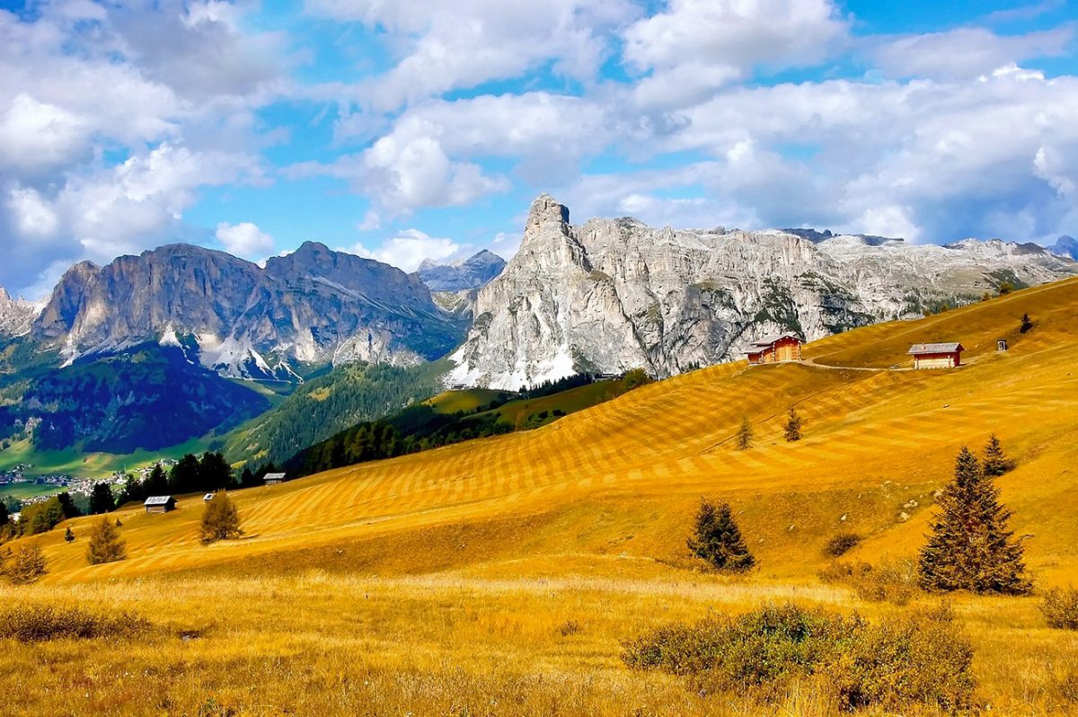
From the lift station, follow the tracks east towards Ütia de Bioch. This opening section is an ideal introduction to the walk, with gentle gradients and wide paths that allow you to look around rather than concentrate on every footstep. The limestone walls of the Sella Group dominate one part of the skyline, while Sassongher rises prominently above Corvara behind you.
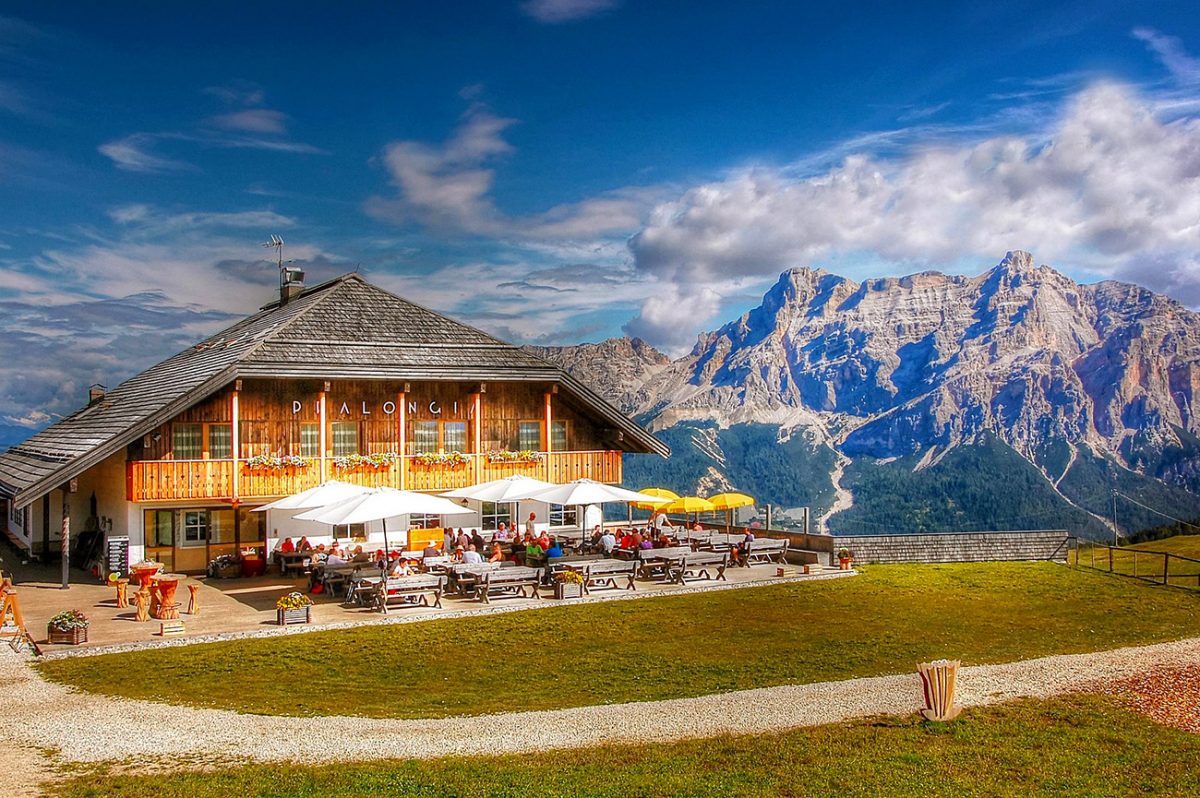
The route gradually gains height as it approaches Ütia de Bioch, which occupies a superb position at just over 2,000 metres. It is tempting to stop at the first hut you reach, particularly with its terrace and mountain views, but there are several more opportunities ahead. Even if you continue without stopping, it is worth taking a few minutes here to look back across Alta Badia and pick out the villages scattered through the valley.
Beyond Bioch, the path continues south across the plateau towards Rifugio Pralongià. The gradient remains manageable, climbing gradually through open meadows rather than confronting you with one sustained ascent. This is the section where the scale of the landscape becomes especially apparent: there is very little to interrupt the view, and the surrounding mountains remain visible for much of the way.
Rifugio Pralongià sits at approximately 2,130 metres and is one of the obvious places to pause. Its large terrace looks directly towards some of the Dolomites’ best-known mountain groups, including the Sella and Marmolada. On a clear day, the pale line of Marmolada’s remaining glacier can be picked out beyond the nearer ridges. Coffee and strudel work perfectly here, although stopping for a full lunch might make the next climb feel slightly harder.
From the rifugio, continue towards Störes, the highest point on the recorded route at around 2,180 metres. It is not a summit in the traditional sense, and there is no difficult or exposed approach. Instead, the track rises steadily onto a higher part of the plateau, adding just enough elevation to improve an already enormous panorama.
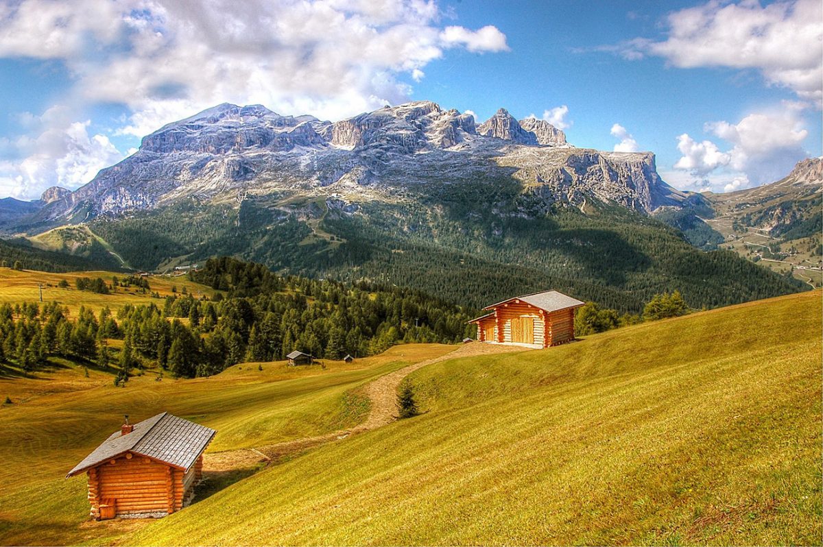
The character of the route changes after Störes. Rather than staying high and returning directly to Col Alt, the GPX descends west towards La Marmotta Hütte. The mountains remain in view, but the path begins to lose height more noticeably as it drops away from the open crest. La Marmotta provides another possible refreshment stop before the loop continues downhill towards the lower meadows and trees.
This descent is where it becomes clear that the walk is more substantial than a simple circuit between plateau huts. The lowest point is close to 1,730 metres, around 450 metres below Störes. It is pleasant walking through quieter countryside, but every metre lost will need to be regained before reaching the lift station.
The final part of the loop therefore requires a steady climb back towards Col Alt. It is never technically difficult, but after several hours of walking it provides the most sustained physical test of the day. Take it steadily, turn around occasionally for the changing views and remember that the route finishes almost directly beside Ütia Col Alt.
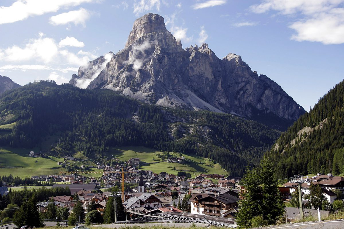
Back at the lift station, there is time for one final look across the plateau before descending into Corvara. The combination of easy-to-follow paths, frequent mountain huts and vast Dolomites scenery makes Pralongià very accessible, while the descent and return climb give this particular circuit enough substance to feel like a proper mountain walk rather than simply a short outing from the lift.

Walk this route yourself in 3D!
The video is a 3D walkthrough of this route; it’ll give you a great idea of what to expect before you set foot on the mountain.
I’ve created 3D videos of my walks and shared them with the Outdooractive and Welsh Man Walking communities.
Places to Stay in the Dolomites – My Picks
I’ve put together a few guides to make choosing a hotel in the Dolomites easier. If you’re after a romantic break, I’ve found some cosy hideaways. If it’s hiking that’s front and centre, I’ve rounded up the best hotels with trails right from the door. There are also ski-in ski-out favourites, family-friendly bases, and hotels with those wow-factor mountain views or even hot tubs to sink into after a long day.
- Most Romantic Hotels in the Dolomites ⇢
- Best Hotels for Hiking in the Dolomites ⇢
- Best Ski-In Ski-Out Hotels in the Dolomites ⇢
- Best Family Friendly Hotels in the Dolomites ⇢
- Best Hotels with Mountain Views in the Dolomites ⇢
- Best Hotels with Hot Tubs in the Dolomites ⇢
Places to Stay in Corvara
For a wider choice of accommodation in the Dolomites, Booking.com has a huge variety to browse through.
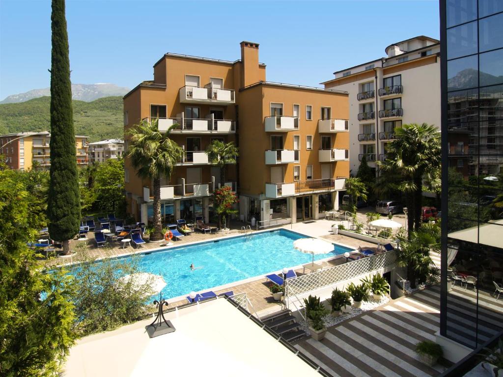
Classic Alta Badia hospitality with spa and great food — easy walk to lifts.
Peaceful rooms, wellness area, and a reputation for standout service.
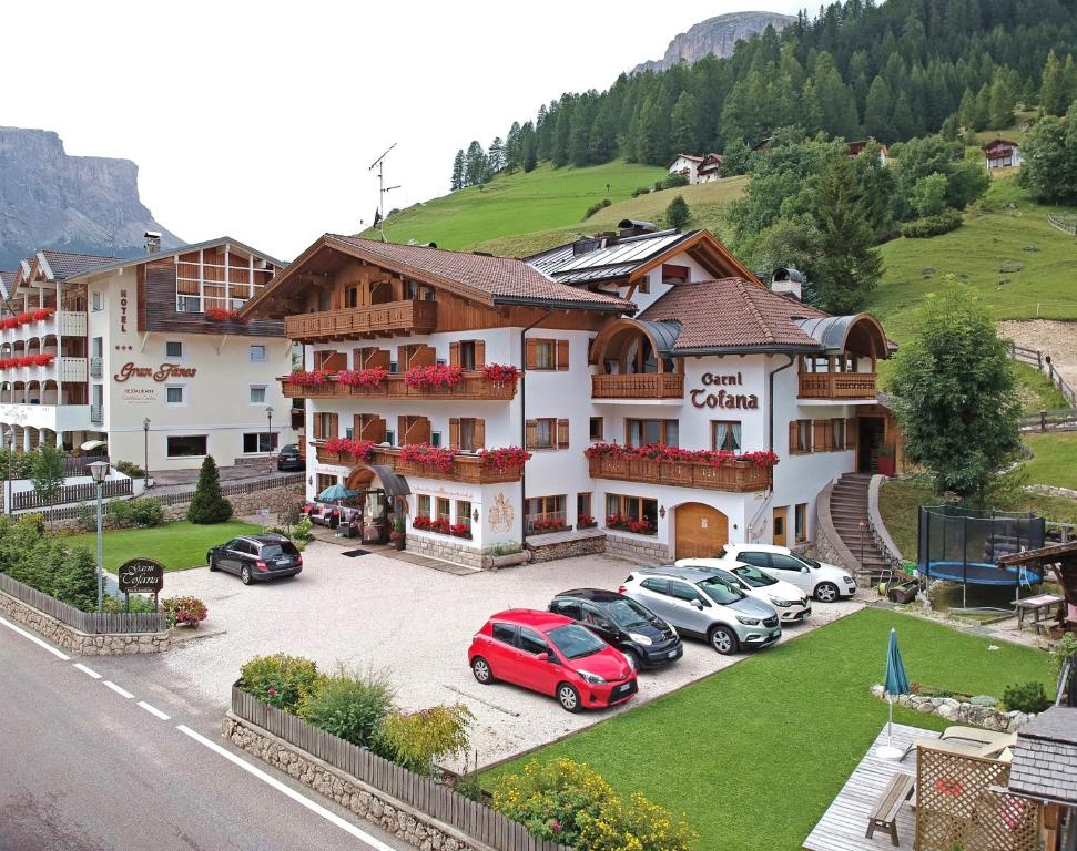
Friendly B&B with simple rooms and good breakfasts — handy for the Col Alt lift.
Great value base if you’re out hiking all day.
Practicalities
- Best time to walk: Late June to early October normally gives the best chance of open lifts, operating mountain huts and snow-free trails. Conditions vary each year, so check locally before setting out.
- Col Alt lift: The walk starts and finishes at the upper Col Alt station. For the 2026 summer season, the gondola is scheduled to operate from 13 June to 4 October, between 08:30 and 17:30. Dates and times can change, so check the current timetable before travelling.
- Allow enough time: Give yourself around five to six hours, including photographs and a stop at one of the rifugi. Avoid relying on the final gondola of the day.
- Difficulty: The paths are broad and non-technical, but the recorded loop is approximately 12.7km with around 670m of cumulative ascent. The descent after Störes creates a sustained return climb to Col Alt.
- Navigation: Signage across the plateau is generally excellent, but several tracks intersect around the huts. Carry the GPX and an offline map to ensure you follow the intended lower loop.
- Food and water: Ütia de Bioch, Rifugio Pralongià and La Marmotta provide several possible refreshment stops when open. Carry sufficient water and some food rather than relying entirely on the huts.
- Footwear: Walking shoes or lightweight boots with reliable grip should be sufficient in dry conditions. The tracks can become slippery after heavy rain.
- Weather: Much of the route is exposed to the sun, wind and rapidly changing mountain weather. Carry sun protection, a warm layer and a waterproof jacket even when Corvara is warm.
- Families: Shorter walks on the upper plateau are excellent for families, but the complete 12.7km circuit and its return ascent may be too demanding for younger children.
- Parking and public transport: Parking is available around Corvara, including municipal parking areas, while local buses connect Corvara with the other Alta Badia villages. Arrive early during the main summer season.
- Alternative without the lift: Col Alt can be reached from central Corvara on foot using trails 24 and 30, but this adds approximately 1.5 hours of climbing before beginning the plateau circuit.
Pralongià Loop FAQs
How long is the Pralongià Plateau loop?
How difficult is the Pralongià loop?
Where does the walk start?
Do I need to use the Col Alt gondola?
What is the highest point on the route?
Are there mountain huts along the walk?
Is the Pralongià loop suitable for children?
Are there any exposed or technical sections?
Can the route be shortened?
What should I carry for the walk?

Water-to-Go Named Best Water Bottle for Travel. Click www.watertogo.eu + 20% Discount Using – ‘WMW20’

AllTrails: Trail Guides & Maps for Hiking, Camping, and Running | AllTrails ‘Plus’ 30% OFF – Read my ‘Full Review‘ for more details.