


Region: Crickhowell — Black Mountains, Bannau Brycheiniog (Brecon Beacons) National Park, Wales
Places To Stay: Base yourself in Crickhowell for bookshops, cafes, pubs and easy access to Table Mountain, or stay in Abergavenny a proper community town packed full of everything you need. Looking for more Welsh walks? Head to my ‘Wales Hiking Guides‘ page to see all regions and routes.
Staying overnight? Check my guide to the Best Places To Stay in the Brecon Beacons
Below are a few ideas for day tours around the Brecon Beacons / Black Mountains area. GetYourGuide makes it easy to book + see more here.
It’s amazing how many of our walks have started in Crickhowell, and they are all different, and this is another special one as on the way you pass by some of the most beautiful Welsh cottages I have ever seen, and the lush green fields and woods as you head to the Sugar Loaf in Abergavenny, makes this really special.
There are plenty of places to hide in the shade also, and in this incredible summer we are having in 2022, it is really important to find the routes that do have cover, although once you start to climb up to the peak of the Sugar Loaf you will be in the sun for quite a while, so plenty of water and suncream.
This is quite a difficult hike, you start in Crickhowell, follow a lane and then quite early cross over fields, and the last climb up to the Sugar Loaf is quite a challenge, but it’s a great way to get up there, and then as we always do, it’s back for cake and coffee in book-ish before heading home.
Getting There: Directions, GPX and Map
- Start/Finish: Start & Finish in the Secondary School Car Park in Crickhowell.
- Transport: Buses run from Abergavenny to Crickhowell. There is a train station in Abergavenny.
- GPX: Download the GPX file here.
- Route Finder: Follow this route on my Outdooractive profile.
Travel Data: I use eSIMs to stay connected — quick setup and no roaming faff when I’m heading further afield. Sim Local has been solid in Europe with good prices and coverage.

Hike Profile
- Distance: ~9 km (14 miles) circular
- Duration: ~5 hours
- Highest Point: ~570 m
- Difficulty: Difficult (steep long climb, uneven pathways and different terrain)
- Terrain: Well-worn pathways most of the way around, good walking shoes are a must.
Flying into Wales? Quick Skyscanner Checker
From Cardiff/Bristol it’s best to hire a car, Skyscanner found the cheapest flights, try the flight widget above.
Hike Description
We started in Crickhowell Secondary School car park, it was a Sunday so it’s always free, but it does fill up quickly. Turn left to head up the hill towards the Shell garage, and then turn right walking a short distance along the main road. Just opposite where you can see down the main street where all the shops are, there is a road called ‘Standard Street’, which takes you up behind the main road and then you continue on that road onto ‘Bellfountain Road’. Continue up that road for approx. half a mile, and you can then leave the road and start your journey across the farm land, and you will walk between ‘Penprysg Farm’ and ‘Graig Wood’.


As you carry on walking through these fields, sometimes the paths are not clear so keep a look out for the little round yellow arrow signs, usually placed in field corners with stiles, but if you’re using the gpx, it will guide you through. At the end of this current field, you will for a short distance join a road called ‘Llangenny Lane’, turn right onto this road, after 100 yards or so, turn left down a lane which is called ‘Millbrook Road’.
It seems strange to be heading down again when your supposed to be heading up, but stick with it, as you’re basically walking around to the side of the Sugar Loaf to then hike up to it.
The lane you’re on is well trodden, and you’ll come across some great things to look at including a tree with a hobbit like opening to it, and then a little bridge with the river ‘Grwyne Fawr’ running beneath it. This is a great place to stop and have a look around, and then as you continue along this road, before you move back onto farmland there are some beautiful Welsh cottages, and then you will arrive at ‘Hall Farm’, and you’re back onto farmland.


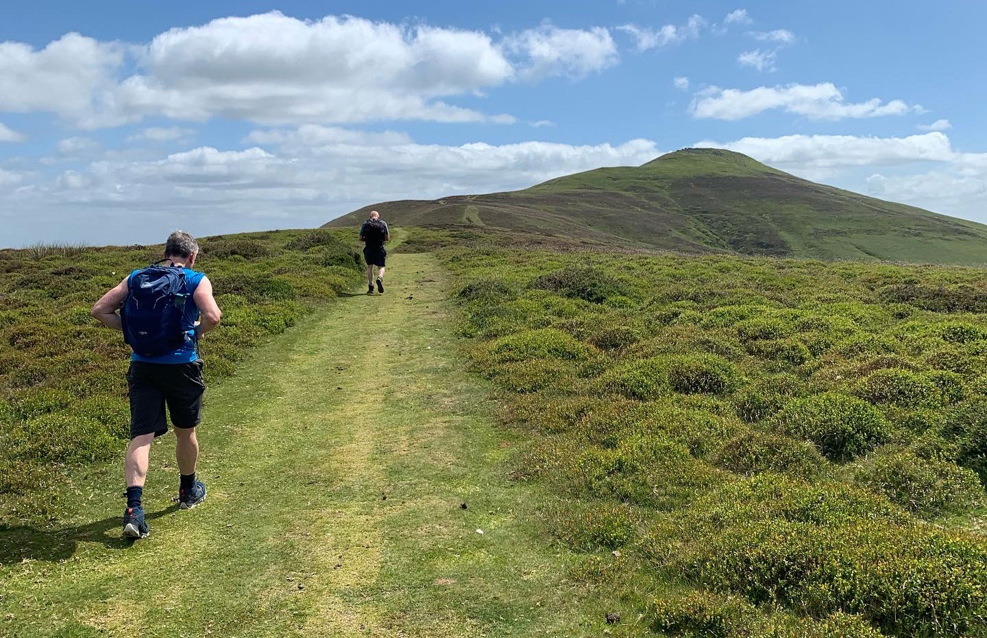
The fields you join are so green and lush, and are easy to walk along, and the views are beautiful, and as you look into the distance you will start to see the Sugar Loaf. One thing to point out is that although this route will guide you up to the top, there are other ways up, and basically it doesn’t matter, as long as you’re heading up to the Sugar Loaf peak, it’s all the same thing.
So pick a path, keep the peak in view and see you at the top. The reason I mentioned the different routes up, is because that is exactly what we did, we decided to go another way. So the pictures below, may not be exactly what you see going up.


Now the easy bit, walking back down, and apart from one last little climb which can catch you out as it’s quite a long walk, it’s all pretty much downhill and flat, we’ll come to the last climb in a bit. So the way down is to face looking at Crickhowell which is towards the right if you’re standing on the Sugar Loaf and looking the way you came up. You’ll follow the path down from the top, then drop down into some woods and then join back up to a lane, as you head towards Llangenny.
Again, it’s worth using the route on the app which you can find in the links I add to each of these posts, as I want say you will get lost, but there a couple of left rights, that will be shown to you as you walk down, it will make the whole thing a better experience I think. Some prefer to find their own way, but if you’re setting out to do a certain route then being guided around is safer and better.


You are now on Llangenny Lane and this road will take you right back into centre of Crickhowell, and there are still a few little things to see and do before the finish.
The first interesting building you will see is on your right, the property has an interesting shape to it, it will make you stop and look before you head down to the bridge and the village of Llangenny which has a lovely pub, a church and also on the other side the last steep climb of the day, which I have to be honest did catch us out slightly, it’s a long walk, but with the end insight, it was fine.


Once back in Crickhowell, it’s totally up to you which way you head to the car, but as a treat we always stop off in a lovely cafe/book shop called Book-ish for cake and coffee.


Places to Stay in Crickhowell
For a wider choice of accommodation in the Bannau Brycheiniog, Booking.com has a huge variety to browse through.
Recommended Stays

This lovely, old stone building is at the foothills of the Black Mountains amid beautiful countryside and views of the Brecon Beacons. It has a restful feel, comfortable rooms and a free Wi-Fi zone.

In Crickhowell, the Dragon Inn has views of the mountains and the Brecon Beacons National Park. It offers modern rooms with free Wi-Fi, a full cooked breakfast and free parking.

AllTrails: Trail Guides & Maps for Hiking, Camping, and Running | AllTrails ‘Plus’ 30% OFF – Read my ‘Full Review‘ for more details.
Staying overnight? Check my guide to the Best Places To Stay in the Brecon Beacons
Practicalities
- Season: All year, but the tops are very exposed – expect strong winds and winter conditions when it’s cold.
- Footwear: Proper walking boots or grippy trail shoes – it can be wet, muddy and steep in places.
- Water & food: Nothing on the route itself; stock up in Crickhowell. Use a Water-to-Go bottole.
- Parking: Lots of parking opportunities – can be busy on sunny weekends.
- Dogs: Yes, but keep on a lead around livestock and on the farmland sections.
- Good for: Big views, border history, long ridge days, and anyone who likes a mix of wild open tops and tucked-away valleys.
Black Mountains Circular FAQs
How long is the walk?
Is it hard?
Which way round is best?
Is navigation straightforward?
What’s special about Sugar Loaf?
What is the Cambrian Way?
Can I shorten the walk?
Is it family friendly?
What about boggy / muddy bits?
Is it good in winter?

Walk this route yourself in 3D!
The video is a 3D walkthrough of this route; it’ll give you a great idea of what to expect before you set foot on the mountain.
I’ve created 3D videos of my walks and shared them with the Outdooractive and Welsh Man Walking communities.

Water-to-Go Named Best Water Bottle for Travel. Click www.watertogo.eu + 20% Discount Using – ‘WMW20’
Disclosure: I may earn a commission if you buy via the links on this page — at no extra cost to you.