


Region: Ortisei — Val Gardena, Dolomites, Italy
Places To Stay: Ortisei is the perfect place to stay for this one, as you have easy access to lifts, great food, and plenty of hotel choice from simple B&Bs to full-on spa stays. If you want to wake up on the plateau, hotels around Compatsch make sunrise doable.
Looking for more Dolomites trails? Head to my ‘Dolomites Hiking Guides‘ page to see all regions and routes.
Below are a few ideas for day tours and transfers around Ortisei, with GetYourGuide offering discounts and easy booking + see more here.
For a wider choice of accommodation in the Dolomites, Booking.com has a huge variety to browse through.
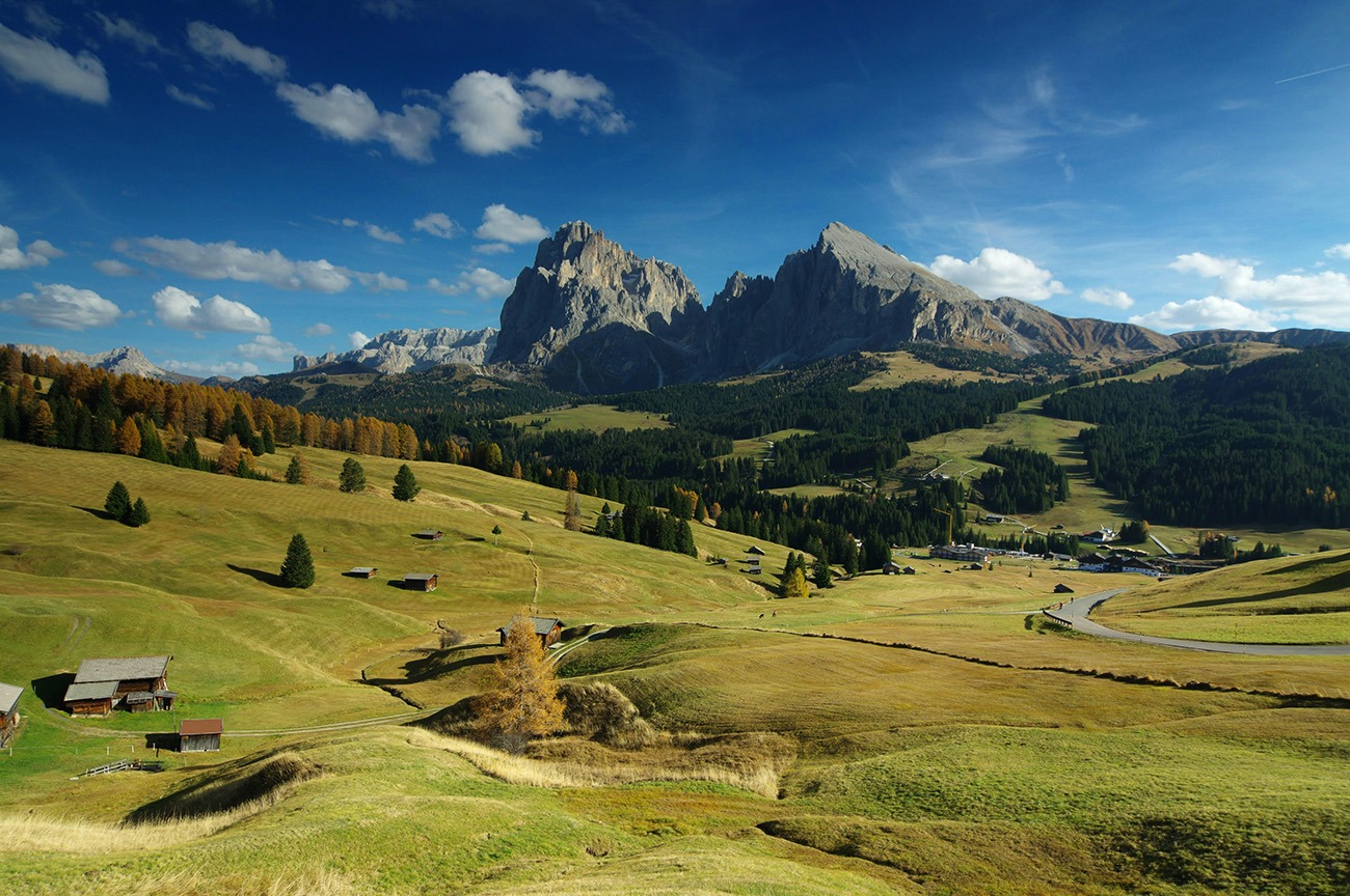
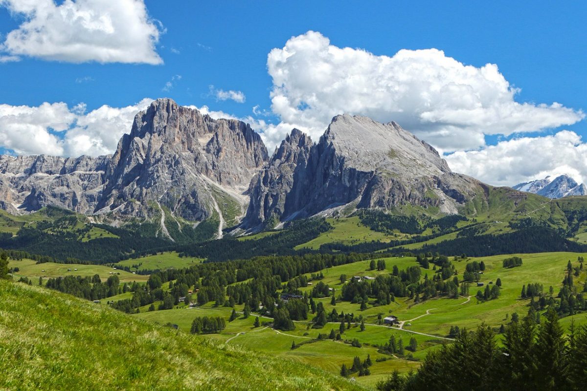
This is a laid-back day out on Europe’s biggest high meadow. The cable car from Ortisei take you to the Alpe di Siusi plateau, where wide paths and rolling grassland make for easy going. You’ll loop past viewpoints and huts for lunch and coffee, with views of the Sassolungo/Sassopiatto group most of the way. You can keep it short and sweet, or wander further if the legs are happy.
Getting There: Directions, GPX and Map
- Start/Finish: Ortisei → Alpe di Siusi (Compatsch) via cable car → panorama loop → back to Compatsch → cable car back to Ortisei.
- Transport: Ortisei links by bus to Bolzano, Bressanone, and Val Gardena villages.
- Download the GPX here.
- You can also follow this route on my Outdooractive Profile.
Travel Data: I use eSIMs to stay connected — quick setup and no roaming faff. Sim Local has been solid in Italy/Europe with good prices and coverage.

Sim Local can reduce or even eliminate your roaming fees. Click www.simlocal.com/ + 10% Discount Using – ‘WELSHMAN’
Hike Profile
- Distance: 10–14 km (loop variations).
- Duration: 5-6 hours with photo/coffee stops.
- Ascent: ~550 m depending on the loop.
- Highest point: Alpe di Siusi plateau ~2,000–2,100 m.
- Difficulty: Moderate/Difficult — wide tracks, a few short steeper bits, depending on length.
- Terrain: Meadow paths, graded tracks, short forest sections near hut spurs.
Route Overview (Typical Loop). Take the cable car from Ortisei, walk starts from top station.
| Section | From → To | Distance | Notes |
|---|---|---|---|
| 1 | Compatsch (top station) → Panorama trail | 2–3 km | Easy warm-up on rolling meadow tracks, big Sassolungo views. |
| 2 | Panorama spur → Hut stop (e.g., Malga Sanon or Ritsch) | 2–3 km | Perfect for coffee/strudel or a simple lunch. |
| 3 | Hut → Saltria area (optional) | 2–3 km | Optional dip further into the plateau; adds distance but stays gentle. |
| 4 | Saltria/loop high point → Compatsch | 4–5 km | Return via a different panoramic line to keep the views fresh. |
Flying into Italy? Quick Skyscanner Checker
From Heathrow, we flew to Venice Marco Polo, and hired cars, Skyscanner found the cheapest flights, try the flight widget above.
Hike Description
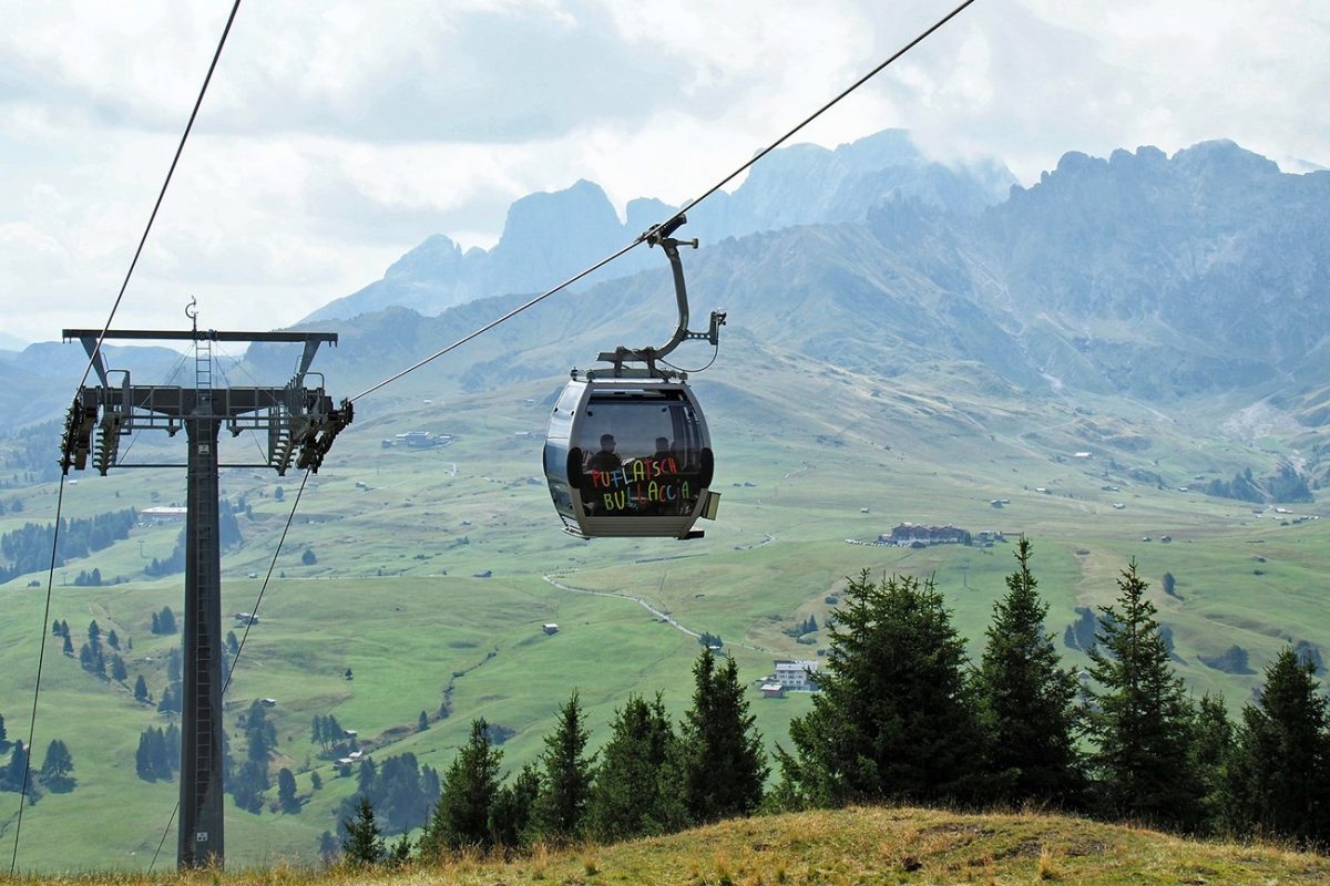
Ride the cable car from Ortisei to the plateau and you’re straight into the views. The paths are wide, waymarking is great, and you can see the route most of the time, it’s very beginner-friendly without being boring. I started with a gentle panoramic line out of Compatsch to get the best of the Sassolungo/Sassopiatto skyline right away.
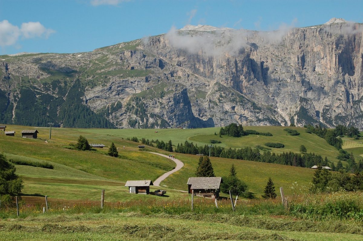
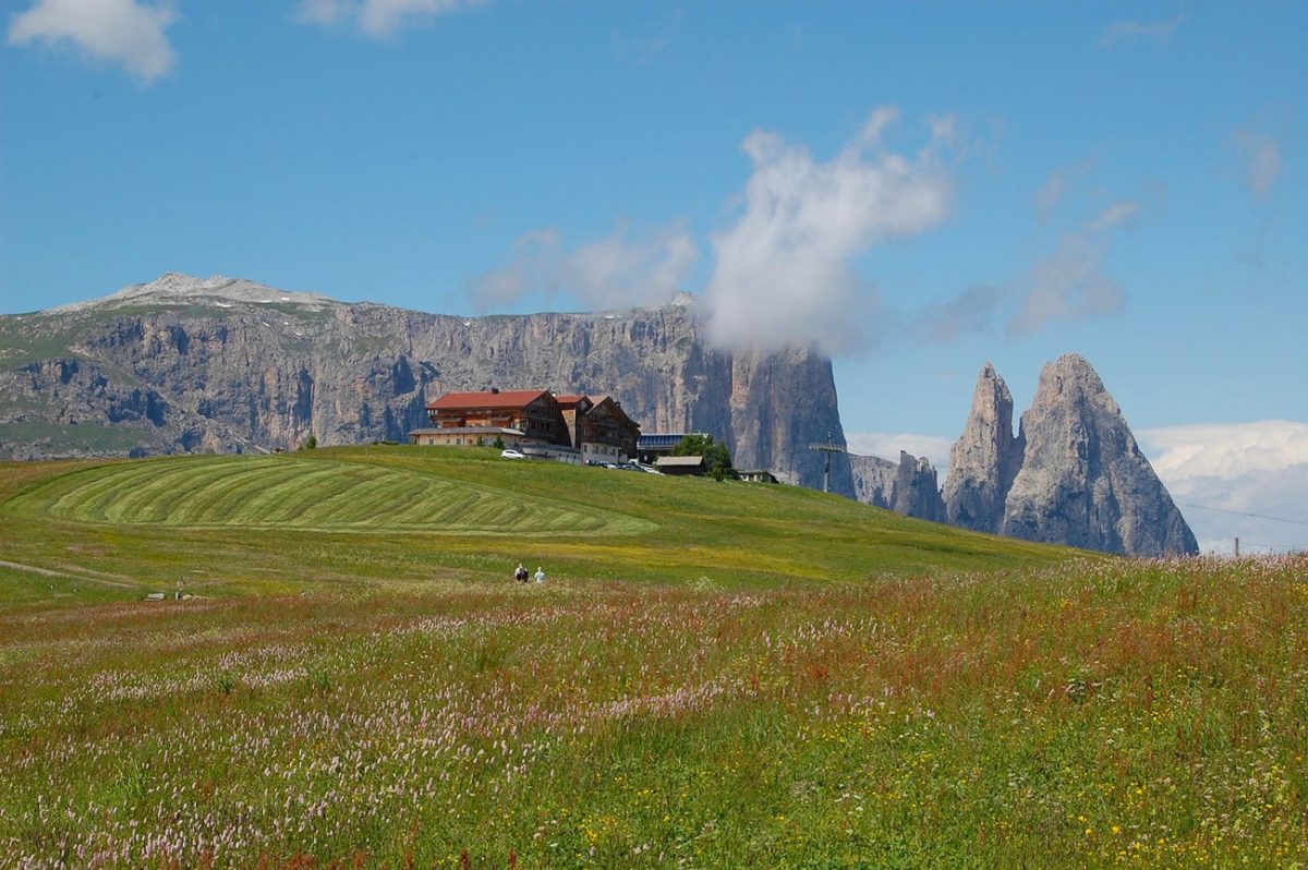
From the first viewpoint you can take an easy spur to a hut, either Malga Sanon, Ritsch or similar, for coffee or a bite. Expect simple, good food: dumplings, soups, strudel, the usual South Tyrolean comfort stuff. If you’re feeling good, you can carry on towards the Saltria side to stretch the legs a bit more; if not, take an earlier loop and you can keep the pace gentle and take it easy.
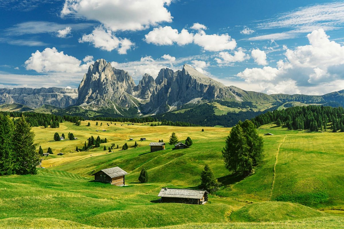
The middle of the route is all rolling meadows and farm tracks with wooden huts dotted about. It’s the kind of walk where you keep stopping because the views look different every five minutes. There are a couple of short ups and downs, nothing technical, and plenty of benches if you want a sit-down with a sandwich.
To finish, head back to Compatsch, you always know where you have come from so don’t worry about this, just take in the views and the beauty, then make your way back to Ortisei on the cable car. If you want to add a tiny flourish at the end, pop out to one last viewpoint near the top station before you head down. It’s an easy day, you’ll get big scenery, and no technical or terrain stress to deal with.
Places to Stay in the Dolomites – My Picks
I’ve put together a few guides to make choosing a hotel in the Dolomites easier. If you’re after a romantic break, I’ve found some cosy hideaways. If it’s hiking that’s front and centre, I’ve rounded up the best hotels with trails right from the door. There are also ski-in ski-out favourites for winter trips, family-friendly bases, and hotels with those wow-factor mountain views or even hot tubs to sink into after a long day.
- Most Romantic Hotels in the Dolomites ⇢
- Best Hotels for Hiking in the Dolomites ⇢
- Best Ski-In Ski-Out Hotels in the Dolomites ⇢
- Best Family Friendly Hotels in the Dolomites ⇢
- Best Hotels with Mountain Views in the Dolomites ⇢
- Best Hotels with Hot Tubs in the Dolomites ⇢
Places to Stay in Ortisei
For a wider choice of accommodation in the Dolomites, Booking.com has a huge variety to browse through.
Ortisei Base

Luxury wellness hotel with pools and saunas — perfect post-hike treat.
Set in a 9000 m² park, Adler Dolomiti is in Ortisei’s pedestrian area, 100 metres from the Alpe di Siusi small cable car. Its free wellness centre includes indoor and outdoor pools plus saunas and hot tubs.
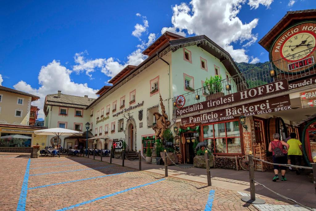
Simple and friendly B&B in town — good value base for hiking.
Set in the centre of Ortisei, the family-run Garni Snaltnerhof offers a traditional restaurant and pizzeria. Buses to Selva di Val Gardena stop 50 metres away.

AllTrails: Trail Guides & Maps for Hiking, Camping, and Running | AllTrails ‘Plus’ 30% OFF – Read my ‘Full Review‘ for more details.
Practicalities
- Lifts: Alpe di Siusi cable car (Ortisei) runs roughly June–Oct; check dates/times.
- Food & drink: Plenty of huts — cash is handy; some take cards, some don’t.
- Gear: Light hiking shoes are fine; pack a layer and a rain shell.
- Weather: Afternoon storms happen in summer — best to start early.
- Families: Great for kids thanks to the wide, mostly gentle paths.
- Options: You can shorten the loop easily; there are signed cut-throughs back to Compatsch.
Alpe di Siusi FAQs
How long is the loop?
10–14 km depending on the spur to Saltria and hut detours.
Is it suitable for beginners?
Yes — wide, well-signed tracks with gentle gradients.
Best time to go?
Late June–October when lifts and huts are open. Early summer is green; autumn is crisp with great light.
Do I need a lift ticket?
Yes for the Ortisei–Alpe di Siusi cable car. Walking from town adds a big climb.
Are there water points?
Mostly at huts — carry a bottle and top up when you stop.
Can I push a buggy?
Short sections near Compatsch: yes (gravel tracks). The full loop is better with a hiking carrier.
Dogs allowed?
Yes on a lead; check lift rules and hut signs.
Any tricky bits?
Not really — just a couple of short rises/descents. Nothing exposed or technical.
Where should I stop for lunch?
Huts like Ritsch, Malga Sanon, or Gostner Schwaige are all good shouts.
Can I extend the day?
Yes — add the Saltria spur or explore extra signed loops before returning to Compatsch.

Walk this route yourself in 3D!
The video is a 3D walkthrough of this route; it’ll give you a great idea of what to expect before you set foot on the mountain.
I’ve created 3D videos of my walks and shared them with the Outdooractive and Welsh Man Walking communities.

Water-to-Go Named Best Water Bottle for Travel. Click www.watertogo.eu + 20% Discount Using – ‘WMW20’